35:
292:
137:
103:
42:
207:
The city's influence stretched towards nearby villages: Avépozo, Kpogan, Noudokopé and Dévégom attracting new migrants from the neighborhoods of Adrométi, Hédzé and Apéyémé. German, French and
British
185:
This region being located along the
Atlantic shore, was at the time completely lush with vegetation and featured numerous game animals and fertile lands. Then, the river
352:
222:). Meanwhile, in 1891, the Togo was under guidance from the Bureau of Colonies, itself linked to the Ministry of German Foreign Affairs. From 1887 on,
333:
158:
Baguida is located approximately 13 kilometers east of Lomé. It is situated between the neighborhoods of Damavo, Kagomé, Avépozo and the
204:
plants. The village became very populated and prosperous, attracting colonisers who founded the capital of Togo between 1884 and 1887.
253:
66:
362:
326:
34:
178:
The village of
Baguida was created at the end of the 17th century, by a hunter named Sani, a former resident of
357:
319:
214:
On 5 July 1884, the signature of the treaty of
Baguida made this settlement the first capital of
186:
303:
118:
113:
346:
208:
242:
291:
226:
succeeded
Baguida as capital, and in turn passed the title on to Lomé in 1897.
268:
255:
81:
68:
136:
102:
215:
201:
159:
193:
163:
148:
128:
197:
179:
167:
135:
299:
223:
152:
106:
192:
Sani and his brethren lived in this natural area, cultivating
307:
211:
stayed there during their conquering of the territory.
124:
112:
97:
21:
327:
8:
334:
320:
18:
235:
218:, German colony until 1893 (then named
147:is a canton and city of the suburbs of
96:
61:
27:
182:, today one of Lomé's neighborhoods.
123:
111:
7:
288:
286:
353:Populated places in Maritime Region
162:, on national highway 5 leading to
306:. You can help Knowledge (XXG) by
155:. It was itself once the capital.
14:
290:
101:
40:
33:
41:
16:Place in Maritime Region, Togo
1:
379:
285:
62:
28:
302:location article is a
141:
139:
363:Togo geography stubs
243:WorldStatesmen- Togo
265: /
78: /
142:
315:
314:
151:, the capital of
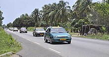
140:A taxi in Baguida
134:
133:
370:
336:
329:
322:
294:
287:
280:
279:
277:
276:
275:
270:
266:
263:
262:
261:
258:
245:
240:
105:
93:
92:
90:
89:
88:
83:
79:
76:
75:
74:
71:
54:Location in Togo
44:
43:
37:
19:
378:
377:
373:
372:
371:
369:
368:
367:
358:Cantons of Togo
343:
342:
341:
340:
283:
273:
271:
269:6.167°N 1.317°E
267:
264:
259:
256:
254:
252:
251:
249:
248:
241:
237:
232:
176:
119:Maritime Region
86:
84:
82:6.167°N 1.317°E
80:
77:
72:
69:
67:
65:
64:
58:
57:
56:
55:
52:
51:
50:
49:
45:
24:
17:
12:
11:
5:
376:
374:
366:
365:
360:
355:
345:
344:
339:
338:
331:
324:
316:
313:
312:
295:
247:
246:
234:
233:
231:
228:
175:
172:
132:
131:
126:
122:
121:
116:
110:
109:
99:
95:
94:
60:
59:
53:
47:
46:
39:
38:
32:
31:
30:
29:
26:
25:
22:
15:
13:
10:
9:
6:
4:
3:
2:
375:
364:
361:
359:
356:
354:
351:
350:
348:
337:
332:
330:
325:
323:
318:
317:
311:
309:
305:
301:
296:
293:
289:
284:
281:
278:
244:
239:
236:
229:
227:
225:
221:
217:
212:
210:
205:
203:
199:
195:
190:
188:
183:
181:
173:
171:
169:
165:
161:
156:
154:
150:
146:
138:
130:
127:
120:
117:
115:
108:
104:
100:
91:
63:Coordinates:
36:
20:
308:expanding it
297:
282:
274:6.167; 1.317
250:
238:
219:
213:
206:
191:
189:ran nearby.
184:
177:
157:
144:
143:
87:6.167; 1.317
272: /
85: /
347:Categories
230:References
209:colonisers
216:Togoland
202:fabaceae
160:littoral
194:cereals
174:History
164:Cotonou
145:Baguida
98:Country
48:Baguida
23:Baguida
260:1°19′E
257:6°10′N
198:tubers
125:Canton
114:Region
73:1°19′E
70:6°10′N
298:This
220:Bagid
168:Benin
304:stub
300:Togo
224:Sebe
200:and
153:Togo
149:Lomé
129:Lomé
107:Togo
187:Zio
349::
196:,
180:Bè
170:.
166:,
335:e
328:t
321:v
310:.
Text is available under the Creative Commons Attribution-ShareAlike License. Additional terms may apply.