59:
43:
832:
128:
447:
employment category was as follows: 402 cultivators (i.e. people who owned or leased their own land); 27 agricultural labourers (i.e. people who worked someone else's land in return for payment); 0 workers in livestock, forestry, fishing, hunting, plantations, orchards, etc.; 0 in mining and quarrying; 4 household industry workers; 1 worker employed in other
66:
433:
recorded
Baramadpur as having a total population of 2,141 people (1,049 male and 1,092 female), in 285 households and 271 physical houses. The area of the village was listed as 346.12 hectares. Members of the 0-6 age group numbered 437, or 20% of the total; this group was 50% male (218) and 50%
446:
of the village was 53% (606 men and 302 women, counting only people age 7 and up). 470 people were classified as main workers (463 men and 7 women), while 28 people were classified as marginal workers (all women); the remaining 1,643 residents were non-workers. The breakdown of main workers by
374:
railway line in
Kalwari Bandh (near Tulsi Nagar railway station) and Rail over bridge is under construction. Uttar Pradesh Chief Minister Yogi Adityanath visited Kalwari Bandh on Feb 8th 2020 to inspect Purvanchal Expressway construction status.
414:
recorded
Baramadpur as comprising 4 hamlets, with a total population of 1,144 people (577 male and 567 female), in 186 households and 174 physical houses.. The area of the village was given as 892 acres.
332:
387:
recorded
Baramadpur as comprising 2 hamlets, with a total population of 996 people (491 male and 505 female), in 158 households and 148 physical houses. The area of the village was given as 892
270:. As of 2011, it has a population of 3,251 people, in 442 households. It has one primary school and one primary health centre and it hosts both a regular market and a weekly
682:
638:
873:
714:
897:
42:
58:
892:
90:
545:
Census 1991 Series-25 Uttar
Pradesh Part-XII B Village & Townwise Primary Census Abstract District Census Handbook District Raebareli
152:
866:
707:
140:
328:
859:
700:
499:
455:; 3 employed in trade and commerce; 5 employed in transport, storage, and communications; and 24 in other services.
164:
577:
Census 1981 Uttar
Pradesh: District Census Handbook Part XIII-A: Village & Town Directory, District Rae Bareli
784:
355:
763:
500:"Census of India 2011: Uttar Pradesh District Census Handbook - Sultanpur, Part A (Village and Town Directory)"
314:
286:
655:
575:
543:
611:
422:
recorded
Baramadpur as having a population of 1,733 people, in 252 households, and having an area of 361.40
306:
363:
359:
339:
753:
430:
419:
411:
384:
238:
794:
452:
407:. It had a district-board run primary school with 63 students in attendance as of 1 January 1951.
290:
839:
724:
676:
632:
259:
169:
391:. 58 residents were literate, 52 male and 6 female. The village was listed as belonging to the
157:
843:
396:
439:
318:
294:
435:
309:
Railway line to the west, and
Kalwaribandh village to the south. Baramadpur is 20 km from
275:
692:
613:
Census of India, 1951: District Census
Handbook Uttar Pradesh (49 - Rae Bareli District)
322:
218:
886:
789:
448:
443:
362:
is intersecting with NH 135A which connects
Baramadpur to Ayodhya and Varanasi. Also
263:
145:
831:
799:
321:. Although the village is part of Sultanpur district, its post office is linked to
251:
814:
657:
Census 1961: District Census Handbook, Uttar Pradesh (44 - Sultanpur District)
105:
92:
438:
numbered 636, or 30% of the village's total population, while no members of
351:
234:
229:
809:
804:
748:
367:
347:
310:
302:
298:
279:
758:
743:
738:
423:
404:
392:
371:
343:
255:
472:
400:
331:
is a government aided school in Baramadpur which is affiliated to
267:
133:
388:
271:
222:
696:
289:, the district headquarters, Baramadpur is surrounded by the
342:
is going to provide Baramadpur a faster connectivity to
847:
426:. The main staple foods were listed as wheat and rice.
47:
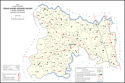
Map showing Baramadpur (#191) in Akhand Nagar CD block
772:
731:
228:
214:
209:
201:
193:
188:
180:
175:
163:
151:
139:
121:
23:
477:Do a radial search using these coordinates here
335:is the main center of education in Baramadpur.
867:
708:
650:
648:
606:
604:
602:
600:
598:
570:
568:
566:
538:
536:
534:
532:
530:
528:
526:
524:
494:
492:
490:
488:
486:
8:
451:, processing, service, and repair roles; 4
874:
860:
715:
701:
693:
681:: CS1 maint: location missing publisher (
637:: CS1 maint: location missing publisher (
20:
663:. Lucknow. 1965. pp. cxxxxli–cxxxlii
464:
227:
208:
187:
174:
120:
85:
51:
39:
674:
630:
619:. Allahabad. 1955. pp. 106–7, 199
329:Shri Kashi Ram Rashtriya Inter College
213:
200:
192:
184:3.506 km (1.354 sq mi)
179:
162:
150:
138:
7:
828:
826:
551:. 1992. pp. xxiv–xxviii, 324–5
846:. You can help Knowledge (XXG) by
65:
14:
898:Ayodhya division geography stubs
830:
126:
78:Location in Uttar Pradesh, India
64:
57:
41:
18:Village in Uttar Pradesh, India
893:Villages in Sultanpur district
773:Villages and other settlements
1:
914:
825:
434:female (219). Members of
356:Gorakhpur Link Expressway
205:930/km (2,400/sq mi)
86:
52:
40:
33:
285:Located 58 km from
106:26.240391°N 82.658968°E
842:location article is a
583:. 1982. pp. 284–5
364:Purvanchal Expressway
360:Purvanchal Expressway
340:Purvanchal Expressway
215: • Official
723:Populated places in
453:construction workers
274:. It is part of the
202: • Density
111:26.240391; 82.658968
795:Kanwarpur-Sultanpur
442:were recorded. The
379:Demographic history
102: /
840:Sultanpur district
725:Sultanpur district
260:Sultanpur district
194: • Total
181: • Total
855:
854:
823:
822:
509:. pp. 539–56
507:Census 2011 India
473:"Geonames Search"
358:). In Baramadpur
297:to the east, the
245:
244:
158:Faizabad division
905:
876:
869:
862:
834:
827:
732:Cities and towns
717:
710:
703:
694:
687:
686:
680:
672:
670:
668:
662:
652:
643:
642:
636:
628:
626:
624:
618:
608:
593:
592:
590:
588:
582:
572:
561:
560:
558:
556:
550:
540:
519:
518:
516:
514:
504:
496:
481:
480:
469:
440:scheduled tribes
436:scheduled castes
319:Nawab Yusuf Road
295:Nawab Yusuf Road
250:is a village in
132:
130:
129:
117:
116:
114:
113:
112:
107:
103:
100:
99:
98:
95:
68:
67:
61:
45:
21:
913:
912:
908:
907:
906:
904:
903:
902:
883:
882:
881:
880:
824:
819:
768:
727:
721:
691:
690:
673:
666:
664:
660:
654:
653:
646:
629:
622:
620:
616:
610:
609:
596:
586:
584:
580:
574:
573:
564:
554:
552:
548:
542:
541:
522:
512:
510:
502:
498:
497:
484:
471:
470:
466:
461:
381:
313:and 27 km from
276:nyaya panchayat
127:
125:
110:
108:
104:
101:
96:
93:
91:
89:
88:
82:
81:
80:
79:
76:
75:
74:
73:
69:
48:
36:
29:
26:
19:
12:
11:
5:
911:
909:
901:
900:
895:
885:
884:
879:
878:
871:
864:
856:
853:
852:
835:
821:
820:
818:
817:
812:
807:
802:
797:
792:
787:
782:
776:
774:
770:
769:
767:
766:
761:
756:
751:
746:
741:
735:
733:
729:
728:
722:
720:
719:
712:
705:
697:
689:
688:
644:
594:
562:
520:
482:
463:
462:
460:
457:
380:
377:
323:Ambedkar Nagar
293:to the north,
243:
242:
232:
226:
225:
216:
212:
211:
207:
206:
203:
199:
198:
195:
191:
190:
186:
185:
182:
178:
177:
173:
172:
167:
161:
160:
155:
149:
148:
143:
137:
136:
123:
119:
118:
84:
83:
77:
71:
70:
63:
62:
56:
55:
54:
53:
50:
49:
46:
38:
37:
34:
31:
30:
27:
24:
17:
13:
10:
9:
6:
4:
3:
2:
910:
899:
896:
894:
891:
890:
888:
877:
872:
870:
865:
863:
858:
857:
851:
849:
845:
841:
836:
833:
829:
816:
813:
811:
808:
806:
803:
801:
798:
796:
793:
791:
790:Jakhani Kalan
788:
786:
783:
781:
778:
777:
775:
771:
765:
762:
760:
757:
755:
752:
750:
747:
745:
742:
740:
737:
736:
734:
730:
726:
718:
713:
711:
706:
704:
699:
698:
695:
684:
678:
659:
658:
651:
649:
645:
640:
634:
615:
614:
607:
605:
603:
601:
599:
595:
579:
578:
571:
569:
567:
563:
547:
546:
539:
537:
535:
533:
531:
529:
527:
525:
521:
508:
501:
495:
493:
491:
489:
487:
483:
478:
474:
468:
465:
458:
456:
454:
450:
449:manufacturing
445:
444:literacy rate
441:
437:
432:
427:
425:
421:
416:
413:
408:
406:
402:
398:
394:
390:
386:
378:
376:
373:
369:
365:
361:
357:
353:
349:
345:
341:
338:New upcoming
336:
334:
330:
326:
324:
320:
316:
312:
308:
304:
300:
296:
292:
288:
283:
281:
277:
273:
269:
265:
264:Uttar Pradesh
261:
257:
253:
249:
240:
236:
233:
231:
224:
220:
217:
204:
196:
183:
171:
168:
166:
159:
156:
154:
147:
146:Uttar Pradesh
144:
142:
135:
124:
115:
87:Coordinates:
60:
44:
32:
22:
16:
848:expanding it
837:
800:Khunshekhpur
779:
665:. Retrieved
656:
621:. Retrieved
612:
585:. Retrieved
576:
553:. Retrieved
544:
511:. Retrieved
506:
476:
467:
428:
417:
409:
382:
366:is crossing
337:
327:
291:Majhui River
284:
252:Akhand Nagar
247:
246:
15:
815:Purebaghrai
667:28 November
623:28 November
587:28 November
555:28 November
513:13 November
431:1991 census
420:1981 census
412:1961 census
385:1951 census
325:district.
109: /
887:Categories
785:Bhagwanpur
780:Baramadpur
459:References
258:tehsil in
248:Baramadpur
189:Population
97:82°39′32″E
94:26°14′25″N
72:Baramadpur
28:Barāmadpur
25:Baramadpur
764:Sultanpur
677:cite book
633:cite book
352:Gorakhpur
287:Sultanpur
254:block of
230:Time zone
210:Languages
170:Sultanpur
810:Maksudan
805:Kurebhar
749:Koeripur
424:hectares
399:and the
368:Shahganj
348:Azamgarh
333:UP Board
315:Akbarpur
311:Shahganj
303:Shahganj
299:Faizabad
280:Sajampur
235:UTC+5:30
165:District
153:Division
759:Lambhua
744:Kadipur
739:Dostpur
405:Dostpur
397:Aldemau
393:pargana
372:Ayodhya
344:Lucknow
307:Jaunpur
256:Kadipur
122:Country
35:Village
131:
838:This
754:Korwa
661:(PDF)
617:(PDF)
581:(PDF)
549:(PDF)
503:(PDF)
401:thana
389:acres
354:(via
268:India
219:Hindi
197:3,251
141:State
134:India
844:stub
683:link
669:2021
639:link
625:2021
589:2021
557:2021
515:2021
429:The
418:The
410:The
383:The
350:and
272:haat
223:Urdu
176:Area
403:of
395:of
317:on
278:of
262:of
239:IST
889::
679:}}
675:{{
647:^
635:}}
631:{{
597:^
565:^
523:^
505:.
485:^
475:.
346:,
282:.
266:,
221:,
875:e
868:t
861:v
850:.
716:e
709:t
702:v
685:)
671:.
641:)
627:.
591:.
559:.
517:.
479:.
370:-
305:-
301:-
241:)
237:(
Text is available under the Creative Commons Attribution-ShareAlike License. Additional terms may apply.