41:
34:
269:
277:
326:. A distinctive mountain overlooking the south side of Keltic Glacier about 4 nautical miles (7.4 km; 4.6 mi) southwest of the mouth of Brandau Glacier. Discovered and named by the British Antarctic Expedition (1907-09). Identification of this feature varied on subsequent maps. The present description follows the H.E. Saunders map of 1961 which has now been generally accepted.
410:. A mountain, 3,210 metres (10,530 ft) high, located 13 nautical miles (24 km; 15 mi) due east of Mount Iveagh. The feature rises along the east margin of the Snakeskin Glacier, near the edge of the interior ice plateau. Discovered and named by the Southern Journey Party of the British Antarctic Expedition (1907-09) under Ernest Shackleton.
734:
680:
530:. Narrow rock ridge, 9 nautical miles (17 km; 10 mi) long, trending in a northwest–southeast direction between Snakeskin Glacier and Jensen Glacier, to the east of Supporters Range. So named by the NZGSAE (1961-62) because the central peak resembles a Tibetan monastery perched on top of a hill.
454:. A peak, 3,260 metres (10,700 ft) high, standing at the northeast end of a ridge running 3 nautical miles (5.6 km; 3.5 mi) northeast from Mount Clarke, just south of the head of Falkenhof Glacier. So named by the NZGSAE (1961-62) because of the graphite found on the peak.
492:. A mountain, 3,475 metres (11,401 ft) high, standing 4 nautical miles (7.4 km; 4.6 mi) east of Graphite Peak, about midway between the heads of Falkenhof and Leigh Hunt Glaciers. Named by the NZGSAE (1961-62) because of its resemblance to an admiral's tricorn hat.
219:
detachment at
Beardmore South Camp in the 1985–86 field season. Lieutenant Commander Barton developed, coordinated, and executed the logistical plan for this large and remote camp, which was in operation for 78 days and required over 800 flight hours in support of research in the
738:
684:
365:
758:
33:
688:
364:. An ice-free peak, 2,970 metres (9,740 ft) high, at the north end of the ridge forming the east side of Leigh Hunt Glacier. Named by the
369:
212:
85:
260:, which defines the west side of the range. The Lhasa Nunatak is a long ridge running north-south to the west of Snakeskin Glacier.
742:
204:
139:
78:
502:
464:
426:
382:
336:
298:
172:
711:
763:
192:
124:
215:(US-ACAN) after Lieutenant Commander Walter H. Barton, U.S. Navy, officer in charge of the Squadron
695:
268:
249:
208:
184:
168:
257:
253:
245:
221:
188:
241:
276:
252:. Features of the south of range include Mount Clarke, Graphite Peak and Tricorn Mountain.
233:
180:
71:
237:
176:
117:
752:
419:
662:
290:
517:
504:
479:
466:
441:
428:
397:
384:
351:
338:
313:
300:
154:
141:
100:
87:
248:. Northern features include Mount Usher, and Hare Peak to the east across
275:
267:
216:
232:
The Barton
Mountains lie to the south of the point where the
544:
542:
670:(2 ed.), United States Board on Geographic Names
211:
aerial photographs, 1958–63. They were named by the
116:
77:
67:
59:
54:
21:
368:(NZGSAE) (1961-62) for C.H. Hare, a member of the
366:New Zealand Geological Survey Antarctic Expedition
256:forms in the Barton Mountains and runs west into
240:from the southwest. They are separated from the
167:) are a group of mountains located south of the
560:
289:For the locality in Queensland, Australia, see
572:
8:
18:
203:The Barton Mountains were mapped by the
40:
689:United States Board on Geographic Names
644:
632:
620:
608:
596:
584:
548:
538:
759:Mountain ranges of the Ross Dependency
280:Southern Barton Mountains upper center
272:Northern Barton Mountains lower center
370:British National Antarctic Expedition
213:Advisory Committee on Antarctic Names
7:
741:from websites or documents of the
687:from websites or documents of the
14:
664:Geographic Names of the Antarctic
737: This article incorporates
732:
683: This article incorporates
678:
39:
32:
16:Group of mountains in Antarctica
743:United States Geological Survey
205:United States Geological Survey
661:Alberts, Fred G., ed. (1995),
1:
207:(USGS) from surveys and from
780:
417:
288:
26:
739:public domain material
685:public domain material
281:
273:
199:Exploration and naming
279:
271:
193:Queen Maud Mountains
125:Queen Maud Mountains
611:, pp. 137–138.
561:The Cloudmaker USGS
514: /
476: /
438: /
394: /
348: /
310: /
244:to the west by the
151: /
97: /
573:Plunket Point USGS
518:85.117°S 171.300°E
480:85.050°S 173.450°E
442:85.050°S 172.750°E
398:85.083°S 172.300°E
352:84.983°S 174.283°E
314:84.950°S 172.067°E
282:
274:
250:Leigh Hunt Glacier
209:United States Navy
185:Leigh Hunt Glacier
169:Commonwealth Range
155:85.033°S 173.000°E
101:85.033°S 173.000°E
258:Snakeskin Glacier
254:Falkenhof Glacier
246:Snakeskin Glacier
222:Beardmore Glacier
189:Snakeskin Glacier
130:
129:
79:Range coordinates
771:
736:
735:
726:
725:
724:
718:
707:
706:
705:
682:
681:
677:
676:
675:
669:
648:
642:
636:
630:
624:
618:
612:
606:
600:
594:
588:
582:
576:
570:
564:
558:
552:
546:
529:
528:
526:
525:
524:
523:-85.117; 171.300
519:
515:
512:
511:
510:
507:
491:
490:
488:
487:
486:
485:-85.050; 173.450
481:
477:
474:
473:
472:
469:
458:Tricorn Mountain
453:
452:
450:
449:
448:
447:-85.050; 172.750
443:
439:
436:
435:
434:
431:
409:
408:
406:
405:
404:
403:-85.083; 172.300
399:
395:
392:
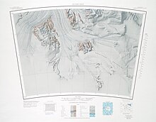
391:
390:
387:
363:
362:
360:
359:
358:
357:-84.983; 174.283
353:
349:
346:
345:
344:
341:
325:
324:
322:
321:
320:
319:-84.950; 172.067
315:
311:
308:
307:
306:
303:
242:Supporters Range
166:
165:
163:
162:
161:
160:-85.033; 173.000
156:
152:
149:
148:
147:
144:
134:Barton Mountains
120:
112:
111:
109:
108:
107:
106:-85.033; 173.000
102:
98:
95:
94:
93:
90:
43:
42:
36:
22:Barton Mountains
19:
779:
778:
774:
773:
772:
770:
769:
768:
749:
748:
733:
729:
722:
720:
716:
710:
703:
701:
694:
679:
673:
671:
667:
660:
656:
651:
643:
639:
631:
627:
619:
615:
607:
603:
595:
591:
583:
579:
571:
567:
559:
555:
547:
540:
536:
522:
520:
516:
513:
508:
505:
503:
501:
500:
498:
484:
482:
478:
475:
470:
467:
465:
463:
462:
460:
446:
444:
440:
437:
432:
429:
427:
425:
424:
422:
416:
402:
400:
396:
393:
388:
385:
383:
381:
380:
378:
356:
354:
350:
347:
342:
339:
337:
335:
334:
332:
318:
316:
312:
309:
304:
301:
299:
297:
296:
294:
287:
266:
234:Brandau Glacier
230:
201:
181:Brandau Glacier
175:and bounded by
159:
157:
153:
150:
145:
142:
140:
138:
137:
118:
105:
103:
99:
96:
91:
88:
86:
84:
83:
72:Ross Dependency
50:
49:
48:
47:
46:
45:
44:
17:
12:
11:
5:
777:
775:
767:
766:
761:
751:
750:
747:
746:
728:
727:
708:
697:The Cloudmaker
692:
657:
655:
652:
650:
649:
647:, p. 432.
637:
635:, p. 758.
625:
623:, p. 291.
613:
601:
599:, p. 312.
589:
587:, p. 772.
577:
565:
553:
537:
535:
532:
497:
494:
459:
456:
418:Main article:
415:
412:
377:
374:
331:
328:
286:
283:
265:
262:
238:Keltie Glacier
229:
226:
200:
197:
177:Keltie Glacier
128:
127:
122:
114:
113:
81:
75:
74:
69:
65:
64:
61:
57:
56:
52:
51:
38:
37:
31:
30:
29:
28:
27:
24:
23:
15:
13:
10:
9:
6:
4:
3:
2:
776:
765:
762:
760:
757:
756:
754:
744:
740:
731:
730:
715:
714:
713:Plunket Point
709:
699:
698:
693:
690:
686:
666:
665:
659:
658:
653:
646:
641:
638:
634:
629:
626:
622:
617:
614:
610:
605:
602:
598:
593:
590:
586:
581:
578:
574:
569:
566:
562:
557:
554:
551:, p. 49.
550:
545:
543:
539:
533:
531:
527:
496:Lhasa Nunatak
495:
493:
489:
457:
455:
451:
421:
420:Graphite Peak
414:Graphite Peak
413:
411:
407:
375:
373:
371:
367:
361:
329:
327:
323:
292:
284:
278:
270:
263:
261:
259:
255:
251:
247:
243:
239:
235:
227:
225:
223:
218:
214:
210:
206:
198:
196:
194:
190:
186:
182:
178:
174:
170:
164:
135:
126:
123:
121:
115:
110:
82:
80:
76:
73:
70:
66:
62:
58:
53:
35:
25:
20:
721:, retrieved
712:
702:, retrieved
696:
672:, retrieved
663:
645:Alberts 1995
640:
633:Alberts 1995
628:
621:Alberts 1995
616:
609:Alberts 1995
604:
597:Alberts 1995
592:
585:Alberts 1995
580:
568:
556:
549:Alberts 1995
499:
461:
423:
379:
376:Mount Clarke
333:
295:
291:Bouldercombe
231:
202:
173:Hughes Range
133:
131:
119:Parent range
764:Dufek Coast
521: /
483: /
445: /
401: /
372:(1901-04).
355: /
317: /
285:Mount Usher
236:enters the
158: /
104: /
753:Categories
723:2023-12-25
704:2023-12-25
674:2023-12-03
534:References
63:Antarctica
330:Hare Peak
191:, in the
60:Continent
55:Geography
509:171°18′E
471:173°27′E
433:172°45′E
389:172°18′E
343:174°17′E
305:172°04′E
264:Features
228:Location
171:and the
654:Sources
506:85°07′S
468:85°03′S
430:85°03′S
386:85°05′S
340:84°59′S
302:84°57′S
146:173°0′E
92:173°0′E
719:, USGS
700:, USGS
224:area.
187:, and
143:85°2′S
89:85°2′S
68:Region
717:(PDF)
668:(PDF)
217:VXE-6
132:The
755::
541:^
195:.
183:,
179:,
745:.
691:.
575:.
563:.
293:.
136:(
Text is available under the Creative Commons Attribution-ShareAlike License. Additional terms may apply.