1547:
48:
76:
83:
55:
1531:
616:
302:
1632:
1612:
1480:
388:
1588:
1377:
624:
126:
653:
421:
1617:
725:
449:
47:
1524:
675:
332:
1347:
370:
295:
75:
1132:
1432:
1637:
1217:
548:
365:
1622:
1517:
1352:
888:
715:
528:
482:
350:
1177:
1581:
730:
513:
360:
288:
1227:
1172:
1272:
783:
690:
323:
311:
1475:
760:
340:
1627:
1267:
1117:
883:
803:
538:
508:
393:
1157:
1427:
1357:
1112:
951:
586:
533:
403:
1574:
1458:
1437:
1137:
931:
843:
755:
700:
518:
1252:
1212:
1392:
1342:
1257:
986:
941:
936:
868:
464:
1407:
1367:
1297:
1232:
1107:
1417:
1302:
1282:
1242:
1167:
999:
878:
685:
28:
1162:
1087:
1192:
1152:
1412:
1402:
1312:
1147:
1034:
398:
1387:
1382:
1422:
1327:
1237:
1142:
858:
798:
765:
745:
177:
1332:
1222:
1082:
1397:
1372:
1337:
1187:
961:
921:
893:
828:
695:
556:
263:
1197:
1127:
591:
1322:
1292:
1287:
1262:
1207:
1182:
1097:
1546:
1307:
1277:
1247:
1029:
863:
853:
720:
1362:
1202:
1049:
1607:
1122:
1059:
898:
813:
601:
1039:
1554:
971:
956:
946:
926:
833:
808:
793:
788:
750:
740:
606:
500:
472:
413:
198:
596:
1019:
1009:
1004:
976:
838:
710:
571:
242:
114:
1014:
1044:
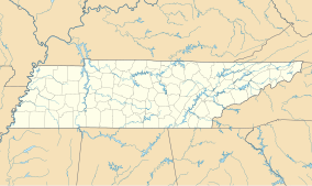
994:
848:
823:
818:
705:
431:
380:
186:
1054:
1024:
873:
735:
639:
1453:
1317:
1064:
903:
680:
670:
581:
561:
444:
1092:
576:
1074:
634:
629:
439:
1558:
1501:
194:
32:
454:
1601:
1102:
966:
202:
280:
490:
141:
128:
523:
315:
210:
206:
229:
284:
1500:
This article related to a protected area in
Tennessee is a
209:. The area's elevation is 3,623 feet (1,104 m) above
1562:
1505:
1481:
Tennessee
Department of Environment and Conservation
82:
54:
1446:
1073:
985:
912:
774:
661:
652:
615:
547:
499:
481:
463:
430:
412:
379:
349:
331:
322:
173:
165:
157:
120:
110:
102:
21:
389:Chickamauga and Chattanooga National Military Park
625:Big South Fork National River and Recreation Area
422:Land Between the Lakes National Recreation Area
1582:
1525:
296:
8:
450:Overmountain Victory National Historic Trail
1633:Southern United States protected area stubs
1613:Protected areas of Carter County, Tennessee
1589:
1575:
1532:
1518:
658:
371:Manhattan Project National Historical Park
328:
303:
289:
281:
18:
366:Cumberland Gap National Historical Park
222:
1358:Stones River Cedar Glade & Barrens
455:Trail of Tears National Historic Trail
1178:Gattinger’s Cedar Glade & Barrens
361:Andrew Johnson National Historic Site
7:
1618:Wilderness areas of the Appalachians
1543:
1541:
1497:
1495:
101:
1476:Tennessee Department of Agriculture
1228:John & Hester Lane Cedar Glades
1173:Flat Rock Cedar Glade & Barrens
445:Natchez Trace National Scenic Trail
341:Great Smoky Mountains National Park
1561:. You can help Knowledge (XXG) by
1504:. You can help Knowledge (XXG) by
394:Fort Donelson National Battlefield
264:"Big Laurel Branch Wilderness, TN"
14:
726:Justin P. Wilson Cumberland Trail
440:Appalachian National Scenic Trail
404:Stones River National Battlefield
1545:
1459:Catoosa Wildlife Management Area
81:
74:
53:
46:
1557:geography–related article is a
483:National Wild and Scenic Rivers
164:
109:
1638:East Tennessee geography stubs
243:"Big Laurel Branch Wilderness"
1:
1623:Wilderness areas of Tennessee
1268:North Chickamauga Creek Gorge
1118:Mr. and Mrs. Harry Lee Carter
399:Shiloh National Military Park
193:is a 6,332-acre (26 km)
93:Show map of the United States
1158:Elsie Quarterman Cedar Glade
191:Big Laurel Branch Wilderness
178:United States Forest Service
22:Big Laurel Branch Wilderness
1428:William R. Davenport Refuge
1113:Carroll Cabin Barrens Glade
161:6,332 acres (25.62 km)
1654:
1540:
1494:
731:Lamar Alexander Rocky Fork
232:- Retrieved March 27, 2023
1628:Tennessee geography stubs
1471:
784:Bicentennial Capitol Mall
691:David Crockett Birthplace
501:National Wildlife Refuges
414:National recreation areas
90:Location in United States
40:
26:
1555:Carter County, Tennessee
1138:Crowder Cemetery Barrens
473:Cherokee National Forest
230:Protected Planet Website
106:Carter County, Tennessee
1348:Stillhouse Hollow Falls
1253:Lucius Burch Jr. Forest
804:Cordell Hull Birthplace
381:National Military Parks
115:Elizabethton, Tennessee
1343:Sneed Road Cedar Glade
1258:Manus Road Cedar Glade
1133:Couchville Cedar Glade
952:Nathan Bedford Forrest
587:Joyce Kilmer-Slickrock
432:National Trails System
187:United States Congress
1408:Walterhill Floodplain
1368:Sunnybell Cedar Glade
1298:Powell River Preserve
1233:John Noel at Bon Aqua
1108:Campbell Bend Barrens
640:Natchez Trace Parkway
617:Other protected areas
142:36.35056°N 82.08694°W
65:Show map of Tennessee
62:Location in Tennessee
1454:Buffalo Ridge Refuge
1418:Watauga River Bluffs
1168:Fate Sanders Barrens
942:Meeman-Shelby Forest
676:Booker T. Washington
592:Little Frog Mountain
1353:Stinging Fork Falls
1163:Falling Water Falls
1075:State natural areas
686:Cumberland Mountain
351:National historical
174:Governing body
147:36.35056; -82.08694
138: /
1433:Wilson School Road
1193:Hampton Creek Cove
1153:Duck River Complex
889:Sgt. Alvin C. York
185:Designated by the
1570:
1569:
1513:
1512:
1489:
1488:
1467:
1466:
1413:Washmorgan Hollow
1383:Vesta Cedar Glade
1313:Roundtop Mountain
1000:Cedars of Lebanon
859:Mousetail Landing
799:Cedars Of Lebanon
648:
647:
635:Gatlinburg Bypass
630:Foothills Parkway
567:Big Laurel Branch
183:
182:
111:Nearest city
1645:
1608:IUCN Category Ib
1591:
1584:
1577:
1549:
1542:
1534:
1527:
1520:
1496:
1423:William B. Clark
1403:Walls of Jericho
1388:Vine Cedar Glade
1035:Martha Sundquist
962:Pickwick Landing
922:Big Cypress Tree
894:South Cumberland
829:Fall Creek Falls
775:Middle Tennessee
696:Fall Creek Falls
659:
602:Sampson Mountain
557:Bald River Gorge
549:Wilderness areas
465:National forests
329:
305:
298:
291:
282:
275:
274:
272:
271:
260:
254:
253:
251:
250:
245:. wilderness.net
239:
233:
227:
153:
152:
150:
149:
148:
143:
139:
136:
135:
134:
131:
94:
85:
84:
78:
66:
57:
56:
50:
19:
1653:
1652:
1648:
1647:
1646:
1644:
1643:
1642:
1598:
1597:
1596:
1595:
1539:
1538:
1492:
1490:
1485:
1463:
1442:
1328:Sequatchie Cave
1238:Langford Branch
1143:Devils Backbone
1088:Barnett's Woods
1069:
1050:Prentice Cooper
981:
914:
908:
854:Montgomery Bell
776:
770:
761:Sycamore Shoals
721:Indian Mountain
663:
644:
611:
543:
495:
477:
459:
426:
408:
375:
353:parks and sites
352:
345:
318:
312:Protected areas
309:
279:
278:
269:
267:
262:
261:
257:
248:
246:
241:
240:
236:
228:
224:
219:
195:wilderness area
146:
144:
140:
137:
132:
129:
127:
125:
124:
98:
97:
96:
95:
92:
91:
88:
87:
86:
69:
68:
67:
64:
63:
60:
59:
58:
36:
33:wilderness area
17:
16:Wilderness area
12:
11:
5:
1651:
1649:
1641:
1640:
1635:
1630:
1625:
1620:
1615:
1610:
1600:
1599:
1594:
1593:
1586:
1579:
1571:
1568:
1567:
1550:
1537:
1536:
1529:
1522:
1514:
1511:
1510:
1487:
1486:
1484:
1483:
1478:
1472:
1469:
1468:
1465:
1464:
1462:
1461:
1456:
1450:
1448:
1444:
1443:
1441:
1440:
1435:
1430:
1425:
1420:
1415:
1410:
1405:
1400:
1395:
1390:
1385:
1380:
1375:
1370:
1365:
1360:
1355:
1350:
1345:
1340:
1335:
1333:Short Mountain
1330:
1325:
1320:
1315:
1310:
1305:
1300:
1295:
1290:
1285:
1280:
1275:
1270:
1265:
1260:
1255:
1250:
1245:
1240:
1235:
1230:
1225:
1223:Hubbard’s Cave
1220:
1218:House Mountain
1215:
1210:
1205:
1200:
1195:
1190:
1185:
1180:
1175:
1170:
1165:
1160:
1155:
1150:
1145:
1140:
1135:
1130:
1125:
1120:
1115:
1110:
1105:
1100:
1095:
1090:
1085:
1083:Auntney Hollow
1079:
1077:
1071:
1070:
1068:
1067:
1062:
1060:Standing Stone
1057:
1052:
1047:
1042:
1037:
1032:
1027:
1022:
1017:
1012:
1007:
1002:
997:
991:
989:
983:
982:
980:
979:
974:
969:
964:
959:
954:
949:
944:
939:
934:
929:
924:
918:
916:
913:West Tennessee
910:
909:
907:
906:
901:
899:Standing Stone
896:
891:
886:
881:
876:
871:
866:
864:Old Stone Fort
861:
856:
851:
846:
841:
836:
831:
826:
821:
816:
814:David Crockett
811:
806:
801:
796:
791:
786:
780:
778:
772:
771:
769:
768:
766:Warriors' Path
763:
758:
753:
748:
743:
738:
733:
728:
723:
718:
716:Hiwassee/Ocoee
713:
708:
703:
698:
693:
688:
683:
678:
673:
667:
665:
662:East Tennessee
656:
650:
649:
646:
645:
643:
642:
637:
632:
627:
621:
619:
613:
612:
610:
609:
607:Unaka Mountain
604:
599:
594:
589:
584:
579:
574:
569:
564:
559:
553:
551:
545:
544:
542:
541:
536:
531:
526:
521:
516:
511:
505:
503:
497:
496:
494:
493:
487:
485:
479:
478:
476:
475:
469:
467:
461:
460:
458:
457:
452:
447:
442:
436:
434:
428:
427:
425:
424:
418:
416:
410:
409:
407:
406:
401:
396:
391:
385:
383:
377:
376:
374:
373:
368:
363:
357:
355:
347:
346:
344:
343:
337:
335:
333:National parks
326:
320:
319:
310:
308:
307:
300:
293:
285:
277:
276:
266:. lat-long.com
255:
234:
221:
220:
218:
215:
181:
180:
175:
171:
170:
167:
163:
162:
159:
155:
154:
122:
118:
117:
112:
108:
107:
104:
100:
99:
89:
80:
79:
73:
72:
71:
70:
61:
52:
51:
45:
44:
43:
42:
41:
38:
37:
27:
24:
23:
15:
13:
10:
9:
6:
4:
3:
2:
1650:
1639:
1636:
1634:
1631:
1629:
1626:
1624:
1621:
1619:
1616:
1614:
1611:
1609:
1606:
1605:
1603:
1592:
1587:
1585:
1580:
1578:
1573:
1572:
1566:
1564:
1560:
1556:
1551:
1548:
1544:
1535:
1530:
1528:
1523:
1521:
1516:
1515:
1509:
1507:
1503:
1498:
1493:
1482:
1479:
1477:
1474:
1473:
1470:
1460:
1457:
1455:
1452:
1451:
1449:
1445:
1439:
1438:Window Cliffs
1436:
1434:
1431:
1429:
1426:
1424:
1421:
1419:
1416:
1414:
1411:
1409:
1406:
1404:
1401:
1399:
1398:Walker Branch
1396:
1394:
1391:
1389:
1386:
1384:
1381:
1379:
1376:
1374:
1373:Taylor Hollow
1371:
1369:
1366:
1364:
1361:
1359:
1356:
1354:
1351:
1349:
1346:
1344:
1341:
1339:
1338:Short Springs
1336:
1334:
1331:
1329:
1326:
1324:
1321:
1319:
1316:
1314:
1311:
1309:
1306:
1304:
1301:
1299:
1296:
1294:
1291:
1289:
1286:
1284:
1281:
1279:
1276:
1274:
1271:
1269:
1266:
1264:
1261:
1259:
1256:
1254:
1251:
1249:
1246:
1244:
1241:
1239:
1236:
1234:
1231:
1229:
1226:
1224:
1221:
1219:
1216:
1214:
1211:
1209:
1206:
1204:
1201:
1199:
1196:
1194:
1191:
1189:
1188:Grundy Forest
1186:
1184:
1181:
1179:
1176:
1174:
1171:
1169:
1166:
1164:
1161:
1159:
1156:
1154:
1151:
1149:
1146:
1144:
1141:
1139:
1136:
1134:
1131:
1129:
1126:
1124:
1121:
1119:
1116:
1114:
1111:
1109:
1106:
1104:
1103:Big Bone Cave
1101:
1099:
1096:
1094:
1093:Bays Mountain
1091:
1089:
1086:
1084:
1081:
1080:
1078:
1076:
1072:
1066:
1063:
1061:
1058:
1056:
1053:
1051:
1048:
1046:
1043:
1041:
1040:Natchez Trace
1038:
1036:
1033:
1031:
1030:Lone Mountain
1028:
1026:
1023:
1021:
1018:
1016:
1013:
1011:
1008:
1006:
1003:
1001:
998:
996:
993:
992:
990:
988:
987:State forests
984:
978:
975:
973:
972:Reelfoot Lake
970:
968:
967:Pinson Mounds
965:
963:
960:
958:
957:Paris Landing
955:
953:
950:
948:
947:Natchez Trace
945:
943:
940:
938:
935:
933:
930:
928:
927:Big Hill Pond
925:
923:
920:
919:
917:
911:
905:
902:
900:
897:
895:
892:
890:
887:
885:
882:
880:
877:
875:
872:
870:
867:
865:
862:
860:
857:
855:
852:
850:
847:
845:
842:
840:
837:
835:
834:Harpeth River
832:
830:
827:
825:
822:
820:
817:
815:
812:
810:
809:Cummins Falls
807:
805:
802:
800:
797:
795:
794:Burgess Falls
792:
790:
789:Bledsoe Creek
787:
785:
782:
781:
779:
773:
767:
764:
762:
759:
757:
756:Seven Islands
754:
752:
751:Roan Mountain
749:
747:
744:
742:
741:Panther Creek
739:
737:
734:
732:
729:
727:
724:
722:
719:
717:
714:
712:
709:
707:
704:
702:
699:
697:
694:
692:
689:
687:
684:
682:
679:
677:
674:
672:
669:
668:
666:
660:
657:
655:
651:
641:
638:
636:
633:
631:
628:
626:
623:
622:
620:
618:
614:
608:
605:
603:
600:
598:
597:Pond Mountain
595:
593:
590:
588:
585:
583:
580:
578:
575:
573:
570:
568:
565:
563:
560:
558:
555:
554:
552:
550:
546:
540:
537:
535:
532:
530:
529:Lower Hatchie
527:
525:
522:
520:
517:
515:
512:
510:
507:
506:
504:
502:
498:
492:
489:
488:
486:
484:
480:
474:
471:
470:
468:
466:
462:
456:
453:
451:
448:
446:
443:
441:
438:
437:
435:
433:
429:
423:
420:
419:
417:
415:
411:
405:
402:
400:
397:
395:
392:
390:
387:
386:
384:
382:
378:
372:
369:
367:
364:
362:
359:
358:
356:
354:
348:
342:
339:
338:
336:
334:
330:
327:
325:
321:
317:
313:
306:
301:
299:
294:
292:
287:
286:
283:
265:
259:
256:
244:
238:
235:
231:
226:
223:
216:
214:
212:
208:
204:
200:
199:Carter County
196:
192:
189:in 1986, the
188:
179:
176:
172:
168:
160:
156:
151:
123:
119:
116:
113:
105:
77:
49:
39:
34:
30:
29:IUCN category
25:
20:
1563:expanding it
1552:
1506:expanding it
1499:
1491:
1393:Virgin Falls
1243:Laurel-Snow
1198:Hawkins Cove
1128:Colditz Cove
977:T. O. Fuller
844:Johnsonville
839:Henry Horton
711:Harrison Bay
701:Fort Loudoun
572:Citico Creek
566:
514:Cross Creeks
268:. Retrieved
258:
247:. Retrieved
237:
225:
190:
184:
1378:Twin Arches
1323:Savage Gulf
1303:Radnor Lake
1293:Pogue Creek
1288:Piney Falls
1283:Ozone Falls
1263:May Prairie
1213:Honey Creek
1208:Hill Forest
1183:Ghost River
1098:Beaman Park
937:Fort Pillow
915:state parks
884:Rock Island
879:Radnor Lake
849:Long Hunter
824:Edgar Evins
819:Dunbar Cave
777:state parks
706:Frozen Head
664:state parks
166:Established
145: /
121:Coordinates
1602:Categories
1308:Riverwoods
1278:Overbridge
1273:Old Forest
1248:Lost Creek
1148:Dry Branch
1020:John Tully
1010:Chuck Swan
874:Port Royal
736:Norris Dam
491:Obed River
270:2008-12-22
249:2008-12-22
217:References
133:82°05′13″W
130:36°21′02″N
1363:Sunk Lake
1203:Hicks Gap
1005:Chickasaw
932:Chickasaw
904:Tims Ford
681:Cove Lake
671:Big Ridge
582:Gee Creek
539:Tennessee
524:Lake Isom
509:Chickasaw
316:Tennessee
211:sea level
207:Tennessee
205:state of
1123:Chimneys
1015:Franklin
746:Red Clay
562:Big Frog
534:Reelfoot
103:Location
1065:Stewart
1045:Pickett
995:Bledsoe
869:Pickett
577:Cohutta
519:Hatchie
324:Federal
201:in the
197:within
1553:This
1447:Other
1318:Rugby
1055:Scott
1025:Lewis
654:State
1559:stub
1502:stub
203:U.S.
169:1986
158:Area
31:Ib (
314:of
1604::
213:.
1590:e
1583:t
1576:v
1565:.
1533:e
1526:t
1519:v
1508:.
304:e
297:t
290:v
273:.
252:.
35:)
Text is available under the Creative Commons Attribution-ShareAlike License. Additional terms may apply.