36:
56:
640:
63:
354:
in South Dakota. They have picnic, boat launching, trail, and camping facilities. An educational center is part of the
Minnesota park. Several vacation resorts are along the shores of Big Stone Lake as well. Visitors are attracted to the lake especially for its
288:
The lake covers 12,610 acres (5,100 ha), stretching 26 miles (42 km) from end to end and averaging around 1 mile (1.6 km) wide. At an elevation of 965 feet (294 m), it is South Dakota's lowest point. Big Stone Lake is the source of the
300:
Flow from the lake to the
Minnesota River is regulated by the Big Stone Lake Dam, built in 1937 at the lake's southern end. Although modest, the dam controls a maximum capacity of 205,000
714:
409:
375:
with anglers, and the lake contains over 30 other species. There are 12 public accesses for fishing use. The lake is stocked every two years with 7,000,000 walleye fry.
709:
704:
586:
110:
556:
699:
594:
626:
694:
497:
552:
689:
664:
55:
669:
470:
679:
659:
404:
462:
383:
232:
88:
84:
674:
399:
92:
644:
351:
347:
684:
387:
236:
308:
161:
379:
228:
168:
41:
601:
428:
324:
546:
35:
530:
154:
466:
327:. The valley of that river now holds Big Stone Lake. The lake is shown on the 1757 edition of
294:
501:
483:
290:
248:
175:
524:
455:
450:
182:
569:
653:
364:
332:
277:
142:
339:("dwellers of the prairie"). Big Stone Lake was named for nearby rock outcroppings.
328:
320:
312:
273:
96:
343:
258:
125:
112:
372:
301:
269:
265:
147:
639:
620:
580:
368:
360:
356:
316:
155:
549:. Minnesota Department of Natural Resources. Retrieved July 29, 2005.
169:
18:
Reservoir in
Minnesota / Roberts County and Grant County, South Dakota
526:
Minnesota
Geographic Names: Their Origin and Historic Significance
261:
562:
410:
List of
Minnesota placenames of Native American origin
304:. It is owned and operated by the state of Minnesota.
224:
220:
212:
204:
196:
192:
181:
167:
153:
141:
102:
80:
23:
454:
103:
457:Native American Placenames of the United States
315:. Big Stone was formed at the end of the last
715:Bodies of water of Grant County, South Dakota
293:, which flows 332 miles (534 km) to the
8:
431:. Minnesota Department of Natural Resources
557:United States Department of Transportation
20:
307:At its north end, the lake is fed by the
529:. Minnesota Historical Society. p.
563:Big Stone Lake Area Chamber of Commerce
420:
570:""Big Stone Lake Restoration Project""
62:
710:Lakes of Roberts County, South Dakota
627:United States Army Corps of Engineers
429:"Lake Information Report – Big Stone"
7:
705:Lakes of Big Stone County, Minnesota
386:, are at the lake's southern tip;
14:
331:as "L. Tinton", referring to the
638:
592:Spading, Kenton (January 2000).
61:
54:
44:'s Lakeside Park, September 2013
34:
587:Environmental Protection Agency
211:
203:
195:
700:United States state-owned dams
268:on the border between western
1:
405:List of lakes in South Dakota
323:drained through the gap into
79:
463:University of Oklahoma Press
384:Big Stone City, South Dakota
208:12,610 acres (5,100 ha)
85:Big Stone County, Minnesota
731:
695:Reservoirs in South Dakota
589:. Retrieved July 29, 2005.
559:. Retrieved July 29, 2005.
400:List of lakes in Minnesota
390:, is at the northern tip.
311:, which flows through the
352:Hartford Beach State Park
348:Big Stone Lake State Park
49:
33:
28:
388:Browns Valley, Minnesota
690:Reservoirs in Minnesota
665:Borders of South Dakota
565:. Viewed July 29, 2005.
252:
216:16 ft (4.9 m)
670:Dams completed in 1937
595:""Browns Valley Dike""
523:Upham, Warren (1920).
309:Little Minnesota River
162:Little Minnesota River
647:at Wikimedia Commons
380:Ortonville, Minnesota
126:45.40778°N 96.61778°W
680:Dams in South Dakota
660:Borders of Minnesota
325:Glacial River Warren
257:) is a long, narrow
40:Big Stone Lake from
607:on November 3, 2005
378:The communities of
131:45.40778; -96.61778
122: /
675:Dams in Minnesota
643:Media related to
350:in Minnesota and
346:are at the lake:
295:Mississippi River
272:and northeastern
242:
241:
233:Big Stone City SD
722:
642:
624:
616:
614:
612:
606:
600:. Archived from
599:
584:
576:
574:
553:"Big Stone Lake"
547:"Big Stone Lake"
535:
534:
520:
514:
513:
511:
509:
504:on March 4, 2016
500:. Archived from
498:"Big Stone Lake"
494:
488:
487:
484:Internet Archive
481:
479:
460:
447:
441:
440:
438:
436:
425:
371:are all popular
335:, also known as
254:Íŋyaŋ Tháŋka Bdé
237:Browns Valley MN
171:
170:Primary outflows
157:
137:
136:
134:
133:
132:
127:
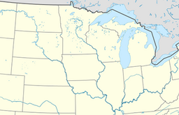
123:
120:
119:
118:
115:
105:
65:
64:
58:
38:
29:Íŋyaŋ Tháŋka Bdé
21:
730:
729:
725:
724:
723:
721:
720:
719:
685:Minnesota River
650:
649:
636:
618:
610:
608:
604:
597:
593:
578:
572:
568:
543:
538:
522:
521:
517:
507:
505:
496:
495:
491:
477:
475:
473:
451:Bright, William
449:
448:
444:
434:
432:
427:
426:
422:
418:
396:
319:, when glacial
291:Minnesota River
286:
185: countries
176:Minnesota River
156:Primary inflows
130:
128:
124:
121:
116:
113:
111:
109:
108:
76:
75:
74:
73:
72:
71:
70:
66:
45:
19:
12:
11:
5:
728:
726:
718:
717:
712:
707:
702:
697:
692:
687:
682:
677:
672:
667:
662:
652:
651:
645:Big Stone Lake
635:
634:External links
632:
631:
630:
590:
566:
560:
550:
542:
539:
537:
536:
515:
489:
471:
465:. p. 64.
442:
419:
417:
414:
413:
412:
407:
402:
395:
392:
285:
282:
245:Big Stone Lake
240:
239:
226:
222:
221:
218:
217:
214:
210:
209:
206:
202:
201:
198:
194:
193:
190:
189:
186:
179:
178:
173:
165:
164:
159:
151:
150:
145:
139:
138:
106:
100:
99:
89:Roberts County
82:
78:
77:
69:Big Stone Lake
68:
67:
60:
59:
53:
52:
51:
50:
47:
46:
39:
31:
30:
26:
25:
24:Big Stone Lake
17:
13:
10:
9:
6:
4:
3:
2:
727:
716:
713:
711:
708:
706:
703:
701:
698:
696:
693:
691:
688:
686:
683:
681:
678:
676:
673:
671:
668:
666:
663:
661:
658:
657:
655:
648:
646:
641:
633:
628:
622:
603:
596:
591:
588:
582:
571:
567:
564:
561:
558:
554:
551:
548:
545:
544:
540:
532:
528:
527:
519:
516:
503:
499:
493:
490:
485:
474:
468:
464:
459:
458:
452:
446:
443:
435:September 10,
430:
424:
421:
415:
411:
408:
406:
403:
401:
398:
397:
393:
391:
389:
385:
381:
376:
374:
370:
366:
365:northern pike
362:
358:
353:
349:
345:
340:
338:
334:
333:Lakota people
330:
326:
322:
318:
314:
310:
305:
303:
298:
296:
292:
283:
281:
279:
278:United States
275:
271:
267:
263:
260:
256:
255:
250:
246:
238:
234:
230:
229:Ortonville MN
227:
223:
219:
215:
207:
200:26 mi (42 km)
199:
191:
188:United States
187:
184:
180:
177:
174:
172:
166:
163:
160:
158:
152:
149:
146:
144:
140:
135:
107:
101:
98:
94:
90:
86:
83:
57:
48:
43:
37:
32:
27:
22:
16:
637:
609:. Retrieved
602:the original
525:
518:
506:. Retrieved
502:the original
492:
482:– via
476:. Retrieved
456:
445:
433:. Retrieved
423:
377:
341:
336:
329:Mitchell Map
321:Lake Agassiz
313:Traverse Gap
306:
299:
287:
274:South Dakota
253:
244:
243:
205:Surface area
97:South Dakota
93:Grant County
15:
619:(2.17
344:state parks
284:Description
225:Settlements
197:Max. length
129: /
104:Coordinates
654:Categories
579:(255
472:080613576X
461:. Norman:
416:References
259:freshwater
213:Max. depth
117:96°37′04″W
114:45°24′28″N
42:Ortonville
508:August 5,
478:March 10,
373:game fish
369:bluegills
302:acre-feet
270:Minnesota
266:reservoir
148:reservoir
611:July 29,
453:(2004).
394:See also
337:Tetonwan
81:Location
541:Sources
361:walleye
357:fishing
317:ice age
276:in the
617:
577:
469:
382:, and
367:, and
249:Dakota
605:(PDF)
598:(PDF)
573:(PDF)
183:Basin
613:2005
510:2012
480:2024
467:ISBN
437:2009
342:Two
264:and
262:lake
143:Type
91:and
621:MiB
581:KiB
656::
625:.
585:.
555:.
531:53
363:,
359::
297:.
280:.
251::
235:,
231:,
95:,
87:/
629:.
623:)
615:.
583:)
575:.
533:.
512:.
486:.
439:.
247:(
Text is available under the Creative Commons Attribution-ShareAlike License. Additional terms may apply.