42:
1219:
314:
is named. The post office opened on August 31, 1901. The Bison
Mercantile Company was originally established as a grocery store by W.J. Scrichfield in 1900 and operated until 1958 when it was purchased by the Bison Cooperative Association. The co-op was established in 1920, the same year that
305:
Bison's economy is agricultural and oil-based with oil wells on several farms and grain elevators by the Bison
Cooperative Association, Star Mill and Burrus Mill companies. Bison was home to Bison State Bank from 1900 until 1933, when it closed due to the
41:
1384:
302:. The church was erected in 1909, followed by a two-story brick school building operated by the Sisters of the Divine Providence from 1911 to 1934, when the Adorers of the Blood of Christ took over.
1152:
1044:
1389:
1122:
1145:
1023:
242:
1102:
307:
62:
252:
913:
1138:
989:
1052:
1130:
311:
323:
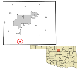
Bison is located in southern
Garfield County on the west side of US Highway 81, which leads north 14 miles (23 km) to
310:. The Hotel Woodring was established in 1900 by Irvin and Ella Woodring, the parents of Irvin "Bertie" Woodring, for whom
299:
195:
116:
952:
298:
located about a mile north of Bison. Bison is home to a
Catholic community, part of St. Joseph's parish under the
1162:
862:
288:
280:
276:
121:
47:
232:
94:
937:
893:
1354:
1303:
272:
32:
1238:
294:
The community was named for nearby
Buffalo Springs, a historic stagecoach stop and a watering hole on the
1066:
1020:
1361:
1288:
205:
1321:
1268:
1248:
332:
268:
1293:
1263:
1258:
1109:
336:
1341:
1331:
1278:
1253:
1243:
1045:"St. Joseph Parish at 101 First Street, Bison, Oklahoma 73720 (Garfield County) United States"
985:
1283:
1273:
1208:
1027:
889:
1336:
1203:
1184:
324:
295:
1378:
681:
953:"Geographic Identifiers: 2010 Demographic Profile Data (G001): Bison CDP, Oklahoma"
1177:
1080:
328:
104:
77:
64:
186:
938:
U.S. Geological Survey
Geographic Names Information System: Bison, Oklahoma
339:, the Bison CDP has an area of 1.06 square miles (2.74 km), all land.
287:, United States, consisting of a 30-acre (12 ha) town plat. As of the
284:
220:
109:
51:
1218:
1103:"2020 CENSUS - SCHOOL DISTRICT REFERENCE MAP: Garfield County, OK"
212:
191:
1230:
1195:
1134:
315:
Oklahoma Gas & Electric brought electricity to the town.
1217:
1067:"Historical Weather for Bison, Oklahoma, United States"
1385:
Census-designated places in
Garfield County, Oklahoma
1320:
1302:
1229:
1194:
251:
241:
231:
219:
202:
185:
177:
169:
164:
156:
148:
140:
132:
127:
115:
103:
93:
23:
18:Census-designated place in Oklahoma, United States
984:. Norman: University of Oklahoma Press, 1987.
1146:
947:
945:
8:
1222:Map of Oklahoma highlighting Garfield County
1032:Encyclopedia of Oklahoma History and Culture
1153:
1139:
1131:
1003:
1001:
999:
997:
835:
347:
20:
976:
974:
905:
240:
218:
184:
163:
155:
126:
92:
57:
38:
933:
931:
855:
250:
230:
201:
176:
168:
147:
139:
131:
114:
102:
7:
1390:Census-designated places in Oklahoma
331:, and south 6 miles (10 km) to
152:0.00 sq mi (0.00 km)
144:1.06 sq mi (2.74 km)
136:1.06 sq mi (2.74 km)
1161:Municipalities and communities of
1081:"Census of Population and Housing"
845:
14:
351:Climate data for Bison, Oklahoma
914:"ArcGIS REST Services Directory"
40:
1007:Rockwell, Stella, ed. "Bison",
312:Enid Woodring Regional Airport
1:
1034:, Oklahoma Historical Society
916:. United States Census Bureau
754:Average snowfall inches (cm)
291:, it had a population of 65.
1049:www.thecatholicdirectory.com
300:Archdiocese of Oklahoma City
540:Mean daily minimum °F (°C)
470:Mean daily maximum °F (°C)
181:52.88/sq mi (20.41/km)
1406:
823:
350:
160:1,217 ft (371 m)
1350:
1215:
1175:
1164:Garfield County, Oklahoma
876:
861:
854:
849:
844:
841:
824:Source: Weatherbase.com
753:
679:
609:
539:
469:
399:
394:
391:
388:
385:
382:
379:
376:
373:
370:
367:
364:
361:
358:
355:
58:
39:
30:
269:unincorporated community
894:Waukomis Public Schools
273:census-designated place
33:Census-designated place
1223:
1221:
877:U.S. Decennial Census
837:Historical population
204: • Summer (
78:36.19583°N 97.89778°W
1363:United States portal
982:Oklahoma Place Names
959:. U.S. Census Bureau
400:Record high °F (°C)
178: • Density
1055:on October 9, 2011.
957:American Factfinder
838:
610:Record low °F (°C)
335:. According to the
83:36.19583; -97.89778
74: /
1224:
1110:U.S. Census Bureau
1026:2012-11-19 at the
1021:The Chisholm Trail
836:
337:U.S. Census Bureau
170: • Total
149: • Water
133: • Total
1372:
1371:
980:Shirk, George H.
881:
880:
828:
827:
275:(CDP) located on
262:
261:
141: • Land
50:and the state of
1397:
1364:
1357:
1220:
1187:
1180:
1170:
1165:
1155:
1148:
1141:
1132:
1125:
1120:
1118:
1116:
1107:
1099:
1093:
1092:
1090:
1088:
1077:
1071:
1070:
1063:
1057:
1056:
1051:. Archived from
1041:
1035:
1018:
1012:
1005:
992:
978:
969:
968:
966:
964:
949:
940:
935:
926:
925:
923:
921:
910:
857:
852:
847:
839:
348:
308:Great Depression
209:
89:
88:
86:
85:
84:
79:
75:
72:
71:
70:
67:
44:
21:
1405:
1404:
1400:
1399:
1398:
1396:
1395:
1394:
1375:
1374:
1373:
1368:
1362:
1356:Oklahoma portal
1355:
1346:
1323:
1316:
1298:
1225:
1213:
1190:
1185:
1178:
1171:
1168:
1163:
1159:
1129:
1128:
1114:
1112:
1105:
1101:
1100:
1096:
1086:
1084:
1079:
1078:
1074:
1065:
1064:
1060:
1043:
1042:
1038:
1028:Wayback Machine
1019:
1015:
1009:Garfield County
1006:
995:
979:
972:
962:
960:
951:
950:
943:
936:
929:
919:
917:
912:
911:
907:
902:
890:school district
886:
850:
834:
829:
818:
813:
808:
803:
798:
793:
788:
783:
778:
773:
768:
763:
758:
748:
743:
738:
733:
728:
723:
718:
713:
708:
703:
698:
693:
688:
674:
669:
664:
659:
654:
649:
644:
639:
634:
629:
624:
619:
614:
604:
599:
594:
589:
584:
579:
574:
569:
564:
559:
554:
549:
544:
534:
529:
524:
519:
514:
509:
504:
499:
494:
489:
484:
479:
474:
464:
459:
454:
449:
444:
439:
434:
429:
424:
419:
414:
409:
404:
345:
321:
281:Garfield County
227:
203:
82:
80:
76:
73:
68:
65:
63:
61:
60:
54:
48:Garfield County
35:
26:
25:Bison, Oklahoma
19:
12:
11:
5:
1403:
1401:
1393:
1392:
1387:
1377:
1376:
1370:
1369:
1367:
1366:
1359:
1351:
1348:
1347:
1345:
1344:
1339:
1334:
1328:
1326:
1322:Unincorporated
1318:
1317:
1315:
1314:
1308:
1306:
1300:
1299:
1297:
1296:
1291:
1286:
1281:
1276:
1271:
1266:
1261:
1256:
1251:
1246:
1241:
1235:
1233:
1227:
1226:
1216:
1214:
1212:
1211:
1206:
1200:
1198:
1192:
1191:
1176:
1173:
1172:
1160:
1158:
1157:
1150:
1143:
1135:
1127:
1126:
1094:
1072:
1058:
1036:
1013:
993:
970:
941:
927:
904:
903:
901:
898:
885:
882:
879:
878:
874:
873:
870:
868:
865:
859:
858:
853:
848:
843:
833:
830:
826:
825:
821:
820:
815:
810:
805:
800:
795:
790:
785:
780:
775:
770:
765:
760:
755:
751:
750:
745:
740:
735:
730:
725:
720:
715:
710:
705:
700:
695:
690:
685:
677:
676:
671:
666:
661:
656:
651:
646:
641:
636:
631:
626:
621:
616:
611:
607:
606:
601:
596:
591:
586:
581:
576:
571:
566:
561:
556:
551:
546:
541:
537:
536:
531:
526:
521:
516:
511:
506:
501:
496:
491:
486:
481:
476:
471:
467:
466:
461:
456:
451:
446:
441:
436:
431:
426:
421:
416:
411:
406:
401:
397:
396:
393:
390:
387:
384:
381:
378:
375:
372:
369:
366:
363:
360:
357:
353:
352:
346:
344:
341:
320:
317:
296:Chisholm Trail
260:
259:
256:
249:
248:
245:
239:
238:
235:
229:
228:
225:
223:
217:
216:
210:
200:
199:
189:
183:
182:
179:
175:
174:
171:
167:
166:
162:
161:
158:
154:
153:
150:
146:
145:
142:
138:
137:
134:
130:
129:
125:
124:
119:
113:
112:
107:
101:
100:
97:
91:
90:
56:
55:
45:
37:
36:
31:
28:
27:
24:
17:
13:
10:
9:
6:
4:
3:
2:
1402:
1391:
1388:
1386:
1383:
1382:
1380:
1365:
1360:
1358:
1353:
1352:
1349:
1343:
1340:
1338:
1335:
1333:
1330:
1329:
1327:
1325:
1319:
1313:
1310:
1309:
1307:
1305:
1301:
1295:
1292:
1290:
1287:
1285:
1282:
1280:
1277:
1275:
1272:
1270:
1267:
1265:
1262:
1260:
1257:
1255:
1252:
1250:
1247:
1245:
1242:
1240:
1237:
1236:
1234:
1232:
1228:
1210:
1207:
1205:
1202:
1201:
1199:
1197:
1193:
1189:
1188:
1181:
1174:
1169:United States
1166:
1156:
1151:
1149:
1144:
1142:
1137:
1136:
1133:
1124:
1115:September 18,
1111:
1104:
1098:
1095:
1082:
1076:
1073:
1068:
1062:
1059:
1054:
1050:
1046:
1040:
1037:
1033:
1029:
1025:
1022:
1017:
1014:
1011:, pgs 862-864
1010:
1004:
1002:
1000:
998:
994:
991:
990:0-8061-2028-2
987:
983:
977:
975:
971:
958:
954:
948:
946:
942:
939:
934:
932:
928:
920:September 20,
915:
909:
906:
899:
897:
895:
891:
883:
875:
871:
869:
866:
864:
860:
840:
831:
822:
816:
811:
806:
801:
796:
791:
786:
781:
776:
771:
766:
761:
756:
752:
746:
741:
736:
731:
726:
721:
716:
711:
706:
701:
696:
691:
686:
683:
682:precipitation
678:
672:
667:
662:
657:
652:
647:
642:
637:
632:
627:
622:
617:
612:
608:
602:
597:
592:
587:
582:
577:
572:
567:
562:
557:
552:
547:
542:
538:
532:
527:
522:
517:
512:
507:
502:
497:
492:
487:
482:
477:
472:
468:
462:
457:
452:
447:
442:
437:
432:
427:
422:
417:
412:
407:
402:
398:
354:
349:
342:
340:
338:
334:
330:
326:
318:
316:
313:
309:
303:
301:
297:
292:
290:
286:
282:
278:
277:US Highway 81
274:
270:
266:
257:
254:
246:
244:
236:
234:
224:
222:
214:
211:
207:
197:
196:Central (CST)
193:
190:
188:
180:
172:
159:
151:
143:
135:
123:
120:
118:
111:
108:
106:
99:United States
98:
96:
87:
59:Coordinates:
53:
49:
43:
34:
29:
22:
16:
1311:
1239:Breckinridge
1183:
1113:. Retrieved
1097:
1085:. Retrieved
1083:. Census.gov
1075:
1061:
1053:the original
1048:
1039:
1031:
1016:
1008:
981:
961:. Retrieved
956:
918:. Retrieved
908:
887:
832:Demographics
684:inches (mm)
322:
304:
293:
264:
263:
46:Location in
15:
1324:communities
1179:County seat
963:January 23,
329:county seat
289:2010 census
81: /
1379:Categories
1289:North Enid
900:References
255:feature ID
165:Population
69:97°53′52″W
66:36°11′45″N
1269:Hillsdale
1249:Covington
1123:Text list
884:Education
333:Hennessey
319:Geography
243:FIPS code
233:Area code
187:Time zone
157:Elevation
1294:Waukomis
1264:Fairmont
1259:Drummond
1024:Archived
680:Average
285:Oklahoma
247:40-06350
221:ZIP code
122:Garfield
110:Oklahoma
52:Oklahoma
1342:Hayward
1332:Blanton
1279:Kremlin
1254:Douglas
1244:Carrier
1087:June 4,
343:Climate
258:2629907
95:Country
1284:Lahoma
1274:Hunter
1209:Garber
1196:Cities
988:
842:Census
814:(2.8)
809:(1.5)
769:(4.3)
764:(8.4)
759:(9.4)
749:(840)
714:(100)
709:(120)
675:(−28)
670:(−21)
665:(−14)
660:(−11)
625:(−21)
620:(−28)
615:(−27)
356:Month
327:, the
267:is an
117:County
1312:Bison
1231:Towns
1106:(PDF)
819:(26)
744:(36)
739:(51)
734:(74)
729:(91)
724:(79)
719:(79)
704:(89)
699:(53)
694:(33)
689:(28)
645:(11)
635:(−2)
630:(−9)
600:(−2)
585:(16)
580:(21)
575:(21)
570:(19)
565:(14)
550:(−2)
545:(−3)
535:(22)
530:(11)
525:(16)
520:(23)
515:(30)
510:(35)
505:(34)
500:(31)
495:(26)
490:(22)
485:(17)
480:(12)
465:(46)
460:(29)
455:(31)
450:(37)
445:(43)
440:(46)
435:(45)
430:(41)
425:(38)
420:(38)
415:(37)
410:(32)
405:(27)
395:Year
265:Bison
226:73720
215:(CDT)
213:UTC-5
192:UTC-6
105:State
1337:Etna
1204:Enid
1186:Enid
1117:2022
1089:2016
986:ISBN
965:2017
922:2022
888:Its
863:2020
851:Note
846:Pop.
817:10.4
804:(0)
799:(0)
794:(0)
789:(0)
784:(0)
779:(0)
774:(0)
655:(0)
650:(6)
640:(6)
605:(9)
595:(3)
590:(9)
560:(9)
555:(3)
475:(9)
392:Dec
389:Nov
386:Oct
383:Sep
380:Aug
377:Jul
374:Jun
371:May
368:Apr
365:Mar
362:Feb
359:Jan
325:Enid
271:and
253:GNIS
128:Area
1304:CDP
892:is
812:1.1
807:0.6
767:1.7
762:3.3
757:3.7
742:1.4
732:2.9
727:3.6
722:3.1
717:3.1
712:4.1
707:4.8
702:3.5
697:2.1
692:1.3
687:1.1
673:−18
618:−18
613:−17
463:115
443:110
438:115
433:113
428:106
423:100
418:100
279:in
237:580
206:DST
1381::
1182::
1167:,
1121:-
1108:.
1047:.
1030:,
996:^
973:^
955:.
944:^
930:^
896:.
867:56
856:%±
747:33
668:−6
658:12
653:32
648:43
643:51
638:43
633:29
628:16
623:−5
603:48
598:28
593:37
588:49
583:61
578:69
573:70
568:66
563:57
558:48
553:37
548:29
543:26
533:72
528:51
523:61
518:74
513:86
508:95
503:93
498:88
493:79
488:72
483:63
478:53
473:48
458:84
453:88
448:99
413:98
408:90
403:81
283:,
173:56
1154:e
1147:t
1140:v
1119:.
1091:.
1069:.
967:.
924:.
872:—
802:0
797:0
792:0
787:0
782:0
777:0
772:0
737:2
663:7
208:)
198:)
194:(
Text is available under the Creative Commons Attribution-ShareAlike License. Additional terms may apply.