42:
867:
590:
In the town, the population was spread out, with 23.8% under the age of 18, 11.4% from 18 to 24, 24.8% from 25 to 44, 22.3% from 45 to 64, and 17.8% who were 65 years of age or older. The median age was 39 years. For every 100 females, there were 72.6 males. For every 100 females age 18 and over,
586:
living together, 9.4% had a female householder with no husband present, and 31.8% were non-families. 28.2% of all households were made up of individuals, and 16.5% had someone living alone who was 65 years of age or older. The average household size was 2.38 and the average family size was 2.93.
566:
of 2000, there were 202 people, 85 households, and 57 families residing in the town. The population density was 65.6 inhabitants per square mile (25.3/km). There were 102 housing units at an average density of 33.1 per square mile (12.8/km). The racial makeup of the town was 94.06%
41:
594:
The median income for a household in the town was $ 31,250, and the median income for a family was $ 36,250. Males had a median income of $ 27,857 versus $ 15,924 for females. The
790:
1043:
689:
1033:
250:
55:
783:
260:
201:
619:
776:
305:
768:
641:
739:
719:
645:
576:
572:
568:
109:
1038:
539:
524:
509:
494:
479:
464:
449:
434:
419:
404:
389:
374:
291:
287:
238:
87:
912:
891:
693:
582:
There were 85 households, out of which 29.4% had children under the age of 18 living with them, 52.9% were
1003:
800:
276:
114:
1010:
211:
970:
945:
930:
975:
955:
337:
667:
980:
940:
846:
598:
for the town was $ 12,628. About 13.2% of families and 19.2% of the population were below the
595:
960:
896:
856:
965:
950:
920:
901:
851:
841:
822:
284:
1027:
243:
602:, including 32.4% of those under the age of eighteen and 8.0% of those 65 or over.
599:
815:
294:, the population was 221, an increase over the figure of 207 tabulated in 2010.
97:
754:
741:
320:
307:
70:
57:
690:"Annual Estimates of the Resident Population: April 1, 2010 to July 1, 2013"
192:
994:‡This populated place also has portions in an adjacent county or counties
583:
340:, the town has a total area of 3.1 square miles (8.0 km), all land.
226:
280:
102:
563:
218:
197:
866:
878:
833:
32:
772:
865:
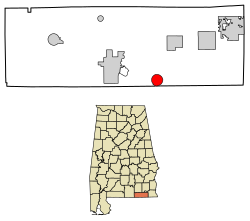
283:, United States. It incorporated in 1905. It is part of the
715:
989:
929:
911:
877:
832:
259:
249:
237:
225:
208:
191:
183:
175:
170:
162:
154:
146:
138:
133:
125:
120:
108:
96:
86:
23:
784:
8:
46:Location of Black in Geneva County, Alabama.
791:
777:
769:
642:"US Gazetteer files: 2010, 2000, and 1990"
347:
20:
870:Map of Alabama highlighting Geneva County
611:
248:
224:
190:
169:
161:
132:
119:
85:
50:
38:
367:
258:
236:
207:
182:
174:
153:
145:
137:
124:
107:
95:
7:
150:4.05 sq mi (10.50 km)
142:4.06 sq mi (10.52 km)
158:0.01 sq mi (0.02 km)
799:Municipalities and communities of
357:
14:
1044:Dothan metropolitan area, Alabama
40:
1034:Towns in Geneva County, Alabama
18:Town in Alabama, United States
1:
622:. United States Census Bureau
288:Metropolitan Statistical Area
720:United States Census Bureau
646:United States Census Bureau
620:"2020 U.S. Gazetteer Files"
187:54.51/sq mi (21.05/km)
1060:
999:
863:
813:
553:
538:
523:
508:
493:
478:
463:
448:
433:
418:
403:
388:
373:
366:
361:
356:
353:
333:(31.011112, -85.744365).
51:
39:
30:
755:31.011112°N 85.744365°W
668:"U.S. Decennial Census"
591:there were 79.1 males.
166:226 ft (69 m)
871:
802:Geneva County, Alabama
869:
760:31.011112; -85.744365
716:"U.S. Census website"
554:U.S. Decennial Census
349:Historical population
321:31.01111°N 85.74444°W
210: • Summer (
71:31.01111°N 85.74417°W
1012:United States portal
302:Black is located at
184: • Density
751: /
648:. February 12, 2011
350:
326:31.01111; -85.74444
317: /
76:31.01111; -85.74417
67: /
872:
348:
338:U.S. Census Bureau
176: • Total
155: • Water
139: • Total
126: • Mayor
1021:
1020:
596:per capita income
560:
559:
336:According to the
270:
269:
147: • Land
1051:
1039:Towns in Alabama
1013:
1006:
868:
825:
818:
808:
803:
793:
786:
779:
770:
766:
765:
763:
762:
761:
756:
752:
749:
748:
747:
744:
731:
730:
728:
726:
712:
706:
705:
703:
701:
692:. Archived from
686:
680:
679:
677:
675:
664:
658:
657:
655:
653:
638:
632:
631:
629:
627:
616:
573:African American
369:
364:
359:
351:
332:
331:
329:
328:
327:
322:
318:
315:
314:
313:
310:
215:
82:
81:
79:
78:
77:
72:
68:
65:
64:
63:
60:
44:
21:
1059:
1058:
1054:
1053:
1052:
1050:
1049:
1048:
1024:
1023:
1022:
1017:
1011:
1004:
995:
985:
932:
925:
907:
873:
861:
828:
823:
816:
809:
806:
801:
797:
759:
757:
753:
750:
745:
742:
740:
738:
737:
735:
734:
724:
722:
714:
713:
709:
699:
697:
696:on May 22, 2014
688:
687:
683:
673:
671:
666:
665:
661:
651:
649:
640:
639:
635:
625:
623:
618:
617:
613:
608:
584:married couples
577:Native American
555:
362:
346:
325:
323:
319:
316:
311:
308:
306:
304:
303:
300:
285:Dothan, Alabama
233:
209:
75:
73:
69:
66:
61:
58:
56:
54:
53:
47:
35:
26:
19:
12:
11:
5:
1057:
1055:
1047:
1046:
1041:
1036:
1026:
1025:
1019:
1018:
1016:
1015:
1008:
1005:Alabama portal
1000:
997:
996:
993:
991:
987:
986:
984:
983:
978:
973:
968:
963:
958:
953:
948:
943:
937:
935:
931:Unincorporated
927:
926:
924:
923:
917:
915:
909:
908:
906:
905:
899:
894:
892:Coffee Springs
889:
883:
881:
875:
874:
864:
862:
860:
859:
854:
849:
844:
838:
836:
830:
829:
814:
811:
810:
798:
796:
795:
788:
781:
773:
733:
732:
707:
681:
659:
633:
610:
609:
607:
604:
558:
557:
551:
550:
547:
545:
542:
536:
535:
532:
530:
527:
521:
520:
517:
515:
512:
506:
505:
502:
500:
497:
491:
490:
487:
485:
482:
476:
475:
472:
470:
467:
461:
460:
457:
455:
452:
446:
445:
442:
440:
437:
431:
430:
427:
425:
422:
416:
415:
412:
410:
407:
401:
400:
397:
395:
392:
386:
385:
382:
380:
377:
371:
370:
365:
360:
355:
345:
342:
299:
296:
268:
267:
264:
257:
256:
253:
247:
246:
241:
235:
234:
231:
229:
223:
222:
216:
206:
205:
195:
189:
188:
185:
181:
180:
177:
173:
172:
168:
167:
164:
160:
159:
156:
152:
151:
148:
144:
143:
140:
136:
135:
131:
130:
127:
123:
122:
118:
117:
112:
106:
105:
100:
94:
93:
90:
84:
83:
49:
48:
45:
37:
36:
31:
28:
27:
25:Black, Alabama
24:
17:
13:
10:
9:
6:
4:
3:
2:
1056:
1045:
1042:
1040:
1037:
1035:
1032:
1031:
1029:
1014:
1009:
1007:
1002:
1001:
998:
992:
988:
982:
979:
977:
974:
972:
969:
967:
964:
962:
959:
957:
954:
952:
949:
947:
944:
942:
939:
938:
936:
934:
928:
922:
919:
918:
916:
914:
910:
903:
900:
898:
895:
893:
890:
888:
885:
884:
882:
880:
876:
858:
855:
853:
850:
848:
845:
843:
840:
839:
837:
835:
831:
827:
826:
819:
812:
807:United States
804:
794:
789:
787:
782:
780:
775:
774:
771:
767:
764:
721:
717:
711:
708:
695:
691:
685:
682:
669:
663:
660:
647:
643:
637:
634:
621:
615:
612:
605:
603:
601:
597:
592:
588:
585:
580:
578:
574:
570:
565:
556:2013 Estimate
552:
548:
546:
543:
541:
537:
533:
531:
528:
526:
522:
518:
516:
513:
511:
507:
503:
501:
498:
496:
492:
488:
486:
483:
481:
477:
473:
471:
468:
466:
462:
458:
456:
453:
451:
447:
443:
441:
438:
436:
432:
428:
426:
423:
421:
417:
413:
411:
408:
406:
402:
398:
396:
393:
391:
387:
383:
381:
378:
376:
372:
352:
343:
341:
339:
334:
330:
297:
295:
293:
289:
286:
282:
278:
277:Geneva County
275:is a town in
274:
265:
262:
254:
252:
245:
242:
240:
230:
228:
220:
217:
213:
203:
202:Central (CST)
199:
196:
194:
186:
178:
165:
157:
149:
141:
128:
116:
113:
111:
104:
101:
99:
92:United States
91:
89:
80:
52:Coordinates:
43:
34:
29:
22:
16:
886:
821:
736:
723:. Retrieved
710:
698:. Retrieved
694:the original
684:
672:. Retrieved
670:. Census.gov
662:
650:. Retrieved
636:
624:. Retrieved
614:
600:poverty line
593:
589:
581:
575:, and 0.50%
561:
344:Demographics
335:
301:
272:
271:
15:
933:communities
817:County seat
758: /
725:January 31,
626:October 29,
324: /
292:2020 census
74: /
1028:Categories
971:High Bluff
946:Chancellor
746:85°44′40″W
743:31°00′40″N
606:References
562:As of the
312:85°44′40″W
263:feature ID
171:Population
129:Lisa Brown
121:Government
62:85°44′39″W
990:Footnotes
976:Highfalls
956:Earlytown
652:April 23,
569:Caucasian
309:31°0′40″N
298:Geography
290:. At the
251:FIPS code
239:Area code
193:Time zone
163:Elevation
59:31°0′40″N
981:Highnote
941:Bellwood
847:Hartford
571:, 5.45%
255:01-07120
227:ZIP code
961:Fadette
897:Malvern
857:Slocomb
700:June 3,
674:June 6,
281:Alabama
266:0114392
103:Alabama
88:Country
966:Hacoda
951:Dundee
921:Eunola
902:Taylor
852:Samson
842:Geneva
834:Cities
824:Geneva
564:census
459:−44.4%
444:−31.3%
414:−45.4%
354:Census
115:Geneva
110:County
887:Black
879:Towns
519:16.1%
504:11.5%
489:−8.8%
474:28.6%
399:26.6%
273:Black
232:36314
221:(CDT)
219:UTC-5
198:UTC-6
98:State
727:2008
702:2014
676:2013
654:2011
628:2021
549:6.8%
540:2020
534:2.5%
525:2010
510:2000
495:1990
480:1980
465:1970
450:1960
435:1950
429:3.9%
420:1940
405:1930
390:1920
375:1910
363:Note
358:Pop.
261:GNIS
134:Area
33:Town
913:CDP
544:221
529:207
514:202
499:174
484:156
469:171
454:133
439:239
424:348
409:335
394:614
379:485
244:334
212:DST
179:221
1030::
820::
805:,
718:.
644:.
579:.
368:%±
279:,
904:‡
792:e
785:t
778:v
729:.
704:.
678:.
656:.
630:.
384:—
214:)
204:)
200:(
Text is available under the Creative Commons Attribution-ShareAlike License. Additional terms may apply.