344:. Mansker returned to the Upper Cumberland in 1771 with a larger group of hunters—among them Isaac Bledsoe—and collected several thousand skins. In 1772, Mansker and Bledsoe led a third expedition to the Upper Cumberland region. This group established a base camp along Station Camp Creek (giving the creek its name) a few miles to the west near Gallatin. It was during this third expedition that Bledsoe followed the ancient buffalo paths to the creek and salt lick that now bear his name, and where he would eventually construct his fort.
567:
579:
48:
495:
431:
550:— a cave is located a few hundred feet east of the fort site. The cave's entrance, which is approximately 5 feet (1.5 m) x 10 feet (3.0 m), is closed to the public. 19th-century cave explorers reported the presence of human skulls in the cave, suggesting that the inhabitants of the Cheskiki Mound village may have used the cave to store "trophy" skulls. A ritual scene depicted on a
261:
528:— the Belote Cemetery (also called the "Pioneer Cemetery") is located along a section of Avery's Trace a few hundred yards southeast of the fort site and contains the graves of various early settlers in the Bledsoe's Lick area. The cemetery's most prominent feature is a 15-foot (4.6 m) obelisk erected by the Bledsoe family in 1908 as a monument to Isaac and Anthony Bledsoe.
591:
522:— Nathaniel Parker's cabin is a typical pioneer log cabin, built in the 1780s. The cabin was originally located a few miles north of Bledsoe's Lick and later dismantled and moved to the park. Parker married Mary Ramsey Bledsoe—the widow of Anthony Bledsoe—in the 1790s and commanded the fort at Greenfield.
516:— Hugh Rogan's stone cottage was built a few miles north of Bledsoe's Lick around 1800. The cottage's architecture was heavily influenced by folk traditions of Rogan's native Ireland, namely the low gabled roof and corresponding doors and windows. The cottage was dismantled and moved to the park in 1998.
361:
485:
The
Bledsoe's Station site was purchased by Sumner County in 1989. Bledsoe's Fort Historical Park consists of approximately 80 acres (0.32 km), and includes the Bledsoe's Station site and several other features important to the early history of the Upper Cumberland region. The park is owned by
413:
a few miles southwest of
Bledsoe's Lick) was overrun in 1792, and Morgan's Station (northwest of Bledsoe's Lick) was nearly burned a few months later. In 1793, Isaac Bledsoe was shot and killed while walking through a field near Bledsoe's Station. The following year, a son of Anthony Bledsoe (named
230:
just over a mile to the south. The hill is relatively blunt and consists of open fields alternating with densely forested areas. The top of the hill is used as a flying zone for radio-controlled airplanes. The spring that furnished the minerals for
Bledsoe's Lick flows at the base of the hill a few
465:, purchased Bledsoe's Station in 1797. The following year, Winchester completed Cragfont near Bledsoe Creek about a mile to the west. In 1807, a pioneer from North Carolina named Jeremiah Belote purchased Bledsoe's Lick, and his descendants retained possession of the property for several decades.
205:
Bledsoe's Fort
Historical Park protects the fort's excavation site, as an outline of the fort's walls can be discerned from former excavation trenches, as well as several historic structures, including the Nathaniel Parker Cabin and Hugh Rogan Cottage, who were compatriots of Isaac Bledsoe and a
473:
Following
Winchester's death in 1826, his daughter, Almira Wynne, inherited what is now the Wynnewood State Historical Site. Wynnewood—the largest extant log structure in the state—was completed in 1830 and operated as an inn. During this period, the Winchester family also managed to
405:
reporting that 14 settlers had been killed that year and sought permission to attack the
Chickamaugas. A schoolmaster named George Hamilton was shot and badly wounded at Bledsoe's Station in 1787. As attacks increased, Anthony moved his family from Greenfield to Bledsoe's Station, which afforded
388:
Isaac
Bledsoe probably began building Bledsoe's Station shortly after his arrival, although he did not move his family into the fort until 1783. Around the time Bledsoe's Station was completed, Anthony completed a fort at Greenfield 2.5 miles (4.0 km) north of Bledsoe's Station. As settlers
234:
Bledsoe's Fort
Historical Park covers most of the hill between the Sumner County RC Flyers airfield and Rock Springs Road. Tennessee State Route 25, also known as Hartsville Pike, provides the park's southern boundary and main access. The park is roughly halfway between
841:
396:
In 1782, frontiersman Hugh Rogan (1747–1814) was nearly killed in an ambush in the vicinity of what is now
Cragfont. A hunting party led by Thomas Spencer was attacked at Drake's Creek in 1784. Spencer survived but was later killed in an ambush near
193:
and Middle
Tennessee at the time. The flood of settlers into the region brought inevitable conflict with the region's Native American inhabitants, and dozens of settlers were killed in the late 1780s and early 1790s. Isaac Bledsoe's brother
393:—a renegade branch of the Cherokee—had for the most part been at war with the United States since 1776 and opposed land concessions that would allow Euro-American settlers to move into the Middle Tennessee area permanently.
534:— the long hunter camp is a demonstration area located along a spring near the ancient salt lick. MTSU has constructed a "lean-to" structure believed to be typical of shelters used at 18th-century long hunter base camps.
866:
292:, a few hundred yards from the mineral springs. The village covered 40 acres (0.16 km) and contained at least 12 mounds. By the time the first Euro-American explorers arrived in the area in the mid-18th century, the
846:
418:. Thomas Bledsoe, another son of Anthony Bledsoe, was ambushed and killed a few months later. Hostilities between the settlers and the Chickamaugas finally subsided when the 1794 Treaty of Tellico brought an end to the
351:
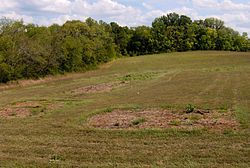
tree just south of the mineral springs. Spencer spent much of the year building cabins in the area, believing (mistakenly) that if he constructed cabins on certain tracts of land, he could lay claim to these tracts.
510:(MTSU) in the late 1990s. Excavators discovered several root cellars (indicating the presence of log cabins) and the fort's stockade. The excavation trench lines remain, and a small platform overlooks the site.
486:
Sumner County and maintained by the Bledsoe's Lick Historical Association. A short loop trail—part of which follows a section of Avery's Trace—provides access to the fort site and other features.
380:
in 1776 and was elected to the Virginia House of Delegates the following year. Isaac Bledsoe also served in the French and Indian War, and following the long hunting excursions of the early 1770s, he joined
347:
In the late 1770s, longhunter and explorer Thomas "Bigfoot" Spencer led a hunting expedition that camped near Bledsoe's Lick. Spencer remained throughout 1778, spending the winter in a hollowed-out
836:
385:
1776 punitive expedition against the Cherokee. In 1779, North Carolina appointed Anthony Bledsoe to lead a surveying party to Middle Tennessee. Isaac Bledsoe followed in 1781.
438:
The first major road connecting the Upper Cumberland region with settlements to the east, known as Avery's Trace, was completed in 1788. The road, which connected
177:
Bledsoe's Station was one of a series of frontier outposts built in the Upper Cumberland during the first major migration of Euro-American settlers into the
861:
85:
406:
better protection, but in 1788 he was shot and mortally wounded when he accidentally stepped into a section of the fort vulnerable to hostile fire.
820:
382:
222:
Bledsoe's Station was located on a hill slope between Bledsoe Creek to the west and Bledsoe Lick Creek to the east. Both streams empty into the
639:
269:
167:
34:
442:
with Nashville, passed a few hundred feet east of Bledsoe's Station. Guests at Bledsoe's Station in the 1790s included French botanist
170:
attacks. While the fort is no longer standing, its location has been verified by archaeological excavations. The site is now part of
507:
409:
Conflict between the Chickamaugas and the Upper Cumberland settlers continued into the early 1790s. Ziegler's Fort (at what is now
198:
was killed in an ambush at the fort in 1788, and Isaac was killed while tending a field outside the fort in 1793. The end of the
544:
used by the Belote family in the 19th century are located along a spring in the Bledsoe's Lick area, near the Long hunter camp.
414:
Anthony) and a nephew of Anthony and Isaac (also named Anthony) were both ambushed and killed near Rock Castle at what is now
268:
For thousands of years, the mineral springs at Bledsoe's Lick attracted buffalo and other large animals and subsequently drew
277:
566:
289:
155:
61:
578:
166:
pioneer Isaac Bledsoe (c. 1735–1793) in the early 1780s to protect Upper Cumberland settlers and migrants from hostile
856:
851:
419:
199:
206:
pioneer cemetery, with a large obelisk, dedicated to the Bledsoe brothers. The Castalian Springs Mound Site and the
454:
182:
415:
389:
poured into the Upper Cumberland region, conflict with the region's Native American inhabitants intensified. The
272:
hunters to the area. Native Americans were hunting around Bledsoe's Lick as early as 12,000 years ago during the
410:
333:
316:, so-called because of the long durations of their hunting expeditions. The longhunters typically followed the
163:
398:
377:
340:
spent several months in the Upper Cumberland area, eventually sending two canoes full of furs downriver to
373:
285:
236:
207:
360:
439:
390:
341:
244:
240:
72:
770:
Information obtained from interpretive signs at Bledsoe's Fort Historical Park, 14 September 2008.
636:
590:
612:
462:
312:
Among the first documented English-American explorers, in the Upper Cumberland region, were the
475:
447:
443:
325:
317:
227:
223:
186:
178:
657:
The Great Leap Westward: A History of Sumner County, Tennessee from Its Beginnings to 1805
643:
474:
change the name of Bledsoe's Lick to "Castalian Springs", the name being derived from the
458:
402:
369:
281:
195:
174:, a public park established in 1989 by Sumner County residents and Bledsoe's descendants.
47:
376:
and in various capacities with the Virginia militia. He commanded Fort Patrick Henry at
494:
337:
336:, and hunted extensively in the Upper Cumberland region. In 1769, an expedition led by
190:
780:
131:
830:
728:
699:
682:
430:
551:
368:
The Bledsoe brothers, Isaac and Anthony, were born in Virginia in the early 1730s.
329:
273:
202:
in 1794 ended much of the violence in the region and reduced the fort's necessity.
482:
in Greece. Castalian Springs thrived sporadically as a health resort until 1914.
260:
607:
541:
301:
313:
159:
842:
Archaeological sites on the National Register of Historic Places in Tennessee
100:
87:
297:
288:(c. 1000–1450 AD), a substantial village had been established at the
154:, was an 18th-century fortified frontier settlement located in what is now
348:
321:
293:
211:
243:
to the west and lies approximately 35 miles (56 km) northeast of
479:
401:. In 1786, Anthony Bledsoe wrote a letter to North Carolina governor
659:(Gallatin, Tenn.: Sumner County Public Library Board, 1969), 17-26.
554:
uncovered at the mound site lends some credence to this hypothesis.
493:
429:
359:
259:
867:
National Register of Historic Places in Sumner County, Tennessee
461:
to the southwest and was later instrumental in the founding of
847:
Forts on the National Register of Historic Places in Tennessee
332:
in 1765 and James Smith in 1766 passed through what is now
276:
period and camped sporadically in the area throughout the
506:— the site of Bledsoe's Station was excavated by
434:
Sign marking what was once a section of Avery's Trace
356:
European-American settlement and Indian hostilities
137:
124:
116:
79:
68:
57:
821:Archaeological Investigations at Bledsoe's Station
210:are located immediately east of the park, and the
785:The Tennessee Encyclopedia of History and Culture
704:The Tennessee Encyclopedia of History and Culture
687:The Tennessee Encyclopedia of History and Culture
631:
629:
627:
8:
735:(Nashville, Tenn.: Charles Elder, 1971), 30.
837:Protected areas of Sumner County, Tennessee
185:. The fort was a convenient stopover along
46:
35:U.S. National Register of Historic Places
635:Bledsoe's Lick Archaeological Project, "
284:(1000 BC - 1000 AD) periods. During the
800:Sumner County Fact Book 2007–2008
637:Historical Background of Bledsoe's Lick
623:
562:
372:, the older of the two, served in the
320:and its headwaters, from southwestern
304:claimed the area as a hunting ground.
18:
231:hundred yards east of the fort site.
7:
787:, 2009. Retrieved: 9 February 2013.
706:, 2009. Retrieved: 9 February 2013.
689:, 2009. Retrieved: 9 February 2013.
468:
364:Map of the Upper Cumberland frontier
214:is located immediately to the west.
823:, Middle Tennessee State University
862:Pre-statehood history of Tennessee
14:
733:Historic Sumner County, Tennessee
508:Middle Tennessee State University
476:spring of mythological importance
646:." Retrieved: October 12, 2008.
589:
577:
565:
189:—the main road connecting
448:Louis-Philippe, Duke of Orléans
469:Bledsoe's Fort Historical Park
172:Bledsoe's Fort Historical Park
126:
1:
308:European-American exploration
208:Wynnewood State Historic Site
52:The site of Bledsoe's Station
808:The Hendersonville Star News
450:and later king of France.
290:Castalian Springs Mound Site
264:Castalian Springs Mound Site
212:Cragfont State Historic Site
156:Castalian Springs, Tennessee
62:Castalian Springs, Tennessee
16:United States historic place
256:Native-American settlements
883:
378:Long Island of the Holston
779:Caneta Skelley Hankins, "
125:NRHP reference
45:
41:
32:
25:
21:
548:The Cavern of the Skulls
411:Bledsoe Creek State Park
334:Sumner County, Tennessee
158:. The fort was built by
759:The Great Leap Westward
746:The Great Leap Westward
717:The Great Leap Westward
670:The Great Leap Westward
540:— the ruins of a
457:, who helped establish
572:Nathaniel Parker Cabin
520:Nathaniel Parker Cabin
504:Bledsoe's Station site
499:
435:
420:Cherokee–American wars
365:
265:
200:Cherokee–American wars
497:
433:
425:
374:French and Indian War
363:
328:. Expeditions led by
263:
101:36.39944°N 86.32056°W
584:Cavern of the Skulls
440:Fort Southwest Point
342:Natchez, Mississippi
286:Mississippian period
490:Historical features
383:William Christian's
280:(8000-1000 BC) and
226:impoundment of the
183:American Revolution
181:area following the
106:36.39944; -86.32056
97: /
73:Gallatin, Tennessee
857:Parks in Tennessee
852:Forts in Tennessee
642:2011-05-03 at the
613:Tellico Blockhouse
538:Belote springhouse
514:Hugh Rogan Cottage
500:
498:Hugh Rogan Cottage
436:
366:
266:
120:c. 1781–1783
804:The News Examiner
148:Bledsoe's Station
145:
144:
27:Bledsoe's Station
874:
788:
777:
771:
768:
762:
755:
749:
742:
736:
726:
720:
713:
707:
698:Walter Durham, "
696:
690:
681:Walter Durham, "
679:
673:
666:
660:
653:
647:
633:
593:
581:
569:
532:Long hunter camp
455:James Winchester
326:Middle Tennessee
318:Cumberland River
239:to the east and
228:Cumberland River
224:Old Hickory Lake
179:Middle Tennessee
150:, also known as
128:
112:
111:
109:
108:
107:
102:
98:
95:
94:
93:
90:
50:
19:
882:
881:
877:
876:
875:
873:
872:
871:
827:
826:
817:
796:
791:
778:
774:
769:
765:
756:
752:
743:
739:
727:
723:
714:
710:
697:
693:
683:Anthony Bledsoe
680:
676:
667:
663:
655:Walter Durham,
654:
650:
644:Wayback Machine
634:
625:
621:
604:
597:
596:Belote Cemetery
594:
585:
582:
573:
570:
561:
526:Belote Cemetery
492:
471:
428:
403:Richard Caswell
370:Anthony Bledsoe
358:
310:
270:Native American
258:
253:
220:
168:Native American
105:
103:
99:
96:
91:
88:
86:
84:
83:
53:
37:
28:
17:
12:
11:
5:
880:
878:
870:
869:
864:
859:
854:
849:
844:
839:
829:
828:
825:
824:
816:
815:External links
813:
812:
811:
795:
792:
790:
789:
772:
763:
750:
737:
721:
708:
691:
674:
661:
648:
622:
620:
617:
616:
615:
610:
603:
600:
599:
598:
595:
588:
586:
583:
576:
574:
571:
564:
560:
557:
556:
555:
545:
535:
529:
523:
517:
511:
491:
488:
470:
467:
427:
424:
416:Hendersonville
357:
354:
338:Kasper Mansker
309:
306:
257:
254:
252:
249:
219:
216:
152:Bledsoe's Fort
143:
142:
139:
135:
134:
129:
122:
121:
118:
114:
113:
81:
77:
76:
70:
66:
65:
59:
55:
54:
51:
43:
42:
39:
38:
33:
30:
29:
26:
23:
22:
15:
13:
10:
9:
6:
4:
3:
2:
879:
868:
865:
863:
860:
858:
855:
853:
850:
848:
845:
843:
840:
838:
835:
834:
832:
822:
819:
818:
814:
809:
805:
801:
798:
797:
793:
786:
782:
776:
773:
767:
764:
760:
754:
751:
747:
741:
738:
734:
730:
729:Jay Guy Cisco
725:
722:
718:
712:
709:
705:
701:
700:Isaac Bledsoe
695:
692:
688:
684:
678:
675:
671:
665:
662:
658:
652:
649:
645:
641:
638:
632:
630:
628:
624:
618:
614:
611:
609:
606:
605:
601:
592:
587:
580:
575:
568:
563:
558:
553:
549:
546:
543:
539:
536:
533:
530:
527:
524:
521:
518:
515:
512:
509:
505:
502:
501:
496:
489:
487:
483:
481:
477:
466:
464:
460:
456:
451:
449:
445:
444:André Michaux
441:
432:
426:Avery's Trace
423:
421:
417:
412:
407:
404:
400:
394:
392:
386:
384:
379:
375:
371:
362:
355:
353:
350:
345:
343:
339:
335:
331:
327:
323:
319:
315:
307:
305:
303:
299:
295:
291:
287:
283:
279:
275:
271:
262:
255:
250:
248:
246:
242:
238:
232:
229:
225:
217:
215:
213:
209:
203:
201:
197:
192:
188:
187:Avery's Trace
184:
180:
175:
173:
169:
165:
164:Sumner County
161:
157:
153:
149:
141:July 30, 1992
140:
138:Added to NRHP
136:
133:
130:
123:
119:
115:
110:
82:
78:
74:
71:
67:
63:
60:
56:
49:
44:
40:
36:
31:
24:
20:
807:
803:
799:
784:
775:
766:
758:
753:
745:
740:
732:
724:
716:
711:
703:
694:
686:
677:
669:
664:
656:
651:
552:shell gorget
547:
537:
531:
525:
519:
513:
503:
484:
472:
452:
437:
408:
399:Crab Orchard
395:
391:Chickamaugas
387:
367:
346:
330:Henry Skaggs
311:
274:Paleo-Indian
267:
233:
221:
204:
176:
171:
151:
147:
146:
69:Nearest city
608:Fort Blount
542:springhouse
314:longhunters
104: /
80:Coordinates
831:Categories
794:References
761:, 107-121.
237:Hartsville
160:longhunter
92:86°19′14″W
89:36°23′58″N
748:, 99-101.
298:Chickasaw
245:Nashville
218:Geography
757:Durham,
744:Durham,
719:, 31-45.
715:Durham,
672:, 28-29.
668:Durham,
640:Archived
602:See also
453:General
349:sycamore
322:Virginia
294:Cherokee
282:Woodland
241:Gallatin
132:92000970
58:Location
810:. 2007.
559:Gallery
463:Memphis
278:Archaic
251:History
196:Anthony
806:&
781:Rogana
480:Delphi
300:, and
619:Notes
478:near
459:Cairo
324:into
302:Creek
117:Built
783:."
702:."
685:."
446:and
191:East
162:and
75:, US
64:, US
127:No.
833::
802:.
731:,
626:^
422:.
296:,
247:.
Text is available under the Creative Commons Attribution-ShareAlike License. Additional terms may apply.