453:. Braxton County was originally divided into four townships: Clay, Franklin, Lincoln, and Washington, which became magisterial districts in 1872. All four districts were renamed in 1873: Clay District became Kanawha, Franklin became Holly, Lincoln became Otter, and Washington became Birch. Two years later, Salt Lick District was formed from part of Kanawha. The two districts were reconsolidated between 1910 and 1920, when the territory of Kanawha District was added to Salt Lick; otherwise they remained stable for the next sixty years. Between 1980 and 1990, the county was reorganized into four new magisterial districts: Northern, Southern, Eastern, and Western.
89:
2927:
45:
64:
74:
104:
948:, there were 14,523 people, 6,000 households, and 4,043 families living in the county. The population density was 28.4 people per square mile (11.0 people/km). There were 7,415 housing units at an average density of 14.5 units per square mile (5.6 units/km). The racial makeup of the county was 98.2% white, 0.4% black or African American, 0.3% American Indian, 0.2% Asian, 0.0% from other races, and 0.9% from two or more races. Those of Hispanic or Latino origin made up 0.5% of the population. In terms of ancestry, 19.7% were
159:
4026:
176:
2782:
464:
2796:
2774:
276:
2757:
504:
474:
494:
484:
1063:, later became supportive. Consequently, up until the decline of coal mining unionization, and growing opposition to socially controversial issues, Braxton County was overwhelmingly Democratic. Like all of West Virginia, it has seen an extremely rapid shift to the Republicans over the past five elections.
1035:
living together, 9.20% had a female householder with no husband present, and 29.00% were non-families. 25.20% of all households were made up of individuals, and 12.40% had someone living alone who was 65 years of age or older. The average household size was 2.46 and the average family size was 2.92.
1039:
In the county, the population was spread out, with 22.80% under the age of 18, 7.50% from 18 to 24, 28.10% from 25 to 44, 25.80% from 45 to 64, and 15.80% who were 65 years of age or older. The median age was 40 years. For every 100 females there were 102.60 males. For every 100 females age 18 and
967:
Of the 6,000 households, 28.0% had children under the age of 18 living with them, 52.8% were married couples living together, 9.5% had a female householder with no husband present, 32.6% were non-families, and 27.9% of all households were made up of individuals. The average household size was 2.36
935:
Of the 4,352 households, 55.5% were married couples living together, 23.5% had a female householder with no spouse present, 16.2% had a male householder with no spouse present. The average household and family size was 3.23. The median age in the county was 46.3 years with 19.6% of the population
971:
The median income for a household in the county was $ 32,158 and the median income for a family was $ 40,421. Males had a median income of $ 42,355 versus $ 22,557 for females. The per capita income for the county was $ 17,469. About 17.0% of families and 21.0% of the population were below the
429:
were massacred by frontiersmen. Jesse Hughes helped
Jeremiah Carpenter track and kill the Indians responsible for the Carpenter massacre. Jeremiah was a notable fiddle player who wrote a song Shelvin’ Rock about the experience of escaping to rock shelter.
2150:
3567:
992:
was 29 people per square mile (11 people/km). There were 7,374 housing units at an average density of 14 units per square mile (5.4 units/km). The racial makeup of the county was 98.02%
3359:
1896:
1867:
1838:
1809:
1780:
1751:
1722:
1693:
1664:
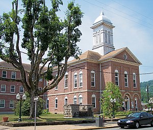
1635:
1606:
1577:
1548:
1519:
1490:
1461:
1432:
1403:
1374:
1345:
1316:
1287:
1258:
1229:
1200:
1171:
1142:
1113:
2850:
1043:
The median income for a household in the county was $ 24,412, and the median income for a family was $ 29,133. Males had a median income of $ 27,560 versus $ 17,778 for females. The
3640:
88:
4043:
3439:
3339:
442:, the county has a total area of 516 square miles (1,340 km), of which 511 square miles (1,320 km) is land and 5.5 square miles (14 km) (1.1%) is water.
44:
3334:
2719:
921:
4097:
3386:
332:
3471:
904:, there were 12,447 people and 4,532 households residing in the county. There were 6,251 housing units in Braxton. The racial makeup of the county was 96.2%
3306:
2550:
3620:
3537:
2843:
3650:
3597:
2465:
2246:
2260:
449:, with the intention of encouraging local government. This proved impractical in the heavily rural state, and in 1872 the townships were converted into
103:
404:
3630:
3557:
2610:
2580:
2520:
4092:
2657:
73:
63:
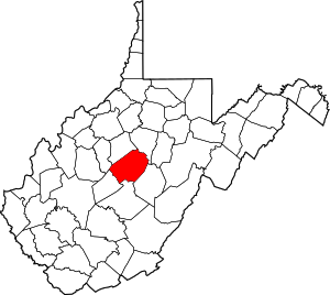
3466:
3273:
2963:
1992:
4087:
2836:
120:
2993:
2948:
2017:
1060:
917:
3514:
3456:
3572:
3461:
3381:
3552:
3354:
2712:
2145:
3733:
3376:
3329:
360:
3926:
3891:
3801:
2828:
2194:
1080:
1075:
4102:
4082:
3921:
3916:
3831:
3806:
3781:
3670:
3607:
3414:
3319:
2220:
3946:
3906:
3871:
3861:
3821:
3746:
3409:
3324:
2810:
531:
392:
4011:
3991:
3961:
3951:
3941:
3931:
3881:
3846:
3836:
3826:
3811:
3786:
3771:
3741:
3582:
3489:
3424:
2815:
2766:
2705:
929:
543:
525:
388:
3996:
3981:
3971:
3966:
3936:
3901:
3896:
3876:
3856:
3791:
3766:
3761:
3645:
3635:
3625:
3451:
3396:
3344:
3231:
3139:
2739:
2117:
549:
2558:
2371:
3986:
3976:
3956:
3886:
3866:
3851:
3841:
3816:
3796:
3751:
3615:
3562:
3349:
3266:
3093:
3088:
2746:
2614:
2584:
2554:
2524:
2354:
2087:
2082:
1085:
1025:
1021:
1017:
1013:
1009:
1005:
1001:
997:
993:
519:
439:
384:
4006:
4001:
3911:
3776:
3713:
3703:
3655:
3434:
3364:
3078:
2805:
2172:
537:
3660:
2581:"DP02 SELECTED SOCIAL CHARACTERISTICS IN THE UNITED STATES – 2006–2010 American Community Survey 5-Year Estimates"
2285:
The Border
Settlers of Northwestern Virginia from 1768 to 1795 1915 The Republican Publishing Company Hamilton, OH
3708:
3698:
3688:
3683:
3446:
3404:
3296:
3023:
2901:
2490:
2047:
1936:
945:
901:
857:
842:
827:
812:
797:
782:
767:
752:
737:
722:
707:
692:
677:
662:
647:
632:
617:
602:
587:
372:
2618:
2588:
2528:
2320:
1031:
There were 5,771 households, out of which 30.30% had children under the age of 18 living with them, 57.30% were
3429:
3371:
3314:
3033:
2973:
2906:
2458:
2052:
2002:
1941:
2264:
3723:
3693:
3198:
3193:
3129:
3124:
3108:
2911:
2107:
2097:
2042:
1946:
422:
3718:
3678:
3592:
3419:
3259:
3113:
3053:
3048:
2998:
2072:
2067:
2022:
507:
35:
3504:
3499:
3494:
3208:
3203:
3170:
3159:
3154:
3134:
3119:
3103:
3098:
3058:
3028:
3018:
2978:
2968:
2958:
2916:
2882:
2132:
2112:
2102:
2092:
2077:
2037:
1997:
1984:
1951:
497:
487:
380:
213:
50:
2640:
4030:
3542:
3532:
3238:
3188:
3164:
3149:
3144:
3083:
3073:
3068:
3013:
3003:
2988:
2953:
2893:
2358:
2127:
2122:
2027:
2012:
925:
450:
411:
310:
2926:
3522:
3063:
3008:
2983:
2938:
2697:
2032:
2007:
1047:
for the county was $ 13,349. About 17.90% of families and 22.00% of the population were below the
988:
of 2000, there were 14,702 people, 5,771 households, and 4,097 families living in the county. The
3547:
3043:
3038:
2662:
2062:
2057:
989:
2392:
2611:"DP03 SELECTED ECONOMIC CHARACTERISTICS – 2006–2010 American Community Survey 5-Year Estimates"
2521:"DP-1 Profile of General Population and Housing Characteristics: 2010 Demographic Profile Data"
3587:
3577:
3527:
2240:
1044:
321:
300:
909:
2658:‘Demographic Shift: Southern Whites’ Loyalty to G.O.P. Nearing That of Blacks to Democrats’
2436:
2372:"Annual Estimates of the Resident Population for Counties: April 1, 2020 to July 1, 2021"
936:
under 18. The median income for a household was $ 42,519 and the poverty rate was 18.3%.
957:
913:
905:
446:
396:
201:
2198:
4076:
3286:
477:
467:
368:
181:
109:
94:
1059:
Braxton County, although initially opposed to secession during the first session of
2224:
1048:
973:
953:
2875:
376:
208:
3282:
3180:
2151:
National
Register of Historic Places listings in Braxton County, West Virginia
1067:
United States presidential election results for
Braxton County, West Virginia
418:
364:
4058:
4045:
2295:
1051:, including 27.90% of those under age 18 and 13.70% of those age 65 or over.
317:
296:
135:
122:
2930:
Map of West
Virginia Strange Creek, West Virginiahighlighting Braxton County
961:
291:
976:, including 30.4% of those under age 18 and 13.0% of those age 65 or over.
3251:
3222:‡This populated place also has portions in an adjacent county or counties
1032:
400:
196:
949:
463:
2677:
985:
968:
and the average family size was 2.86. The median age was 43.8 years.
426:
2414:
343:
2345:, 2nd ed., University Press of Kentucky, Lexington (1993), p. 240.
2459:"Census 2000 PHC-T-4. Ranking Tables for Counties: 1990 and 2000"
1020:, and 0.71% from two or more races. 0.44% of the population were
503:
473:
3255:
2832:
2701:
493:
483:
2361:, Tables of Minor Civil Divisions in West Virginia, 1870–2010.
2551:"Population, Housing Units, Area, and Density: 2010 – County"
2925:
425:
and here, in 1772, Captain Bull and his family and friendly
2437:"Population of Counties by Decennial Census: 1900 to 1990"
445:
In 1863, West
Virginia's counties were divided into
3732:
3669:
3606:
3513:
3482:
3395:
3305:
3217:
3179:
2937:
2892:
338:
328:
307:
290:
282:
269:
261:
256:
248:
240:
232:
227:
219:
207:
195:
187:
169:
151:
26:
2678:"Dave Leip's Atlas of U.S. Presidential Elections"
2197:. National Association of Counties. Archived from
414:of West Virginia was in northern Braxton County.
2728:Places adjacent to Braxton County, West Virginia
2323:. United States Census Bureau. August 22, 2012
383:. The county was formed in 1836 from parts of
3267:
2844:
2713:
2515:
2513:
2511:
2263:. United States Census Bureau. Archived from
8:
3274:
3260:
3252:
2851:
2837:
2829:
2720:
2706:
2698:
1065:
560:
23:
932:of any race were 0.7% of the population.
244:510.74 sq mi (1,322.8 km)
236:516.28 sq mi (1,337.2 km)
2161:
337:
327:
289:
255:
226:
206:
186:
150:
115:
85:
57:
41:
3598:Washington–Baltimore metropolitan area
2261:"Centers of Population by State: 2010"
2245:: CS1 maint: archived copy as title (
2238:
580:
16:County in West Virginia, United States
2341:Otis K. Rice & Stephen W. Brown,
1084:
1079:
1074:
1071:
306:
281:
268:
260:
247:
239:
231:
218:
194:
168:
100:
7:
4098:Populated places established in 1836
2735:
2471:from the original on October 9, 2022
2167:
2165:
108:West Virginia's location within the
2641:‘How Central Appalachia Went Right’
252:5.54 sq mi (14.3 km)
2859:Municipalities and communities of
2146:Elk River Wildlife Management Area
570:
93:Location within the U.S. state of
14:
1061:the Virginia Secession Convention
375:, the population was 12,447. The
49:The Braxton County Courthouse in
4024:
2794:
2780:
2772:
2755:
2417:. University of Virginia Library
502:
492:
482:
472:
462:
275:
274:
174:
157:
102:
87:
72:
62:
43:
4093:1836 establishments in Virginia
2464:. United States Census Bureau.
2173:"State & County QuickFacts"
1040:over, there were 103.00 males.
1:
4088:Braxton County, West Virginia
3583:Ridge-and-Valley Appalachians
2862:Braxton County, West Virginia
2795:
2778:Braxton County, West Virginia
2756:
2439:. United States Census Bureau
2395:. United States Census Bureau
2321:"2010 Census Gazetteer Files"
2175:. United States Census Bureau
3558:Huntington metropolitan area
3538:Charleston metropolitan area
2781:
2773:
403:statesman and signer of the
3641:Parkersburg–Marietta–Vienna
2615:United States Census Bureau
2585:United States Census Bureau
2555:United States Census Bureau
2525:United States Census Bureau
2415:"Historical Census Browser"
2355:United States Census Bureau
440:United States Census Bureau
405:Declaration of Independence
363:in the central part of the
270: • Estimate
4119:
2300:West Virginia Encyclopedia
1978:Unincorporated communities
286:24.37/sq mi (9.41/km)
4020:
3440:Colleges and universities
3293:
3227:
2923:
2873:
2733:
2296:"e-WV | Carpenter Family"
1106:
1103:
1100:
1097:
1094:
946:2010 United States census
884:
871:
856:
841:
826:
811:
796:
781:
766:
751:
736:
721:
706:
691:
676:
661:
646:
631:
616:
601:
586:
579:
574:
569:
566:
116:
101:
86:
58:
42:
33:
4031:West Virginia portal
3340:Census-designated places
2343:West Virginia: A History
2393:"U.S. Decennial Census"
395:counties and named for
21:County in West Virginia
4103:Counties of Appalachia
4083:West Virginia counties
3626:Hagerstown–Martinsburg
2931:
508:West Virginia Route 15
329:Congressional district
3335:Magisterial districts
2929:
2491:"Explore Census Data"
2359:U.S. Decennial Census
2227:on September 23, 2001
1959:Magisterial districts
885:U.S. Decennial Census
562:Historical population
498:West Virginia Route 5
488:West Virginia Route 4
451:magisterial districts
309: • Summer (
3651:Weirton–Steubenville
3543:Cumberland Mountains
3533:Blue Ridge Mountains
3240:United States portal
3233:West Virginia portal
2621:on February 13, 2020
2591:on February 13, 2020
2561:on February 13, 2020
2531:on February 13, 2020
930:Hispanics or Latinos
412:center of population
283: • Density
4055: /
3523:Allegheny Mountains
3387:Tourist attractions
2682:uselectionatlas.org
2639:Schwartzman, Gabe;
1068:
889:1990–2000 2010–2020
887:1790–1960 1900–1990
563:
132: /
3631:Huntington–Ashland
3573:Northern Panhandle
3548:Cumberland Plateau
2932:
2663:The New York Times
2647:, January 13, 2015
2267:on January 3, 2014
1066:
990:population density
561:
262: • Total
249: • Water
233: • Total
4038:
4037:
3588:Shenandoah Valley
3578:Potomac Highlands
3553:Eastern Panhandle
3528:Allegheny Plateau
3249:
3248:
2826:
2825:
2821:
2820:
1923:
1922:
1045:per capita income
926:two or more races
893:
892:
514:Adjacent counties
438:According to the
354:
353:
241: • Land
4110:
4070:
4069:
4067:
4066:
4065:
4060:
4056:
4053:
4052:
4051:
4048:
4029:
4028:
4027:
3276:
3269:
3262:
3253:
3241:
3234:
2928:
2885:
2878:
2868:
2863:
2853:
2846:
2839:
2830:
2798:
2797:
2784:
2783:
2776:
2775:
2759:
2758:
2736:
2722:
2715:
2708:
2699:
2693:
2692:
2690:
2688:
2673:
2667:
2666:, April 24, 2014
2654:
2648:
2637:
2631:
2630:
2628:
2626:
2617:. Archived from
2607:
2601:
2600:
2598:
2596:
2587:. Archived from
2577:
2571:
2570:
2568:
2566:
2557:. Archived from
2547:
2541:
2540:
2538:
2536:
2527:. Archived from
2517:
2506:
2505:
2503:
2501:
2487:
2481:
2480:
2478:
2476:
2470:
2463:
2455:
2449:
2448:
2446:
2444:
2433:
2427:
2426:
2424:
2422:
2411:
2405:
2404:
2402:
2400:
2389:
2383:
2382:
2380:
2378:
2368:
2362:
2352:
2346:
2339:
2333:
2332:
2330:
2328:
2317:
2311:
2310:
2308:
2306:
2292:
2286:
2283:
2277:
2276:
2274:
2272:
2257:
2251:
2250:
2244:
2236:
2234:
2232:
2223:. Archived from
2217:
2211:
2210:
2208:
2206:
2191:
2185:
2184:
2182:
2180:
2169:
1086:Third party(ies)
1069:
1014:Pacific Islander
1002:African American
960:, and 8.0% were
924:, and 2.8% from
910:African American
582:
577:
572:
564:
506:
496:
486:
476:
466:
427:Delaware Indians
421:were located at
350:
347:
346:.braxtoncountywv
345:
314:
278:
277:
191:January 15, 1836
180:
178:
177:
165:
163:
161:
160:
147:
146:
144:
143:
142:
137:
133:
130:
129:
128:
125:
106:
91:
76:
66:
47:
24:
4118:
4117:
4113:
4112:
4111:
4109:
4108:
4107:
4073:
4072:
4063:
4061:
4059:38.70°N 80.73°W
4057:
4054:
4049:
4046:
4044:
4042:
4041:
4039:
4034:
4025:
4023:
4016:
3728:
3665:
3602:
3509:
3478:
3391:
3301:
3289:
3280:
3250:
3245:
3239:
3232:
3223:
3213:
3175:
2940:
2933:
2921:
2888:
2883:
2876:
2869:
2866:
2861:
2857:
2827:
2822:
2811:Nicholas County
2785:
2729:
2726:
2696:
2686:
2684:
2675:
2674:
2670:
2655:
2651:
2638:
2634:
2624:
2622:
2609:
2608:
2604:
2594:
2592:
2579:
2578:
2574:
2564:
2562:
2549:
2548:
2544:
2534:
2532:
2519:
2518:
2509:
2499:
2497:
2495:data.census.gov
2489:
2488:
2484:
2474:
2472:
2468:
2461:
2457:
2456:
2452:
2442:
2440:
2435:
2434:
2430:
2420:
2418:
2413:
2412:
2408:
2398:
2396:
2391:
2390:
2386:
2376:
2374:
2370:
2369:
2365:
2353:
2349:
2340:
2336:
2326:
2324:
2319:
2318:
2314:
2304:
2302:
2294:
2293:
2289:
2284:
2280:
2270:
2268:
2259:
2258:
2254:
2237:
2230:
2228:
2221:"Archived copy"
2219:
2218:
2214:
2204:
2202:
2201:on May 31, 2011
2195:"Find a County"
2193:
2192:
2188:
2178:
2176:
2171:
2170:
2163:
2159:
2142:
2137:
1980:
1961:
1933:
1928:
1057:
1033:married couples
1006:Native American
982:
942:
918:Native American
898:
888:
886:
575:
559:
532:Nicholas County
516:
478:U.S. Highway 19
459:
447:civil townships
436:
342:
308:
175:
173:
158:
156:
155:
140:
138:
134:
131:
126:
123:
121:
119:
118:
112:
97:
82:
81:
80:
79:
70:
69:
54:
38:
29:
22:
17:
12:
11:
5:
4116:
4114:
4106:
4105:
4100:
4095:
4090:
4085:
4075:
4074:
4036:
4035:
4021:
4018:
4017:
4015:
4014:
4009:
4004:
3999:
3994:
3989:
3984:
3979:
3974:
3969:
3964:
3959:
3954:
3949:
3944:
3939:
3934:
3929:
3924:
3919:
3914:
3909:
3904:
3899:
3894:
3889:
3884:
3879:
3874:
3869:
3864:
3859:
3854:
3849:
3844:
3839:
3834:
3829:
3824:
3819:
3814:
3809:
3804:
3799:
3794:
3789:
3784:
3779:
3774:
3769:
3764:
3759:
3754:
3749:
3744:
3738:
3736:
3730:
3729:
3727:
3726:
3721:
3716:
3711:
3706:
3701:
3696:
3691:
3686:
3681:
3675:
3673:
3671:Largest cities
3667:
3666:
3664:
3663:
3658:
3653:
3648:
3643:
3638:
3633:
3628:
3623:
3618:
3612:
3610:
3604:
3603:
3601:
3600:
3595:
3590:
3585:
3580:
3575:
3570:
3565:
3560:
3555:
3550:
3545:
3540:
3535:
3530:
3525:
3519:
3517:
3511:
3510:
3508:
3507:
3502:
3497:
3492:
3486:
3484:
3480:
3479:
3477:
3476:
3475:
3474:
3469:
3464:
3454:
3449:
3444:
3443:
3442:
3432:
3427:
3422:
3417:
3415:Climate change
3412:
3407:
3401:
3399:
3393:
3392:
3390:
3389:
3384:
3379:
3374:
3369:
3368:
3367:
3362:
3357:
3347:
3342:
3337:
3332:
3327:
3322:
3317:
3311:
3309:
3303:
3302:
3294:
3291:
3290:
3281:
3279:
3278:
3271:
3264:
3256:
3247:
3246:
3244:
3243:
3236:
3228:
3225:
3224:
3221:
3219:
3215:
3214:
3212:
3211:
3206:
3201:
3196:
3191:
3185:
3183:
3177:
3176:
3174:
3173:
3168:
3162:
3157:
3152:
3147:
3142:
3137:
3132:
3127:
3122:
3117:
3111:
3106:
3101:
3096:
3091:
3086:
3081:
3076:
3071:
3066:
3061:
3056:
3051:
3046:
3041:
3036:
3031:
3026:
3021:
3016:
3011:
3006:
3001:
2996:
2991:
2986:
2981:
2976:
2971:
2966:
2961:
2956:
2951:
2945:
2943:
2939:Unincorporated
2935:
2934:
2924:
2922:
2920:
2919:
2914:
2909:
2904:
2898:
2896:
2890:
2889:
2874:
2871:
2870:
2858:
2856:
2855:
2848:
2841:
2833:
2824:
2823:
2819:
2818:
2816:Webster County
2813:
2808:
2802:
2801:
2799:
2792:
2789:
2788:
2786:
2771:
2769:
2767:Calhoun County
2763:
2762:
2760:
2753:
2750:
2749:
2744:
2742:
2734:
2731:
2730:
2727:
2725:
2724:
2717:
2710:
2702:
2695:
2694:
2668:
2649:
2632:
2602:
2572:
2542:
2507:
2482:
2450:
2428:
2406:
2384:
2363:
2347:
2334:
2312:
2287:
2278:
2252:
2212:
2186:
2160:
2158:
2155:
2154:
2153:
2148:
2141:
2138:
2136:
2135:
2130:
2125:
2120:
2115:
2110:
2105:
2100:
2095:
2090:
2085:
2080:
2075:
2070:
2065:
2060:
2055:
2050:
2045:
2040:
2035:
2030:
2025:
2020:
2015:
2010:
2005:
2000:
1995:
1990:
1987:
1981:
1979:
1976:
1975:
1974:
1971:
1968:
1965:
1960:
1957:
1956:
1955:
1949:
1944:
1939:
1932:
1929:
1927:
1924:
1921:
1920:
1917:
1914:
1909:
1906:
1903:
1900:
1892:
1891:
1888:
1885:
1880:
1877:
1874:
1871:
1863:
1862:
1859:
1856:
1853:
1850:
1845:
1842:
1834:
1833:
1830:
1827:
1822:
1819:
1816:
1813:
1805:
1804:
1801:
1798:
1793:
1790:
1787:
1784:
1776:
1775:
1772:
1769:
1764:
1761:
1758:
1755:
1747:
1746:
1743:
1740:
1735:
1732:
1729:
1726:
1718:
1717:
1714:
1711:
1706:
1703:
1700:
1697:
1689:
1688:
1685:
1682:
1677:
1674:
1671:
1668:
1660:
1659:
1656:
1653:
1648:
1645:
1642:
1639:
1631:
1630:
1627:
1624:
1619:
1616:
1613:
1610:
1602:
1601:
1598:
1595:
1590:
1587:
1584:
1581:
1573:
1572:
1569:
1566:
1561:
1558:
1555:
1552:
1544:
1543:
1540:
1537:
1532:
1529:
1526:
1523:
1515:
1514:
1511:
1508:
1503:
1500:
1497:
1494:
1486:
1485:
1482:
1479:
1476:
1473:
1468:
1465:
1457:
1456:
1453:
1450:
1445:
1442:
1439:
1436:
1428:
1427:
1424:
1421:
1416:
1413:
1410:
1407:
1399:
1398:
1395:
1392:
1387:
1384:
1381:
1378:
1370:
1369:
1366:
1363:
1358:
1355:
1352:
1349:
1341:
1340:
1337:
1334:
1329:
1326:
1323:
1320:
1312:
1311:
1308:
1305:
1300:
1297:
1294:
1291:
1283:
1282:
1279:
1276:
1271:
1268:
1265:
1262:
1254:
1253:
1250:
1247:
1242:
1239:
1236:
1233:
1225:
1224:
1221:
1218:
1213:
1210:
1207:
1204:
1196:
1195:
1192:
1189:
1186:
1183:
1178:
1175:
1167:
1166:
1163:
1160:
1157:
1154:
1149:
1146:
1138:
1137:
1134:
1131:
1128:
1125:
1120:
1117:
1109:
1108:
1105:
1102:
1099:
1096:
1093:
1089:
1088:
1083:
1078:
1073:
1056:
1053:
981:
978:
941:
938:
897:
894:
891:
890:
882:
881:
878:
876:
873:
869:
868:
865:
863:
860:
854:
853:
850:
848:
845:
839:
838:
835:
833:
830:
824:
823:
820:
818:
815:
809:
808:
805:
803:
800:
794:
793:
790:
788:
785:
779:
778:
775:
773:
770:
764:
763:
760:
758:
755:
749:
748:
745:
743:
740:
734:
733:
730:
728:
725:
719:
718:
715:
713:
710:
704:
703:
700:
698:
695:
689:
688:
685:
683:
680:
674:
673:
670:
668:
665:
659:
658:
655:
653:
650:
644:
643:
640:
638:
635:
629:
628:
625:
623:
620:
614:
613:
610:
608:
605:
599:
598:
595:
593:
590:
584:
583:
578:
573:
568:
558:
555:
554:
553:
547:
544:Calhoun County
541:
535:
529:
526:Webster County
523:
515:
512:
511:
510:
500:
490:
480:
470:
458:
457:Major highways
455:
435:
432:
397:Carter Braxton
357:Braxton County
352:
351:
340:
336:
335:
330:
326:
325:
315:
305:
304:
294:
288:
287:
284:
280:
279:
271:
267:
266:
263:
259:
258:
254:
253:
250:
246:
245:
242:
238:
237:
234:
230:
229:
225:
224:
221:
217:
216:
211:
205:
204:
202:Carter Braxton
199:
193:
192:
189:
185:
184:
171:
167:
166:
153:
149:
148:
136:38.7°N 80.73°W
114:
113:
107:
99:
98:
92:
84:
83:
77:
71:
67:
61:
60:
59:
56:
55:
48:
40:
39:
34:
31:
30:
28:Braxton County
27:
20:
15:
13:
10:
9:
6:
4:
3:
2:
4115:
4104:
4101:
4099:
4096:
4094:
4091:
4089:
4086:
4084:
4081:
4080:
4078:
4071:
4068:
4064:38.70; -80.73
4033:
4032:
4019:
4013:
4010:
4008:
4005:
4003:
4000:
3998:
3995:
3993:
3990:
3988:
3985:
3983:
3980:
3978:
3975:
3973:
3970:
3968:
3965:
3963:
3960:
3958:
3955:
3953:
3950:
3948:
3945:
3943:
3940:
3938:
3935:
3933:
3930:
3928:
3925:
3923:
3920:
3918:
3915:
3913:
3910:
3908:
3905:
3903:
3900:
3898:
3895:
3893:
3890:
3888:
3885:
3883:
3880:
3878:
3875:
3873:
3870:
3868:
3865:
3863:
3860:
3858:
3855:
3853:
3850:
3848:
3845:
3843:
3840:
3838:
3835:
3833:
3830:
3828:
3825:
3823:
3820:
3818:
3815:
3813:
3810:
3808:
3805:
3803:
3800:
3798:
3795:
3793:
3790:
3788:
3785:
3783:
3780:
3778:
3775:
3773:
3770:
3768:
3765:
3763:
3760:
3758:
3755:
3753:
3750:
3748:
3745:
3743:
3740:
3739:
3737:
3735:
3731:
3725:
3722:
3720:
3717:
3715:
3712:
3710:
3707:
3705:
3702:
3700:
3697:
3695:
3692:
3690:
3687:
3685:
3682:
3680:
3677:
3676:
3674:
3672:
3668:
3662:
3659:
3657:
3654:
3652:
3649:
3647:
3644:
3642:
3639:
3637:
3634:
3632:
3629:
3627:
3624:
3622:
3619:
3617:
3614:
3613:
3611:
3609:
3605:
3599:
3596:
3594:
3591:
3589:
3586:
3584:
3581:
3579:
3576:
3574:
3571:
3569:
3566:
3564:
3563:North Central
3561:
3559:
3556:
3554:
3551:
3549:
3546:
3544:
3541:
3539:
3536:
3534:
3531:
3529:
3526:
3524:
3521:
3520:
3518:
3516:
3512:
3506:
3503:
3501:
3498:
3496:
3493:
3491:
3488:
3487:
3485:
3481:
3473:
3470:
3468:
3465:
3463:
3460:
3459:
3458:
3455:
3453:
3450:
3448:
3445:
3441:
3438:
3437:
3436:
3433:
3431:
3428:
3426:
3423:
3421:
3418:
3416:
3413:
3411:
3408:
3406:
3403:
3402:
3400:
3398:
3394:
3388:
3385:
3383:
3380:
3378:
3375:
3373:
3370:
3366:
3363:
3361:
3358:
3356:
3353:
3352:
3351:
3348:
3346:
3343:
3341:
3338:
3336:
3333:
3331:
3328:
3326:
3323:
3321:
3318:
3316:
3313:
3312:
3310:
3308:
3304:
3299:
3298:
3292:
3288:
3287:West Virginia
3284:
3277:
3272:
3270:
3265:
3263:
3258:
3257:
3254:
3242:
3237:
3235:
3230:
3229:
3226:
3220:
3216:
3210:
3207:
3205:
3202:
3200:
3197:
3195:
3192:
3190:
3187:
3186:
3184:
3182:
3178:
3172:
3169:
3166:
3163:
3161:
3158:
3156:
3153:
3151:
3148:
3146:
3143:
3141:
3140:Strange Creek
3138:
3136:
3133:
3131:
3128:
3126:
3123:
3121:
3118:
3115:
3112:
3110:
3107:
3105:
3102:
3100:
3097:
3095:
3092:
3090:
3087:
3085:
3082:
3080:
3077:
3075:
3072:
3070:
3067:
3065:
3062:
3060:
3057:
3055:
3052:
3050:
3047:
3045:
3042:
3040:
3037:
3035:
3032:
3030:
3027:
3025:
3022:
3020:
3017:
3015:
3012:
3010:
3007:
3005:
3002:
3000:
2997:
2995:
2992:
2990:
2987:
2985:
2982:
2980:
2977:
2975:
2972:
2970:
2967:
2965:
2962:
2960:
2957:
2955:
2952:
2950:
2947:
2946:
2944:
2942:
2936:
2918:
2915:
2913:
2910:
2908:
2905:
2903:
2900:
2899:
2897:
2895:
2891:
2887:
2886:
2879:
2872:
2867:United States
2864:
2854:
2849:
2847:
2842:
2840:
2835:
2834:
2831:
2817:
2814:
2812:
2809:
2807:
2804:
2803:
2800:
2793:
2791:
2790:
2787:
2779:
2770:
2768:
2765:
2764:
2761:
2754:
2752:
2751:
2748:
2745:
2743:
2741:
2740:Gilmer County
2738:
2737:
2732:
2723:
2718:
2716:
2711:
2709:
2704:
2703:
2700:
2683:
2679:
2676:Leip, David.
2672:
2669:
2665:
2664:
2659:
2653:
2650:
2646:
2642:
2636:
2633:
2620:
2616:
2612:
2606:
2603:
2590:
2586:
2582:
2576:
2573:
2560:
2556:
2552:
2546:
2543:
2530:
2526:
2522:
2516:
2514:
2512:
2508:
2496:
2492:
2486:
2483:
2467:
2460:
2454:
2451:
2438:
2432:
2429:
2416:
2410:
2407:
2394:
2388:
2385:
2373:
2367:
2364:
2360:
2356:
2351:
2348:
2344:
2338:
2335:
2322:
2316:
2313:
2301:
2297:
2291:
2288:
2282:
2279:
2266:
2262:
2256:
2253:
2248:
2242:
2226:
2222:
2216:
2213:
2200:
2196:
2190:
2187:
2174:
2168:
2166:
2162:
2156:
2152:
2149:
2147:
2144:
2143:
2139:
2134:
2131:
2129:
2126:
2124:
2121:
2119:
2118:Strange Creek
2116:
2114:
2111:
2109:
2106:
2104:
2101:
2099:
2096:
2094:
2091:
2089:
2086:
2084:
2081:
2079:
2076:
2074:
2071:
2069:
2066:
2064:
2061:
2059:
2056:
2054:
2051:
2049:
2046:
2044:
2041:
2039:
2036:
2034:
2031:
2029:
2026:
2024:
2021:
2019:
2016:
2014:
2011:
2009:
2006:
2004:
2001:
1999:
1996:
1994:
1991:
1988:
1986:
1983:
1982:
1977:
1972:
1969:
1966:
1963:
1962:
1958:
1954:(county seat)
1953:
1950:
1948:
1945:
1943:
1940:
1938:
1935:
1934:
1930:
1925:
1918:
1915:
1913:
1910:
1907:
1904:
1901:
1899:
1898:
1894:
1893:
1889:
1886:
1884:
1881:
1878:
1875:
1872:
1870:
1869:
1865:
1864:
1860:
1857:
1854:
1851:
1849:
1846:
1843:
1841:
1840:
1836:
1835:
1831:
1828:
1826:
1823:
1820:
1817:
1814:
1812:
1811:
1807:
1806:
1802:
1799:
1797:
1794:
1791:
1788:
1785:
1783:
1782:
1778:
1777:
1773:
1770:
1768:
1765:
1762:
1759:
1756:
1754:
1753:
1749:
1748:
1744:
1741:
1739:
1736:
1733:
1730:
1727:
1725:
1724:
1720:
1719:
1715:
1712:
1710:
1707:
1704:
1701:
1698:
1696:
1695:
1691:
1690:
1686:
1683:
1681:
1678:
1675:
1672:
1669:
1667:
1666:
1662:
1661:
1657:
1654:
1652:
1649:
1646:
1643:
1640:
1638:
1637:
1633:
1632:
1628:
1625:
1623:
1620:
1617:
1614:
1611:
1609:
1608:
1604:
1603:
1599:
1596:
1594:
1591:
1588:
1585:
1582:
1580:
1579:
1575:
1574:
1570:
1567:
1565:
1562:
1559:
1556:
1553:
1551:
1550:
1546:
1545:
1541:
1538:
1536:
1533:
1530:
1527:
1524:
1522:
1521:
1517:
1516:
1512:
1509:
1507:
1504:
1501:
1498:
1495:
1493:
1492:
1488:
1487:
1483:
1480:
1477:
1474:
1472:
1469:
1466:
1464:
1463:
1459:
1458:
1454:
1451:
1449:
1446:
1443:
1440:
1437:
1435:
1434:
1430:
1429:
1425:
1422:
1420:
1417:
1414:
1411:
1408:
1406:
1405:
1401:
1400:
1396:
1393:
1391:
1388:
1385:
1382:
1379:
1377:
1376:
1372:
1371:
1367:
1364:
1362:
1359:
1356:
1353:
1350:
1348:
1347:
1343:
1342:
1338:
1335:
1333:
1330:
1327:
1324:
1321:
1319:
1318:
1314:
1313:
1309:
1306:
1304:
1301:
1298:
1295:
1292:
1290:
1289:
1285:
1284:
1280:
1277:
1275:
1272:
1269:
1266:
1263:
1261:
1260:
1256:
1255:
1251:
1248:
1246:
1243:
1240:
1237:
1234:
1232:
1231:
1227:
1226:
1222:
1219:
1217:
1214:
1211:
1208:
1205:
1203:
1202:
1198:
1197:
1193:
1190:
1187:
1184:
1182:
1179:
1176:
1174:
1173:
1169:
1168:
1164:
1161:
1158:
1155:
1153:
1150:
1147:
1145:
1144:
1140:
1139:
1135:
1132:
1129:
1126:
1124:
1121:
1118:
1116:
1115:
1111:
1110:
1091:
1090:
1087:
1082:
1077:
1070:
1064:
1062:
1054:
1052:
1050:
1046:
1041:
1037:
1034:
1029:
1028:of any race.
1027:
1023:
1019:
1016:, 0.08% from
1015:
1011:
1007:
1003:
999:
995:
991:
987:
979:
977:
975:
969:
965:
963:
959:
956:, 11.7% were
955:
952:, 15.0% were
951:
947:
939:
937:
933:
931:
927:
923:
919:
915:
911:
907:
903:
895:
883:
879:
877:
874:
870:
866:
864:
861:
859:
855:
851:
849:
846:
844:
840:
836:
834:
831:
829:
825:
821:
819:
816:
814:
810:
806:
804:
801:
799:
795:
791:
789:
786:
784:
780:
776:
774:
771:
769:
765:
761:
759:
756:
754:
750:
746:
744:
741:
739:
735:
731:
729:
726:
724:
720:
716:
714:
711:
709:
705:
701:
699:
696:
694:
690:
686:
684:
681:
679:
675:
671:
669:
666:
664:
660:
656:
654:
651:
649:
645:
641:
639:
636:
634:
630:
626:
624:
621:
619:
615:
611:
609:
606:
604:
600:
596:
594:
591:
589:
585:
565:
556:
551:
550:Gilmer County
548:
545:
542:
539:
536:
533:
530:
527:
524:
521:
518:
517:
513:
509:
505:
501:
499:
495:
491:
489:
485:
481:
479:
475:
471:
469:
468:Interstate 79
465:
461:
460:
456:
454:
452:
448:
443:
441:
433:
431:
428:
424:
420:
415:
413:
410:In 2010, the
408:
406:
402:
398:
394:
390:
386:
382:
378:
374:
370:
369:West Virginia
366:
362:
358:
349:
341:
334:
331:
323:
319:
316:
312:
302:
298:
295:
293:
285:
272:
264:
251:
243:
235:
222:
215:
212:
210:
203:
200:
198:
190:
183:
182:West Virginia
172:
164:United States
154:
145:
117:Coordinates:
111:
105:
96:
95:West Virginia
90:
75:
65:
52:
46:
37:
32:
25:
19:
4040:
4022:
3756:
3490:Coat of arms
3425:Demographics
3295:
3094:Little Otter
3089:Little Birch
2881:
2860:
2777:
2747:Lewis County
2685:. Retrieved
2681:
2671:
2661:
2656:Cohn, Nate;
2652:
2645:Daily Yonder
2644:
2635:
2623:. Retrieved
2619:the original
2605:
2593:. Retrieved
2589:the original
2575:
2563:. Retrieved
2559:the original
2545:
2533:. Retrieved
2529:the original
2498:. Retrieved
2494:
2485:
2473:. Retrieved
2453:
2441:. Retrieved
2431:
2419:. Retrieved
2409:
2397:. Retrieved
2387:
2375:. Retrieved
2366:
2350:
2342:
2337:
2325:. Retrieved
2315:
2305:December 21,
2303:. Retrieved
2299:
2290:
2281:
2269:. Retrieved
2265:the original
2255:
2229:. Retrieved
2225:the original
2215:
2203:. Retrieved
2199:the original
2189:
2177:. Retrieved
2088:Little Otter
2083:Little Birch
1911:
1895:
1882:
1866:
1847:
1837:
1824:
1808:
1795:
1779:
1766:
1750:
1737:
1721:
1708:
1692:
1679:
1663:
1650:
1634:
1621:
1605:
1592:
1576:
1563:
1547:
1534:
1518:
1505:
1489:
1470:
1460:
1447:
1431:
1418:
1402:
1389:
1373:
1360:
1344:
1331:
1315:
1302:
1286:
1273:
1257:
1244:
1228:
1215:
1199:
1180:
1170:
1151:
1141:
1122:
1112:
1058:
1049:poverty line
1042:
1038:
1030:
983:
974:poverty line
970:
966:
943:
934:
920:, 0.2% from
899:
557:Demographics
520:Lewis County
444:
437:
416:
409:
371:. As of the
356:
355:
220:Largest town
141:38.7; -80.73
18:
4062: /
3714:Parkersburg
3704:Martinsburg
3608:Metro areas
3568:Ohio Valley
3452:LGBT rights
3360:Delegations
3345:Environment
3181:Ghost towns
3079:Laurel Fork
2941:communities
2877:County seat
2806:Clay County
2377:October 21,
2179:October 21,
1926:Communities
1018:other races
980:2000 census
940:2010 census
922:other races
902:2020 census
896:2020 census
872:2021 (est.)
552:(northwest)
540:(southwest)
538:Clay County
528:(southeast)
522:(northeast)
377:county seat
373:2020 census
139: /
4077:Categories
3927:Pocahontas
3892:Monongalia
3802:Greenbrier
3709:Morgantown
3699:Huntington
3689:Clarksburg
3684:Charleston
3661:Winchester
3646:Washington
3636:Morgantown
3621:Charleston
3462:Newspapers
3457:Mass media
3350:Government
3297:Charleston
3024:Falls Mill
2902:Burnsville
2475:January 9,
2443:January 9,
2421:January 9,
2399:January 9,
2157:References
2048:Falls Mill
1937:Burnsville
1104:No.
1098:No.
1092:No.
1081:Democratic
1076:Republican
984:As of the
944:As of the
900:As of the
419:salt works
417:Important
365:U.S. state
257:Population
3922:Pleasants
3917:Pendleton
3832:Jefferson
3807:Hampshire
3782:Doddridge
3616:Bluefield
3435:Education
3365:Elections
3355:Governors
3300:(capital)
3218:Footnotes
3034:Frametown
2974:Centralia
2907:Flatwoods
2687:March 27,
2500:April 17,
2053:Frametown
2003:Centralia
1942:Flatwoods
434:Geography
292:Time zone
197:Named for
3947:Randolph
3907:Nicholas
3872:McDowell
3862:Marshall
3822:Harrison
3747:Berkeley
3734:Counties
3724:Wheeling
3694:Fairmont
3656:Wheeling
3593:Southern
3483:Insignia
3447:Gun laws
3405:Abortion
3330:Villages
3199:Exchange
3194:Bulltown
3130:Rosedale
3125:Rollyson
3109:Newville
2964:Canfield
2912:Gassaway
2625:April 3,
2595:April 3,
2565:April 3,
2535:April 3,
2466:Archived
2327:July 23,
2241:cite web
2231:July 23,
2140:See also
2108:Rosedale
2098:Newville
2043:Exchange
1993:Canfield
1970:Southern
1967:Northern
1947:Gassaway
1055:Politics
1022:Hispanic
1012:, 0.05%
1008:, 0.11%
1004:, 0.35%
996:, 0.69%
962:American
423:Bulltown
401:Virginia
393:Nicholas
4050:80°44′W
4047:38°42′N
4012:Wyoming
3992:Webster
3962:Summers
3952:Ritchie
3942:Raleigh
3932:Preston
3882:Mineral
3847:Lincoln
3837:Kanawha
3827:Jackson
3812:Hancock
3787:Fayette
3772:Calhoun
3757:Braxton
3742:Barbour
3719:Weirton
3679:Beckley
3515:Regions
3430:Economy
3410:Culture
3397:Society
3382:Symbols
3372:History
3315:Outline
3114:Orlando
3054:Heaters
3049:Glendon
2999:Cutlips
2271:May 11,
2205:June 7,
2073:Heaters
2068:Glendon
2023:Cutlips
1989:Braxton
1973:Western
1964:Eastern
1919:36.76%
1905:11.49%
1876:44.02%
1855:49.85%
1818:44.17%
1789:46.56%
1760:36.85%
1731:39.49%
1702:41.54%
1673:41.21%
1644:40.01%
1615:44.26%
1586:46.79%
1557:41.57%
1528:28.06%
1499:40.35%
1478:46.76%
1441:32.29%
1412:37.50%
1383:46.32%
1354:37.32%
1339:14.47%
1325:26.63%
1310:11.09%
1296:28.84%
1267:47.47%
1238:49.35%
1209:48.55%
1188:41.54%
1159:25.90%
1130:25.72%
958:English
916:, 0.2%
912:, 0.2%
908:, 0.4%
534:(south)
389:Kanawha
339:Website
301:Eastern
273:12,247
188:Founded
152:Country
127:80°44′W
124:38°42′N
53:in 2007
3997:Wetzel
3982:Upshur
3972:Tucker
3967:Taylor
3937:Putnam
3902:Morgan
3897:Monroe
3877:Mercer
3857:Marion
3792:Gilmer
3767:Cabell
3762:Brooke
3377:People
3320:Cities
3307:Topics
3209:Sleith
3204:Palmer
3171:Wilsie
3160:Vernon
3155:Thrash
3135:Servia
3120:Riffle
3104:Napier
3099:McNutt
3059:Herold
3029:Flower
3019:Elmira
2994:Corley
2979:Chapel
2969:Caress
2959:Bonnie
2949:Arnett
2917:Sutton
2884:Sutton
2133:Wilsie
2113:Servia
2103:Riffle
2093:Napier
2078:Herold
2038:Elmira
2018:Corley
1998:Caress
1985:Bonnie
1952:Sutton
1916:1,855
1912:51.74%
1908:2,611
1890:0.17%
1883:55.81%
1879:2,957
1873:2,332
1861:0.23%
1852:4,269
1848:49.91%
1844:4,274
1832:1.37%
1825:54.46%
1821:5,168
1815:4,192
1803:0.47%
1796:52.96%
1792:4,582
1786:4,028
1774:0.60%
1767:62.55%
1763:6,043
1757:3,560
1745:0.17%
1738:60.34%
1734:5,667
1728:3,709
1716:0.00%
1709:58.46%
1705:5,709
1699:4,056
1687:0.00%
1680:58.79%
1676:4,313
1670:3,023
1658:0.10%
1651:59.89%
1647:4,287
1641:2,864
1629:0.00%
1622:55.74%
1618:4,259
1612:3,382
1600:0.00%
1593:53.21%
1589:3,913
1583:3,441
1571:0.00%
1564:58.43%
1560:4,185
1554:2,977
1542:0.00%
1535:71.94%
1531:4,787
1525:1,867
1513:5.64%
1506:54.02%
1502:3,268
1496:2,441
1484:0.00%
1475:2,771
1471:53.24%
1467:3,155
1455:0.00%
1448:67.71%
1444:4,012
1438:1,913
1426:3.28%
1419:59.22%
1415:3,795
1409:2,403
1397:0.21%
1390:53.47%
1386:3,350
1380:2,902
1368:0.41%
1361:62.27%
1357:3,377
1351:2,024
1332:58.91%
1328:3,396
1322:1,535
1303:60.07%
1299:3,001
1293:1,441
1281:1.50%
1274:51.03%
1270:2,719
1264:2,529
1252:0.50%
1245:50.16%
1241:3,035
1235:2,986
1223:1.51%
1216:49.94%
1212:2,704
1206:2,629
1194:1.81%
1185:1,998
1181:56.65%
1177:2,725
1165:4.75%
1156:1,321
1152:69.35%
1148:3,537
1136:1.54%
1127:1,457
1123:72.74%
1119:4,120
1026:Latino
986:census
950:German
875:12,247
867:−14.3%
862:12,447
847:14,523
832:14,702
817:12,998
802:13,894
792:−16.4%
787:12,666
777:−16.2%
772:15,152
762:−16.5%
757:18,082
742:21,658
727:22,579
712:23,973
697:23,023
682:18,904
667:13,928
567:Census
546:(west)
391:, and
381:Sutton
361:county
265:12,447
223:Sutton
214:Sutton
179:
162:
51:Sutton
36:County
3987:Wayne
3977:Tyler
3957:Roane
3887:Mingo
3867:Mason
3852:Logan
3842:Lewis
3817:Hardy
3797:Grant
3752:Boone
3500:Motto
3467:Radio
3420:Crime
3325:Towns
3283:State
3189:Bower
3165:Waggy
3150:Tesla
3145:Tague
3084:Letch
3074:Joppa
3069:Hyers
3014:Dutch
3004:Dingy
2989:Copen
2954:Bison
2894:Towns
2469:(PDF)
2462:(PDF)
2128:Tesla
2123:Tague
2028:Dingy
2013:Copen
1931:Towns
1072:Year
1010:Asian
998:Black
994:White
954:Irish
914:Asian
906:White
880:−1.6%
852:−1.2%
837:13.1%
822:−6.4%
747:−4.1%
732:−5.8%
702:21.8%
687:35.7%
672:42.3%
657:51.0%
652:9,787
642:29.8%
637:6,480
627:18.5%
622:4,992
612:63.6%
607:4,212
592:2,575
385:Lewis
359:is a
318:UTC−4
297:UTC−5
170:State
4007:Wood
4002:Wirt
3912:Ohio
3777:Clay
3505:Seal
3495:Flag
3064:Home
3009:Duck
2984:Clem
2689:2018
2627:2016
2597:2016
2567:2016
2537:2016
2502:2023
2477:2014
2445:2014
2423:2014
2401:2014
2379:2022
2329:2015
2307:2020
2273:2014
2247:link
2233:2013
2207:2011
2181:2022
2033:Duck
2008:Clem
1902:580
1897:1912
1868:1916
1839:1920
1829:130
1810:1924
1781:1928
1752:1932
1723:1936
1694:1940
1665:1944
1636:1948
1607:1952
1578:1956
1549:1960
1520:1964
1510:341
1491:1968
1462:1972
1433:1976
1423:210
1404:1980
1375:1984
1346:1988
1336:834
1317:1992
1307:554
1288:1996
1259:2000
1230:2004
1201:2008
1172:2012
1162:242
1143:2016
1114:2020
858:2020
843:2010
828:2000
813:1990
807:9.7%
798:1980
783:1970
768:1960
753:1950
738:1940
723:1930
717:4.1%
708:1920
693:1910
678:1900
663:1890
648:1880
633:1870
618:1860
603:1850
588:1840
576:Note
571:Pop.
399:, a
348:.gov
228:Area
209:Seat
110:U.S.
78:Logo
68:Seal
3285:of
3044:Gip
3039:Gem
2063:Gip
2058:Gem
1858:20
1800:41
1771:58
1742:16
1394:13
1365:22
1278:80
1249:30
1220:82
1191:87
1133:87
1024:or
1000:or
379:is
367:of
344:www
333:1st
322:EDT
311:DST
4079::
3472:TV
2880::
2865:,
2680:.
2660:,
2643:;
2613:.
2583:.
2553:.
2523:.
2510:^
2493:.
2357:,
2298:.
2243:}}
2239:{{
2164:^
1887:9
1713:0
1684:0
1655:7
1626:0
1597:0
1568:0
1539:0
1481:0
1452:0
1107:%
964:.
928:.
581:%±
407:.
387:,
3275:e
3268:t
3261:v
3167:‡
3116:‡
2852:e
2845:t
2838:v
2721:e
2714:t
2707:v
2691:.
2629:.
2599:.
2569:.
2539:.
2504:.
2479:.
2447:.
2425:.
2403:.
2381:.
2331:.
2309:.
2275:.
2249:)
2235:.
2209:.
2183:.
1101:%
1095:%
597:—
324:)
320:(
313:)
303:)
299:(
Text is available under the Creative Commons Attribution-ShareAlike License. Additional terms may apply.