29:
45:
362:
52:
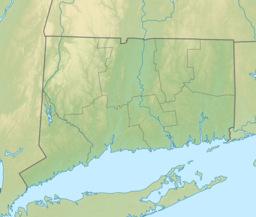
167:. The maximum depth of the lake is 12 feet (3.7 m). The entire lake shore is undeveloped and motorized vehicles and boats are prohibited. The lake is accessible through trails from
295:
205:
403:
427:
326:
281:
236:
87:
442:
44:
250:
396:
437:
422:
389:
302:
212:
28:
432:
73:
168:
164:
342:
171:
and camping is permitted at three locations around the lake. It is also the northern terminus for the
156:
160:
347:
320:
275:
230:
191:
373:
257:
361:
416:
172:
119:
369:
33:
Southern
Breakneck Pond on Nipmuck Trail facing north on the last day of winter.
102:
89:
124:
377:
155:is a 92-acre (0.37 km) lake surrounded by the
142:
134:
130:
118:
79:
69:
21:
16:Lake in Tolland County, Connecticut, United States
80:
397:
8:
163:. A small portion of the lake extends into
404:
390:
18:
183:
343:CT Bigelow Hollow State Park Web Site
325:: CS1 maint: archived copy as title (
318:
280:: CS1 maint: archived copy as title (
273:
235:: CS1 maint: archived copy as title (
228:
51:
7:
428:Lakes of Tolland County, Connecticut
358:
356:
376:. You can help Knowledge (XXG) by
14:
360:
50:
43:
27:
141:
133:
1:
68:
372:state location article is a
443:Connecticut geography stubs
74:Tolland County, Connecticut
459:
355:
169:Bigelow Hollow State Park
165:Sturbridge, Massachusetts
38:
26:
192:"Breakneck Pond Fishing"
146:12 ft (3.7 m)
138:92 acres (0.37 km)
103:42.021356°N 72.109986°W
348:CT Fish Finder report
108:42.021356; -72.109986
438:Nipmuck State Forest
423:Lakes of Connecticut
157:Nipmuck State Forest
99: /
433:Union, Connecticut
161:Union, Connecticut
385:
384:
150:
149:
450:
406:
399:
392:
364:
357:
331:
330:
324:
316:
314:
313:
307:
301:. Archived from
300:
292:
286:
285:
279:
271:
269:
268:
262:
256:. Archived from
255:
247:
241:
240:
234:
226:
224:
223:
217:
211:. Archived from
210:
202:
196:
195:
188:
114:
113:
111:
110:
109:
104:
100:
97:
96:
95:
92:
82:
54:
53:
47:
31:
19:
458:
457:
453:
452:
451:
449:
448:
447:
413:
412:
411:
410:
353:
339:
334:
317:
311:
309:
305:
298:
296:"Archived copy"
294:
293:
289:
272:
266:
264:
260:
253:
251:"Archived copy"
249:
248:
244:
227:
221:
219:
215:
208:
206:"Archived copy"
204:
203:
199:
190:
189:
185:
181:
107:
105:
101:
98:
93:
90:
88:
86:
85:
65:
64:
63:
62:
61:
60:
59:
55:
34:
17:
12:
11:
5:
456:
454:
446:
445:
440:
435:
430:
425:
415:
414:
409:
408:
401:
394:
386:
383:
382:
365:
351:
350:
345:
338:
337:External links
335:
333:
332:
287:
242:
197:
182:
180:
177:
153:Breakneck Pond
148:
147:
144:
140:
139:
136:
132:
131:
128:
127:
122:
116:
115:
83:
77:
76:
71:
67:
66:
58:Breakneck Pond
57:
56:
49:
48:
42:
41:
40:
39:
36:
35:
32:
24:
23:
22:Breakneck Pond
15:
13:
10:
9:
6:
4:
3:
2:
455:
444:
441:
439:
436:
434:
431:
429:
426:
424:
421:
420:
418:
407:
402:
400:
395:
393:
388:
387:
381:
379:
375:
371:
366:
363:
359:
354:
349:
346:
344:
341:
340:
336:
328:
322:
308:on 2011-08-10
304:
297:
291:
288:
283:
277:
263:on 2012-10-21
259:
252:
246:
243:
238:
232:
218:on 2015-12-22
214:
207:
201:
198:
193:
187:
184:
178:
176:
174:
173:Nipmuck Trail
170:
166:
162:
158:
154:
145:
137:
129:
126:
123:
121:
117:
112:
84:
78:
75:
72:
46:
37:
30:
25:
20:
378:expanding it
367:
352:
310:. Retrieved
303:the original
290:
265:. Retrieved
258:the original
245:
220:. Retrieved
213:the original
200:
186:
152:
151:
135:Surface area
370:Connecticut
106: /
81:Coordinates
417:Categories
312:2012-06-01
267:2012-06-01
222:2015-12-21
179:References
143:Max. depth
94:72°06′36″W
91:42°01′17″N
321:cite web
276:cite web
231:cite web
70:Location
368:This
306:(PDF)
299:(PDF)
261:(PDF)
254:(PDF)
216:(PDF)
209:(PDF)
374:stub
327:link
282:link
237:link
125:lake
120:Type
159:in
419::
323:}}
319:{{
278:}}
274:{{
233:}}
229:{{
175:.
405:e
398:t
391:v
380:.
329:)
315:.
284:)
270:.
239:)
225:.
194:.
Text is available under the Creative Commons Attribution-ShareAlike License. Additional terms may apply.