54:
771:
617:
42:
308:
298:
434:
living together, 10.2% had a female householder with no husband present, and 30.6% were non-families. 29.6% of all households were made up of individuals, and 14.3% had someone living alone who was 65 years of age or older. The average household size was 2.45 and the average family size was 2.94.
438:
In the town the population was spread out, with 29.2% under the age of 18, 7.5% from 18 to 24, 22.1% from 25 to 44, 24.6% from 45 to 64, and 16.7% who were 65 years of age or older. The median age was 38 years. For every 100 females, there were 101.7 males. For every 100 females age 18 and over,
274:
The community began as a small retirement community near Lake
Norfork following completion of the Norfork Dam. Initially an unincorporated area, residents voted to incorporate as a town in 1997. In 2000, town residents approved upgrading Briarcliff's status to a second-class city in order to
53:
419:
was50.9 people /km (132 people/sq mi). There were 117 housing units at an average density of 24.8 units /km (64 units/sq mi). The racial makeup of the town was 97.92%
635:
442:
The median income for a household in the town was $ 26,875, and the median income for a family was $ 32,188. Males had a median income of $ 26,000 versus $ 16,250 for females. The
641:
679:
939:
513:
929:
225:
67:
672:
235:
518:
866:
200:
665:
482:
846:
824:
543:
522:
657:
121:
934:
596:
424:
420:
284:
508:
251:
652:
390:
375:
360:
263:
41:
876:
99:
470:
899:
801:
750:
711:
689:
255:
126:
430:
There were 98 households, out of which 32.7% had children under the age of 18 living with them, 56.1% were
809:
647:
906:
871:
861:
760:
622:
311:
210:
834:
819:
740:
323:
814:
790:
745:
416:
301:
570:
856:
755:
443:
446:
for the town was $ 16,420. About 9.0% of families and 13.7% of the population were below the
851:
735:
415:
of 2000, there were 240 people, 98 households, and 68 families residing in the town. The
923:
450:, including 21.7% of those under the age of eighteen and 5.1% of those 65 or over.
447:
704:
471:
U.S. Geological Survey
Geographic Names Information System: Briarcliff, Arkansas
612:
109:
82:
69:
287:, the town has a total area of 4.7 km (1.8 sq mi), all land.
191:
322:
Briarcliff is in the
Norfork School District with students graduating from
307:
890:‡This populated place also has portions in an adjacent county or counties
431:
259:
114:
297:
412:
770:
217:
196:
782:
722:
32:
661:
545:
School
District Reference Map (2010 Census) Baxter County, AR
769:
592:
885:
833:
800:
781:
721:
234:
224:
207:
190:
182:
174:
169:
161:
153:
145:
137:
132:
120:
108:
98:
23:
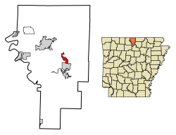
58:Location of Briarcliff in Baxter County, Arkansas.
653:Baxter County Historical and Genealogical Society
262:, United States. The population was 236 at the
673:
8:
514:Encyclopedia of Arkansas History and Culture
774:Map of Arkansas highlighting Baxter County
680:
666:
658:
333:
20:
458:
223:
189:
168:
160:
131:
97:
62:
50:
38:
466:
464:
462:
353:
502:
500:
233:
206:
181:
173:
152:
144:
136:
119:
107:
7:
940:Populated places established in 1997
427:, and 1.25% from two or more races.
157:0.00 sq mi (0.00 km)
149:2.25 sq mi (5.83 km)
141:2.25 sq mi (5.83 km)
688:Municipalities and communities of
571:"Census of Population and Housing"
519:Butler Center for Arkansas Studies
343:
275:establish a municipal government.
14:
930:Cities in Baxter County, Arkansas
615:
306:
296:
52:
40:
523:Central Arkansas Library System
18:City in Arkansas, United States
507:Teske, Steven (July 6, 2012).
1:
485:. United States Census Bureau
509:"Briarcliff (Baxter County)"
186:104.84/sq mi (40.47/km)
597:United States Census Bureau
483:"2020 U.S. Gazetteer Files"
285:United States Census Bureau
956:
895:
767:
702:
404:
389:
374:
359:
352:
347:
342:
339:
63:
51:
39:
30:
439:there were 104.8 males.
165:709 ft (216 m)
691:Baxter County, Arkansas
648:Norfork School District
551:(Map). US Census Bureau
775:
773:
593:"U.S. Census website"
405:U.S. Decennial Census
335:Historical population
209: • Summer (
83:36.27194°N 92.28222°W
908:United States portal
642:Map of Baxter County
623:United States portal
312:Arkansas Highway 342
183: • Density
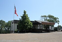
46:Briarcliff City Hall
25:Briarcliff, Arkansas
336:
324:Norfork High School
88:36.27194; -92.28222
79: /
935:Cities in Arkansas
776:
644:(US Census Bureau)
638:(US Census Bureau)
417:population density
334:
302:Arkansas Highway 5
175: • Total
154: • Water
138: • Total
917:
916:
636:Map of Briarcliff
444:per capita income
409:
408:
283:According to the
252:second-class city
245:
244:
146: • Land
947:
909:
902:
772:
714:
707:
697:
692:
682:
675:
668:
659:
625:
620:
619:
618:
608:
607:
605:
603:
589:
583:
582:
580:
578:
567:
561:
560:
558:
556:
550:
540:
534:
533:
531:
529:
504:
495:
494:
492:
490:
479:
473:
468:
355:
350:
345:
337:
310:
300:
291:List Of highways
214:
94:
93:
91:
90:
89:
84:
80:
77:
76:
75:
72:
56:
44:
21:
955:
954:
950:
949:
948:
946:
945:
944:
920:
919:
918:
913:
907:
901:Arkansas portal
900:
891:
881:
838:
836:
829:
796:
777:
765:
717:
712:
705:
698:
695:
690:
686:
632:
621:
616:
614:
611:
601:
599:
591:
590:
586:
576:
574:
569:
568:
564:
554:
552:
548:
542:
541:
537:
527:
525:
506:
505:
498:
488:
486:
481:
480:
476:
469:
460:
456:
432:married couples
425:Native American
348:
332:
320:
318:School District
293:
281:
272:
208:
87:
85:
81:
78:
73:
70:
68:
66:
65:
59:
47:
35:
26:
19:
12:
11:
5:
953:
951:
943:
942:
937:
932:
922:
921:
915:
914:
912:
911:
904:
896:
893:
892:
889:
887:
883:
882:
880:
879:
877:Three Brothers
874:
869:
864:
859:
854:
849:
843:
841:
837:unincorporated
831:
830:
828:
827:
822:
817:
812:
806:
804:
798:
797:
795:
794:
787:
785:
779:
778:
768:
766:
764:
763:
758:
753:
748:
743:
738:
733:
727:
725:
719:
718:
703:
700:
699:
687:
685:
684:
677:
670:
662:
656:
655:
650:
645:
639:
631:
630:External links
628:
627:
626:
610:
609:
584:
562:
535:
496:
474:
457:
455:
452:
407:
406:
402:
401:
398:
396:
393:
387:
386:
383:
381:
378:
372:
371:
368:
366:
363:
357:
356:
351:
346:
341:
331:
328:
319:
316:
315:
314:
304:
292:
289:
280:
277:
271:
268:
243:
242:
239:
232:
231:
228:
222:
221:
215:
205:
204:
194:
188:
187:
184:
180:
179:
176:
172:
171:
167:
166:
163:
159:
158:
155:
151:
150:
147:
143:
142:
139:
135:
134:
130:
129:
124:
118:
117:
112:
106:
105:
102:
96:
95:
61:
60:
57:
49:
48:
45:
37:
36:
31:
28:
27:
24:
17:
13:
10:
9:
6:
4:
3:
2:
952:
941:
938:
936:
933:
931:
928:
927:
925:
910:
905:
903:
898:
897:
894:
888:
884:
878:
875:
873:
870:
868:
865:
863:
860:
858:
855:
853:
850:
848:
845:
844:
842:
840:
832:
826:
823:
821:
818:
816:
813:
811:
808:
807:
805:
803:
799:
792:
789:
788:
786:
784:
780:
762:
759:
757:
754:
752:
751:Mountain Home
749:
747:
744:
742:
739:
737:
734:
732:
729:
728:
726:
724:
720:
716:
715:
713:Mountain Home
708:
701:
696:United States
693:
683:
678:
676:
671:
669:
664:
663:
660:
654:
651:
649:
646:
643:
640:
637:
634:
633:
629:
624:
613:
598:
594:
588:
585:
572:
566:
563:
547:
546:
539:
536:
524:
520:
516:
515:
510:
503:
501:
497:
484:
478:
475:
472:
467:
465:
463:
459:
453:
451:
449:
445:
440:
436:
433:
428:
426:
422:
418:
414:
403:
399:
397:
394:
392:
388:
384:
382:
379:
377:
373:
369:
367:
364:
362:
358:
338:
329:
327:
325:
317:
313:
309:
305:
303:
299:
295:
294:
290:
288:
286:
278:
276:
269:
267:
265:
261:
257:
256:Baxter County
253:
249:
240:
237:
229:
227:
219:
216:
212:
202:
201:Central (CST)
198:
195:
193:
185:
177:
164:
156:
148:
140:
128:
125:
123:
116:
113:
111:
104:United States
103:
101:
92:
64:Coordinates:
55:
43:
34:
29:
22:
16:
810:Buffalo City
730:
710:
600:. Retrieved
587:
575:. Retrieved
573:. Census.gov
565:
553:. Retrieved
544:
538:
526:. Retrieved
512:
487:. Retrieved
477:
448:poverty line
441:
437:
429:
410:
330:Demographics
321:
282:
273:
247:
246:
15:
839:communities
706:County seat
602:January 31,
489:October 29,
264:2010 census
86: /
924:Categories
872:Monkey Run
862:Clarkridge
761:Salesville
731:Briarcliff
454:References
411:As of the
248:Briarcliff
238:feature ID
170:Population
74:92°16′56″W
71:36°16′19″N
886:Footnotes
820:Henderson
741:Gassville
528:April 27,
279:Geography
226:FIPS code
192:Time zone
162:Elevation
867:Hopewell
815:Gamaliel
791:Big Flat
746:Lakeview
555:July 12,
423:, 0.83%
260:Arkansas
230:05-08665
115:Arkansas
857:Cartney
756:Norfork
577:June 4,
521:at the
270:History
241:2403922
100:Country
852:Buford
847:Arkana
825:Midway
736:Cotter
723:Cities
413:census
340:Census
127:Baxter
122:County
835:Other
783:Towns
549:(PDF)
421:White
385:−1.7%
250:is a
220:(CDT)
218:UTC-5
197:UTC-6
110:State
802:CDPs
604:2008
579:2015
557:2011
530:2013
491:2021
400:0.0%
391:2020
376:2010
361:2000
349:Note
344:Pop.
236:GNIS
133:Area
33:City
395:236
380:236
365:240
254:in
211:DST
178:236
926::
709::
694:,
595:.
517:.
511:.
499:^
461:^
354:%±
326:.
266:.
258:,
793:‡
681:e
674:t
667:v
606:.
581:.
559:.
532:.
493:.
370:—
213:)
203:)
199:(
Text is available under the Creative Commons Attribution-ShareAlike License. Additional terms may apply.