42:
61:
417:
68:
359:
where it "forms itself into a pool and fights to get to the sea intact before sinking into the shingle." It has nine tributaries and descends more than 60 metres (200 ft) in its first three miles.
933:
375:
escarpment to the south, with a "strong undeveloped rural character". Land use is primarily a patchwork of dairy pasture and wet woodland in the valley floor, and arable, scrub and
608:
371:). The National Landscape Partnership describe it as a broad clay valley having a sweeping profile enclosed by the chalk escarpment to the north and east, and smaller
1054:
918:
331:
The River Bride is approximately 6.5 miles (10.5 km) long and has a catchment area of 15 square miles (39 km). It rises on the eastern side of
60:
442:
998:
41:
993:
604:
988:
368:
540:
512:
231:
1047:
760:
573:
947:
583:
1003:
1078:
913:
1040:
978:
898:
122:
1073:
973:
963:
953:
893:
364:
888:
968:
903:
787:
938:
797:
792:
662:
566:
376:
983:
928:
852:
832:
827:
777:
614:
722:
682:
672:
652:
351:, reaching the coast through a break in coastal cliffs at Burton Freshwater. It empties into the
332:
313:
958:
943:
923:
908:
867:
536:
508:
752:
747:
410:
399:
388:
348:
288:
209:
136:
87:
742:
637:
559:
490:
352:
335:
at an altitude of 90 metres (300 ft) beneath an artificial lake at
Bridehead House,
1024:
883:
1067:
862:
857:
732:
493:
1:25,000 Pathfinder Series of Great
Britain, Sheet SY 49/59 Bridport, published 1977
847:
667:
528:
356:
344:
469:
842:
837:
822:
812:
782:
707:
642:
416:
336:
325:
194:
165:
132:
47:
817:
807:
717:
692:
687:
657:
632:
551:
406:
405:"to boil", so means "boiling or gushing" stream. The river gives its name to
340:
246:
233:
712:
392:
372:
17:
677:
647:
317:
737:
727:
309:
217:
173:
102:
697:
589:
305:
213:
169:
112:
702:
415:
555:
1028:
443:"Extracts from C.J. Bailey's Book "The Bride Valley""
363:
The Bride Valley is a protected area as part of the
876:
770:
623:
597:
282:
274:
262:
223:
203:
193:
179:
159:
151:
142:
128:
118:
108:
98:
93:
83:
34:
1023:This article related to a river in England is a
533:The Cambridge Dictionary of English Place-Names
46:Source of the River Bride at Bridehead House,
1048:
567:
8:
420:Mouth of the River Bride at Burton Bradstock
67:
1055:
1041:
574:
560:
552:
464:
462:
460:
436:
434:
472:. Dorset National Landscape Partnership
430:
31:
347:. It flows west to its mouth west of
7:
1020:
1018:
605:Bournemouth, Christchurch and Poole
324:, a distinct landscape area in the
369:Area of Outstanding Natural Beauty
25:
761:List of civil parishes in Dorset
507:. Robert Hale Ltd. p. 152.
312:, situated between the towns of
66:
59:
40:
919:Population of major settlements
535:, Cambridge University Press,
225: • coordinates
1:
143:Physical characteristics
1027:. You can help Knowledge by
445:. www.burtonbradstock.org.uk
181: • elevation
391:origin. It is derived from
284: • location
205: • location
161: • location
1095:
1017:
999:Grade II* listed buildings
266:10.5 km (6.5 mi)
994:Grade II listed buildings
365:Dorset National Landscape
326:Dorset National Landscape
294:
270:
189:
147:
54:
39:
989:Grade I listed buildings
413:and probably Bridport.
355:over the western end of
27:River in Dorset, England
531:, ed. (2010), "Bredy",
387:The river's name is of
185:300 ft (91 m)
421:
320:. It runs through the
75:Location within Dorset
441:C. J. Bailey (1982).
419:
379:on the valley sides.
503:Roland Gant (1980).
377:calcareous grassland
1079:England river stubs
1004:Scheduled monuments
626:(cities in italics)
598:Unitary authorities
243: /
723:Sturminster Newton
422:
247:50.7026°N 2.7405°W
129:Towns and villages
1036:
1035:
1012:
1011:
948:English Civil War
624:Major settlements
609:areas and suburbs
584:Ceremonial county
298:
297:
16:(Redirected from
1086:
1074:Rivers of Dorset
1057:
1050:
1043:
1019:
964:Lord Lieutenants
753:Wimborne Minster
592:
586:
576:
569:
562:
553:
546:
545:
525:
519:
518:
500:
494:
488:
482:
481:
479:
477:
466:
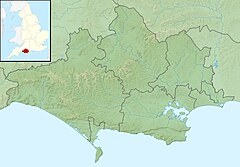
455:
454:
452:
450:
438:
411:Burton Bradstock
349:Burton Bradstock
289:Burton Bradstock
285:
258:
257:
255:
254:
253:
252:50.7026; -2.7405
248:
244:
241:
240:
239:
236:
210:Burton Bradstock
182:
162:
137:Burton Bradstock
70:
69:
63:
44:
32:
21:
1094:
1093:
1089:
1088:
1087:
1085:
1084:
1083:
1064:
1063:
1062:
1061:
1015:
1013:
1008:
872:
766:
755:
638:Blandford Forum
625:
619:
593:
588:
582:
580:
550:
549:
543:
527:
526:
522:
515:
505:Dorset Villages
502:
501:
497:
491:Ordnance Survey
489:
485:
475:
473:
468:
467:
458:
448:
446:
440:
439:
432:
427:
409:, Littlebredy,
385:
353:English Channel
283:
251:
249:
245:
242:
237:
234:
232:
230:
229:
226:
206:
180:
160:
79:
78:
77:
76:
73:
72:
71:
50:
28:
23:
22:
15:
12:
11:
5:
1092:
1090:
1082:
1081:
1076:
1066:
1065:
1060:
1059:
1052:
1045:
1037:
1034:
1033:
1010:
1009:
1007:
1006:
1001:
996:
991:
986:
981:
976:
971:
966:
961:
956:
951:
941:
936:
931:
926:
921:
916:
911:
906:
904:County Council
901:
896:
891:
886:
880:
878:
874:
873:
871:
870:
865:
860:
855:
850:
845:
840:
835:
830:
825:
820:
815:
810:
805:
800:
795:
790:
785:
780:
774:
772:
768:
767:
765:
764:
750:
745:
740:
735:
730:
725:
720:
715:
710:
705:
700:
695:
690:
685:
680:
675:
670:
665:
660:
655:
650:
645:
640:
635:
629:
627:
621:
620:
618:
617:
612:
601:
599:
595:
594:
581:
579:
578:
571:
564:
556:
548:
547:
541:
520:
513:
495:
483:
470:"Bride Valley"
456:
429:
428:
426:
423:
384:
381:
304:is a river in
296:
295:
292:
291:
286:
280:
279:
276:
272:
271:
268:
267:
264:
260:
259:
227:
224:
221:
220:
207:
204:
201:
200:
197:
191:
190:
187:
186:
183:
177:
176:
163:
157:
156:
153:
149:
148:
145:
144:
140:
139:
130:
126:
125:
120:
116:
115:
110:
106:
105:
100:
96:
95:
91:
90:
85:
81:
80:
74:
65:
64:
58:
57:
56:
55:
52:
51:
45:
37:
36:
26:
24:
14:
13:
10:
9:
6:
4:
3:
2:
1091:
1080:
1077:
1075:
1072:
1071:
1069:
1058:
1053:
1051:
1046:
1044:
1039:
1038:
1032:
1030:
1026:
1021:
1016:
1005:
1002:
1000:
997:
995:
992:
990:
987:
985:
982:
980:
977:
975:
972:
970:
969:High Sheriffs
967:
965:
962:
960:
957:
955:
952:
949:
945:
942:
940:
937:
935:
932:
930:
927:
925:
922:
920:
917:
915:
912:
910:
907:
905:
902:
900:
897:
895:
892:
890:
887:
885:
882:
881:
879:
875:
869:
866:
864:
861:
859:
858:Sydling Water
856:
854:
851:
849:
846:
844:
841:
839:
836:
834:
831:
829:
826:
824:
821:
819:
816:
814:
811:
809:
806:
804:
801:
799:
796:
794:
791:
789:
786:
784:
781:
779:
776:
775:
773:
769:
763:
762:
758:
754:
751:
749:
746:
744:
741:
739:
736:
734:
731:
729:
726:
724:
721:
719:
716:
714:
711:
709:
706:
704:
701:
699:
696:
694:
691:
689:
686:
684:
681:
679:
676:
674:
671:
669:
666:
664:
661:
659:
656:
654:
651:
649:
646:
644:
641:
639:
636:
634:
631:
630:
628:
622:
616:
613:
610:
606:
603:
602:
600:
596:
591:
585:
577:
572:
570:
565:
563:
558:
557:
554:
544:
542:9780521168557
538:
534:
530:
529:Watts, Victor
524:
521:
516:
514:0 7091 8135 3
510:
506:
499:
496:
492:
487:
484:
471:
465:
463:
461:
457:
444:
437:
435:
431:
424:
418:
414:
412:
408:
404:
401:
398:, related to
397:
394:
390:
382:
380:
378:
374:
370:
366:
361:
358:
354:
350:
346:
342:
338:
334:
329:
327:
323:
319:
315:
311:
307:
303:
293:
290:
287:
281:
277:
273:
269:
265:
261:
256:
228:
222:
219:
215:
211:
208:
202:
198:
196:
192:
188:
184:
178:
175:
171:
167:
164:
158:
154:
150:
146:
141:
138:
134:
131:
127:
124:
121:
117:
114:
111:
107:
104:
101:
97:
92:
89:
86:
82:
62:
53:
49:
43:
38:
33:
30:
19:
1029:expanding it
1022:
1014:
802:
759:
756:
668:Corfe Mullen
663:Christchurch
532:
523:
504:
498:
486:
474:. Retrieved
447:. Retrieved
402:
395:
386:
362:
357:Chesil Beach
345:Dorset Downs
330:
322:Bride Valley
321:
301:
299:
29:
18:Bride Valley
889:Settlements
708:Shaftesbury
643:Bournemouth
337:Littlebredy
302:River Bride
250: /
166:Littlebredy
133:Littlebredy
48:Littlebredy
35:River Bride
1068:Categories
939:Healthcare
718:Stalbridge
693:Lyme Regis
688:Highcliffe
683:Gillingham
673:Dorchester
658:Chickerell
653:Broadstone
633:Beaminster
407:Long Bredy
341:escarpment
333:Black Down
314:Dorchester
235:50°42′09″N
984:Transport
929:Geography
757:See also:
713:Sherborne
393:Old Welsh
383:Etymology
373:limestone
275:Discharge
238:2°44′26″W
84:Etymology
899:Churches
748:Weymouth
678:Ferndown
648:Bridport
476:3 August
318:Bridport
119:District
94:Location
974:Museums
959:Tourism
954:Schools
944:History
924:Geology
909:Economy
894:Beaches
863:Tarrant
743:Wareham
738:Verwood
728:Swanage
449:6 March
403:bredion
400:Cornish
343:of the
339:on the
310:England
218:England
174:England
103:England
99:Country
979:People
914:Places
877:Topics
848:Piddle
798:Bourne
771:Rivers
698:Merley
615:Dorset
590:Dorset
539:
511:
389:Celtic
306:Dorset
278:
263:Length
214:Dorset
199:
170:Dorset
155:
152:Source
123:Dorset
113:Dorset
109:County
88:Celtic
934:SSSIs
853:Stour
843:Moors
838:Hooke
833:Frome
828:Crane
823:Corfe
813:Cerne
803:Bride
783:Asker
778:Allen
733:Upton
703:Poole
425:Notes
396:Brydi
195:Mouth
1025:stub
884:Flag
818:Char
808:Brit
788:Avon
537:ISBN
509:ISBN
478:2024
451:2014
367:(an
316:and
300:The
868:Wey
793:Axe
587:of
1070::
459:^
433:^
328:.
308:,
216:,
212:,
172:,
168:,
135:,
1056:e
1049:t
1042:v
1031:.
950:)
946:(
611:)
607:(
575:e
568:t
561:v
517:.
480:.
453:.
20:)
Text is available under the Creative Commons Attribution-ShareAlike License. Additional terms may apply.