794:
42:
61:
68:
490:
In the township the population was spread out, with 28.7% under the age of 18, 8.0% from 18 to 24, 29.9% from 25 to 44, 24.4% from 45 to 64, and 9.0% who were 65 years of age or older. The median age was 35 years. For every 100 females, there were 100.2 males. For every 100 females age 18 and over,
486:
living together, 7.8% had a female householder with no husband present, and 15.1% were non-families. 12.4% of all households were made up of individuals, and 5.2% had someone living alone who was 65 years of age or older. The average household size was 2.97 and the average family size was 3.22.
450:
of 2000, there were 1,900 people, 637 households, and 540 families residing in the township. The population density was 56.1 inhabitants per square mile (21.7/km). There were 669 housing units at an average density of 19.7 per square mile (7.6/km). The racial makeup of the township was 96.89%
494:
The median income for a household in the township was $ 52,361, and the median income for a family was $ 55,592. Males had a median income of $ 41,286 versus $ 30,000 for females. The
695:
1330:
919:
1345:
899:
92:
909:
869:
416:
949:
914:
894:
884:
1335:
688:
982:
295:
615:
1222:
60:
41:
681:
305:
666:
576:
387:
904:
645:
Michigan Place Names: The
History of the Founding and the Naming of More Than Five Thousand Past and Present Michigan Communities
246:
846:
673:
1340:
879:
656:
456:
1062:
851:
841:
460:
425:
is an unincorporated community which was established as a lumber town in 1866. It had a post office from 1876 until 1883.
1207:
954:
648:
146:
929:
544:
468:
435:
1167:
934:
705:
337:
151:
47:
1227:
1092:
944:
349:
1187:
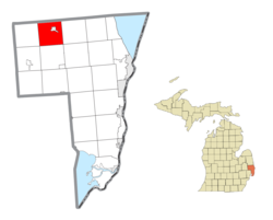
1127:
959:
836:
381:
373:
283:
124:
612:
564:
1300:
1247:
1117:
1082:
969:
939:
889:
805:
482:
There were 637 households, out of which 39.6% had children under the age of 18 living with them, 73.2% were
377:
1272:
1237:
1217:
1192:
1077:
1037:
924:
472:
1277:
1242:
1197:
1182:
1157:
1047:
1022:
1007:
751:
1307:
1232:
1212:
1162:
1112:
1097:
767:
756:
727:
476:
256:
1252:
1147:
1132:
997:
778:
464:
452:
1262:
1122:
1087:
1067:
1052:
1017:
977:
772:
498:
for the township was $ 19,268. About 6.0% of families and 8.0% of the population were below the
1267:
1142:
1107:
761:
746:
662:
652:
495:
1257:
1202:
1172:
1057:
1042:
1027:
828:
818:
1177:
1152:
1137:
1102:
1072:
1032:
1012:
813:
987:
861:
783:
565:
U.S. Geological Survey
Geographic Names Information System: Brockway Township, Michigan
333:
32:
1324:
288:
514:, actress, screenwriter, novelist and businesswoman; born near Brockway (1873—1935)
499:
320:
720:
511:
613:
U.S. Geological Survey
Geographic Names Information System: Brockway, Michigan
341:
134:
438:, the township has a total area of 33.9 square miles (88 km), all land.
402:
389:
107:
94:
237:
502:, including 12.5% of those under age 18 and 7.0% of those age 65 or over.
1291:‡This populated place also has portions in an adjacent county or counties
793:
483:
345:
271:
139:
447:
263:
242:
738:
677:
792:
647:(Paperback). Great Lakes Books Series. Detroit, Michigan:
540:
1286:
996:
968:
860:
827:
804:
737:
315:
304:
294:
282:
270:
253:
236:
228:
220:
215:
207:
199:
191:
183:
178:
170:
165:
157:
145:
133:
123:
23:
797:Map_of_Michigan_highlighting_St._Clair_County.svg
376:in the southeastern part of the Township where
689:
8:
360:Brockway Township was established in 1848.
696:
682:
674:
479:of any race were 2.05% of the population.
20:
67:
18:Civil township in Michigan, United States
1331:Townships in St. Clair County, Michigan
529:
314:
293:
269:
235:
214:
206:
177:
164:
156:
122:
87:
53:
38:
626:
600:
535:
533:
352:, the township population was 1,897.
303:
281:
252:
227:
219:
198:
190:
182:
169:
144:
132:
80:Location within the state of Michigan
7:
1346:Populated places established in 1848
471:, and 0.95% from two or more races.
195:33.9 sq mi (87.7 km)
187:33.9 sq mi (87.7 km)
704:Municipalities and communities of
643:Romig, Walter (October 1, 1986) .
14:
203:0.0 sq mi (0.0 km)
66:
59:
40:
1336:1848 establishments in Michigan
1:
649:Wayne State University Press
545:United States Census Bureau
436:United States Census Bureau
25:Brockway Township, Michigan
1362:
707:St. Clair County, Michigan
1296:
790:
718:
88:
54:
39:
30:
374:unincorporated community
211:801 ft (244 m)
491:there were 95.5 males.
415:) near the border with
171: • Supervisor
798:
1341:Townships in Michigan
796:
577:"Explore Census Data"
541:"U.S. Census website"
403:43.07444°N 82.76556°W
255: • Summer (
232:56/sq mi (22/km)
108:43.12222°N 82.80806°W
1309:United States portal
229: • Density
1063:Broadbridge Station
408:43.07444; -82.76556
399: /
113:43.12222; -82.80806
104: /
1208:Pointe aux Tremble
799:
616:GNIS in Google Map
221: • Total
200: • Water
184: • Total
1318:
1317:
829:Charter townships
496:per capita income
434:According to the
330:Brockway Township
327:
326:
192: • Land
174:William McMurtrie
74:Brockway Township
1353:
1310:
1303:
1168:Martindale Beach
795:
730:
723:
713:
708:
698:
691:
684:
675:
670:
630:
624:
618:
610:
604:
598:
592:
591:
589:
587:
573:
567:
562:
556:
555:
553:
551:
537:
457:African American
414:
413:
411:
410:
409:
404:
400:
397:
396:
395:
392:
338:St. Clair County
323:
321:Official website
260:
119:
118:
116:
115:
114:
109:
105:
102:
101:
100:
97:
70:
69:
63:
48:St. Clair County
46:Location within
44:
21:
1361:
1360:
1356:
1355:
1354:
1352:
1351:
1350:
1321:
1320:
1319:
1314:
1308:
1302:Michigan portal
1301:
1292:
1282:
1228:Roberts Landing
1093:Copeland Corner
999:
992:
964:
862:Civil townships
856:
823:
800:
788:
733:
728:
721:
714:
711:
706:
702:
659:
642:
639:
634:
633:
625:
621:
611:
607:
599:
595:
585:
583:
581:data.census.gov
575:
574:
570:
563:
559:
549:
547:
539:
538:
531:
526:
521:
508:
484:married couples
461:Native American
444:
432:
417:Emmett Township
407:
405:
401:
398:
393:
390:
388:
386:
385:
366:
358:
319:
278:
254:
112:
110:
106:
103:
98:
95:
93:
91:
90:
84:
83:
82:
81:
78:
77:
76:
75:
71:
50:
35:
26:
19:
12:
11:
5:
1359:
1357:
1349:
1348:
1343:
1338:
1333:
1323:
1322:
1316:
1315:
1313:
1312:
1305:
1297:
1294:
1293:
1290:
1288:
1284:
1283:
1281:
1280:
1275:
1270:
1265:
1260:
1255:
1250:
1245:
1240:
1235:
1230:
1225:
1220:
1215:
1210:
1205:
1200:
1195:
1190:
1188:North Lakeport
1185:
1180:
1175:
1170:
1165:
1160:
1155:
1150:
1145:
1140:
1135:
1130:
1128:Harsens Island
1125:
1120:
1115:
1110:
1105:
1100:
1095:
1090:
1085:
1080:
1075:
1070:
1065:
1060:
1055:
1050:
1045:
1040:
1035:
1030:
1025:
1020:
1015:
1010:
1004:
1002:
994:
993:
991:
990:
985:
980:
974:
972:
966:
965:
963:
962:
957:
952:
947:
942:
937:
932:
927:
922:
917:
912:
907:
902:
897:
892:
887:
882:
877:
872:
866:
864:
858:
857:
855:
854:
849:
844:
839:
833:
831:
825:
824:
822:
821:
816:
810:
808:
802:
801:
791:
789:
787:
786:
781:
776:
770:
765:
759:
754:
749:
743:
741:
735:
734:
719:
716:
715:
703:
701:
700:
693:
686:
678:
672:
671:
667:978-0814318386
657:
638:
635:
632:
631:
619:
605:
593:
568:
557:
528:
527:
525:
522:
520:
517:
516:
515:
507:
506:Notable person
504:
443:
440:
431:
428:
427:
426:
420:
365:
362:
357:
354:
334:civil township
325:
324:
317:
313:
312:
309:
302:
301:
298:
292:
291:
286:
280:
279:
276:
274:
268:
267:
261:
251:
250:
240:
234:
233:
230:
226:
225:
222:
218:
217:
213:
212:
209:
205:
204:
201:
197:
196:
193:
189:
188:
185:
181:
180:
176:
175:
172:
168:
167:
163:
162:
159:
155:
154:
149:
143:
142:
137:
131:
130:
127:
121:
120:
86:
85:
79:
73:
72:
65:
64:
58:
57:
56:
55:
52:
51:
45:
37:
36:
33:Civil township
31:
28:
27:
24:
17:
13:
10:
9:
6:
4:
3:
2:
1358:
1347:
1344:
1342:
1339:
1337:
1334:
1332:
1329:
1328:
1326:
1311:
1306:
1304:
1299:
1298:
1295:
1289:
1285:
1279:
1276:
1274:
1271:
1269:
1266:
1264:
1261:
1259:
1256:
1254:
1251:
1249:
1248:Sparlingville
1246:
1244:
1241:
1239:
1236:
1234:
1231:
1229:
1226:
1224:
1221:
1219:
1216:
1214:
1211:
1209:
1206:
1204:
1201:
1199:
1196:
1194:
1191:
1189:
1186:
1184:
1181:
1179:
1176:
1174:
1171:
1169:
1166:
1164:
1161:
1159:
1156:
1154:
1151:
1149:
1146:
1144:
1141:
1139:
1136:
1134:
1131:
1129:
1126:
1124:
1121:
1119:
1118:Grande Pointe
1116:
1114:
1111:
1109:
1106:
1104:
1101:
1099:
1096:
1094:
1091:
1089:
1086:
1084:
1083:Clays Landing
1081:
1079:
1076:
1074:
1071:
1069:
1066:
1064:
1061:
1059:
1056:
1054:
1051:
1049:
1046:
1044:
1041:
1039:
1036:
1034:
1031:
1029:
1026:
1024:
1021:
1019:
1016:
1014:
1011:
1009:
1006:
1005:
1003:
1001:
995:
989:
986:
984:
981:
979:
976:
975:
973:
971:
967:
961:
958:
956:
953:
951:
948:
946:
943:
941:
938:
936:
933:
931:
928:
926:
923:
921:
918:
916:
913:
911:
908:
906:
905:Cottrellville
903:
901:
898:
896:
893:
891:
888:
886:
883:
881:
878:
876:
873:
871:
868:
867:
865:
863:
859:
853:
850:
848:
845:
843:
840:
838:
835:
834:
832:
830:
826:
820:
817:
815:
812:
811:
809:
807:
803:
785:
782:
780:
777:
774:
771:
769:
766:
763:
760:
758:
755:
753:
750:
748:
745:
744:
742:
740:
736:
732:
731:
724:
717:
712:United States
709:
699:
694:
692:
687:
685:
680:
679:
676:
668:
664:
660:
654:
650:
646:
641:
640:
636:
629:, p. 97.
628:
623:
620:
617:
614:
609:
606:
603:, p. 79.
602:
597:
594:
582:
578:
572:
569:
566:
561:
558:
546:
542:
536:
534:
530:
523:
518:
513:
510:
509:
505:
503:
501:
497:
492:
488:
485:
480:
478:
474:
470:
467:, 1.16% from
466:
462:
458:
454:
449:
441:
439:
437:
429:
424:
421:
418:
412:
383:
379:
375:
371:
368:
367:
363:
361:
355:
353:
351:
348:. As of the
347:
343:
339:
335:
331:
322:
318:
310:
307:
299:
297:
290:
287:
285:
275:
273:
265:
262:
258:
248:
247:Eastern (EST)
244:
241:
239:
231:
223:
210:
202:
194:
186:
173:
160:
153:
150:
148:
141:
138:
136:
129:United States
128:
126:
117:
89:Coordinates:
62:
49:
43:
34:
29:
22:
16:
1273:Wales Center
1238:Smiths Creek
1218:Riley Center
1193:North Street
1078:Cherry Beach
1038:Avalon Beach
874:
847:Fort Gratiot
726:
644:
622:
608:
596:
584:. Retrieved
580:
571:
560:
548:. Retrieved
500:poverty line
493:
489:
481:
445:
442:Demographics
433:
422:
369:
359:
329:
328:
15:
1278:West Tappan
1243:Snyderville
1198:Perch Point
1183:Muttonville
1158:Lesterville
1048:Belle River
1023:Anchorville
1008:Abbottsford
1000:communities
983:Pearl Beach
880:Burtchville
752:Marine City
722:County seat
550:January 31,
512:Zelda Sears
469:other races
406: /
384:intersect (
350:2020 Census
272:ZIP code(s)
158:Established
111: /
1325:Categories
1233:Sans Souci
1213:Rattle Run
1163:Maple Leaf
1113:Gardendale
1098:Fair Haven
852:Port Huron
842:East China
768:Port Huron
757:Marysville
729:Port Huron
658:081431838X
627:Romig 1986
601:Romig 1986
519:References
446:As of the
394:82°45′56″W
391:43°04′28″N
342:U.S. state
308:feature ID
216:Population
166:Government
99:82°48′29″W
96:43°07′20″N
1287:Footnotes
1253:Starville
1223:Riverside
1148:Keewahdin
1133:Hawthorne
955:St. Clair
920:Greenwood
779:St. Clair
586:April 25,
430:Geography
364:Community
296:FIPS code
284:Area code
238:Time zone
208:Elevation
152:St. Clair
1263:Thornton
1123:Goodells
1088:Columbus
1068:Brockway
1053:Berville
1018:Allenton
978:Lakeport
930:Kenockee
900:Columbus
875:Brockway
806:Villages
773:Richmond
473:Hispanic
463:, 0.32%
459:, 0.32%
455:, 0.37%
370:Brockway
346:Michigan
300:26-10820
140:Michigan
1268:Wadhams
1143:Kimball
1108:Forster
935:Kimball
762:Memphis
747:Algonac
637:Sources
356:History
340:in the
316:Website
311:1625984
125:Country
1258:Tappan
1203:Peters
1173:Miller
1058:Blaine
1043:Bedore
1028:Atkins
945:Mussey
910:Emmett
870:Berlin
819:Emmett
739:Cities
665:
655:
477:Latino
448:census
423:Canova
372:is an
147:County
1178:Muirs
1153:Lambs
1138:Jeddo
1103:Fargo
1073:Casco
1033:Avoca
1013:Adair
998:Other
960:Wales
950:Riley
915:Grant
895:Clyde
885:Casco
837:China
814:Capac
524:Notes
465:Asian
453:White
382:M-136
332:is a
277:48097
266:(EDT)
264:UTC-4
243:UTC-5
224:1,897
135:State
988:Ruby
970:CDPs
940:Lynn
890:Clay
784:Yale
663:ISBN
653:ISBN
588:2024
552:2008
380:and
378:M-19
306:GNIS
179:Area
161:1848
925:Ira
475:or
344:of
336:of
289:810
257:DST
1327::
725::
710:,
661:.
651:.
579:.
543:.
532:^
775:‡
764:‡
697:e
690:t
683:v
669:.
590:.
554:.
419:.
259:)
249:)
245:(
Text is available under the Creative Commons Attribution-ShareAlike License. Additional terms may apply.