47:
155:
452:
148:
252:
after losing control of its brakes while nearing the top of the southern descent, killing 15 of the 35 people on board. In July 2014 the presumed remains of a 20-year missing
Northland man were found there by forestry workers on a steep hillside.
335:
326:
493:
517:
522:
364:
147:
360:
79:
486:
512:
302:
274:
298:
270:
249:
234:
72:
479:
401:
226:
229:, which is forced to follow a tortuous route for some distance as it descends to the south. The small settlement of
46:
214:
415:
385:
420:
182:
221:) in the west. Though not of great height (reaching only some 450 metres) it is a notable feature of the
397:
202:
238:
424:
127:
459:
222:
218:
463:
451:
506:
51:
The eastern end of the
Brynderwyn Range as seen from Mangawhai Heads (October 2010)
248:
The hills were the site of New
Zealand's worst road accident. On 7 February 1963,
206:
17:
230:
94:
81:
242:
210:
62:
237:. There are different walks of up to 10 km giving views of the
233:
lies at the southern foot of the hills, at the junction of SH1 and
416:"Body found believed to be Northland man missing for 20 years"
467:
398:
New
Zealand Disasters – Bus Accident: The Brynderwyns
328:
Piroa-Brynderwyns
Landcare Five Year Plan – 2018–2023
334:(Booklet). Piroa-Brynderwyns Landcare. August 2018.
205:
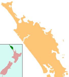
in northern New
Zealand some 60 kilometres south of
225:'s geography, not least because it is traversed by
181:
176:
135:
115:
110:
71:
61:
56:
34:
27:Ridge of hills across the Northland Peninsula.
487:
386:Brynderwyn tragedy: The nightmare never fades
8:
119:
494:
480:
201:is a ridge extending east–west across the
31:
365:Department of Conservation (New Zealand)
154:
361:"Whangarei area: Brynderwyn Hills Walk"
262:
7:
448:
446:
341:from the original on 28 January 2020
25:
518:Landforms of the Northland Region
523:Northland Region geography stubs
462:-related geography article is a
450:
153:
146:
45:
414:Edge, Kristin (25 July 2014).
276:Topo50 map AY30 - Maungaturoto
1:
466:. You can help Knowledge by
299:Land Information New Zealand
271:Land Information New Zealand
402:Christchurch City Libraries
304:Topo50 map AY31 - Mangawhai
209:, from the southern end of
539:
445:
67:430 m (1,410 ft)
388:. The New Zealand Herald.
140:
44:
39:
421:The New Zealand Herald
167:Northland, New Zealand
120:
513:Hills of New Zealand
95:36.0742°S 174.5024°E
213:in the east to the
203:Northland Peninsula
91: /
100:-36.0742; 174.5024
57:Highest point
475:
474:
425:Northern Advocate
191:
190:
16:(Redirected from
530:
496:
489:
482:
460:Northland Region
454:
447:
437:
436:
434:
432:
411:
405:
395:
389:
383:
377:
376:
374:
372:
357:
351:
350:
348:
346:
340:
333:
323:
317:
316:
314:
312:
295:
289:
288:
286:
284:
267:
245:and out to sea.
223:Northland Region
199:Brynderwyn Hills
195:Brynderwyn Range
161:Brynderwyn Range
157:
156:
150:
131:
123:
106:
105:
103:
102:
101:
96:
92:
89:
88:
87:
84:
49:
40:Brynderwyn Hills
35:Brynderwyn Range
32:
21:
18:Brynderwyn Hills
538:
537:
533:
532:
531:
529:
528:
527:
503:
502:
501:
500:
443:
441:
440:
430:
428:
413:
412:
408:
396:
392:
384:
380:
370:
368:
359:
358:
354:
344:
342:
338:
331:
325:
324:
320:
310:
308:
297:
296:
292:
282:
280:
269:
268:
264:
259:
239:Whangārei Heads
227:State Highway 1
219:Kaipara Harbour
217:(an arm of the
172:
171:
170:
169:
168:
165:
164:
163:
162:
158:
125:
99:
97:
93:
90:
85:
82:
80:
78:
77:
52:
28:
23:
22:
15:
12:
11:
5:
536:
534:
526:
525:
520:
515:
505:
504:
499:
498:
491:
484:
476:
473:
472:
455:
439:
438:
406:
390:
378:
352:
318:
290:
261:
260:
258:
255:
215:Otamatea River
189:
188:
187:Mountain range
185:
179:
178:
174:
173:
166:
160:
159:
152:
151:
145:
144:
143:
142:
141:
138:
137:
133:
132:
117:
113:
112:
108:
107:
75:
69:
68:
65:
59:
58:
54:
53:
50:
42:
41:
37:
36:
26:
24:
14:
13:
10:
9:
6:
4:
3:
2:
535:
524:
521:
519:
516:
514:
511:
510:
508:
497:
492:
490:
485:
483:
478:
477:
471:
469:
465:
461:
456:
453:
449:
444:
427:
426:
422:
417:
410:
407:
403:
399:
394:
391:
387:
382:
379:
366:
362:
356:
353:
337:
330:
329:
322:
319:
306:
305:
300:
294:
291:
278:
277:
272:
266:
263:
256:
254:
251:
250:a bus crashed
246:
244:
240:
236:
232:
228:
224:
220:
216:
212:
208:
204:
200:
196:
186:
184:
183:Mountain type
180:
175:
149:
139:
134:
129:
122:
118:
114:
109:
104:
76:
74:
70:
66:
64:
60:
55:
48:
43:
38:
33:
30:
19:
468:expanding it
457:
442:
429:. Retrieved
419:
409:
393:
381:
369:. Retrieved
355:
343:. Retrieved
327:
321:
309:. Retrieved
303:
301:(May 2020).
293:
281:. Retrieved
275:
273:(May 2020).
265:
247:
198:
194:
192:
29:
116:Native name
98: /
86:174°30′09″E
73:Coordinates
507:Categories
367:. May 2014
345:10 October
311:10 October
283:10 October
257:References
231:Brynderwyn
83:36°04′27″S
243:Bream Bay
211:Bream Bay
207:Whangārei
136:Geography
63:Elevation
404:website.
336:Archived
431:25 July
371:25 July
177:Geology
124:
111:Naming
458:This
339:(PDF)
332:(PDF)
307:(Map)
279:(Map)
128:Māori
121:Piroa
464:stub
433:2014
373:2014
347:2020
313:2020
285:2020
235:SH12
193:The
197:or
509::
423:/
418:.
400:.
363:.
241:,
495:e
488:t
481:v
470:.
435:.
375:.
349:.
315:.
287:.
130:)
126:(
20:)
Text is available under the Creative Commons Attribution-ShareAlike License. Additional terms may apply.