610:
531:
586:
66:
598:
96:
255:
436:
126:
622:
641:
267:
543:(USACE), Huntsville in order to identify “cultural resources, sensitive habitats, and endangered plants and animals that may exist” on Isla Culebrita. During the survey, a total of 97 plant species were recorded, none of which are state or federally threatened or endangered species. In addition, 32 birds, four reptiles, and two mammals were recorded. Of these animals, one federally endangered species, the
45:
483:
133:
103:
73:
522:, is located near the middle of the island's west coast and covers about 0.9 acres (0.36 ha). Both lagoons are bordered on the seaward-side by a small mangrove fringe. These wetlands are an important habitat for some of the local wildlife.
466:
that use the beach for breeding grounds and the surrounding waters for grazing. Sea turtles Tina and Ike call Playa
Tortuga home. The other two large beaches are Trash Beach and West Beach. Because Trash Beach is located on the
538:
In 2006, an environmental and cultural resource survey of
Culebrita was carried out by Southeastern Archaeological Research (SEARCH) of Jonesville, Florida and Ellis Environmental Group, LC, in conjunction with the
518:(Mill Lagoon), is located in northwest branch of the island. It covers approximately 5.5 acres (2.2 ha) and is about 3 feet (0.91 m) below sea level. The second lagoon, referred to as the eastern
585:
494:
on the east side of the island where people lounge as if they were large baths. The pools trap small sea life at low tide. The west side of the island contains two
609:
597:
65:
773:
810:
281:
95:
447:
island approximately 1 mile in length and a tourist spot. It is roughly y-shaped with three branches extending from the island's center.
530:
714:
621:
173:
50:
125:
412:
348:
688:
805:
369:
540:
471:
side of the island, debris is often blown onto this beach. This is how the beach gets its name. West Beach is where the
404:
306:
452:
381:
401:
377:
662:
552:
748:
435:
416:
373:
296:
499:
368:
meaning "little snake island") is a small, uninhabited island off the eastern coast of the island-
646:
722:
560:
361:
476:
408:
385:
799:
571:
544:
260:
462:(Turtle Beach) on the north side of the island. The beach is named for the many
427:. Culebrita is only accessible by private boat from the main island of Culebra.
286:
272:
44:
636:
519:
491:
482:
472:
463:
420:
188:
175:
424:
468:
17:
689:"Culebra, Off Puerto Rico's East Coast, Is A Rustic, Beautiful Island"
742:
740:
511:
495:
774:"Lawsuit Launched to Protect Rare Caribbean Lizards as Endangered"
666:
529:
481:
444:
439:
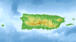
Map of
Culebra highlighting Fraile barrio which includes Culebrita
434:
749:"Environmental and Cultural Resources Surveys for Isla Culebrita"
335:
458:
There are six beaches on
Culebrita, the chief one being
486:
Chart of
Culebrita, with Cayo Botella to the northwest
330:
325:
317:
312:
302:
292:
280:
244:
236:
228:
220:
212:
204:
167:
159:
154:
35:
603:North Anchorage view from Faro Tower on Culebrita
627:A photo taken of people snorkeling in Culebrita
8:
30:
502:lays off the southern coast of the island.
43:
29:
654:
581:
407:of the main island of Culebra. It is a
715:"Review of Culebra's Culebrita Island"
591:Remains of the Lighthouse on Culebrita
400:to the west, Culebrita belongs to the
132:
102:
72:
7:
567:) were also observed on the island.
451:is the easternmost landmass of the
811:Uninhabited islands of Puerto Rico
687:Williams, Erin (28 October 2015).
551:) and one threatened species, the
25:
721:. About.com Guide. Archived from
386:archipelago of the Virgin Islands
51:Saint Thomas, U.S. Virgin Islands
27:Uninhabited island of Puerto Rico
639:
620:
608:
596:
584:
413:Culebra National Wildlife Refuge
392:off the northwestern point, and
349:Culebra National Wildlife Refuge
265:
253:
131:
124:
101:
94:
71:
64:
778:Center for Biological Diversity
747:Ellis Environmental Group, LC.
510:Isla Culebrita has two shallow
384:and geographically part of the
380:, administratively part of the
1:
49:Culebrita lighthouse on top,
719:About.com Puerto Rico Travel
559:) were observed. Endangered
541:U.S. Army Corps of Engineers
453:Commonwealth of Puerto Rico
115:Show map of Lesser Antilles
827:
534:Cacti growing on Culebrita
382:archipelago of Puerto Rico
224:1.5 km (0.93 mi)
216:1.7 km (1.06 mi)
514:, the largest of which,
346:
249:
58:
42:
415:. The island is home to
232:185 m (607 ft)
208:Puerto Rico Archipelago
189:18.313694°N 65.227444°W
85:Show map of Puerto Rico
549:Pelecanus occidentalis
535:
487:
440:
378:Spanish Virgin Islands
326:Additional information
229:Highest elevation
615:Tourists in Culebrita
553:white-cheeked pintail
533:
490:There are also large
485:
438:
194:18.313694; -65.227444
145:Show map of Caribbean
806:Culebra, Puerto Rico
754:. United States Army
419:, one of the oldest
417:Culebrita Lighthouse
574:live on Culebrita.
411:and is part of the
185: /
37:Nickname: Culebrita
32:
663:"Culebrita Island"
647:Puerto Rico portal
536:
488:
441:
237:Highest point
561:green sea turtles
355:
354:
347:Nature Reserve (
16:(Redirected from
818:
790:
789:
787:
785:
770:
764:
763:
761:
759:
753:
744:
735:
734:
732:
730:
725:on 22 March 2012
710:
704:
703:
701:
699:
684:
678:
677:
675:
674:
665:. Archived from
659:
649:
644:
643:
642:
624:
612:
600:
588:
516:Laguna de Molino
388:. Together with
358:Culebrita Island
342:
339:
338:.culebritaisland
337:
331:Official website
271:
269:
268:
259:
257:
256:
200:
199:
197:
196:
195:
190:
186:
183:
182:
181:
178:
146:
135:
134:
128:
116:
105:
104:
98:
86:
75:
74:
68:
47:
33:
21:
826:
825:
821:
820:
819:
817:
816:
815:
796:
795:
794:
793:
783:
781:
780:. 10 March 2020
772:
771:
767:
757:
755:
751:
746:
745:
738:
728:
726:
712:
711:
707:
697:
695:
686:
685:
681:
672:
670:
661:
660:
656:
645:
640:
638:
635:
628:
625:
616:
613:
604:
601:
592:
589:
580:
570:The endangered
557:Anas bahamensis
528:
526:Flora and fauna
508:
443:Culebrita is a
433:
366:Isla Culebrita,
334:
276:
266:
264:
263:
254:
252:
240:Lighthouse Hill
193:
191:
187:
184:
179:
176:
174:
172:
171:
150:
149:
148:
147:
144:
143:
142:
141:
140:
136:
119:
118:
117:
114:
113:
112:
111:
110:
106:
89:
88:
87:
84:
83:
82:
81:
80:
76:
54:
38:
28:
23:
22:
15:
12:
11:
5:
824:
822:
814:
813:
808:
798:
797:
792:
791:
765:
736:
705:
679:
653:
652:
651:
650:
634:
631:
630:
629:
626:
619:
617:
614:
607:
605:
602:
595:
593:
590:
583:
579:
576:
565:Chelonia mydas
527:
524:
507:
504:
500:Culebrita Reef
477:Culebra Island
449:Punta del Este
432:
429:
409:nature reserve
353:
352:
344:
343:
332:
328:
327:
323:
322:
319:
315:
314:
310:
309:
304:
300:
299:
294:
290:
289:
284:
278:
277:
250:
247:
246:
245:Administration
242:
241:
238:
234:
233:
230:
226:
225:
222:
218:
217:
214:
210:
209:
206:
202:
201:
169:
165:
164:
161:
157:
156:
152:
151:
139:Isla Culebrita
138:
137:
130:
129:
123:
122:
121:
120:
109:Isla Culebrita
108:
107:
100:
99:
93:
92:
91:
90:
79:Isla Culebrita
78:
77:
70:
69:
63:
62:
61:
60:
59:
56:
55:
53:on the horizon
48:
40:
39:
36:
31:Isla Culebrita
26:
24:
14:
13:
10:
9:
6:
4:
3:
2:
823:
812:
809:
807:
804:
803:
801:
779:
775:
769:
766:
750:
743:
741:
737:
724:
720:
716:
713:Deane, Zain.
709:
706:
694:
690:
683:
680:
669:on 2018-03-20
668:
664:
658:
655:
648:
637:
632:
623:
618:
611:
606:
599:
594:
587:
582:
577:
575:
573:
572:Culebra skink
568:
566:
562:
558:
554:
550:
546:
545:brown pelican
542:
532:
525:
523:
521:
517:
513:
505:
503:
501:
497:
493:
484:
480:
478:
474:
470:
465:
461:
460:Playa Tortuga
456:
454:
450:
446:
437:
430:
428:
426:
422:
418:
414:
410:
406:
403:
399:
395:
391:
387:
383:
379:
375:
371:
367:
363:
359:
350:
345:
341:
333:
329:
324:
320:
316:
311:
308:
305:
301:
298:
295:
291:
288:
285:
283:
279:
275:
274:
262:
261:United States
248:
243:
239:
235:
231:
227:
223:
219:
215:
211:
207:
203:
198:
170:
166:
163:Caribbean Sea
162:
158:
153:
127:
97:
67:
57:
52:
46:
41:
34:
19:
782:. Retrieved
777:
768:
756:. Retrieved
727:. Retrieved
723:the original
718:
708:
696:. Retrieved
692:
682:
671:. Retrieved
667:the original
657:
569:
564:
556:
548:
537:
515:
509:
489:
459:
457:
448:
442:
397:
393:
390:Cayo Botella
389:
370:municipality
365:
357:
356:
313:Demographics
293:Municipality
251:
180:65°13′38.8″W
177:18°18′49.3″N
784:9 September
698:9 September
693:courant.com
492:tidal pools
473:water taxis
464:sea turtles
421:lighthouses
287:Puerto Rico
273:Puerto Rico
205:Archipelago
192: /
168:Coordinates
800:Categories
758:7 December
729:8 December
673:2020-01-08
633:References
520:tidal flat
318:Population
431:Geography
425:Caribbean
282:Territory
155:Geography
18:Culebrita
506:Wetlands
469:windward
321:0 (2020)
160:Location
578:Gallery
512:lagoons
496:lagoons
423:in the
398:Pelaita
376:in the
374:Culebra
362:Spanish
297:Culebra
498:. The
479:dock.
405:Fraile
402:barrio
307:Fraile
303:Barrio
270:
258:
213:Length
752:(PDF)
475:from
445:coral
221:Width
786:2020
760:2011
731:2011
700:2020
396:and
394:Pelá
340:.org
372:of
336:www
802::
776:.
739:^
717:.
691:.
455:.
364::
788:.
762:.
733:.
702:.
676:.
563:(
555:(
547:(
360:(
351:)
20:)
Text is available under the Creative Commons Attribution-ShareAlike License. Additional terms may apply.