49:
743:
74:
104:
111:
81:
498:
In the township the population was spread out, with 25.7% under the age of 18, 7.3% from 18 to 24, 26.7% from 25 to 44, 26.2% from 45 to 64, and 14.0% who were 65 years of age or older. The median age was 39 years. For every 100 females, there were 98.3 males. For every 100 females age 18 and over,
494:
living together, 8.0% had a female householder with no husband present, and 24.3% were non-families. 20.7% of all households were made up of individuals, and 10.0% had someone living alone who was 65 years of age or older. The average household size was 2.63, and the average family size was 3.02.
458:
of 2000, there were 1,307 people, 489 households, and 370 families residing in the township. The population density was 37.4 inhabitants per square mile (14.4/km). There were 550 housing units at an average density of 15.7 per square mile (6.1/km). The racial makeup of the township was 95.10%
48:
438:, the township has a total area of 34.97 square miles (90.57 km), of which 34.91 square miles (90.42 km) are land and 0.06 square miles (0.16 km), or 0.16%, are water. The
502:
The median income for a household in the township was $ 36,597, and the median income for a family was $ 40,625. Males had a median income of $ 32,143 versus $ 23,625 for females. The
136:
676:
996:
17:
858:
790:
863:
868:
838:
352:
848:
843:
833:
103:
823:
669:
73:
942:
362:
530:
904:
616:
293:
662:
555:
1001:
464:
654:
468:
828:
190:
853:
584:
476:
435:
873:
899:
813:
408:
808:
340:
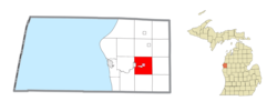
168:
604:
966:
754:
490:
There were 489 households, out of which 33.9% had children under the age of 18 living with them, 64.8% were
419:
686:
480:
396:
195:
54:
973:
914:
732:
484:
439:
431:
331:
303:
883:
772:
727:
708:
605:
U.S. Geological Survey
Geographic Names Information System: Custer Township, Mason County, Michigan
472:
460:
934:
924:
767:
506:
for the township was $ 17,407. About 9.1% of families and 9.8% of the population were below the
446:
crosses the township from east to west as well, passing through the north side of the village.
919:
503:
430:
The township is in central Mason County and is bordered to the west partially by the city of
893:
782:
762:
412:
325:
58:
216:
909:
800:
392:
39:
990:
443:
345:
507:
701:
556:"P1. Race – Custer township, Michigan: 2020 DEC Redistricting Data (PL 94-171)"
400:
178:
151:
138:
284:
510:, including 12.6% of those under age 18, and 6.4% of those age 65 or over.
434:. The village of Custer is in the center of the township. According to the
957:‡This populated place also has portions in an adjacent county or counties
491:
442:
flows east to west across the township, passing south of Custer village.
404:
318:
183:
742:
455:
310:
289:
719:
658:
741:
647:
377:
580:
525:
523:
16:
For other places in
Michigan with the same name, see
952:
933:
882:
799:
781:
753:
718:
372:
361:
351:
339:
317:
300:
283:
275:
267:
262:
254:
246:
238:
230:
225:
214:
206:
201:
189:
177:
167:
30:
746:Map of Michigan highlighting Mason County.svg
670:
550:
548:
8:
617:"Focus on our history: How county was named"
677:
663:
655:
487:of any race were 3.14% of the population.
27:
25:Civil township in Michigan, United States
519:
371:
350:
316:
282:
261:
253:
224:
200:
166:
131:
110:
80:
65:
45:
57:(red) and the administered village of
575:
573:
531:"2022 U.S. Gazetteer Files: Michigan"
360:
338:
299:
274:
266:
245:
237:
229:
213:
205:
188:
176:
7:
479:, and 1.76% from two or more races.
242:34.91 sq mi (90.4 km)
234:34.97 sq mi (90.6 km)
997:Townships in Mason County, Michigan
685:Municipalities and communities of
407:. The population was 1,321 at the
250:0.06 sq mi (0.2 km)
14:
422:, a United States Army officer.
415:is located within the township.
109:
102:
79:
72:
47:
1:
533:. United States Census Bureau
123:Show map of the United States
623:. October 3, 1987. p. 2
585:United States Census Bureau
436:United States Census Bureau
418:The township was named for
1018:
15:
962:
739:
699:
279:37.8/sq mi (14.6/km)
132:
66:
46:
37:
32:Custer Township, Michigan
18:Custer Township, Michigan
943:Little River Reservation
258:692 ft (211 m)
499:there were 95.4 males.
420:George Armstrong Custer
207: • Supervisor
747:
688:Mason County, Michigan
1002:Townships in Michigan
745:
581:"U.S. Census website"
302: • Summer (
152:43.94806°N 86.22083°W
975:United States portal
621:Ludington Daily News
558:. U.S. Census Bureau
440:Pere Marquette River
276: • Density
93:Show map of Michigan
157:43.94806; -86.22083
148: /
935:Indian reservation
748:
268: • Total
247: • Water
231: • Total
984:
983:
504:per capita income
411:. The village of
386:
385:
239: • Land
1009:
976:
969:
783:Charter township
744:
711:
704:
694:
689:
679:
672:
665:
656:
651:
650:
648:Official website
633:
632:
630:
628:
613:
607:
602:
596:
595:
593:
591:
577:
568:
567:
565:
563:
552:
543:
542:
540:
538:
527:
465:African American
382:
379:
307:
163:
162:
160:
159:
158:
153:
149:
146:
145:
144:
141:
124:
113:
112:
106:
94:
83:
82:
76:
53:Location within
51:
28:
1017:
1016:
1012:
1011:
1010:
1008:
1007:
1006:
987:
986:
985:
980:
974:
968:Michigan portal
967:
958:
948:
929:
900:Chapple Corners
885:
878:
801:Civil townships
795:
777:
749:
737:
714:
709:
702:
695:
692:
687:
683:
646:
645:
642:
637:
636:
626:
624:
615:
614:
610:
603:
599:
589:
587:
579:
578:
571:
561:
559:
554:
553:
546:
536:
534:
529:
528:
521:
516:
492:married couples
469:Native American
452:
428:
389:Custer Township
376:
335:
329:
301:
156:
154:
150:
147:
142:
139:
137:
135:
134:
128:
127:
126:
125:
122:
121:
120:
119:
118:
117:Custer Township
114:
97:
96:
95:
92:
91:
90:
89:
88:
87:Custer Township
84:
62:
42:
33:
26:
21:
12:
11:
5:
1015:
1013:
1005:
1004:
999:
989:
988:
982:
981:
979:
978:
971:
963:
960:
959:
956:
954:
950:
949:
947:
946:
939:
937:
931:
930:
928:
927:
922:
917:
912:
907:
902:
897:
890:
888:
884:Unincorporated
880:
879:
877:
876:
871:
866:
861:
856:
851:
846:
841:
836:
831:
826:
821:
816:
811:
805:
803:
797:
796:
794:
793:
791:Pere Marquette
787:
785:
779:
778:
776:
775:
770:
765:
759:
757:
751:
750:
740:
738:
736:
735:
730:
724:
722:
716:
715:
700:
697:
696:
684:
682:
681:
674:
667:
659:
653:
652:
641:
640:External links
638:
635:
634:
608:
597:
569:
544:
518:
517:
515:
512:
451:
448:
427:
424:
393:civil township
384:
383:
378:custertownship
374:
370:
369:
366:
359:
358:
355:
349:
348:
343:
337:
336:
323:
321:
315:
314:
308:
298:
297:
287:
281:
280:
277:
273:
272:
269:
265:
264:
260:
259:
256:
252:
251:
248:
244:
243:
240:
236:
235:
232:
228:
227:
223:
222:
219:
212:
211:
208:
204:
203:
199:
198:
193:
187:
186:
181:
175:
174:
171:
165:
164:
130:
129:
116:
115:
108:
107:
101:
100:
99:
98:
86:
85:
78:
77:
71:
70:
69:
68:
67:
64:
63:
52:
44:
43:
40:Civil township
38:
35:
34:
31:
24:
13:
10:
9:
6:
4:
3:
2:
1014:
1003:
1000:
998:
995:
994:
992:
977:
972:
970:
965:
964:
961:
955:
951:
944:
941:
940:
938:
936:
932:
926:
923:
921:
918:
916:
913:
911:
908:
906:
903:
901:
898:
895:
892:
891:
889:
887:
881:
875:
872:
870:
867:
865:
862:
860:
857:
855:
852:
850:
847:
845:
842:
840:
837:
835:
832:
830:
827:
825:
822:
820:
817:
815:
812:
810:
807:
806:
804:
802:
798:
792:
789:
788:
786:
784:
780:
774:
771:
769:
766:
764:
761:
760:
758:
756:
752:
734:
731:
729:
726:
725:
723:
721:
717:
713:
712:
705:
698:
693:United States
690:
680:
675:
673:
668:
666:
661:
660:
657:
649:
644:
643:
639:
622:
618:
612:
609:
606:
601:
598:
586:
582:
576:
574:
570:
557:
551:
549:
545:
532:
526:
524:
520:
513:
511:
509:
505:
500:
496:
493:
488:
486:
482:
478:
475:, 1.07% from
474:
470:
466:
462:
457:
449:
447:
445:
444:U.S. Route 10
441:
437:
433:
425:
423:
421:
416:
414:
410:
406:
402:
398:
394:
390:
381:
375:
367:
364:
356:
354:
347:
344:
342:
333:
327:
322:
320:
312:
309:
305:
295:
294:Eastern (EST)
291:
288:
286:
278:
270:
257:
249:
241:
233:
220:
218:
215: •
210:Mark Anderson
209:
197:
194:
192:
185:
182:
180:
173:United States
172:
170:
161:
133:Coordinates:
105:
75:
60:
56:
50:
41:
36:
29:
23:
19:
818:
707:
625:. Retrieved
620:
611:
600:
588:. Retrieved
562:September 7,
560:. Retrieved
537:September 7,
535:. Retrieved
508:poverty line
501:
497:
489:
453:
450:Demographics
429:
417:
397:Mason County
388:
387:
357:26-105-19440
55:Mason County
22:
886:communities
703:County seat
590:January 31,
477:other races
409:2020 census
155: /
991:Categories
915:Ferryville
733:Scottville
514:References
454:As of the
432:Scottville
401:U.S. state
365:feature ID
332:Scottville
263:Population
202:Government
143:86°13′15″W
140:43°56′53″N
953:Footnotes
829:Free Soil
773:Free Soil
728:Ludington
710:Ludington
627:April 30,
426:Geography
353:FIPS code
341:Area code
319:ZIP Codes
285:Time zone
255:Elevation
925:Walhalla
905:Fairview
859:Sheridan
854:Riverton
768:Fountain
755:Villages
481:Hispanic
471:, 0.31%
467:, 1.45%
463:, 0.31%
405:Michigan
221:Ann Larr
184:Michigan
920:Tallman
874:Victory
864:Sherman
399:in the
373:Website
368:1626152
330:49454 (
324:49405 (
169:Country
894:Branch
869:Summit
839:Hamlin
819:Custer
814:Branch
763:Custer
720:Cities
485:Latino
456:census
413:Custer
326:Custer
191:County
61:(pink)
59:Custer
849:Meade
844:Logan
834:Grant
809:Amber
473:Asian
461:White
391:is a
313:(EDT)
311:UTC-4
290:UTC-5
271:1,321
217:Clerk
196:Mason
179:State
910:Fern
824:Eden
629:2015
592:2008
564:2023
539:2023
380:.com
363:GNIS
226:Area
483:or
403:of
395:of
346:231
304:DST
993::
706::
691:,
619:.
583:.
572:^
547:^
522:^
945:‡
896:‡
678:e
671:t
664:v
631:.
594:.
566:.
541:.
334:)
328:)
306:)
296:)
292:(
20:.
Text is available under the Creative Commons Attribution-ShareAlike License. Additional terms may apply.