84:
1093:
117:
1004:
124:
91:
439:
seats. This boat appeared to have had no nail or iron work, being completely hallowed out from the trunk of a tree. In the 1780s a smaller boat of similar construction had also been found, but had been scuttled and sunk several times. It is stated that these boats may have been either pleasure or fishing boats belonging to
Calmore Castle.
986:
70:
453:
The O'Hagans of
Ballinascreen when being questioned by John O'Donovan in 1821 as part of his letters pertaining to the antiquities of County Londonderry, claimed that Sir William O'Hagan built Calmore Castle. Local traditions however picked up by the Ordnance Survey Memoirs of 1836-37 state that it
438:
and constructed of an oak frame, composed of large logs and planks bound together by wooden pins. This frame was enclosed by long poles, standing upright and fastened by mortices. In April 1835, at the crannog, a flat bottomed boat of oak was discovered, containing several oak boards that served as
495:
A tradition is recorded claiming that two years after it was burnt down, the very person who led the party and was the first to throw a sheaf of burning straw into the rooms, came begging to the windows of the partly repaired building. When he was recognised he was immediately "stalled" by Rowley
496:
himself. The last inhabitant of the estate was Henry Rowley in 1814, but was still listed as "Rowley's Castle" in Civil Survey maps from 1850. The plantation house that succeeded
Calmore Castle no longer exists. Its remains were carried off by a local tenant, John McKee, for building work.
476:
After Sir
William O'Hagan, Calmore Castle was inhabited by Owen Roe O'Hagan, who after which it is said to have been burned down. By 1619, a plantation house was built for William Rowley, which incorporated parts of Calmore Castle. Rowley was the brother of
473:, who are said to have come rampaging down from Ballynascreen. During its control by the O'Hagans, Calmore Castle was considered "once a place of very considerable strength, which commanded the mountain passes, and the fords of the Moyola".
904:
1015:
83:
1103:
1045:
1704:
450:
Calmore Castle was an ancient castle that once stood in the townland of
Calmore. It has been formerly known as O'Hagan's Castle and Rowley's Castle.
1745:
116:
1144:
485:, and later for the Drapers Company. Shortly after the 1641 rebellion, it fell back into Irish hands. In 1689, it was burnt by a party of the
1750:
152:
1065:
1686:
1681:
869:
311:
1038:
822:
482:
1709:
1192:
796:
1222:
455:
384:
239:
1557:
1522:
1462:
1357:
1327:
1262:
1232:
395:
422:
The townland of
Calmore is named after a large ancient hazel tree that was said to have been used in pagan ceremonies.
1658:
1167:
1031:
305:
1312:
1092:
1547:
1447:
1287:
352:
1512:
615:- along with townlands of Moneyshanere and Tobermore, population counted as part of total for Tobermore town.
454:
was his father, Shane More O'Hagan, who built it. Shane More O'Hagan is noted as being the proprietor of the
1714:
1638:
1074:
458:
Proportion in this area together with other tracts of land, including ten townlands in
Ballynascreen and
1719:
469:, a battle was said to have been fought between the O'Hagans who are stated as ruling Tobermore and the
380:
234:
407:
277:
1666:
1055:
360:
207:
470:
430:
The townland of
Calmore appears to have formerly been a place of some importance, attested by a
1671:
1507:
865:
368:
886:, 1925, Alfred Moore Munn, Clerk of the Crown and Peace of the City and County of Londonderry
364:
197:
964:
1598:
1457:
1207:
434:
that once lay in an ancient lake in the townland. This crannog is stated as having been
1724:
1613:
1005:
HistPop; Area, houses, and population, Vol. III [Part 2], Ireland, 1901 Page 35
490:
339:
187:
40:
826:
398:, however in 1926 it was part of Tobermore district electoral division as part of the
1739:
1676:
1437:
1347:
1227:
1202:
508:
lies partially in this townland, and those of
Moneyshanere, Moyesset, and Tobermore.
459:
411:
217:
1502:
1417:
1322:
1277:
1212:
1197:
1187:
884:
Notes on the Place Names of the
Parishes and Townlands of the County of Londonderry
791:
466:
372:
356:
227:
987:
HistPop; Area, population and number of houses, Vol. III, Ireland, 1881, page 698
1628:
1623:
1542:
1537:
1332:
1317:
1272:
1157:
1131:
1126:
478:
403:
1023:
367:. It lies in the north-west of the parish, and is bounded by the townlands of;
1633:
1603:
1577:
1562:
1527:
1497:
1482:
1362:
1342:
1282:
1217:
486:
167:
154:
1691:
1618:
1572:
1492:
1472:
1427:
1412:
1407:
1402:
1392:
1257:
1242:
1177:
1172:
1162:
1152:
1111:
801:
505:
388:
243:
1643:
1593:
1567:
1552:
1452:
1422:
1397:
1372:
1352:
1337:
1237:
1182:
1121:
1116:
929:
Ordnance Survey Memoirs for the Parishes of Desertmartin and Kilcronaghan
376:
348:
334:
328:
32:
1532:
1487:
1477:
1387:
1377:
1307:
1302:
1267:
1252:
431:
399:
1608:
1517:
1467:
1432:
1292:
1247:
69:
1648:
1442:
1382:
1367:
1297:
1082:
905:
HistPop; County and County Borough of Londonderry, 1926, page 27
394:
The townland was part of Tobermore electoral ward of the former
1027:
952:
Statistical Reports of Six Derry Parishes 1821, John MacCloskey
1091:
511:
465:
The Ordnance Survey Memoirs note that in neighbouring
442:
The crannog was dismantled in the early 19th century.
864:, page 115-116. Queen's University of Belfast, 1996,
607:- decrease is attributed to emigration and removals
1657:
1586:
1140:
1102:
1073:
462:, the heart of a large territory of the same name.
304:
296:
291:
283:
273:
268:
258:
250:
233:
223:
213:
203:
193:
183:
59:
47:
39:
23:
931:, Ballinascreen Historical Society. Published 1986
406:Rural District. It was also part of the historic
924:
922:
920:
918:
916:
914:
912:
1016:HistPop; County of Londonderry, 1851, page 241
1000:
998:
996:
994:
960:
958:
941:Statistical Reports of Six Derry Parishes 1821
1039:
982:
980:
978:
976:
974:
972:
900:
898:
896:
894:
892:
8:
18:Townland in Northern Ireland, United Kingdom
342:
51:
1046:
1032:
1024:
20:
943:. Ballinascreen Historical Society, 1983.
766:
672:
623:
601:
515:
347:, meaning 'the great/large hazel') is a
813:
770:(Charter) - Charter of Londonderry 1613
303:
290:
267:
257:
232:
182:
147:
75:
66:
58:
38:
879:
877:
333:
327:
856:
854:
852:
850:
848:
846:
844:
821:Northern Ireland Environment Agency.
295:
282:
272:
249:
222:
212:
202:
192:
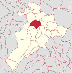
103:Calmore shown within Northern Ireland
46:
7:
1066:List of places in County Londonderry
768:(E.C.) - Escheated Counties Map 1609
1687:North West Liberties of Londonderry
300:278.98 acres (112.90 ha)
14:
1682:North East Liberties of Coleraine
483:The Honourable The Irish Society
122:
115:
89:
82:
68:
1746:Townlands of County Londonderry
862:Place-Names of Northern Ireland
123:
90:
797:List of townlands in Tobermore
139:Show map of the United Kingdom
1:
1751:Civil parish of Kilcronaghan
1705:WikiProject Northern Ireland
396:Magherafelt District Council
383:. It was apportioned to the
136:Calmore (the United Kingdom)
106:Show map of Northern Ireland
625:Size (acres, roods, poles)
1767:
1700:
1089:
1062:
489:army retreating from the
436:of a tolerable large size
148:
76:
67:
30:
965:Place Names NI - Calmore
738:Calmoore & Cloghfin
481:, former chief agent of
48: • Derivation:
1715:Northern Ireland Portal
674:Earlier recorded forms
63:"The great/large hazel"
1096:
343:
52:
43: transcription(s)
1720:United Kingdom Portal
1095:
60: • Meaning:
1141:Villages, parishes,
706:Culemoire (Charter)
274: • Council
1710:WikiProject Ireland
829:on 24 November 2011
675:
626:
518:
500:Townland statistics
387:company as well as
335:[ˌkɔlˈmoːr]
329:[ˌkalˈmoːr]
278:Mid Ulster District
164: /
1097:
1056:County Londonderry
673:
624:
516:
471:O'Neills of Tyrone
361:County Londonderry
297: • Total
208:County Londonderry
168:54.8057°N 6.7108°W
1733:
1732:
823:"NIEA Map Viewer"
782:
781:
775:
774:
669:
668:
620:
619:
351:lying within the
318:
317:
284: • Ward
1758:
1048:
1041:
1034:
1025:
1018:
1013:
1007:
1002:
989:
984:
967:
962:
953:
950:
944:
938:
932:
926:
907:
902:
887:
881:
872:
860:Toner, Gregory:
858:
839:
838:
836:
834:
825:. Archived from
818:
690:Calemore (E.C.)
676:
627:
616:
614:
608:
606:
519:
512:
365:Northern Ireland
346:
337:
331:
326:
314:
235:Plantation grant
198:Northern Ireland
179:
178:
176:
175:
174:
173:54.8057; -6.7108
169:
165:
162:
161:
160:
157:
140:
126:
125:
119:
107:
93:
92:
86:
72:
55:
21:
1766:
1765:
1761:
1760:
1759:
1757:
1756:
1755:
1736:
1735:
1734:
1729:
1696:
1653:
1599:Ballynahone Bog
1582:
1458:Lettershandoney
1208:Ballynagalliagh
1142:
1136:
1098:
1087:
1069:
1058:
1052:
1022:
1021:
1014:
1010:
1003:
992:
985:
970:
963:
956:
951:
947:
939:
935:
927:
910:
903:
890:
882:
875:
859:
842:
832:
830:
820:
819:
815:
810:
788:
783:
771:
769:
611:
610:
609:
603:
602:
502:
491:Siege of Derry.
448:
428:
426:Calmore crannog
420:
324:
310:
240:Drapers Company
184:Sovereign state
172:
170:
166:
163:
158:
155:
153:
151:
150:
144:
143:
142:
141:
138:
137:
134:
133:
132:
131:
127:
110:
109:
108:
105:
104:
101:
100:
99:
98:
94:
35:
26:
19:
12:
11:
5:
1764:
1762:
1754:
1753:
1748:
1738:
1737:
1731:
1730:
1728:
1727:
1725:Ireland Portal
1722:
1717:
1712:
1707:
1701:
1698:
1697:
1695:
1694:
1689:
1684:
1679:
1674:
1669:
1663:
1661:
1655:
1654:
1652:
1651:
1646:
1641:
1636:
1631:
1626:
1621:
1616:
1614:Glenshane Pass
1611:
1606:
1601:
1596:
1590:
1588:
1584:
1583:
1581:
1580:
1575:
1570:
1565:
1560:
1555:
1550:
1545:
1540:
1535:
1530:
1525:
1520:
1515:
1510:
1508:Nixon's Corner
1505:
1500:
1495:
1490:
1485:
1480:
1475:
1470:
1465:
1460:
1455:
1450:
1445:
1440:
1435:
1430:
1425:
1420:
1415:
1410:
1405:
1400:
1395:
1390:
1385:
1380:
1375:
1370:
1365:
1360:
1355:
1350:
1345:
1340:
1335:
1330:
1325:
1320:
1315:
1310:
1305:
1300:
1295:
1290:
1285:
1280:
1275:
1270:
1265:
1260:
1255:
1250:
1245:
1240:
1235:
1230:
1225:
1220:
1215:
1210:
1205:
1200:
1195:
1190:
1185:
1180:
1175:
1170:
1165:
1160:
1155:
1149:
1147:
1138:
1137:
1135:
1134:
1129:
1124:
1119:
1114:
1108:
1106:
1100:
1099:
1090:
1088:
1086:
1085:
1079:
1077:
1071:
1070:
1063:
1060:
1059:
1053:
1051:
1050:
1043:
1036:
1028:
1020:
1019:
1008:
990:
968:
954:
945:
933:
908:
888:
873:
840:
812:
811:
809:
806:
805:
804:
799:
794:
787:
784:
780:
779:
773:
772:
767:
764:
763:
760:
756:
755:
752:
748:
747:
744:
740:
739:
736:
732:
731:
728:
724:
723:
722:san Chall M-r
720:
716:
715:
712:
708:
707:
704:
700:
699:
696:
692:
691:
688:
684:
683:
680:
670:
667:
666:
663:
659:
658:
655:
651:
650:
647:
643:
642:
639:
635:
634:
631:
621:
618:
617:
599:
598:
595:
591:
590:
587:
583:
582:
579:
575:
574:
571:
567:
566:
563:
559:
558:
555:
551:
550:
547:
543:
542:
539:
535:
534:
531:
527:
526:
523:
510:
501:
498:
460:Lough Insholin
447:
446:Calmore castle
444:
427:
424:
419:
416:
316:
315:
308:
306:Irish grid ref
302:
301:
298:
294:
293:
289:
288:
285:
281:
280:
275:
271:
270:
266:
265:
260:
256:
255:
252:
251:First recorded
248:
247:
237:
231:
230:
225:
221:
220:
215:
211:
210:
205:
201:
200:
195:
191:
190:
188:United Kingdom
185:
181:
180:
146:
145:
135:
129:
128:
121:
120:
114:
113:
112:
111:
102:
96:
95:
88:
87:
81:
80:
79:
78:
77:
74:
73:
65:
64:
61:
57:
56:
49:
45:
44:
37:
36:
31:
28:
27:
24:
17:
13:
10:
9:
6:
4:
3:
2:
1763:
1752:
1749:
1747:
1744:
1743:
1741:
1726:
1723:
1721:
1718:
1716:
1713:
1711:
1708:
1706:
1703:
1702:
1699:
1693:
1690:
1688:
1685:
1683:
1680:
1678:
1677:Loughinsholin
1675:
1673:
1670:
1668:
1665:
1664:
1662:
1660:
1656:
1650:
1647:
1645:
1642:
1640:
1637:
1635:
1632:
1630:
1627:
1625:
1622:
1620:
1617:
1615:
1612:
1610:
1607:
1605:
1602:
1600:
1597:
1595:
1592:
1591:
1589:
1585:
1579:
1576:
1574:
1571:
1569:
1566:
1564:
1561:
1559:
1556:
1554:
1551:
1549:
1546:
1544:
1541:
1539:
1536:
1534:
1531:
1529:
1526:
1524:
1521:
1519:
1516:
1514:
1511:
1509:
1506:
1504:
1501:
1499:
1496:
1494:
1491:
1489:
1486:
1484:
1481:
1479:
1476:
1474:
1471:
1469:
1466:
1464:
1461:
1459:
1456:
1454:
1451:
1449:
1446:
1444:
1441:
1439:
1438:Knockloughrim
1436:
1434:
1431:
1429:
1426:
1424:
1421:
1419:
1416:
1414:
1411:
1409:
1406:
1404:
1401:
1399:
1396:
1394:
1391:
1389:
1386:
1384:
1381:
1379:
1376:
1374:
1371:
1369:
1366:
1364:
1361:
1359:
1356:
1354:
1351:
1349:
1348:Drumraighland
1346:
1344:
1341:
1339:
1336:
1334:
1331:
1329:
1326:
1324:
1321:
1319:
1316:
1314:
1311:
1309:
1306:
1304:
1301:
1299:
1296:
1294:
1291:
1289:
1286:
1284:
1281:
1279:
1276:
1274:
1271:
1269:
1266:
1264:
1261:
1259:
1256:
1254:
1251:
1249:
1246:
1244:
1241:
1239:
1236:
1234:
1231:
1229:
1228:Ballyscullion
1226:
1224:
1221:
1219:
1216:
1214:
1211:
1209:
1206:
1204:
1203:Ballymaguigan
1201:
1199:
1196:
1194:
1191:
1189:
1186:
1184:
1181:
1179:
1176:
1174:
1171:
1169:
1166:
1164:
1161:
1159:
1156:
1154:
1151:
1150:
1148:
1146:
1139:
1133:
1130:
1128:
1125:
1123:
1120:
1118:
1115:
1113:
1110:
1109:
1107:
1105:
1101:
1094:
1084:
1081:
1080:
1078:
1076:
1072:
1068:
1067:
1061:
1057:
1049:
1044:
1042:
1037:
1035:
1030:
1029:
1026:
1017:
1012:
1009:
1006:
1001:
999:
997:
995:
991:
988:
983:
981:
979:
977:
975:
973:
969:
966:
961:
959:
955:
949:
946:
942:
937:
934:
930:
925:
923:
921:
919:
917:
915:
913:
909:
906:
901:
899:
897:
895:
893:
889:
885:
880:
878:
874:
871:
870:0-85389-613-5
867:
863:
857:
855:
853:
851:
849:
847:
845:
841:
828:
824:
817:
814:
807:
803:
800:
798:
795:
793:
790:
789:
785:
778:
765:
761:
758:
757:
753:
750:
749:
745:
742:
741:
737:
734:
733:
729:
726:
725:
721:
718:
717:
713:
710:
709:
705:
702:
701:
697:
694:
693:
689:
686:
685:
681:
678:
677:
671:
664:
661:
660:
656:
653:
652:
648:
645:
644:
640:
637:
636:
632:
629:
628:
622:
613:
605:
600:
596:
593:
592:
588:
585:
584:
580:
577:
576:
572:
569:
568:
564:
561:
560:
556:
553:
552:
548:
545:
544:
540:
537:
536:
532:
529:
528:
524:
521:
520:
514:
513:
509:
507:
499:
497:
493:
492:
488:
484:
480:
474:
472:
468:
463:
461:
457:
451:
445:
443:
440:
437:
433:
425:
423:
417:
415:
413:
412:Loughinsholin
409:
405:
401:
397:
392:
390:
386:
382:
378:
374:
370:
366:
362:
358:
354:
350:
345:
341:
336:
330:
322:
313:
309:
307:
299:
286:
279:
276:
263:
261:
253:
245:
241:
238:
236:
229:
226:
219:
218:Loughinsholin
216:
209:
206:
199:
196:
189:
186:
177:
149:Coordinates:
118:
85:
71:
62:
54:
50:
42:
34:
29:
22:
16:
1503:Newbuildings
1418:Kilcronaghan
1323:Desertmartin
1278:Castledawson
1213:Ballyrashane
1198:Ballylifford
1188:Ballyhanedin
1064:
1011:
948:
940:
936:
928:
883:
861:
831:. Retrieved
827:the original
816:
792:Kilcronaghan
776:
657:284, 1, 26
649:284, 1, 26
641:283, 2, 10
612:
604:
504:The town of
503:
494:
475:
467:Moneyshanere
464:
452:
449:
441:
435:
429:
421:
402:division of
393:
373:Moneyshanere
357:Kilcronaghan
353:civil parish
320:
319:
262:
228:Kilcronaghan
224:Civil parish
15:
1629:Lough Foyle
1624:Lough Enagh
1543:Strathfoyle
1538:Straidarran
1333:Draperstown
1318:Derrynaflaw
1273:Carrowclare
1158:Altnagelvin
1132:Portstewart
1127:Magherafelt
698:Call Moore
665:283, 0, 2
517:Population
479:John Rowley
404:Magherafelt
391:freeholds.
344:An Coll Mór
259:Settlements
171: /
53:An Coll Mór
1740:Categories
1639:Roe Valley
1634:Magilligan
1604:Binevenagh
1578:Upperlands
1563:Tamnaherin
1528:Shantallow
1498:Moneyneany
1483:Magilligan
1363:Elagh More
1343:Drummullan
1283:Castlerock
1218:Ballyronan
1193:Ballykelly
1054:Places in
833:27 January
808:References
762:Caul-more
269:Government
156:54°48′21″N
1692:Tirkeeran
1667:Coleraine
1619:Lough Beg
1587:Landforms
1573:Tobermore
1493:Moneymore
1473:Macosquin
1428:Killywool
1413:Inishrush
1408:Gulladuff
1403:Greysteel
1393:Gortnahey
1258:Broighter
1243:Bellarena
1223:Ballyrory
1178:Artikelly
1173:Articlave
1163:Ardgarvan
1153:Aghadowey
1145:townlands
1112:Coleraine
802:Tobermore
730:Kallmore
506:Tobermore
381:Tobermore
287:Tobermore
264:Tobermore
246:freeholds
159:6°42′39″W
1672:Keenaght
1659:Baronies
1644:Sperrins
1594:Aughlish
1568:The Loup
1558:Tamlaght
1553:Swatragh
1523:Ringsend
1463:Lisbunny
1453:Lenamore
1423:Killaloo
1398:Goshedan
1373:Foreglen
1358:Eglinton
1353:Drumsurn
1338:Drumahoe
1328:Downhill
1263:Burnfoot
1238:Bellaghy
1233:Banagher
1183:Ballerin
1122:Limavady
1117:Dungiven
786:See also
754:Calmore
746:Culmore
714:Coolmor
633:a, r, p
487:Jacobite
377:Moyesset
349:townland
33:townland
1533:Shanvey
1488:Maydown
1478:Maghera
1388:Glenone
1378:Garvagh
1308:Culnady
1303:Culmore
1268:Campsey
1253:Bogside
1168:Ardmore
456:Drapers
432:crannog
418:History
400:Maghera
385:Drapers
338:, from
325:locally
321:Calmore
312:H829961
194:Country
130:Calmore
97:Calmore
25:Calmore
1609:Corick
1518:Prehen
1468:Lissan
1433:Kilrea
1313:Curran
1293:Claudy
1248:Benone
1075:Cities
868:
777:
759:1834c
735:1659c
719:1645c
408:barony
379:, and
369:Granny
214:Barony
204:County
1649:Traad
1548:Straw
1448:Lavey
1443:Largy
1383:Glack
1368:Feeny
1298:Coagh
1288:Clady
1104:Towns
1083:Derry
751:1767
743:1663
727:1654
711:1622
703:1613
695:1613
687:1609
682:Form
679:Year
662:1926
654:1901
646:1881
638:1851
630:Year
594:1926
589:342
586:1911
578:1901
570:1891
565:169
562:1881
557:169
554:1871
549:190
546:1861
541:185
538:1851
533:215
530:1841
525:Pop.
522:Year
389:Crown
340:Irish
244:Crown
41:Irish
1513:Park
1143:and
866:ISBN
835:2012
597:98
581:54
573:69
332:and
292:Area
254:1609
242:and
410:of
355:of
1742::
993:^
971:^
957:^
911:^
891:^
876:^
843:^
414:.
375:,
371:,
363:,
359:,
1047:e
1040:t
1033:v
837:.
323:(
Text is available under the Creative Commons Attribution-ShareAlike License. Additional terms may apply.