31:
431:
397:
47:
377:
been re-modelled as a farm. In 1909 a post office is shown next to the smithy and a horse trough stands opposite. A later OS map shows a telephone call box at the post office with the smithy no longer marked. The
Caldermill Farm buildings next to the old Calder Mill are shown as greatly enlarged in the mid-20th century. The farm of Calderbraehead is recorded in the OS Name book for the period 1858 to 1861 as being occupied by William Wiseman and at the time it was the property of the
759:
439:
54:
190:
376:
stands beside the entrance to
Hillhead Farm off the A71. By 1858 a group of four dwellings are named as Calderbank on the north side of the main road and a building is shown to the west of Calder Mill. By 1896 one of the Calderbank buildings is shown as a smithy and the building close to the mill had
417:
A 2005 photograph shows the old mill as a ruin (datum 2023), but it has since been restored as a private dwelling. In 2022 the site of the mill pond remains as a flooded area next to the old access road to the abandoned Calder Bridge. In the mid-20th century the mill is not shown as an operational
446:
The old Calder Brig or Bridge is
Category B Listed and crosses the Calder Water and is dated 1829, with Thomas Telford and Henry Welch as architects. It has a single semi-circular span and is built of ashlar and parapet coping. The abutments are splayed and sloping. A date stone with 'Built by Wm
421:
The mill had an overshot waterwheel and there was a grain kiln with two sets of millstones for general grinding and for producing oatmeal. The last miller was John McStrovock who died in
January 1946, the mill having ceased operation in 1945. An earlier miller was William McKenzie.
238:
407:
The 1858 OS map records Calder Mill as a corn mill and a mill pond is shown on the north side of the main road with a dam on the Calder Water partly diverting the current down the lade towards the mill.
447:
Brownlie,' a
Strathaven mason, is set in a rectangular panel over the keystone on the southern side. The bridge has been replaced by a wider concrete bridge with a new alignment through the settlement.
248:
664:
414:
In 1909 Calder Mill's mill pond is shown as abandoned and the route of the tail race of the lade to the Calder Water is not marked although the mill is still recorded as a corn mill.
1103:
230:
393:
does not name the mill; however, a building is marked next to the mill lade running from the Calder Water is clearly shown. Calder Bridge is drawn and
Hillhead Farm is shown.
610:
566:
214:
411:
The OS Name Book records in the period 1858 to 1861 that the Corn Mill was occupied by John Barr and was the property of Thomas
Allison of Strawfrank in Carstairs.
256:
85:
657:
30:
46:
348:. It is a hamlet of just a few houses. For children raised in Caldermill, the closest primary school is Gilmourton Primary, in the nearby hamlet of
176:
650:
404:
The mill is shown in 1776 on the Taylor and
Skinner survey of road. Calder Mill is indicated by a waterwheel symbol in the early 19th century.
1098:
621:
430:
1079:
202:
555:
577:
274:
207:
289:
164:
130:
1023:
973:
456:
112:
78:
1108:
1028:
883:
853:
818:
813:
803:
396:
1018:
1013:
1008:
873:
858:
848:
778:
773:
718:
693:
349:
1053:
988:
898:
868:
808:
279:
219:
1058:
688:
913:
144:
94:
460:
948:
352:, which is 2 miles (3 km) further along the A71 towards Kilmarnock. The nearest high school is
369:
341:
589:
George Taylor and Andrew
Skinner's Survey and maps of the roads of North Britain or Scotland, 1776
843:
373:
353:
674:
326:
102:
67:
378:
169:
758:
195:
438:
918:
340:, and is the next settlement a driver will come across after leaving Strathaven on the
1092:
998:
938:
713:
1068:
1048:
1043:
943:
878:
642:
364:
The name of the settlement means 'hazel stream' in Gaelic. It was linked with the
793:
390:
120:
1038:
968:
963:
933:
893:
798:
788:
748:
743:
738:
733:
703:
637:
464:
365:
345:
337:
304:
291:
1063:
993:
983:
958:
953:
923:
908:
838:
154:
863:
833:
823:
723:
698:
330:
136:
1033:
1003:
978:
928:
903:
888:
783:
708:
515:
Lanarkshire XXX.2 (Avondale) Survey date: 1858, Publication date: 1860
728:
600:
Forrest, William, 1799-1832. The county of Lanark from actual survey.
468:
599:
588:
539:
525:
514:
429:
395:
646:
459:
ran near to
Caldermill; however, the nearest station was at
471:
from 1905 to 1939 with WWI closure between 1917 and 1922.
622:
British Listed Buildings - Calder Bridge, Calder Mill
766:
681:
578:
1747-55 - William ROY - Military Survey of Scotland
247:
229:
213:
201:
189:
175:
163:
153:
143:
129:
111:
93:
77:
23:
526:Lanarkshire XXX.2 Revised: 1896, Published: 1897
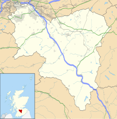
336:Caldermill is 3 miles (5 km) south-west of
540:Lanarkshire XXX.2 Revised:1909, Published:1911
1104:Buildings and structures in South Lanarkshire
658:
638:YouTube video history of the Trumpeter's Well
8:
442:Old track formation looking towards Ryeland
665:
651:
643:
368:during the so called 'Killing Times'. The
20:
437:
239:East Kilbride, Strathaven and Lesmahagow
492:
490:
486:
228:
184:
152:
128:
76:
27:
551:
549:
547:
535:
533:
510:
508:
356:, located in the town of Strathaven.
246:
212:
200:
188:
174:
162:
142:
110:
92:
7:
499:A History of Strathaven and Avondale
1080:List of places in South Lanarkshire
501:. Privately published. p. 181.
35:The Trumpeter's Well and Calderbank
567:OS Name Book - Calderbraehead Farm
53:
14:
463:with passenger trains running to
757:
497:Downie, William Fleming (1979).
52:
45:
29:
1:
457:Darvel and Strathaven Railway
1099:History of South Lanarkshire
389:The mid-18th century map by
18:Human settlement in Scotland
79:OS grid reference
1125:
611:OS Name Book - Calder Mill
1077:
755:
325:is a small settlement in
265:
225:
185:
40:
28:
249:Scottish Parliament
443:
435:
434:Old Calder Bridge road
401:
165:Postcode district
441:
433:
399:
113:Lieutenancy area
767:Villages and hamlets
145:Sovereign state
1109:Hamlets in Scotland
372:linked to the 1679
301: /
844:Carstairs Junction
444:
436:
402:
374:Battle of Drumclog
354:Strathaven Academy
344:westbound towards
231:UK Parliament
177:Dialling code
1086:
1085:
675:South Lanarkshire
327:South Lanarkshire
320:
319:
103:South Lanarkshire
95:Council area
68:South Lanarkshire
1116:
761:
667:
660:
653:
644:
624:
619:
613:
608:
602:
597:
591:
586:
580:
575:
569:
564:
558:
553:
542:
537:
528:
523:
517:
512:
503:
502:
494:
379:Duke of Hamilton
370:Trumpeter's Well
316:
315:
313:
312:
311:
306:
302:
299:
298:
297:
294:
271:
139:
89:
88:
66:Location within
56:
55:
49:
33:
21:
1124:
1123:
1119:
1118:
1117:
1115:
1114:
1113:
1089:
1088:
1087:
1082:
1073:
762:
753:
677:
673:Settlements in
671:
634:
629:
628:
627:
620:
616:
609:
605:
598:
594:
587:
583:
576:
572:
565:
561:
554:
545:
538:
531:
524:
520:
513:
506:
496:
495:
488:
477:
453:
428:
387:
362:
309:
307:
305:55.64°N 04.13°W
303:
300:
295:
292:
290:
288:
287:
286:
269:
261:
243:
135:
125:
107:
84:
83:
73:
72:
71:
70:
64:
63:
62:
61:
57:
36:
19:
12:
11:
5:
1122:
1120:
1112:
1111:
1106:
1101:
1091:
1090:
1084:
1083:
1078:
1075:
1074:
1072:
1071:
1066:
1061:
1056:
1051:
1046:
1041:
1036:
1031:
1026:
1021:
1016:
1011:
1006:
1001:
996:
991:
986:
981:
976:
971:
966:
961:
956:
951:
946:
941:
936:
931:
926:
921:
919:Garrion Bridge
916:
911:
906:
901:
896:
891:
886:
881:
876:
871:
866:
861:
856:
851:
846:
841:
836:
831:
826:
821:
816:
811:
806:
801:
796:
791:
786:
781:
776:
770:
768:
764:
763:
756:
754:
752:
751:
746:
741:
736:
731:
726:
721:
716:
711:
706:
701:
696:
691:
685:
683:
679:
678:
672:
670:
669:
662:
655:
647:
641:
640:
633:
632:External links
630:
626:
625:
614:
603:
592:
581:
570:
559:
543:
529:
518:
504:
485:
484:
483:
482:
481:
476:
473:
452:
449:
427:
424:
386:
383:
361:
358:
318:
317:
285:
284:
282:
277:
272:
270:List of places
266:
263:
262:
260:
259:
253:
251:
245:
244:
242:
241:
235:
233:
227:
226:
223:
222:
217:
211:
210:
205:
199:
198:
193:
187:
186:
183:
182:
179:
173:
172:
167:
161:
160:
157:
151:
150:
149:United Kingdom
147:
141:
140:
133:
127:
126:
124:
123:
117:
115:
109:
108:
106:
105:
99:
97:
91:
90:
81:
75:
74:
65:
59:
58:
51:
50:
44:
43:
42:
41:
38:
37:
34:
26:
25:
17:
13:
10:
9:
6:
4:
3:
2:
1121:
1110:
1107:
1105:
1102:
1100:
1097:
1096:
1094:
1081:
1076:
1070:
1067:
1065:
1062:
1060:
1057:
1055:
1052:
1050:
1047:
1045:
1042:
1040:
1037:
1035:
1032:
1030:
1027:
1025:
1022:
1020:
1017:
1015:
1012:
1010:
1007:
1005:
1002:
1000:
999:Ravenstruther
997:
995:
992:
990:
987:
985:
982:
980:
977:
975:
972:
970:
967:
965:
962:
960:
957:
955:
952:
950:
947:
945:
942:
940:
939:Kirkfieldbank
937:
935:
932:
930:
927:
925:
922:
920:
917:
915:
912:
910:
907:
905:
902:
900:
897:
895:
892:
890:
887:
885:
882:
880:
877:
875:
872:
870:
867:
865:
862:
860:
857:
855:
852:
850:
847:
845:
842:
840:
837:
835:
832:
830:
827:
825:
822:
820:
817:
815:
812:
810:
807:
805:
802:
800:
797:
795:
792:
790:
787:
785:
782:
780:
777:
775:
772:
771:
769:
765:
760:
750:
747:
745:
742:
740:
737:
735:
732:
730:
727:
725:
722:
720:
717:
715:
714:East Kilbride
712:
710:
707:
705:
702:
700:
697:
695:
692:
690:
687:
686:
684:
680:
676:
668:
663:
661:
656:
654:
649:
648:
645:
639:
636:
635:
631:
623:
618:
615:
612:
607:
604:
601:
596:
593:
590:
585:
582:
579:
574:
571:
568:
563:
560:
557:
552:
550:
548:
544:
541:
536:
534:
530:
527:
522:
519:
516:
511:
509:
505:
500:
493:
491:
487:
479:
478:
474:
472:
470:
466:
462:
458:
450:
448:
440:
432:
426:Calder Bridge
425:
423:
419:
415:
412:
409:
405:
398:
394:
392:
384:
382:
380:
375:
371:
367:
359:
357:
355:
351:
347:
343:
339:
334:
332:
328:
324:
314:
310:55.64; -04.13
283:
281:
278:
276:
273:
268:
267:
264:
258:
255:
254:
252:
250:
240:
237:
236:
234:
232:
224:
221:
218:
216:
209:
206:
204:
197:
194:
192:
180:
178:
171:
168:
166:
158:
156:
148:
146:
138:
134:
132:
122:
119:
118:
116:
114:
104:
101:
100:
98:
96:
87:
82:
80:
69:
48:
39:
32:
22:
16:
1069:Yieldshields
1049:Tillietudlem
1044:Thorntonhall
944:Kirkmuirhill
879:Crawfordjohn
828:
617:
606:
595:
584:
573:
562:
521:
498:
454:
445:
420:
416:
413:
410:
406:
403:
388:
363:
335:
322:
321:
15:
794:Auchenheath
418:corn mill.
400:Calder Mill
391:William Roy
385:Calder Mill
366:covenanters
308: /
121:Lanarkshire
1093:Categories
1039:Thankerton
1024:Stonehouse
974:Newbigging
969:New Lanark
964:Netherburn
934:Kilncadzow
894:Dolphinton
829:Caldermill
799:Auchlochan
789:Auchengray
749:Uddingston
744:Strathaven
739:Rutherglen
734:Lesmahagow
704:Cambuslang
556:OS 1944-71
475:References
465:Strathaven
346:Kilmarnock
338:Strathaven
323:Caldermill
257:Clydesdale
159:STRATHAVEN
60:Caldermill
24:Caldermill
1064:Woolfords
1029:Symington
994:Quothquan
984:Pettinain
959:Libberton
954:Leadhills
924:Glassford
909:Elsrickle
884:Crossford
854:Chapelton
839:Carstairs
819:Braidwood
814:Blackwood
804:Auldhouse
451:Transport
215:Ambulance
155:Post town
1019:Sandford
1014:Rosebank
1009:Roberton
874:Crawford
864:Coalburn
859:Cleghorn
849:Cartland
834:Carnwath
824:Burnbank
779:Allanton
774:Abington
724:Larkhall
719:Hamilton
699:Bothwell
694:Blantyre
350:Drumclog
331:Scotland
280:Scotland
220:Scottish
208:Scottish
196:Scotland
137:Scotland
1054:Walston
1034:Tarbrax
1004:Rigside
989:Quarter
979:Nerston
929:Jackton
904:Dunsyre
899:Douglas
889:Dalserf
869:Coulter
809:Bankend
784:Ashgill
709:Carluke
480:Sources
461:Ryeland
360:History
293:55°38′N
131:Country
1059:Wiston
729:Lanark
689:Biggar
469:Darvel
296:4°08′W
191:Police
86:NS6641
914:Forth
682:Towns
181:01357
467:and
455:The
203:Fire
170:ML10
949:Law
342:A71
1095::
546:^
532:^
507:^
489:^
381:.
333:.
329:,
275:UK
666:e
659:t
652:v
Text is available under the Creative Commons Attribution-ShareAlike License. Additional terms may apply.