54:
735:
42:
507:
466:
In the CDP, the population was spread out, with 20.2% under the age of 18, 8.0% from 18 to 24, 28.8% from 25 to 44, 25.5% from 45 to 64, and 17.5% who were 65 years of age or older. The median age was 41 years. For every 100 females, there were 93.3 males. For every 100 females age 18 and over, there
490:
and it is located on T366 street there's also a train station restaurant that goes along with the train station Museum/Hotel the train station restaurant being on Logan Ave and the Museum/Hotel being on Bridge St. There's also a trail you can walk on called the Bald Eagle valley trail over by the
462:
living together, 6.6% had a female householder with no husband present, and 28.0% were non-families. 21.5% of all households were made up of individuals, and 9.9% had someone living alone who was 65 years of age or older. The average household size was 2.39 and the average family size was 2.77.
427:
of 2000, there were 1,189 people, 497 households, and 357 families residing in the CDP, figures representing about 96% of the population of the
Township. There are only 44 people, 19 households, and 15 families located outside of the CDP but within the township.
53:
1073:
431:
The population density was 887.4 inhabitants per square mile (342.6/km). There were 512 housing units at an average density of 382.1 per square mile (147.5/km). The racial makeup of the CDP was 98.74%
673:
368:, the Castanea CDP has a total area of 1.39 square miles (3.60 km), of which 1.36 square miles (3.53 km) is land and 0.03 square miles (0.07 km), or 1.94%, is water.
470:
The median income for a household in the CDP was $ 33,519, and the median income for a family was $ 35,966. Males had a median income of $ 28,864 versus $ 20,529 for females. The
532:
1078:
881:
346:
901:
342:
146:
821:
886:
851:
891:
871:
666:
557:
257:
313:
75:
659:
896:
841:
267:
811:
836:
806:
41:
846:
826:
220:
129:
651:
831:
816:
287:
801:
440:
354:
856:
583:
876:
866:
861:
683:
291:
134:
59:
1043:
1010:
635:
587:
444:
365:
783:
299:
561:
980:
954:
924:
758:
402:
959:
949:
763:
724:
705:
358:
107:
1005:
964:
929:
911:
793:
773:
458:
There were 497 households, out of which 26.2% had children under the age of 18 living with them, 61.8% were
283:
141:
32:
487:
1020:
985:
768:
745:
448:
1015:
934:
1050:
975:
778:
452:
230:
995:
944:
939:
716:
436:
432:
350:
970:
753:
471:
474:
for the CDP was $ 15,133. About 6.7% of families and 9.1% of the population were below the
486:
Castanea is home to a few small little places that you could visit, there's a park called
353:
to the south. Jarrett Avenue crosses Bald Eagle Creek, connecting the center of town with
558:"Geographic Identifiers: 2010 Census Summary File 1 (G001): Castanea CDP, Pennsylvania"
1067:
475:
295:
122:
63:
698:
609:
117:
328:
315:
90:
77:
211:
478:, including 7.7% of those under age 18 and 6.4% of those age 65 or over.
459:
245:
527:
525:
424:
237:
216:
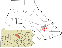
341:(41.122882, -77.432578). It occupies most of the western side of
655:
1034:‡This populated place also has portions in an adjacent county
733:
631:
560:. U.S. Census Bureau, American Factfinder. Archived from
1074:
Census-designated places in
Clinton County, Pennsylvania
310:
Castanea is located in southeastern
Clinton County at
18:
1029:
994:
910:
792:
744:
715:
266:
256:
244:
227:
210:
202:
194:
189:
181:
173:
165:
157:
152:
140:
128:
116:
106:
23:
298:, United States. The population was 1,125 at the
667:
552:
550:
345:. The community occupies an area bordered by
8:
674:
660:
652:
584:"US Gazetteer files: 2010, 2000, and 1990"
455:of any race were 0.25% of the population.
375:
20:
1079:Census-designated places in Pennsylvania
499:
255:
243:
209:
188:
180:
151:
105:
70:
50:
38:
395:
265:
226:
201:
193:
172:
164:
156:
139:
127:
115:
7:
447:, and 0.34% from two or more races.
177:0.03 sq mi (0.07 km)
169:1.36 sq mi (3.53 km)
161:1.39 sq mi (3.60 km)
682:Municipalities and communities of
610:"Census of Population and Housing"
385:
14:
508:"ArcGIS REST Services Directory"
52:
40:
1:
535:. United States Census Bureau
510:. United States Census Bureau
206:767.60/sq mi (296.36/km)
46:West Brown Street in Castanea
685:Clinton County, Pennsylvania
636:United States Census Bureau
588:United States Census Bureau
491:train station Museum/Hotel
366:United States Census Bureau
1095:
1039:
731:
696:
416:
401:
394:
389:
384:
381:
71:
51:
39:
30:
185:600 ft (200 m)
533:"Census Population API"
284:census-designated place
33:Census-designated place
738:
62:and the U.S. state of
25:Castanea, Pennsylvania
737:
632:"U.S. Census website"
417:U.S. Decennial Census
377:Historical population
329:41.12278°N 77.43250°W
229: • Summer (
91:41.12278°N 77.43250°W
1052:United States portal
564:on February 13, 2020
203: • Density
1045:Pennsylvania portal
590:. February 12, 2011
378:
351:Bald Eagle Mountain
334:41.12278; -77.43250
325: /
96:41.12278; -77.43250
87: /
739:
376:
195: • Total
174: • Water
158: • Total
1061:
1060:
488:Harvey's Run Park
472:per capita income
467:were 90.9 males.
421:
420:
364:According to the
349:to the north and
343:Castanea Township
288:Castanea Township
277:
276:
166: • Land
1086:
1053:
1046:
736:
708:
701:
691:
686:
676:
669:
662:
653:
647:
646:
644:
642:
628:
622:
621:
619:
617:
606:
600:
599:
597:
595:
580:
574:
573:
571:
569:
554:
545:
544:
542:
540:
529:
520:
519:
517:
515:
504:
441:African American
397:
392:
387:
379:
357:and the city of
347:Bald Eagle Creek
340:
339:
337:
336:
335:
330:
326:
323:
322:
321:
318:
234:
102:
101:
99:
98:
97:
92:
88:
85:
84:
83:
80:
56:
44:
21:
1094:
1093:
1089:
1088:
1087:
1085:
1084:
1083:
1064:
1063:
1062:
1057:
1051:
1044:
1035:
1025:
997:
990:
906:
788:
740:
734:
729:
711:
706:
699:
692:
689:
684:
680:
650:
640:
638:
630:
629:
625:
615:
613:
608:
607:
603:
593:
591:
582:
581:
577:
567:
565:
556:
555:
548:
538:
536:
531:
530:
523:
513:
511:
506:
505:
501:
497:
484:
460:married couples
390:
374:
333:
331:
327:
324:
319:
316:
314:
312:
311:
308:
252:
228:
95:
93:
89:
86:
81:
78:
76:
74:
73:
67:
47:
35:
26:
19:
12:
11:
5:
1092:
1090:
1082:
1081:
1076:
1066:
1065:
1059:
1058:
1056:
1055:
1048:
1040:
1037:
1036:
1033:
1031:
1027:
1026:
1024:
1023:
1018:
1013:
1008:
1002:
1000:
992:
991:
989:
988:
983:
978:
973:
968:
962:
957:
952:
947:
942:
937:
932:
927:
922:
916:
914:
908:
907:
905:
904:
899:
894:
889:
884:
879:
874:
869:
864:
859:
854:
849:
844:
839:
834:
829:
824:
819:
814:
809:
804:
798:
796:
790:
789:
787:
786:
781:
776:
771:
766:
761:
756:
750:
748:
742:
741:
732:
730:
728:
727:
721:
719:
713:
712:
697:
694:
693:
681:
679:
678:
671:
664:
656:
649:
648:
623:
601:
575:
546:
521:
498:
496:
493:
483:
480:
419:
418:
414:
413:
410:
408:
405:
399:
398:
393:
388:
383:
373:
370:
361:to the north.
355:U.S. Route 220
307:
304:
292:Clinton County
275:
274:
271:
264:
263:
260:
254:
253:
250:
248:
242:
241:
235:
225:
224:
214:
208:
207:
204:
200:
199:
196:
192:
191:
187:
186:
183:
179:
178:
175:
171:
170:
167:
163:
162:
159:
155:
154:
150:
149:
144:
138:
137:
132:
126:
125:
120:
114:
113:
110:
104:
103:
69:
68:
60:Clinton County
57:
49:
48:
45:
37:
36:
31:
28:
27:
24:
17:
13:
10:
9:
6:
4:
3:
2:
1091:
1080:
1077:
1075:
1072:
1071:
1069:
1054:
1049:
1047:
1042:
1041:
1038:
1032:
1028:
1022:
1019:
1017:
1014:
1012:
1011:Farrandsville
1009:
1007:
1004:
1003:
1001:
999:
993:
987:
984:
982:
979:
977:
974:
972:
969:
966:
963:
961:
958:
956:
953:
951:
948:
946:
943:
941:
938:
936:
933:
931:
928:
926:
923:
921:
918:
917:
915:
913:
909:
903:
900:
898:
895:
893:
890:
888:
885:
883:
880:
878:
875:
873:
870:
868:
865:
863:
860:
858:
855:
853:
850:
848:
845:
843:
840:
838:
835:
833:
830:
828:
825:
823:
820:
818:
815:
813:
810:
808:
805:
803:
800:
799:
797:
795:
791:
785:
782:
780:
777:
775:
772:
770:
767:
765:
762:
760:
757:
755:
752:
751:
749:
747:
743:
726:
723:
722:
720:
718:
714:
710:
709:
702:
695:
690:United States
687:
677:
672:
670:
665:
663:
658:
657:
654:
637:
633:
627:
624:
611:
605:
602:
589:
585:
579:
576:
563:
559:
553:
551:
547:
534:
528:
526:
522:
509:
503:
500:
494:
492:
489:
481:
479:
477:
473:
468:
464:
461:
456:
454:
450:
446:
443:, 0.17% from
442:
438:
434:
429:
426:
415:
411:
409:
406:
404:
400:
380:
371:
369:
367:
362:
360:
356:
352:
348:
344:
338:
305:
303:
301:
297:
293:
289:
285:
281:
272:
269:
261:
259:
249:
247:
239:
236:
232:
222:
221:Eastern (EST)
218:
215:
213:
205:
197:
184:
176:
168:
160:
148:
145:
143:
136:
133:
131:
124:
121:
119:
112:United States
111:
109:
100:
72:Coordinates:
65:
61:
55:
43:
34:
29:
22:
16:
919:
897:West Keating
842:East Keating
784:South Renovo
704:
639:. Retrieved
626:
614:. Retrieved
612:. Census.gov
604:
592:. Retrieved
578:
566:. Retrieved
562:the original
537:. Retrieved
512:. Retrieved
502:
485:
476:poverty line
469:
465:
457:
430:
422:
372:Demographics
363:
309:
296:Pennsylvania
279:
278:
123:Pennsylvania
64:Pennsylvania
58:Location in
15:
998:communities
981:Tylersville
955:Mackeyville
925:Clintondale
812:Beech Creek
759:Beech Creek
700:County seat
641:January 31,
539:October 12,
514:October 12,
445:other races
332: /
300:2010 census
94: /
1068:Categories
960:North Bend
950:McElhattan
882:Pine Creek
837:Dunnstable
807:Bald Eagle
764:Flemington
725:Lock Haven
707:Lock Haven
495:References
423:As of the
359:Lock Haven
320:77°25′57″W
270:feature ID
190:Population
82:77°25′57″W
1030:Footnotes
1006:Cooks Run
965:Rauchtown
930:Dunnstown
847:Gallagher
827:Colebrook
794:Townships
774:Mill Hall
594:April 23,
317:41°7′22″N
306:Geography
286:(CDP) in
258:FIPS code
212:Time zone
182:Elevation
79:41°7′22″N
1021:Westport
986:Woolrich
920:Castanea
902:Woodward
832:Crawford
817:Castanea
769:Loganton
746:Boroughs
449:Hispanic
439:, 0.08%
435:, 0.67%
280:Castanea
262:42-11648
246:ZIP code
147:Castanea
142:Township
1016:Keating
935:Farwell
822:Chapman
802:Allison
616:June 4,
568:May 19,
273:1171315
135:Clinton
108:Country
976:Salona
887:Porter
857:Grugan
852:Greene
779:Renovo
482:Places
453:Latino
425:census
382:Census
130:County
996:Other
945:Lamar
940:Hyner
892:Wayne
877:Noyes
872:Logan
867:Leidy
862:Lamar
437:Asian
433:White
407:1,047
282:is a
251:17726
240:(EDT)
238:UTC-4
217:UTC-5
198:1,047
118:State
971:Rote
912:CDPs
754:Avis
717:City
643:2008
618:2016
596:2011
570:2015
541:2022
516:2022
403:2020
391:Note
386:Pop.
268:GNIS
153:Area
451:or
231:DST
1070::
703::
688:,
634:.
586:.
549:^
524:^
396:%±
302:.
294:,
290:,
967:‡
675:e
668:t
661:v
645:.
620:.
598:.
572:.
543:.
518:.
412:—
233:)
223:)
219:(
66:.
Text is available under the Creative Commons Attribution-ShareAlike License. Additional terms may apply.