28:
35:
243:, have been detected. There are about 225 closely spaced postholes; they are positioned so that there are five concentric circles, and they are also radially aligned. The circle is about 50 metres (160 ft) in diameter. It is regarded as late Neolithic, being similar to the second phase of the southern circle of
285:
and excavation. As a result, the sequence in which the features were built has been suggested. It is thought that the radiating pit alignments are the earliest parts of the "sunburst" monument; the circular ditch was built later; about 2500 BC it was made into a segmented enclosure, and the timber
258:, diameter 17 metres (56 ft), with an external ditch. It is known as the "sunburst" monument, since there are 12 lines of up to five postholes outside the ditch, aligned with the centre of the circle. The overall diameter is 60 metres (200 ft).
286:
circle, displaying upright oak posts, was built about this time. About 500 years later, an individual was buried in the centre of the "sunburst" monument, with grave goods including
403:
398:
27:
109:
71:
290:. The pit alignments to the north and south are thought to be less ancient, perhaps late Bronze Age, built as though to respect the earlier monuments.
103:
323:
318:
278:
408:
393:
225:
193:
143:
353:
274:
201:
55:
261:
About 50 metres (160 ft) to the north and south of the timber circle and "sunburst" monument are
248:
205:
155:
371:
314:
244:
255:
120:
287:
262:
128:
319:"Timber circle, hengi-form monument and part of a pit alignment at Catholme (1019109)"
387:
240:
197:
124:
59:
374:
Making One's Way in the World: The
Footprints and Trackways of Prehistoric People
221:
217:
86:
73:
220:
to the east, a short distance north of the confluence of the Trent with the
236:
229:
228:. The features are not visible at ground level, but are visible as
282:
265:
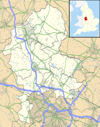
running west–east, over 1 kilometre (0.62 mi) long.
170:
162:
153:
149:
139:
134:
116:
102:
65:
50:
34:
254:200 metres (660 ft) to the west, there is a
354:Henry Chapman. "The Catholme Neolithic Complex"
8:
16:
309:
307:
305:
303:
15:
359:, 5 December 2013. Retrieved 2 July 2020.
349:
347:
345:
343:
341:
299:
367:
365:
404:Archaeological sites in Staffordshire
247:near Stonehenge, and to the rings of
169:
161:
152:
7:
399:Scheduled monuments in Staffordshire
324:National Heritage List for England
14:
192:is an archaeological site of the
33:
26:
277:from 2002 to 2004, involving a
1:
376:. Oxbow Books, 2020. Page 241
273:The site was investigated by
232:seen in aerial photographs.
190:Catholme ceremonial complex
17:Catholme ceremonial complex
425:
42:Shown within Staffordshire
182:
178:
21:
275:Birmingham Archaeology
216:The site is near the
202:Barton-under-Needwood
56:Barton-under-Needwood
249:Mount Pleasant henge
87:52.74778°N 1.71194°W
83: /
18:
279:geophysical survey
206:scheduled monument
171:Reference no.
156:Scheduled monument
92:52.74778; -1.71194
409:Neolithic England
394:Henges in England
186:
185:
104:OS grid reference
416:
378:
369:
360:
351:
336:
335:
333:
331:
315:Historic England
311:
245:Durrington Walls
200:, England, near
112:
98:
97:
95:
94:
93:
88:
84:
81:
80:
79:
76:
37:
36:
30:
19:
424:
423:
419:
418:
417:
415:
414:
413:
384:
383:
382:
381:
370:
363:
357:Digital Digging
352:
339:
329:
327:
313:
312:
301:
296:
271:
256:henge enclosure
214:
166:8 December 1999
158:
127:
123:
121:Henge enclosure
108:
91:
89:
85:
82:
77:
74:
72:
70:
69:
46:
45:
44:
43:
40:
39:
38:
12:
11:
5:
422:
420:
412:
411:
406:
401:
396:
386:
385:
380:
379:
361:
337:
298:
297:
295:
292:
288:Beaker pottery
270:
267:
263:pit alignments
213:
210:
184:
183:
180:
179:
176:
175:
172:
168:
167:
164:
160:
159:
154:
151:
150:
147:
146:
141:
137:
136:
132:
131:
129:Pit alignments
118:
114:
113:
106:
100:
99:
67:
63:
62:
52:
48:
47:
41:
32:
31:
25:
24:
23:
22:
13:
10:
9:
6:
4:
3:
2:
421:
410:
407:
405:
402:
400:
397:
395:
392:
391:
389:
377:
375:
372:Martin Bell.
368:
366:
362:
358:
355:
350:
348:
346:
344:
342:
338:
326:
325:
320:
316:
310:
308:
306:
304:
300:
293:
291:
289:
284:
280:
276:
269:Investigation
268:
266:
264:
259:
257:
252:
250:
246:
242:
241:timber circle
238:
233:
231:
227:
223:
219:
211:
209:
207:
203:
199:
198:Staffordshire
195:
191:
181:
177:
173:
165:
157:
148:
145:
142:
138:
133:
130:
126:
125:Timber circle
122:
119:
115:
111:
107:
105:
101:
96:
68:
64:
61:
60:Staffordshire
57:
53:
49:
29:
20:
373:
356:
328:. Retrieved
322:
272:
260:
253:
234:
215:
189:
187:
251:in Dorset.
222:River Mease
218:River Trent
212:Description
90: /
66:Coordinates
388:Categories
294:References
226:River Tame
204:. It is a
196:period in
163:Designated
110:SK 195 167
75:52°44′52″N
237:postholes
230:cropmarks
194:Neolithic
144:Neolithic
78:1°42′43″W
224:and the
51:Location
174:1019109
140:Periods
135:History
330:2 July
283:Lidar
239:of a
54:Near
332:2020
235:The
188:The
117:Type
390::
364:^
340:^
321:.
317:.
302:^
281:,
208:.
58:,
334:.
Text is available under the Creative Commons Attribution-ShareAlike License. Additional terms may apply.