54:
834:
42:
530:
502:
the town, the population was spread out, with 23.7% under the age of 18, 13.2% from 18 to 24, 23.0% from 25 to 44, 28.8% from 45 to 64, and 11.3% who were 65 years of age or older. The median age was 37 years. For every 100 females, there were 97.7 males. For every 100 females age 18 and over, there were 106.3 males.
501:
living together, 2.9% had a female householder with no husband present, and 27.5% were non-families. 25.5% of all households were made up of individuals, and 9.8% had someone living alone who was 65 years of age or older. The average household size was 2.52 and the average family size was 3.04. In
477:
of 2000, there were 257 people, 102 households, and 73 families residing in the town. The population density was 279.0 inhabitants per square mile (107.7/km). There were 117 housing units at an average density of 127.0 per square mile (49.0/km). The racial makeup of the town was 97.28%
53:
505:
The median income for a household in the town was $ 29,792, and the median income for a family was $ 44,250. Males had a median income of $ 35,625 versus $ 25,833 for females. The
569:
772:
745:
980:
67:
712:
293:
249:
927:
765:
917:
41:
259:
644:
758:
907:
200:
713:"Incorporated Places and Minor Civil Divisions Datasets: Subcounty Resident Population Estimates: April 1, 2010 to July 1, 2012"
887:
882:
483:
750:
661:
121:
975:
691:
665:
620:
325:
932:
902:
452:
437:
422:
407:
392:
377:
362:
945:
782:
275:
237:
126:
99:
554:
497:
There were 102 households, out of which 33.3% had children under the age of 18 living with them, 64.7% were
912:
823:
804:
487:
720:
952:
491:
210:
897:
892:
872:
857:
479:
687:
922:
506:
509:
for the town was $ 15,157. About 5.2% of families and 11.7% of the population were below the
862:
648:
641:
969:
242:
513:, including 13.7% of those under the age of eighteen and 15.6% of those 65 or over.
510:
651:, State of Tennessee official website, July 14, 2011. Retrieved: December 6, 2013.
555:
U.S. Geological Survey
Geographic Names Information System: Centertown, Tennessee
797:
328:, the town has a total area of 0.9 square miles (2.3 km), all of it land.
109:
308:
295:
82:
69:
279:
191:
114:
642:
Certified
Population of Tennessee Incorporated Municipalities and Counties
498:
225:
564:
562:
474:
591:
217:
196:
844:
815:
32:
754:
832:
640:
Tennessee
Department of Economic and Community Development,
282:, United States. The population was 243 at the 2010 census.
616:
688:"Census of Population and Housing: Decennial Censuses"
871:
843:
814:
258:
248:
236:
224:
207:
190:
182:
174:
169:
161:
153:
145:
137:
132:
120:
108:
98:
58:
Location of
Centertown in Warren County, Tennessee.
23:
766:
8:
773:
759:
751:
662:"US Gazetteer files: 2010, 2000, and 1990"
494:of any race were 0.78% of the population.
335:
20:
522:
247:
223:
189:
168:
160:
131:
97:
62:
50:
38:
550:
548:
355:
611:
609:
257:
235:
206:
181:
173:
152:
144:
136:
119:
107:
7:
719:. U.S. Census Bureau. Archived from
486:, and 1.56% from two or more races.
157:0.00 sq mi (0.00 km)
149:0.92 sq mi (2.39 km)
141:0.92 sq mi (2.39 km)
781:Municipalities and communities of
345:
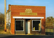
46:Former Bank of Centertown building
14:
981:Towns in Warren County, Tennessee
531:"ArcGIS REST Services Directory"
52:
40:
18:Town in Tennessee, United States
1:
572:. United States Census Bureau
533:. United States Census Bureau
186:321.43/sq mi (124.04/km)
692:United States Census Bureau
666:United States Census Bureau
621:United States Census Bureau
326:United States Census Bureau
997:
165:1,102 ft (336 m)
941:
830:
795:
466:
451:
436:
421:
406:
391:
376:
361:
354:
349:
344:
341:
290:Centertown is located at
63:
51:
39:
30:
784:Warren County, Tennessee
592:"Centertown TN ZIP Code"
594:. zipdatamaps.com. 2023
570:"Census Population API"
309:35.722624°N 85.920299°W
837:
647:June 30, 2014, at the
836:
617:"U.S. Census website"
337:Historical population
314:35.722624; -85.920299
209: • Summer (
83:35.72250°N 85.92028°W
25:Centertown, Tennessee
954:United States portal
888:Bratchers Crossroads
717:Population Estimates
183: • Density
668:. February 12, 2011
338:
305: /
88:35.72250; -85.92028
79: /
976:Towns in Tennessee
838:
336:
175: • Total
154: • Water
138: • Total
963:
962:
507:per capita income
471:
470:
324:According to the
269:
268:
146: • Land
988:
955:
948:
947:Tennessee portal
835:
807:
800:
790:
785:
775:
768:
761:
752:
733:
732:
730:
728:
723:on June 11, 2013
709:
703:
702:
700:
698:
684:
678:
677:
675:
673:
658:
652:
638:
632:
631:
629:
627:
613:
604:
603:
601:
599:
588:
582:
581:
579:
577:
566:
557:
552:
543:
542:
540:
538:
527:
484:African American
357:
352:
347:
339:
320:
319:
317:
316:
315:
310:
306:
303:
302:
301:
298:
214:
94:
93:
91:
90:
89:
84:
80:
77:
76:
75:
72:
56:
44:
21:
996:
995:
991:
990:
989:
987:
986:
985:
966:
965:
964:
959:
953:
946:
937:
874:
867:
839:
833:
828:
810:
805:
798:
791:
788:
783:
779:
742:
737:
736:
726:
724:
711:
710:
706:
696:
694:
686:
685:
681:
671:
669:
660:
659:
655:
649:Wayback Machine
639:
635:
625:
623:
615:
614:
607:
597:
595:
590:
589:
585:
575:
573:
568:
567:
560:
553:
546:
536:
534:
529:
528:
524:
519:
499:married couples
350:
334:
313:
311:
307:
304:
299:
296:
294:
292:
291:
288:
232:
208:
87:
85:
81:
78:
73:
70:
68:
66:
65:
59:
47:
35:
26:
19:
12:
11:
5:
994:
992:
984:
983:
978:
968:
967:
961:
960:
958:
957:
950:
942:
939:
938:
936:
935:
933:Stewart Chapel
930:
925:
920:
915:
910:
905:
903:Irving College
900:
895:
890:
885:
879:
877:
873:Unincorporated
869:
868:
866:
865:
860:
855:
849:
847:
841:
840:
831:
829:
827:
826:
820:
818:
812:
811:
796:
793:
792:
780:
778:
777:
770:
763:
755:
749:
748:
741:
740:External links
738:
735:
734:
704:
679:
653:
633:
605:
583:
558:
544:
521:
520:
518:
515:
469:
468:
464:
463:
460:
458:
455:
449:
448:
445:
443:
440:
434:
433:
430:
428:
425:
419:
418:
415:
413:
410:
404:
403:
400:
398:
395:
389:
388:
385:
383:
380:
374:
373:
370:
368:
365:
359:
358:
353:
348:
343:
333:
330:
287:
284:
267:
266:
263:
256:
255:
252:
246:
245:
240:
234:
233:
230:
228:
222:
221:
215:
205:
204:
194:
188:
187:
184:
180:
179:
176:
172:
171:
167:
166:
163:
159:
158:
155:
151:
150:
147:
143:
142:
139:
135:
134:
130:
129:
124:
118:
117:
112:
106:
105:
102:
96:
95:
61:
60:
57:
49:
48:
45:
37:
36:
31:
28:
27:
24:
17:
13:
10:
9:
6:
4:
3:
2:
993:
982:
979:
977:
974:
973:
971:
956:
951:
949:
944:
943:
940:
934:
931:
929:
926:
924:
921:
919:
916:
914:
911:
909:
906:
904:
901:
899:
896:
894:
891:
889:
886:
884:
881:
880:
878:
876:
870:
864:
861:
859:
856:
854:
851:
850:
848:
846:
842:
825:
822:
821:
819:
817:
813:
809:
808:
801:
794:
789:United States
786:
776:
771:
769:
764:
762:
757:
756:
753:
747:
744:
743:
739:
722:
718:
714:
708:
705:
693:
689:
683:
680:
667:
663:
657:
654:
650:
646:
643:
637:
634:
622:
618:
612:
610:
606:
593:
587:
584:
571:
565:
563:
559:
556:
551:
549:
545:
532:
526:
523:
516:
514:
512:
508:
503:
500:
495:
493:
489:
485:
481:
476:
465:
461:
459:
456:
454:
450:
446:
444:
441:
439:
435:
431:
429:
426:
424:
420:
416:
414:
411:
409:
405:
401:
399:
396:
394:
390:
386:
384:
381:
379:
375:
371:
369:
366:
364:
360:
340:
331:
329:
327:
322:
318:
285:
283:
281:
277:
276:Warren County
274:is a town in
273:
264:
261:
253:
251:
244:
241:
239:
229:
227:
219:
216:
212:
202:
201:Central (CST)
198:
195:
193:
185:
177:
164:
156:
148:
140:
128:
125:
123:
116:
113:
111:
104:United States
103:
101:
92:
64:Coordinates:
55:
43:
34:
29:
22:
16:
928:Spring Creek
852:
803:
746:Town charter
727:December 11,
725:. Retrieved
721:the original
716:
707:
695:. Retrieved
682:
670:. Retrieved
656:
636:
624:. Retrieved
598:February 17,
596:. Retrieved
586:
574:. Retrieved
535:. Retrieved
525:
511:poverty line
504:
496:
472:
332:Demographics
323:
289:
271:
270:
15:
913:Rock Island
875:communities
824:McMinnville
806:McMinnville
799:County seat
626:January 31,
576:October 15,
537:October 15,
312: /
86: /
970:Categories
918:Shady Rest
853:Centertown
517:References
473:As of the
300:85°55′13″W
297:35°43′21″N
272:Centertown
262:feature ID
170:Population
74:85°55′13″W
71:35°43′21″N
672:April 23,
286:Geography
280:Tennessee
250:FIPS code
238:Area code
192:Time zone
162:Elevation
115:Tennessee
898:Daylight
893:Campaign
858:Morrison
697:March 4,
645:Archived
488:Hispanic
482:, 1.17%
467:Sources:
254:47-12380
226:ZIP code
265:1305810
100:Country
923:Smartt
908:Midway
492:Latino
475:census
432:−22.6%
342:Census
127:Warren
122:County
883:Berea
863:Viola
845:Towns
480:White
462:22.2%
447:−5.4%
417:10.7%
402:65.7%
231:37110
220:(CDT)
218:UTC-5
197:UTC-6
110:State
816:City
729:2013
699:2012
674:2011
628:2008
600:2023
578:2022
539:2022
453:2020
438:2010
423:2000
408:1990
393:1980
387:7.1%
378:1970
363:1960
351:Note
346:Pop.
260:GNIS
133:Area
33:Town
490:or
457:297
442:243
427:257
412:332
397:300
382:181
367:169
243:931
211:DST
178:297
972::
802::
787:,
715:.
690:.
664:.
619:.
608:^
561:^
547:^
356:%±
321:.
278:,
774:e
767:t
760:v
731:.
701:.
676:.
630:.
602:.
580:.
541:.
372:—
213:)
203:)
199:(
Text is available under the Creative Commons Attribution-ShareAlike License. Additional terms may apply.