42:
54:
1035:
79:
112:
185:
203:
613:
119:
86:
602:
668:
In the township the population was spread out, with 24.7% under the age of 18, 5.1% from 18 to 24, 26.6% from 25 to 44, 30.5% from 45 to 64, and 13.0% who were 65 years of age or older. The median age was 42 years. For every 100 females, there were 98.3 males. For every 100 females age 18 and over,
632:
of 2000, there were 2,328 people, 908 households, and 714 families residing in the township. The population density was 69.8 inhabitants per square mile (26.9/km). There were 1,198 housing units at an average density of 35.9 per square mile (13.9/km). The racial makeup of the township was 97.98%
664:
living together, 4.7% had a female householder with no husband present, and 21.3% were non-families. 18.3% of all households were made up of individuals, and 5.4% had someone living alone who was 65 years of age or older. The average household size was 2.56 and the average family size was 2.89.
477:. Axin was settled about 9.5 miles (15.3 km) southwest of Cadillac and named after local resident J. Axin Morgan. A post office in Axin operated from August 21, 1899 until January 30, 1943.
53:
528:
was one of the original communities within the township when a rural post office was established. The post office was very short lived and operated only from
February 7 to March 3, 1879.
672:
The median income for a household in the township was $ 51,190, and the median income for a family was $ 55,444. Males had a median income of $ 39,688 versus $ 25,781 for females. The
41:
584:, the township has a total area of 36.21 square miles (93.78 km), of which 33.37 square miles (86.43 km) is land and 2.84 square miles (7.36 km) (7.84%) is water.
968:
1160:
147:
1436:
1110:
1130:
1145:
1135:
1125:
881:
111:
377:
78:
961:
937:
522:. The community was named after local farmer Swan Benson and once contained its own post office from November 17, 1884 until April 30, 1911.
1363:
1378:
872:
543:
486:
449:
387:
1253:
954:
926:
Michigan Place Names: The
History of the Founding and the Naming of More Than Five Thousand Past and Present Michigan Communities
318:
877:
1431:
1165:
784:
638:
946:
896:
642:
688:
Cherry Grove
Township is served by two separate public school districts. The vast majority of the township is served by
1284:
1140:
1120:
929:
689:
215:
780:
732:
581:
1170:
1100:
1243:
1155:
1082:
775:
427:
1294:
1150:
978:
705:
616:
588:
419:
365:
220:
59:
1323:
867:
831:
808:
752:
697:
1401:
1338:
1180:
1105:
1046:
660:
There were 908 households, out of which 32.4% had children under the age of 18 living with them, 70.9% were
605:
537:
515:
1333:
1279:
650:
1408:
1274:
1269:
654:
328:
1213:
1203:
1059:
646:
634:
532:
443:
63:
1193:
1019:
1000:
693:
676:
for the township was $ 22,798. About 5.3% of families and 5.9% of the population were below the
519:
350:
1289:
1248:
1228:
1054:
933:
673:
1358:
1343:
1328:
1318:
1264:
1258:
1238:
1233:
1198:
1074:
1064:
1024:
753:
U.S. Geological Survey
Geographic Names Information System: Cherry Grove Township, Michigan
1373:
1368:
1353:
1348:
701:
241:
768:"Michigan: 2010 Population and Housing Unit Counts 2010 Census of Population and Housing"
1300:
1223:
1188:
1092:
415:
356:
32:
1425:
370:
767:
677:
993:
608:(East Michigan 55) runs east–west through the northern portion of the township.
1310:
195:
696:. A very small portion of the southeast corner of the township is served by
558:
545:
501:
488:
464:
451:
162:
149:
832:
U.S. Geological Survey
Geographic Names Information System: Benson, Michigan
309:
809:
U.S. Geological Survey
Geographic Names Information System: Axin, Michigan
1392:‡This populated place also has portions in an adjacent county or counties
680:, including 4.0% of those under age 18 and 1.8% of those age 65 or over.
661:
423:
343:
208:
1034:
629:
335:
314:
402:
1011:
950:
619:
runs very briefly through the northeast corner of the township.
1033:
728:
540:
located within the southeast portion of the township at
483:
is an unincorporated community within the township at
1387:
1309:
1212:
1179:
1091:
1073:
1045:
1010:
895:Michigan Geographic Framework (November 15, 2013).
397:
386:
376:
364:
342:
325:
308:
300:
292:
287:
279:
271:
263:
255:
250:
239:
231:
226:
214:
194:
178:
23:
1038:Map of Michigan highlighting Wexford County.svg
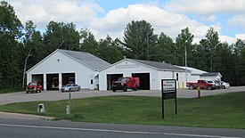
46:Cherry Grove Township Hall and Fire Department
962:
591:is located in the northeast of the township.
118:
85:
8:
969:
955:
947:
657:of any race were 0.69% of the population.
20:
514:. It is located about one mile south of
18:Civil township in Michigan, United States
882:United States Department of the Interior
783:. September 2012. p. 45 Michigan.
717:
396:
375:
341:
307:
286:
278:
249:
225:
177:
142:
70:
50:
38:
762:
760:
1437:Townships in Wexford County, Michigan
854:
842:
819:
790:from the original on October 19, 2012
723:
721:
385:
363:
324:
299:
291:
270:
267:33.37 sq mi (86.43 km)
262:
259:36.21 sq mi (93.78 km)
254:
238:
230:
213:
193:
98:Location within the state of Michigan
7:
649:, and 0.95% from two or more races.
873:Geographic Names Information System
868:"Wedgewood Census Designated Place"
536:is an unincorporated community and
275:2.84 sq mi (7.36 km)
977:Municipalities and communities of
924:Romig, Walter (October 1, 1986) .
426:. The population was 2,421 at the
62:(red) and the administered CDP of
14:
897:"Wexford County School Districts"
131:Location within the United States
928:(Paperback). Detroit, Michigan:
611:
600:
201:
183:
117:
110:
84:
77:
52:
40:
878:United States Geological Survey
700:to the south in the village of
25:Cherry Grove Township, Michigan
1:
134:Show map of the United States
930:Wayne State University Press
690:Cadillac Area Public Schools
781:United States Census Bureau
733:United States Census Bureau
692:to the east in the city of
1453:
283:1,283 ft (391 m)
1397:
1031:
991:
776:2010 United States census
143:
71:
51:
39:
30:
980:Wexford County, Michigan
932:. pp. 37, 56, 113.
669:there were 100.0 males.
444:unincorporated community
698:Pine River Area Schools
538:census-designated place
446:within the township at
232: • Supervisor
1039:
1432:Townships in Michigan
1037:
729:"U.S. Census website"
559:44.19361°N 85.49028°W
518:, five miles west of
502:44.20861°N 85.49694°W
465:44.21000°N 85.54750°W
422:in the U.S. state of
412:Cherry Grove Township
327: • Summer (
304:67/sq mi (26/km)
163:44.19833°N 85.50694°W
125:Cherry Grove Township
92:Cherry Grove Township
1410:United States portal
301: • Density
101:Show map of Michigan
564:44.19361; -85.49028
555: /
507:44.20861; -85.49694
498: /
470:44.21000; -85.54750
461: /
168:44.19833; -85.50694
159: /
1285:Missaukee Junction
1040:
582:U.S. Census Bureau
293: • Total
272: • Water
256: • Total
1419:
1418:
939:978-0-8143-1838-6
674:per capita income
580:According to the
409:
408:
264: • Land
1444:
1411:
1404:
1075:Charter township
1036:
1003:
996:
986:
981:
971:
964:
957:
948:
943:
911:
910:
908:
906:
901:
892:
886:
885:
864:
858:
852:
846:
840:
834:
829:
823:
817:
811:
806:
800:
799:
797:
795:
789:
772:
764:
755:
750:
744:
743:
741:
739:
725:
639:African American
615:
614:
604:
603:
570:
569:
567:
566:
565:
560:
556:
553:
552:
551:
548:
513:
512:
510:
509:
508:
503:
499:
496:
495:
494:
491:
476:
475:
473:
472:
471:
466:
462:
459:
458:
457:
454:
405:
403:Official website
332:
207:
205:
204:
189:
187:
186:
174:
173:
171:
170:
169:
164:
160:
157:
156:
155:
152:
135:
121:
120:
114:
102:
88:
87:
81:
58:Location within
56:
44:
21:
1452:
1451:
1447:
1446:
1445:
1443:
1442:
1441:
1422:
1421:
1420:
1415:
1409:
1403:Michigan portal
1402:
1393:
1383:
1305:
1244:Garletts Corner
1215:
1208:
1175:
1093:Civil townships
1087:
1069:
1041:
1029:
1006:
1001:
994:
987:
984:
979:
975:
940:
923:
920:
915:
914:
904:
902:
899:
894:
893:
889:
866:
865:
861:
853:
849:
841:
837:
830:
826:
818:
814:
807:
803:
793:
791:
787:
770:
766:
765:
758:
751:
747:
737:
735:
727:
726:
719:
714:
686:
662:married couples
643:Native American
626:
612:
601:
597:
578:
563:
561:
557:
554:
549:
546:
544:
542:
541:
506:
504:
500:
497:
492:
489:
487:
485:
484:
469:
467:
463:
460:
455:
452:
450:
448:
447:
436:
401:
360:
354:
326:
202:
200:
184:
182:
167:
165:
161:
158:
153:
150:
148:
146:
145:
139:
138:
137:
136:
133:
132:
129:
128:
127:
126:
122:
105:
104:
103:
100:
99:
96:
95:
94:
93:
89:
67:
47:
35:
26:
19:
12:
11:
5:
1450:
1448:
1440:
1439:
1434:
1424:
1423:
1417:
1416:
1414:
1413:
1406:
1398:
1395:
1394:
1391:
1389:
1385:
1384:
1382:
1381:
1376:
1371:
1366:
1361:
1356:
1351:
1346:
1341:
1336:
1331:
1326:
1321:
1315:
1313:
1307:
1306:
1304:
1303:
1298:
1295:Wexford Corner
1292:
1287:
1282:
1277:
1272:
1267:
1262:
1256:
1251:
1246:
1241:
1236:
1231:
1226:
1220:
1218:
1210:
1209:
1207:
1206:
1201:
1196:
1191:
1185:
1183:
1177:
1176:
1174:
1173:
1168:
1163:
1158:
1153:
1148:
1143:
1138:
1133:
1128:
1123:
1118:
1113:
1108:
1103:
1097:
1095:
1089:
1088:
1086:
1085:
1079:
1077:
1071:
1070:
1068:
1067:
1062:
1057:
1051:
1049:
1043:
1042:
1032:
1030:
1028:
1027:
1022:
1016:
1014:
1008:
1007:
992:
989:
988:
976:
974:
973:
966:
959:
951:
945:
944:
938:
919:
916:
913:
912:
887:
859:
857:, p. 113.
847:
835:
824:
812:
801:
756:
745:
716:
715:
713:
710:
706:Osceola County
685:
682:
625:
622:
621:
620:
609:
596:
595:Major highways
593:
577:
574:
573:
572:
529:
523:
478:
435:
432:
420:Wexford County
416:civil township
407:
406:
399:
395:
394:
391:
384:
383:
380:
374:
373:
368:
362:
361:
348:
346:
340:
339:
333:
323:
322:
312:
306:
305:
302:
298:
297:
294:
290:
289:
285:
284:
281:
277:
276:
273:
269:
268:
265:
261:
260:
257:
253:
252:
248:
247:
244:
237:
236:
233:
229:
228:
224:
223:
218:
212:
211:
198:
192:
191:
180:
176:
175:
141:
140:
130:
124:
123:
116:
115:
109:
108:
107:
106:
97:
91:
90:
83:
82:
76:
75:
74:
73:
72:
69:
68:
60:Wexford County
57:
49:
48:
45:
37:
36:
33:Civil township
31:
28:
27:
24:
17:
13:
10:
9:
6:
4:
3:
2:
1449:
1438:
1435:
1433:
1430:
1429:
1427:
1412:
1407:
1405:
1400:
1399:
1396:
1390:
1386:
1380:
1377:
1375:
1372:
1370:
1367:
1365:
1362:
1360:
1357:
1355:
1352:
1350:
1347:
1345:
1342:
1340:
1339:Claggettville
1337:
1335:
1332:
1330:
1327:
1325:
1322:
1320:
1317:
1316:
1314:
1312:
1308:
1302:
1299:
1296:
1293:
1291:
1288:
1286:
1283:
1281:
1278:
1276:
1273:
1271:
1268:
1266:
1263:
1260:
1257:
1255:
1252:
1250:
1247:
1245:
1242:
1240:
1237:
1235:
1232:
1230:
1227:
1225:
1222:
1221:
1219:
1217:
1211:
1205:
1202:
1200:
1197:
1195:
1192:
1190:
1187:
1186:
1184:
1182:
1178:
1172:
1169:
1167:
1164:
1162:
1159:
1157:
1154:
1152:
1149:
1147:
1144:
1142:
1139:
1137:
1134:
1132:
1129:
1127:
1124:
1122:
1119:
1117:
1114:
1112:
1109:
1107:
1104:
1102:
1099:
1098:
1096:
1094:
1090:
1084:
1081:
1080:
1078:
1076:
1072:
1066:
1063:
1061:
1058:
1056:
1053:
1052:
1050:
1048:
1044:
1026:
1023:
1021:
1018:
1017:
1015:
1013:
1009:
1005:
1004:
997:
990:
985:United States
982:
972:
967:
965:
960:
958:
953:
952:
949:
941:
935:
931:
927:
922:
921:
917:
898:
891:
888:
883:
879:
875:
874:
869:
863:
860:
856:
851:
848:
845:, p. 56.
844:
839:
836:
833:
828:
825:
822:, p. 37.
821:
816:
813:
810:
805:
802:
786:
782:
778:
777:
769:
763:
761:
757:
754:
749:
746:
734:
730:
724:
722:
718:
711:
709:
707:
703:
699:
695:
691:
683:
681:
679:
675:
670:
666:
663:
658:
656:
652:
648:
644:
640:
636:
631:
623:
618:
610:
607:
599:
598:
594:
592:
590:
589:Lake Mitchell
585:
583:
575:
568:
539:
535:
534:
530:
527:
524:
521:
517:
511:
482:
479:
474:
445:
441:
438:
437:
433:
431:
429:
425:
421:
417:
413:
404:
400:
392:
389:
381:
379:
372:
369:
367:
358:
352:
347:
345:
337:
334:
330:
320:
319:Eastern (EST)
316:
313:
311:
303:
295:
282:
274:
266:
258:
245:
243:
240: •
234:
222:
219:
217:
210:
199:
197:
190:United States
181:
172:
144:Coordinates:
113:
80:
65:
61:
55:
43:
34:
29:
22:
16:
1334:Cherry Grove
1280:Millersville
1161:South Branch
1116:Cherry Grove
1115:
999:
925:
903:. Retrieved
890:
871:
862:
850:
838:
827:
815:
804:
792:. Retrieved
774:
748:
736:. Retrieved
687:
678:poverty line
671:
667:
659:
627:
624:Demographics
586:
579:
531:
526:Cherry Grove
525:
480:
439:
411:
410:
15:
1324:Bond's Mill
1311:Ghost towns
1216:communities
1166:Springville
1111:Cedar Creek
995:County seat
794:January 30,
738:January 31,
562: /
505: /
468: /
434:Communities
428:2020 census
344:ZIP code(s)
235:Ben Pearson
166: /
1426:Categories
1364:Round Lake
1275:Meauwataka
1270:Hoxeyville
855:Romig 1986
843:Romig 1986
820:Romig 1986
712:References
628:As of the
550:85°29′25″W
547:44°11′37″N
493:85°29′49″W
490:44°12′31″N
456:85°32′51″W
453:44°12′36″N
390:feature ID
288:Population
246:Lynn Nixon
227:Government
154:85°30′25″W
151:44°11′54″N
1388:Footnotes
1204:Wedgewood
1141:Henderson
1131:Greenwood
1121:Clam Lake
1060:Harrietta
905:August 8,
684:Education
576:Geography
533:Wedgewood
378:FIPS code
366:Area code
310:Time zone
280:Elevation
64:Wedgewood
1254:Glengary
1194:Caberfae
1047:Villages
1020:Cadillac
1002:Cadillac
785:Archived
694:Cadillac
651:Hispanic
645:, 0.60%
641:, 0.39%
637:, 0.09%
587:Much of
520:Cadillac
424:Michigan
382:26-15060
351:Cadillac
209:Michigan
1379:Wexford
1290:Sherman
1249:Gilbert
1229:Bagnall
1171:Wexford
1146:Liberty
1136:Hanover
1101:Antioch
1055:Buckley
918:Sources
398:Website
393:1626067
355:49618 (
349:49601 (
221:Wexford
179:Country
1359:Mystic
1344:Coline
1329:Bunyea
1319:Angola
1265:Hobart
1259:Harlan
1239:Benson
1234:Baxter
1199:Haring
1156:Slagle
1126:Colfax
1083:Haring
1065:Mesick
1025:Manton
1012:Cities
936:
655:Latino
630:census
481:Benson
442:is an
216:County
206:
188:
66:(pink)
1374:Thorp
1369:Soper
1354:Haire
1349:Elton
1214:Other
1151:Selma
900:(PDF)
788:(PDF)
771:(PDF)
702:LeRoy
647:Asian
635:White
617:M-115
414:is a
338:(EDT)
336:UTC-4
315:UTC-5
296:2,421
242:Clerk
196:State
1301:Yuma
1224:Axin
1189:Boon
1181:CDPs
1106:Boon
934:ISBN
907:2023
796:2022
740:2008
606:M-55
516:M-55
440:Axin
388:GNIS
357:Boon
251:Area
704:in
653:or
418:of
371:231
329:DST
1428::
998::
983:,
880:,
876:.
870:.
779:.
773:.
759:^
731:.
720:^
708:.
430:.
1297:‡
1261:‡
970:e
963:t
956:v
942:.
909:.
884:.
798:.
742:.
571:.
359:)
353:)
331:)
321:)
317:(
Text is available under the Creative Commons Attribution-ShareAlike License. Additional terms may apply.