19:
267:
79:
66:
With more and more miners heading into Cherry Creek area, a road was built from Lumby in 1877, through Blue
Springs Valley, attracting new families to the area. The community was known by the post office name of Cherry Creek, then Hilton. It was officially named Cherryville in 1919, after the wild
74:
Services in
Cherryville include accommodation, two general stores, restaurants, a library, a campground, shops and other amenities. Originally an area of orchards, ranching and logging are major industries in the community.
63:. Between 1863 and 1895, the original town that is now known as Cherryville was a small mining camp located within the canyon walls of Cherry Creek. Its population was 100 people, half of which were Chinese miners.
545:
540:
413:
298:
565:
154:
555:
560:
205:
359:
18:
453:
486:
341:
228:
198:
275:
443:
311:
403:
191:
509:
326:
306:
103:
60:
183:
367:
266:
236:
499:
398:
377:
45:
428:
382:
241:
550:
433:
392:
283:
256:
494:
349:
41:
476:
471:
128:
504:
461:
423:
56:
466:
33:
68:
219:
37:
40:
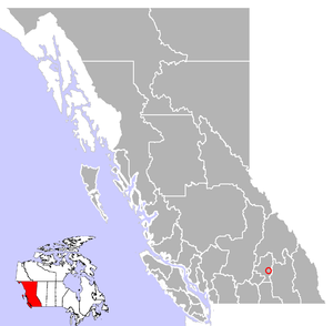
with a population of approximately 930. It is located 22 kilometres (14 mi) east of
387:
534:
438:
123:
331:
321:
91:
52:
169:
156:
316:
251:
83:
215:
90:
Recreation opportunities in the
Cherryville area include bird watching,
288:
246:
78:
77:
187:
523:‡This populated place also has portions in an adjacent region
146:
17:
546:
Populated places in the
Regional District of North Okanagan
94:, skiing, hiking, camping, horseback tours, and fishing.
32:
is an unincorporated community in the foothills of the
518:
485:
452:
412:
358:
340:
297:
274:
227:
55:camp founded in the 1860s by prospectors from the
541:Unincorporated settlements in British Columbia
51:The small community of Cherryville was an old
199:
8:
206:
192:
184:
71:) that grow along the banks of the creek.
566:Populated places in the Okanagan Country
115:
556:Mining communities in British Columbia
561:Designated places in British Columbia
7:
214:Municipalities and communities of
14:
147:Cherryville, B.C., Canada Website
265:
1:
24:Cherryville, British Columbia
104:British Columbia gold rushes
61:British Columbia gold rushes
582:
59:who had come north to the
263:
87:
26:
477:Westbank First Nation
472:Penticton Indian Band
129:BC Geographical Names
82:Hiking in the nearby
81:
21:
462:Okanagan Indian Band
57:California Gold Rush
467:Osoyoos Indian Band
166: /
170:50.233°N 118.617°W
88:
34:Monashee Mountains
27:
528:
527:
505:Monashee Townsite
360:Designated places
69:Prunus virginiana
573:
269:
220:British Columbia
208:
201:
194:
185:
181:
180:
178:
177:
176:
175:50.233; -118.617
171:
167:
164:
163:
162:
159:
134:
133:
120:
67:Choke Cherries (
38:British Columbia
581:
580:
576:
575:
574:
572:
571:
570:
551:Shuswap Country
531:
530:
529:
524:
514:
481:
454:Indian reserves
448:
415:
408:
354:
336:
293:
270:
261:
223:
212:
174:
172:
168:
165:
160:
157:
155:
153:
152:
143:
138:
137:
122:
121:
117:
112:
100:
12:
11:
5:
579:
577:
569:
568:
563:
558:
553:
548:
543:
533:
532:
526:
525:
522:
520:
516:
515:
513:
512:
507:
502:
497:
491:
489:
483:
482:
480:
479:
474:
469:
464:
458:
456:
450:
449:
447:
446:
441:
436:
431:
426:
420:
418:
414:Unincorporated
410:
409:
407:
406:
401:
396:
390:
388:Okanagan Falls
385:
380:
375:
370:
364:
362:
356:
355:
353:
352:
346:
344:
338:
337:
335:
334:
329:
324:
319:
314:
309:
303:
301:
295:
294:
292:
291:
286:
280:
278:
272:
271:
264:
262:
260:
259:
254:
249:
244:
239:
233:
231:
225:
224:
213:
211:
210:
203:
196:
188:
150:
149:
142:
141:External links
139:
136:
135:
114:
113:
111:
108:
107:
106:
99:
96:
46:Highway 6
13:
10:
9:
6:
4:
3:
2:
578:
567:
564:
562:
559:
557:
554:
552:
549:
547:
544:
542:
539:
538:
536:
521:
517:
511:
508:
506:
503:
501:
498:
496:
493:
492:
490:
488:
484:
478:
475:
473:
470:
468:
465:
463:
460:
459:
457:
455:
451:
445:
444:Shingle Creek
442:
440:
439:Marron Valley
437:
435:
432:
430:
427:
425:
422:
421:
419:
417:
411:
405:
402:
400:
397:
394:
391:
389:
386:
384:
381:
379:
376:
374:
371:
369:
366:
365:
363:
361:
357:
351:
348:
347:
345:
343:
339:
333:
330:
328:
325:
323:
320:
318:
315:
313:
310:
308:
305:
304:
302:
300:
296:
290:
287:
285:
282:
281:
279:
277:
273:
268:
258:
255:
253:
250:
248:
245:
243:
240:
238:
235:
234:
232:
230:
226:
221:
217:
209:
204:
202:
197:
195:
190:
189:
186:
182:
179:
148:
145:
144:
140:
131:
130:
125:
124:"Cherryville"
119:
116:
109:
105:
102:
101:
97:
95:
93:
85:
80:
76:
72:
70:
64:
62:
58:
54:
49:
47:
43:
39:
35:
31:
25:
20:
16:
372:
332:West Kelowna
322:Spallumcheen
312:Lake Country
151:
127:
118:
92:gold panning
89:
73:
65:
50:
29:
28:
23:
22:Location of
15:
487:Ghost towns
416:communities
404:Silver Star
373:Cherryville
173: /
53:gold mining
30:Cherryville
535:Categories
327:Summerland
307:Coldstream
110:References
519:Footnotes
368:Big White
317:Peachland
299:Districts
252:Penticton
237:Armstrong
84:Monashees
500:Fairview
399:Naramata
378:Grindrod
342:Villages
222:, Canada
216:Okanagan
161:118°37′W
98:See also
44:, along
510:O'Keefe
429:Faulder
383:Kaleden
289:Osoyoos
247:Kelowna
242:Enderby
158:50°14′N
434:Fintry
393:Olalla
284:Oliver
257:Vernon
229:Cities
495:Carmi
350:Lumby
276:Towns
42:Lumby
424:Apex
36:in
537::
218:,
126:.
48:.
395:‡
207:e
200:t
193:v
132:.
86:.
Text is available under the Creative Commons Attribution-ShareAlike License. Additional terms may apply.