357:
48:
424:
55:
196:. The village is located at an altitude of 4,502 metres (14,770 ft), making it one of the highest settlements in Nepal and in the world. The village is best viewed on
488:
469:
309:
231:
which reveals areas under cultivation, suggesting a permanent settlement. It is not a known village along the hiking route to Gokyo, lying across the valley.
503:
79:
462:
302:
365:
338:
47:
455:
295:
498:
203:
431:
398:
356:
329:
318:
177:
138:
493:
133:
439:
126:
248:
121:
482:
373:
346:
378:
277:
197:
388:
185:
403:
164:
218:
205:
94:
81:
383:
160:
155:
423:
252:
193:
181:
148:
287:
393:
435:
189:
114:
291:
443:
364:
337:
154:
144:
132:
120:
110:
24:
463:
303:
16:Former Village Development Committee in Nepal
8:
470:
456:
310:
296:
288:
184:of Nepal. It lies to the southeast of the
21:
489:Populated places in Solukhumbu District
240:
153:
109:
74:
40:
143:
131:
119:
7:
420:
418:
504:Solukhumbu District geography stubs
442:. You can help Knowledge (XXG) by
54:
14:
430:This article about a location in
19:Village in Sagarmatha Zone, Nepal
422:
355:
53:
46:
1:
520:
417:
353:
325:
75:
41:
34:
176:is a small village in
219:27.92389°N 86.72333°E
192:village and north of
95:27.92389°N 86.72333°E
366:Rural Municipalities
432:Solukhumbu District
399:Khumbu Pasang Lhamu
319:Solukhumbu District
215: /
178:Solukhumbu District
139:Solukhumbu District
91: /
499:Khumbu Pasanglhamu
224:27.92389; 86.72333
100:27.92389; 86.72333
451:
450:
412:
411:
171:
170:
67:Location in Nepal
511:
472:
465:
458:
426:
419:
359:
312:
305:
298:
289:
282:
281:
270:
264:
263:
261:
259:
245:
230:
229:
227:
226:
225:
220:
216:
213:
212:
211:
208:
106:
105:
103:
102:
101:
96:
92:
89:
88:
87:
84:
57:
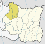
56:
50:
22:
519:
518:
514:
513:
512:
510:
509:
508:
479:
478:
477:
476:
415:
413:
408:
360:
351:
333:
321:
316:
286:
285:
272:
271:
267:
257:
255:
247:
246:
242:
237:
223:
221:
217:
214:
209:
206:
204:
202:
201:
127:Sagarmatha Zone
99:
97:
93:
90:
85:
82:
80:
78:
77:
71:
70:
69:
68:
65:
64:
63:
62:
58:
37:
30:
27:
20:
17:
12:
11:
5:
517:
515:
507:
506:
501:
496:
491:
481:
480:
475:
474:
467:
460:
452:
449:
448:
427:
410:
409:
407:
406:
401:
396:
391:
386:
381:
376:
370:
368:
362:
361:
354:
352:
350:
349:
343:
341:
335:
334:
326:
323:
322:
317:
315:
314:
307:
300:
292:
284:
283:
265:
239:
238:
236:
233:
169:
168:
158:
152:
151:
146:
142:
141:
136:
130:
129:
124:
118:
117:
112:
108:
107:
73:
72:
66:
60:
59:
52:
51:
45:
44:
43:
42:
39:
38:
35:
32:
31:
28:
25:
18:
15:
13:
10:
9:
6:
4:
3:
2:
516:
505:
502:
500:
497:
495:
492:
490:
487:
486:
484:
473:
468:
466:
461:
459:
454:
453:
447:
445:
441:
437:
433:
428:
425:
421:
416:
405:
402:
400:
397:
395:
392:
390:
387:
385:
382:
380:
377:
375:
374:Dudhakaushika
372:
371:
369:
367:
363:
358:
348:
347:Solududhkunda
345:
344:
342:
340:
336:
332:
331:
327:Headquarter:
324:
320:
313:
308:
306:
301:
299:
294:
293:
290:
279:
275:
269:
266:
254:
250:
244:
241:
234:
232:
228:
199:
195:
191:
187:
183:
179:
175:
166:
162:
159:
157:
150:
147:
140:
137:
135:
128:
125:
123:
116:
113:
104:
76:Coordinates:
49:
33:
23:
444:expanding it
429:
414:
379:Necha Salyan
339:Municipality
328:
278:Google Earth
273:
268:
256:. Retrieved
249:"Chharchung"
243:
198:Google Earth
173:
172:
389:Maha Kulung
222: /
186:Gokyo Lakes
98: /
483:Categories
404:Likhu Pike
235:References
210:86°43′24″E
207:27°55′26″N
174:Chharchung
165:Nepal Time
86:86°43′24″E
83:27°55′26″N
61:Chharchung
26:Chharchung
494:Himalayas
384:Dudhkoshi
182:Himalayas
156:Time zone
253:GeoNames
194:Khumjung
161:UTC+5:45
149:Khumjung
134:District
330:Salleri
276:(Map).
180:in the
111:Country
36:Village
394:Sotang
258:13 May
29:छर्चुङ
438:is a
436:Nepal
190:Gokyo
115:Nepal
440:stub
274:Maps
260:2012
188:and
122:Zone
200:at
145:VDC
485::
434:,
251:.
471:e
464:t
457:v
446:.
311:e
304:t
297:v
280:.
262:.
167:)
163:(
Text is available under the Creative Commons Attribution-ShareAlike License. Additional terms may apply.