60:
46:
120:
90:
209:
127:
97:
67:
318:) from the Tup-Dzhankoi Peninsula in the south (in Crimea). The strait is about 300 metres (980 ft) long, varying in width from 80–150 metres (260–490 ft) and is less than 3 metres (9.8 ft) deep. Two road
404:
in which
Russian forces had seized parts of southeast Ukraine bordering Crimea, Russian-installed occupation officials announced that Ukraine had damaged the highway bridge crossing the Chonhar Strait with one or more
45:
642:
328:
324:
397:
592:
514:
59:
341:. The old bridge, located further south, is abandoned. There is no railway bridge across the strait, but a rail bridge a few kilometres west at
707:
544:
433:
156:
119:
89:
702:
618:
401:
697:
489:
363:
522:
463:
409:
missiles. Russia quickly built a pontoon bridge. Ukraine damaged the bridge again (along with the bridge of
342:
275:
712:
643:"Ukraine knocks out two critical bridges used by Russia to supply southern troops from Crimea – ISW"
413:) with Storm Shadow missiles on 6 August 2023. On 15 August the bridge was reopened after repairs.
367:
334:
593:"Satellite imagery shows new pontoon crossing under Chonhar Bridge after alleged Ukrainian strike"
299:
259:
35:
359:
311:
410:
370:. The operation resulted in the Soviet capture of Crimea and forced the final evacuation of
267:
319:
200:
691:
371:
188:
666:
406:
345:
village (also on
Chonhar Peninsula) is sometimes also called "Chonhar Bridge".
375:
171:
158:
568:
333:
cross the strait. One carries the
Ukrainian M18 highway, which is part of
388:
545:"Ukraine updates: Ukraine 'damages' key Crimea bridge – DW – 06/22/2023"
400:
Crimean peninsula, and was militarized. Around 22 June 2023, amidst the
393:
315:
214:
490:"Russian Army Digging on Chongar Strait: UK Telegraph (man on scene)"
295:
291:
287:
283:
193:
338:
619:"Explosions hit road bridges between Crimea and occupied Ukraine"
286:
in
Ukraine, separating the eastern and western portions of the
617:
Nechyporenko, Kostan; Lapin, Denis; Lister, Tim (2023-08-06).
386:
Between 2014 and 2022, the
Chonhar Strait formed part of the
314:
in the north (on the mainland, and containing the village of
667:"Чонгарский мост открыли. Это самая короткая дорога в Крым"
362:, the Chonhar Strait was one avenue of attack during the
434:"Ukraine updates: Ukraine 'damages' key Crimea bridge"
240:
232:
224:
220:
199:
187:
148:
21:
16:Strait between eastern Crimea and mainland Ukraine
149:
366:in November 1920 and was crossed by the Soviet
27:
8:
378:and the end of the Civil War in the south.
18:
422:
402:full-scale Russian invasion of Ukraine
126:
96:
66:
7:
428:
426:
464:"Perekop-Chongar Operation of 1920"
14:
521:. March 21, 2014. Archived from
337:running from northern Norway to
207:
125:
118:
95:
88:
65:
58:
44:
239:
231:
228:80–150 m (260–490 ft)
223:
298:from the mainland east of the
282:) is a short, shallow, narrow
1:
515:"Photos: Conflict in Ukraine"
488:Epaminondas (March 4, 2014).
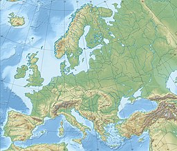
310:The Chonhar Strait separates
708:Geography of Kherson Oblast
729:
494:Infidel Blogger's Alliance
279:
364:Perekop-Chongar Operation
271:
263:
52:
43:
28:
26:
392:border between mainland
236:300 m (980 ft)
172:45.986667°N 34.551944°E
453:Лист карты L-36-XXIII.
244:3 m (9.8 ft)
597:The Kyiv Independent
177:45.986667; 34.551944
573:www.imago-images.de
468:The Free Dictionary
382:Russo-Ukrainian War
368:30th Rifle Division
335:European route E105
168: /
109:Show map of Ukraine
703:Straits of Ukraine
525:on October 6, 2014
300:Isthmus of Perekop
294:system separating
264:Чонгарська протока
139:Show map of Europe
79:Show map of Crimea
29:Чонгарська протока
698:Straits of Crimea
360:Russian Civil War
354:Russian Civil War
312:Chonhar Peninsula
272:Чонгарский пролив
248:
247:
720:
682:
681:
679:
678:
663:
657:
656:
654:
653:
639:
633:
632:
630:
629:
614:
608:
607:
605:
604:
589:
583:
582:
580:
579:
565:
559:
558:
556:
555:
541:
535:
534:
532:
530:
519:Montreal Gazette
511:
505:
504:
502:
500:
485:
479:
478:
476:
474:
460:
454:
451:
445:
444:
442:
440:
430:
411:Henichesk Strait
332:
281:
273:
265:
213:
211:
210:
183:
182:
180:
179:
178:
173:
169:
166:
165:
164:
161:
151:
140:
129:
128:
122:
110:
99:
98:
92:
80:
69:
68:
62:
48:
39:
31:
30:
19:
728:
727:
723:
722:
721:
719:
718:
717:
688:
687:
686:
685:
676:
674:
665:
664:
660:
651:
649:
641:
640:
636:
627:
625:
616:
615:
611:
602:
600:
591:
590:
586:
577:
575:
567:
566:
562:
553:
551:
543:
542:
538:
528:
526:
513:
512:
508:
498:
496:
487:
486:
482:
472:
470:
462:
461:
457:
452:
448:
438:
436:
432:
431:
424:
419:
398:Russian-annexed
384:
356:
351:
322:
308:
208:
206:
203: countries
176:
174:
170:
167:
162:
159:
157:
155:
154:
144:
143:
142:
141:
138:
137:
136:
135:
134:
130:
113:
112:
111:
108:
107:
106:
105:
104:
100:
83:
82:
81:
78:
77:
76:
75:
74:
70:
33:
17:
12:
11:
5:
726:
724:
716:
715:
710:
705:
700:
690:
689:
684:
683:
658:
634:
609:
584:
560:
536:
506:
480:
455:
446:
421:
420:
418:
415:
383:
380:
355:
352:
350:
347:
307:
304:
290:, the shallow
256:Chongar Strait
252:Chonhar Strait
246:
245:
242:
238:
237:
234:
230:
229:
226:
222:
221:
218:
217:
204:
197:
196:
191:
185:
184:
152:
146:
145:
133:Chonhar Strait
132:
131:
124:
123:
117:
116:
115:
114:
103:Chonhar Strait
102:
101:
94:
93:
87:
86:
85:
84:
73:Chonhar Strait
72:
71:
64:
63:
57:
56:
55:
54:
53:
50:
49:
41:
40:
24:
23:
22:Chonhar Strait
15:
13:
10:
9:
6:
4:
3:
2:
725:
714:
711:
709:
706:
704:
701:
699:
696:
695:
693:
672:
668:
662:
659:
648:
647:english.nv.ua
644:
638:
635:
624:
620:
613:
610:
598:
594:
588:
585:
574:
570:
564:
561:
550:
546:
540:
537:
524:
520:
516:
510:
507:
495:
491:
484:
481:
469:
465:
459:
456:
450:
447:
435:
429:
427:
423:
416:
414:
412:
408:
403:
399:
395:
391:
390:
381:
379:
377:
373:
372:Pyotr Wrangel
369:
365:
361:
353:
348:
346:
344:
340:
336:
330:
326:
321:
317:
313:
305:
303:
301:
297:
293:
289:
285:
280:Çonğar boğazı
277:
276:Crimean Tatar
269:
261:
257:
253:
243:
235:
227:
219:
216:
205:
202:
198:
195:
192:
190:
186:
181:
153:
147:
121:
91:
61:
51:
47:
42:
37:
25:
20:
675:. Retrieved
673:. 2023-08-17
671:gazetapik.ru
670:
661:
650:. Retrieved
646:
637:
626:. Retrieved
622:
612:
601:. Retrieved
599:. 2023-06-23
596:
587:
576:. Retrieved
572:
563:
552:. Retrieved
548:
539:
527:. Retrieved
523:the original
518:
509:
497:. Retrieved
493:
483:
471:. Retrieved
467:
458:
449:
437:. Retrieved
407:Storm Shadow
387:
385:
357:
309:
255:
251:
249:
163:34°33′07.0″E
160:45°59′12.0″N
713:Sea of Azov
358:During the
323: [
225:Max. length
175: /
150:Coordinates
692:Categories
677:2023-10-02
652:2023-10-02
628:2023-10-02
603:2023-07-18
578:2023-07-18
554:2023-07-18
529:October 3,
499:October 3,
473:October 3,
417:References
376:White Army
241:Max. depth
233:Min. width
306:Geography
260:Ukrainian
36:Ukrainian
396:and the
389:de facto
569:"IMAGO"
439:23 June
394:Ukraine
349:History
320:bridges
316:Chonhar
268:Russian
215:Ukraine
549:dw.com
343:Syvash
296:Crimea
292:lagoon
288:Syvash
284:strait
212:
194:Strait
32:
339:Yalta
331:]
201:Basin
531:2014
501:2014
475:2014
441:2023
250:The
189:Type
623:CNN
374:'s
254:or
694::
669:.
645:.
621:.
595:.
571:.
547:.
517:.
492:.
466:.
425:^
329:ru
327:;
325:uk
302:.
278::
274:;
270::
266:;
262::
680:.
655:.
631:.
606:.
581:.
557:.
533:.
503:.
477:.
443:.
258:(
38:)
34:(
Text is available under the Creative Commons Attribution-ShareAlike License. Additional terms may apply.