54:
376:, noted in his journal that the Chugwater area was a wintering area for cattle: "A very conspicuous feature which we notice in descending the valley of the Chug is the high bluff of Lower Cretaceous sandstone, which stretches away toward the northeast like a hugh wall. the jointage is so regular that it presents the appearance of massive mason-work gradually falling to decay. The sides of these sandstone walls are from 40 to 60 feet perpendicular, sometimes overhanging, large masses of which have broken off and fallen to the base. Their most striking feature, however is to weather into most picturesque castlllated forms. The valley of the Chug is 100 miles long, and is a favorite place to winter stock."
1658:
2644:
42:
1868:
70:
1419:
77:
483:". Under his direction, hunters drove the bison over nearby cliffs; when the animals reached the ground below, a sound of "chugging" was heard by the hunters. The story concludes with an etymology: since a stream was near the base of the cliffs, the site of the stampede has been called "the place" or "water at the place where the buffalo chug."
1460:
1449:
1430:
515:(1879 – 1970) who was then working as a ranch hand in the Chugwater area, and was stabled for many years south of Chugwater near Cheyenne, in an historic barn owned and maintained by Mike and Linda Holst. The Wyoming license plate logo, showing Steamboat being ridden by Danks, is the longest-running license plate motif in the world.
1392:
1775:
living together, 10.8% had a female householder with no husband present, 5.4% had a male householder with no wife present, and 35.5% were non-families. 34.4% of all households were made up of individuals, and 12.9% had someone living alone who was 65 years of age or older. The average household size
1827:
In the town, the population was spread out, with 29.9% under the age of 18, 10.2% from 18 to 24, 21.7% from 25 to 44, 20.9% from 45 to 64, and 17.2% who were 65 years of age or older. The median age was 34 years. For every 100 females, there were 110.3 males. For every 100 females age 18 and over,
1823:
living together, 8.5% had a female householder with no husband present, and 30.9% were non-families. 26.6% of all households were made up of individuals, and 16.0% had someone living alone who was 65 years of age or older. The average household size was 2.60 and the average family size was 3.18.
1720:
The median age in the town was 69.9 years. 10.8% of residents were under the age of 20; 4.4% were between the ages of 18 and 24; 4.2% were from 25 to 44; 19.9% were from 45 to 64; and 60.7% were 65 years of age or older. The gender makeup of the town was 55.4% male and 44.6% female.
1779:
The median age in the town was 48.3 years. 25% of residents were under the age of 18; 3.8% were between the ages of 18 and 24; 17% were from 25 to 44; 34% were from 45 to 64; and 20.3% were 65 years of age or older. The gender makeup of the town was 51.9% male and 48.1% female.
503:
organization by the ranch's general chairman, Ace V. Tyrrell. As a young horse, Steamboat sustained a nose injury, requiring removal of a bone fragment from a nostril, and as a result, developed a sound resembling the whistling of a steamboat whenever he bucked.
53:
1875:
In 2005, a promotion to attract new residents to the town offered building lots for $ 100, provided the new owner built a house within a year, and lived on the property for at least two years. Four lots were sold.
518:
The famous horse died in 1914, and is buried in
Frontier Park in Cheyenne near bucking chute number 9, the only horse to be so honored with interment on park grounds. In 1975, Steamboat was inducted into the
2360:
416:
was constructed, and the Grant Hotel opened in 1912. After the drought in the early 20th century, many of the early settlers left the area, but a number stayed, and by 1919 the town was incorporated.
1831:
The median income for a household in the town was $ 23,750, and the median income for a family was $ 26,250. Males had a median income of $ 24,688 versus $ 17,917 for females. The
404:
was chartered to serve points north of
Cheyenne in Wyoming. It was as a result primarily of the Swan Land and Cattle Co., and the railroad, that the town of Chugwater grew up.
1744:
was 69.3 inhabitants per square mile (26.8/km). There were 106 housing units at an average density of 34.6 per square mile (13.4/km). The racial makeup of the town was 97.2%
1682:
was 57.2 inhabitants per square mile (22.1/km). There were 101 housing units at an average density of 33.0 per square mile (12.7/km). The racial makeup of the town was 89.8%
1883:
crashed into Horton's Corner on
December 30, 2012, resulting in a fire that burned the convenience store. The loss of the convenience store has forced residents to drive to
1796:
was 80.0 people per square mile (30.9/km). There were 120 housing units at an average density of 39.3 per square mile (15.2/km). The racial makeup of the town was 95.90%
2562:
384:
The first settler in the valley is reported to have been James
Bordeaux (1814-1878), who opened a general store in 1868, located at the crossroads where the road from
456:
1717:
living together, 17.1% had a female householder with no husband present, and 9.0% had a male householder with no wife present. The average family size was 1.74.
520:
2160:
2120:
397:
2788:
2308:
1895:
to inform motorists that gas can not be purchased in
Chugwater, yet drivers still stop in the town to fill up based on inaccurate GPS information.
281:
101:
372:(1823-1880), who sketched Chugwater Bluff, and later completed a large painting of it entitled "Valley of the Chugwater". Hayden's photographer,
69:
1898:
As of the summer of 2017, drivers can purchase fuel from unattended fuel islands 24/7 or check out the convenience store during business hours.
1848:
2233:
2555:
2526:
1914:
412:
The town of
Chugwater was surveyed and laid out by engineers for the Swan Land and Cattle Co. in 1886. The town grew slowly, but in 1904 a
393:
349:
291:
1910:
554:
441:
state symbol, worked on the 2-Bar Ranch near
Chugwater early in the 20th century. The bucking horse on the logo, that he rode at the
1966:
1657:
364:
In 1870, the Hayden
Expedition passed through what they referred to as "the valley of the Chug". Along on the expedition was famed
41:
1985:
1422:
2548:
2061:
1901:
Chugwater Chili, which employs 15 people, lost a major seller of its packets of chili mix with the closure of Horton's Corner.
1749:
1703:
2094:
2540:
2282:
1801:
1753:
1707:
401:
463:, farmed and ranched in Chugwater. He served in the state legislature from 1963 to 1977, with his last term as Speaker.
2312:
2286:
2036:
2011:
1805:
586:
329:
153:
2188:
532:
325:
2793:
1940:
1636:
1621:
1606:
1591:
1576:
1561:
1546:
1531:
1516:
1501:
479:
hunt. According to this narrative, a chief was disabled during the hunt and his son took charge of the hunt or "
2508:
2682:
1433:
420:
369:
269:
2164:
2722:
2672:
2654:
1395:
496:
438:
419:
As late as the 1940s, Chugwater was still a railroad stop where cattle were loaded for shipment east to the
1819:
There were 94 households, out of which 33.0% had children under the age of 18 living with them, 55.3% were
2758:
2572:
1930:
1809:
1761:
1691:
528:
500:
499:
motif on
Wyoming license plates, came from the Tyrrell ranch located near Chugwater, and was given to the
442:
317:
158:
2316:
2243:
2531:
2238:
536:
373:
1771:
There were 93 households, of which 25.8% had children under the age of 18 living with them, 48.4% were
1724:
The median income for a household in the town was $ 57,934. Only 1.1% of the population fell below the
1852:
2765:
1891:, to buy basic necessities, such as groceries. The town also has erected electronic highway signs on
1813:
1765:
1695:
460:
353:
242:
1867:
2702:
1961:
1797:
1745:
1699:
1683:
1665:, an unusual vaneless model built circa 1910. Restored for Wyoming's Centennial Celebration, 1991.
1463:
1452:
365:
2687:
2667:
2662:
2633:
2628:
2594:
1936:
1884:
1793:
1757:
1741:
1687:
1679:
1437:
1407:
449:
337:
232:
2484:
2386:
2712:
2623:
2114:
1945:
1888:
1835:
for the town was $ 10,609. About 27.9% of families and 30.3% of the population were below the
1832:
540:
385:
333:
2745:
2692:
2677:
2618:
2192:
2138:
424:
1792:
of 2000, there were 244 people, 94 households, and 64 families residing in the town. The
1740:
of 2010, there were 212 people, 93 households, and 60 families residing in the town. The
1816:
of any race were 4.92% of the population and not a single
African American in the town.
2717:
2605:
1856:
476:
389:
2782:
1926:
1892:
1136:
524:
512:
434:
274:
2268:
1839:, including 38.5% of those under the age of eighteen and 28.6% of those 65 or over.
2727:
1836:
1725:
480:
413:
2098:
2587:
1949:
1917:
on September 28, 1984. Unfortunately, it no longer functions as a guest ranch.
2737:
2338:
1399:
141:
2463:
569:
556:
352:, was visited by some of the earliest Western expeditions, including that of
249:
228:
116:
103:
1913:, established near Chugwater in 1878 by George Rainsford, was placed on the
596:
Climate data for Chugwater, Wyoming (1991–2020 normals, extremes 1900–2019)
223:
589:, the town has a total area of 3.06 square miles (7.93 km), all land.
2185:
1820:
1772:
1714:
1662:
428:
257:
356:
in 1845, and cattle were first wintered in the valley as early as 1859.
1403:
321:
146:
1948:(born 1959), actor who portrayed Mike Danton in the biographical film
1698:
of any race made up 5.9% of the population. The town did not have any
1789:
1737:
1675:
472:
2365:
U.S. Climate Normals 2020: U.S. Monthly Climate Normals (1991-2020)
1678:
of 2010, there were 175 people and 111 households in the town. The
445:
rodeo in 1909, was Steamboat, who was foaled at Chugwater in 1896.
2208:
1866:
1656:
1411:
508:
2521:
471:
Some historians hold that the name "Chugwater" is derived from a
1441:
1374:
32:
2544:
1880:
2642:
2057:
305:
2408:
2438:
2032:
2007:
1847:
Public education in the town of Chugwater is provided by
1879:
Chugwater lost its only grocery and gas station when an
1425:- Alternate Interstate Business Route through Chugwater.
1859:, a branch of the Platte County Public Library System.
1855:, a K-12 campus, serves the community. Chugwater has a
452:
was among those who have drove cattle into Chugwater.
2505:
Ripple effect after fire takes out Wyoming town store
2186:
The history of Chugwater - How the town got its name
535:. Steamboat and Danks are also on the logo for the
2736:
2701:
2653:
2604:
2269:"Historical Information Wyoming Secretary of State"
301:
290:
280:
268:
256:
239:
222:
214:
206:
201:
193:
185:
177:
169:
164:
152:
140:
132:
23:
1768:of any race accounted for 5.7% of the population.
2367:. National Oceanic and Atmospheric Administration
2341:. National Oceanic and Atmospheric Administration
2161:"For the Record: Robert Mills Grant, May 2, 2012"
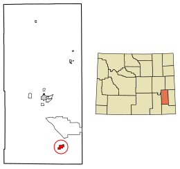
58:Location of Chugwater in Platte County, Wyoming.
1776:was 2.28 and the average family size was 2.90.
1713:There were 111 households, of which 73.9% were
457:Speaker of the Wyoming House of Representatives
380:First settlers & the coming of the railroad
1728:, all of whom were above the age of 65 years.
507:Steamboat was first ridden at a Frontier Days
2556:
2195:wheatlandwy.com. Retrieved February 21, 2010.
8:
2485:Wyoming Town Offers Cheap Land for New Blood
2163:. Platte County Record Times. Archived from
2133:
2131:
2085:
2083:
2081:
2079:
2563:
2549:
2541:
2283:"US Gazetteer files: 2010, 2000, and 1990"
1474:
592:
348:The Chugwater area, with its proximity to
76:
20:
437:, the model for the rider on the Wyoming
2228:
2226:
2203:
2201:
1977:
1436:- north–south route through Chugwater,
300:
279:
255:
221:
200:
192:
163:
131:
96:
62:
50:
38:
2522:"National Register Information System"
2263:
2261:
2119:: CS1 maint: archived copy as title (
2112:
1494:
1406:; runs north–south through Chugwater,
487:The Chugwater horse called "Steamboat"
2499:
2497:
2495:
2493:
2433:
2431:
2429:
1377:(mean maxima/minima 1981–2010)
289:
267:
238:
213:
205:
184:
176:
168:
151:
139:
7:
2527:National Register of Historic Places
2339:"NOWData - NOAA Online Weather Data"
1933:rodeo rider, cowboy & ranch hand
1915:National Register of Historic Places
1808:, and 2.87% from two or more races.
1760:, and 0.9% from two or more races.
1690:, and 3.8% from two or more races.
328:, the town population was 175. The
189:0.00 sq mi (0.00 km)
181:3.06 sq mi (7.93 km)
173:3.06 sq mi (7.93 km)
2571:Municipalities and communities of
2387:"Census of Population and Housing"
1484:
400:was established, and in 1886, the
332:town is located 45 miles north of
14:
1967:List of municipalities in Wyoming
1849:Platte County School District #1
1458:
1447:
1428:
1417:
1390:
388:forks into the roads leading to
75:
68:
52:
40:
2789:Towns in Platte County, Wyoming
2062:United States Geological Survey
360:Early expeditions to the Valley
2139:"Frontier Days: Clayton Danks"
2058:"US Board on Geographic Names"
1398:- north–south Interstate from
18:Town in Wyoming, United States
1:
2234:"Kelsey Bray, Blazin' saddle"
1988:. United States Census Bureau
1209:Average snowfall inches (cm)
491:The iconic black horse named
402:Cheyenne and Northern Railway
89:Location in the United States
1941:Wyoming State Representative
521:National Cowboy Hall of Fame
495:, who was the model for the
467:Etymology of the town's name
197:5,295 ft (1,614 m)
2443:United States Census Bureau
2313:United States Census Bureau
2287:United States Census Bureau
2141:. wyomingtalesandtrails.com
2037:United States Census Bureau
2012:United States Census Bureau
1986:"2019 U.S. Gazetteer Files"
1871:Grain elevator in Chugwater
1279:Average precipitation days
925:Mean daily minimum °F (°C)
785:Mean daily maximum °F (°C)
587:United States Census Bureau
324:, United States. As of the
218:65.69/sq mi (25.36/km)
2810:
2464:"Wyoming Public Libraries"
1372:
595:
582:(41.755797, -104.825482).
2754:
2640:
2585:
2309:"US Gazetteer files 2010"
2209:"Questions & Answers"
2191:February 5, 2010, at the
1650:
1635:
1620:
1605:
1590:
1575:
1560:
1545:
1530:
1515:
1500:
1493:
1488:
1483:
1480:
1325:
1278:
1208:
1134:
1064:
994:
924:
854:
784:
714:
644:
639:
636:
633:
630:
627:
624:
621:
618:
615:
612:
609:
606:
603:
600:
408:Establishment of the town
306:http://www.chugwater.com/
97:
63:
51:
39:
30:
2361:"Station: Chugwater, WY"
2090:Wyoming Tales and Trails
1828:there were 111.1 males.
551:Chugwater is located at
527:, and in 1979, into the
398:Swan Land and Cattle Co.
370:Sanford Robinson Gifford
2125:Retrieved July 31, 2015
497:bucking horse and rider
439:Bucking Horse and Rider
2647:
2574:Platte County, Wyoming
2511:Retrieved May 9, 2013.
2487:NPR, February 14, 2005
1931:Cheyenne Frontier Days
1872:
1666:
570:41.75583°N 104.82556°W
529:Pro Rodeo Hall of Fame
501:Cheyenne Frontier Days
443:Cheyenne Frontier Days
336:and 25 miles south of
117:41.75583°N 104.82556°W
46:Chugwater welcome sign
2646:
2532:National Park Service
2466:. PublicLibraries.com
2439:"U.S. Census Website"
2409:"Explore Census Data"
2246:on September 23, 2013
2239:Wyoming Tribune-Eagle
2033:"U.S. Census website"
2008:"U.S. Census website"
1870:
1660:
1651:U.S. Decennial Census
1476:Historical population
995:Mean minimum °F (°C)
715:Mean maximum °F (°C)
547:Geography and climate
539:, and on the Wyoming
537:University of Wyoming
448:State Representative
374:William Henry Jackson
241: • Summer (
2767:United States portal
1929:(1879–1970), famous
645:Record high °F (°C)
575:41.75583; -104.82556
466:
354:Stephen Watts Kearny
215: • Density
122:41.75583; -104.82556
2319:on January 25, 2012
2289:. February 12, 2011
2167:on February 1, 2015
1962:Chugwater Formation
1661:Chugwater's Legacy
1477:
1326:Average snowy days
1065:Record low °F (°C)
855:Daily mean °F (°C)
566: /
366:Hudson River School
113: /
2648:
2064:. October 25, 2007
1937:Robert Mills Grant
1873:
1794:population density
1742:population density
1680:population density
1667:
1475:
1455:(Iron Mountain Rd)
450:Robert Mills Grant
207: • Total
186: • Water
170: • Total
83:Chugwater, Wyoming
25:Chugwater, Wyoming
2776:
2775:
2509:Associated Press.
1946:Ted Prior (actor)
1833:per capita income
1655:
1654:
1381:
1380:
585:According to the
311:
310:
178: • Land
2801:
2794:Towns in Wyoming
2768:
2761:
2645:
2597:
2590:
2580:
2575:
2565:
2558:
2551:
2542:
2536:
2535:
2518:
2512:
2501:
2488:
2482:
2476:
2475:
2473:
2471:
2460:
2454:
2453:
2451:
2449:
2435:
2424:
2423:
2421:
2419:
2405:
2399:
2398:
2396:
2394:
2383:
2377:
2376:
2374:
2372:
2357:
2351:
2350:
2348:
2346:
2335:
2329:
2328:
2326:
2324:
2315:. Archived from
2305:
2299:
2298:
2296:
2294:
2279:
2273:
2272:
2265:
2256:
2255:
2253:
2251:
2242:. Archived from
2230:
2221:
2220:
2218:
2216:
2205:
2196:
2183:
2177:
2176:
2174:
2172:
2157:
2151:
2150:
2148:
2146:
2135:
2126:
2124:
2118:
2110:
2108:
2106:
2101:on July 22, 2015
2097:. Archived from
2087:
2074:
2073:
2071:
2069:
2054:
2048:
2047:
2045:
2043:
2029:
2023:
2022:
2020:
2018:
2004:
1998:
1997:
1995:
1993:
1982:
1905:Area attractions
1853:Chugwater School
1750:African American
1704:African American
1496:
1491:
1486:
1478:
1462:
1461:
1451:
1450:
1432:
1431:
1421:
1420:
1394:
1393:
1329:
1282:
593:
581:
580:
578:
577:
576:
571:
567:
564:
563:
562:
559:
533:Colorado Springs
421:Union Stockyards
246:
128:
127:
125:
124:
123:
118:
114:
111:
110:
109:
106:
79:
78:
72:
56:
44:
21:
2809:
2808:
2804:
2803:
2802:
2800:
2799:
2798:
2779:
2778:
2777:
2772:
2766:
2759:
2750:
2732:
2704:
2697:
2683:Westview Circle
2649:
2643:
2638:
2600:
2595:
2588:
2581:
2578:
2573:
2569:
2539:
2534:. July 9, 2010.
2520:
2519:
2515:
2502:
2491:
2483:
2479:
2469:
2467:
2462:
2461:
2457:
2447:
2445:
2437:
2436:
2427:
2417:
2415:
2413:data.census.gov
2407:
2406:
2402:
2392:
2390:
2385:
2384:
2380:
2370:
2368:
2359:
2358:
2354:
2344:
2342:
2337:
2336:
2332:
2322:
2320:
2307:
2306:
2302:
2292:
2290:
2281:
2280:
2276:
2267:
2266:
2259:
2249:
2247:
2232:
2231:
2224:
2214:
2212:
2207:
2206:
2199:
2193:Wayback Machine
2184:
2180:
2170:
2168:
2159:
2158:
2154:
2144:
2142:
2137:
2136:
2129:
2111:
2104:
2102:
2095:"Archived copy"
2093:
2088:
2077:
2067:
2065:
2056:
2055:
2051:
2041:
2039:
2031:
2030:
2026:
2016:
2014:
2006:
2005:
2001:
1991:
1989:
1984:
1983:
1979:
1975:
1958:
1923:
1907:
1865:
1845:
1821:married couples
1802:Native American
1786:
1773:married couples
1754:Native American
1734:
1715:married couples
1708:Native American
1672:
1489:
1473:
1459:
1448:
1429:
1418:
1391:
1387:
1382:
1327:
1280:
1273:
1268:
1263:
1258:
1253:
1248:
1243:
1238:
1233:
1228:
1223:
1218:
1213:
1203:
1198:
1193:
1188:
1183:
1178:
1173:
1168:
1163:
1158:
1153:
1148:
1143:
1129:
1124:
1119:
1114:
1109:
1104:
1099:
1094:
1089:
1084:
1079:
1074:
1069:
1059:
1054:
1049:
1044:
1039:
1034:
1029:
1024:
1019:
1014:
1009:
1004:
999:
989:
984:
979:
974:
969:
964:
959:
954:
949:
944:
939:
934:
929:
919:
914:
909:
904:
899:
894:
889:
884:
879:
874:
869:
864:
859:
849:
844:
839:
834:
829:
824:
819:
814:
809:
804:
799:
794:
789:
779:
774:
769:
764:
759:
754:
749:
744:
739:
734:
729:
724:
719:
709:
704:
699:
694:
689:
684:
679:
674:
669:
664:
659:
654:
649:
574:
572:
568:
565:
560:
557:
555:
553:
552:
549:
489:
469:
461:Harold Hellbaum
410:
396:. In 1884, the
382:
362:
346:
264:
240:
121:
119:
115:
112:
107:
104:
102:
100:
99:
93:
92:
91:
90:
87:
86:
85:
84:
80:
59:
47:
35:
26:
19:
12:
11:
5:
2807:
2805:
2797:
2796:
2791:
2781:
2780:
2774:
2773:
2771:
2770:
2763:
2760:Wyoming portal
2755:
2752:
2751:
2749:
2748:
2742:
2740:
2734:
2733:
2731:
2730:
2725:
2723:Dwyer Junction
2720:
2715:
2709:
2707:
2699:
2698:
2696:
2695:
2690:
2685:
2680:
2675:
2673:Lakeview North
2670:
2665:
2659:
2657:
2651:
2650:
2641:
2639:
2637:
2636:
2631:
2626:
2621:
2616:
2610:
2608:
2602:
2601:
2586:
2583:
2582:
2570:
2568:
2567:
2560:
2553:
2545:
2538:
2537:
2513:
2503:Gruver, Mead.
2489:
2477:
2455:
2425:
2400:
2378:
2352:
2330:
2300:
2274:
2257:
2222:
2197:
2178:
2152:
2127:
2092:- "Chugwater".
2075:
2049:
2024:
1999:
1976:
1974:
1971:
1970:
1969:
1964:
1957:
1954:
1953:
1952:
1943:
1934:
1922:
1921:Notable people
1919:
1906:
1903:
1864:
1861:
1857:public library
1844:
1841:
1785:
1782:
1733:
1730:
1671:
1668:
1653:
1652:
1648:
1647:
1644:
1642:
1639:
1633:
1632:
1629:
1627:
1624:
1618:
1617:
1614:
1612:
1609:
1603:
1602:
1599:
1597:
1594:
1588:
1587:
1584:
1582:
1579:
1573:
1572:
1569:
1567:
1564:
1558:
1557:
1554:
1552:
1549:
1543:
1542:
1539:
1537:
1534:
1528:
1527:
1524:
1522:
1519:
1513:
1512:
1509:
1507:
1504:
1498:
1497:
1492:
1487:
1482:
1472:
1469:
1468:
1467:
1466:(Lone Tree Rd)
1456:
1445:
1426:
1415:
1386:
1383:
1379:
1378:
1370:
1369:
1366:
1363:
1360:
1357:
1354:
1351:
1348:
1345:
1342:
1339:
1336:
1333:
1330:
1323:
1322:
1319:
1316:
1313:
1310:
1307:
1304:
1301:
1298:
1295:
1292:
1289:
1286:
1283:
1276:
1275:
1270:
1265:
1260:
1255:
1250:
1245:
1240:
1235:
1230:
1225:
1220:
1215:
1210:
1206:
1205:
1200:
1195:
1190:
1185:
1180:
1175:
1170:
1165:
1160:
1155:
1150:
1145:
1140:
1132:
1131:
1126:
1121:
1116:
1111:
1106:
1101:
1096:
1091:
1086:
1081:
1076:
1071:
1066:
1062:
1061:
1056:
1051:
1046:
1041:
1036:
1031:
1026:
1021:
1016:
1011:
1006:
1001:
996:
992:
991:
986:
981:
976:
971:
966:
961:
956:
951:
946:
941:
936:
931:
926:
922:
921:
916:
911:
906:
901:
896:
891:
886:
881:
876:
871:
866:
861:
856:
852:
851:
846:
841:
836:
831:
826:
821:
816:
811:
806:
801:
796:
791:
786:
782:
781:
776:
771:
766:
761:
756:
751:
746:
741:
736:
731:
726:
721:
716:
712:
711:
706:
701:
696:
691:
686:
681:
676:
671:
666:
661:
656:
651:
646:
642:
641:
638:
635:
632:
629:
626:
623:
620:
617:
614:
611:
608:
605:
602:
598:
597:
591:
548:
545:
488:
485:
468:
465:
409:
406:
390:Fort Fetterman
381:
378:
361:
358:
345:
342:
309:
308:
303:
299:
298:
295:
288:
287:
284:
278:
277:
272:
266:
265:
262:
260:
254:
253:
247:
237:
236:
233:Mountain (MST)
226:
220:
219:
216:
212:
211:
208:
204:
203:
199:
198:
195:
191:
190:
187:
183:
182:
179:
175:
174:
171:
167:
166:
162:
161:
156:
150:
149:
144:
138:
137:
134:
130:
129:
95:
94:
88:
82:
81:
74:
73:
67:
66:
65:
64:
61:
60:
57:
49:
48:
45:
37:
36:
31:
28:
27:
24:
17:
13:
10:
9:
6:
4:
3:
2:
2806:
2795:
2792:
2790:
2787:
2786:
2784:
2769:
2764:
2762:
2757:
2756:
2753:
2747:
2744:
2743:
2741:
2739:
2735:
2729:
2726:
2724:
2721:
2719:
2716:
2714:
2711:
2710:
2708:
2706:
2700:
2694:
2691:
2689:
2686:
2684:
2681:
2679:
2676:
2674:
2671:
2669:
2666:
2664:
2661:
2660:
2658:
2656:
2652:
2635:
2632:
2630:
2627:
2625:
2622:
2620:
2617:
2615:
2612:
2611:
2609:
2607:
2603:
2599:
2598:
2591:
2584:
2579:United States
2576:
2566:
2561:
2559:
2554:
2552:
2547:
2546:
2543:
2533:
2529:
2528:
2523:
2517:
2514:
2510:
2506:
2500:
2498:
2496:
2494:
2490:
2486:
2481:
2478:
2465:
2459:
2456:
2444:
2440:
2434:
2432:
2430:
2426:
2414:
2410:
2404:
2401:
2388:
2382:
2379:
2366:
2362:
2356:
2353:
2340:
2334:
2331:
2318:
2314:
2310:
2304:
2301:
2288:
2284:
2278:
2275:
2270:
2264:
2262:
2258:
2250:September 23,
2245:
2241:
2240:
2235:
2229:
2227:
2223:
2215:September 23,
2210:
2204:
2202:
2198:
2194:
2190:
2187:
2182:
2179:
2166:
2162:
2156:
2153:
2145:September 23,
2140:
2134:
2132:
2128:
2122:
2116:
2100:
2096:
2091:
2086:
2084:
2082:
2080:
2076:
2063:
2059:
2053:
2050:
2038:
2034:
2028:
2025:
2013:
2009:
2003:
2000:
1987:
1981:
1978:
1972:
1968:
1965:
1963:
1960:
1959:
1955:
1951:
1947:
1944:
1942:
1939:(1926–2012),
1938:
1935:
1932:
1928:
1927:Clayton Danks
1925:
1924:
1920:
1918:
1916:
1912:
1911:Diamond Ranch
1904:
1902:
1899:
1896:
1894:
1893:Interstate 25
1890:
1886:
1882:
1877:
1869:
1862:
1860:
1858:
1854:
1850:
1842:
1840:
1838:
1834:
1829:
1825:
1822:
1817:
1815:
1811:
1807:
1804:, 0.82% from
1803:
1799:
1795:
1791:
1783:
1781:
1777:
1774:
1769:
1767:
1763:
1759:
1755:
1751:
1747:
1743:
1739:
1731:
1729:
1727:
1722:
1718:
1716:
1711:
1709:
1705:
1701:
1697:
1693:
1689:
1685:
1681:
1677:
1669:
1664:
1659:
1649:
1645:
1643:
1640:
1638:
1634:
1630:
1628:
1625:
1623:
1619:
1615:
1613:
1610:
1608:
1604:
1600:
1598:
1595:
1593:
1589:
1585:
1583:
1580:
1578:
1574:
1570:
1568:
1565:
1563:
1559:
1555:
1553:
1550:
1548:
1544:
1540:
1538:
1535:
1533:
1529:
1525:
1523:
1520:
1518:
1514:
1510:
1508:
1505:
1503:
1499:
1479:
1470:
1465:
1457:
1454:
1446:
1443:
1439:
1435:
1427:
1424:
1416:
1413:
1409:
1405:
1401:
1397:
1389:
1388:
1384:
1376:
1371:
1367:
1364:
1361:
1358:
1355:
1352:
1349:
1346:
1343:
1340:
1337:
1334:
1331:
1324:
1320:
1317:
1314:
1311:
1308:
1305:
1302:
1299:
1296:
1293:
1290:
1287:
1284:
1277:
1271:
1266:
1261:
1256:
1251:
1246:
1241:
1236:
1231:
1226:
1221:
1216:
1211:
1207:
1201:
1196:
1191:
1186:
1181:
1176:
1171:
1166:
1161:
1156:
1151:
1146:
1141:
1138:
1137:precipitation
1133:
1127:
1122:
1117:
1112:
1107:
1102:
1097:
1092:
1087:
1082:
1077:
1072:
1067:
1063:
1057:
1052:
1047:
1042:
1037:
1032:
1027:
1022:
1017:
1012:
1007:
1002:
997:
993:
987:
982:
977:
972:
967:
962:
957:
952:
947:
942:
937:
932:
927:
923:
917:
912:
907:
902:
897:
892:
887:
882:
877:
872:
867:
862:
857:
853:
847:
842:
837:
832:
827:
822:
817:
812:
807:
802:
797:
792:
787:
783:
777:
772:
767:
762:
757:
752:
747:
742:
737:
732:
727:
722:
717:
713:
707:
702:
697:
692:
687:
682:
677:
672:
667:
662:
657:
652:
647:
643:
599:
594:
590:
588:
583:
579:
546:
544:
542:
541:state quarter
538:
534:
530:
526:
525:Oklahoma City
522:
516:
514:
513:Clayton Danks
510:
505:
502:
498:
494:
486:
484:
482:
478:
475:account of a
474:
464:
462:
458:
453:
451:
446:
444:
440:
436:
435:Clayton Danks
432:
430:
426:
422:
417:
415:
407:
405:
403:
399:
395:
391:
387:
379:
377:
375:
371:
367:
359:
357:
355:
351:
343:
341:
339:
335:
331:
327:
323:
319:
318:Platte County
316:is a town in
315:
307:
304:
296:
293:
285:
283:
276:
273:
271:
261:
259:
251:
248:
244:
234:
230:
227:
225:
217:
209:
196:
188:
180:
172:
160:
157:
155:
148:
145:
143:
136:United States
135:
126:
98:Coordinates:
71:
55:
43:
34:
29:
22:
16:
2613:
2593:
2525:
2516:
2504:
2480:
2468:. Retrieved
2458:
2446:. Retrieved
2442:
2416:. Retrieved
2412:
2403:
2391:. Retrieved
2389:. Census.gov
2381:
2371:December 15,
2369:. Retrieved
2364:
2355:
2345:December 15,
2343:. Retrieved
2333:
2323:December 14,
2321:. Retrieved
2317:the original
2303:
2291:. Retrieved
2277:
2248:. Retrieved
2244:the original
2237:
2213:. Retrieved
2181:
2169:. Retrieved
2165:the original
2155:
2143:. Retrieved
2103:. Retrieved
2099:the original
2089:
2066:. Retrieved
2052:
2040:. Retrieved
2027:
2017:December 14,
2015:. Retrieved
2002:
1990:. Retrieved
1980:
1908:
1900:
1897:
1878:
1874:
1846:
1837:poverty line
1830:
1826:
1818:
1787:
1778:
1770:
1756:, 0.5% from
1735:
1726:poverty line
1723:
1719:
1712:
1686:, 0.5% from
1673:
1471:Demographics
1464:WYO 313
1453:WYO 211
1139:inches (mm)
584:
550:
517:
511:in 1909, by
506:
492:
490:
481:buffalo jump
470:
454:
447:
433:
418:
414:Masonic Hall
411:
394:Fort Laramie
383:
363:
350:Fort Laramie
347:
313:
312:
15:
2705:communities
2589:County seat
2448:January 18,
2418:January 31,
2211:. lemen.com
2068:January 31,
2042:January 31,
1950:Deadly Prey
1806:other races
1784:2000 census
1758:other races
1732:2010 census
1710:residents.
1688:other races
1670:2020 census
1281:(≥ 0.01 in)
573: /
561:104°49′32″W
493:"Steamboat"
455:The former
330:High Plains
326:2020 census
250:UTC−6
229:UTC−7
120: /
108:104°49′32″W
2783:Categories
2738:Ghost town
2171:August 10,
1973:References
1788:As of the
1736:As of the
1674:As of the
1438:concurrent
1434:US 87
1408:concurrent
1400:New Mexico
1328:(≥ 0.1 in)
558:41°45′21″N
294:feature ID
202:Population
105:41°45′21″N
2688:Y-O Ranch
2668:El Rancho
2663:Chugcreek
2634:Wheatland
2629:Hartville
2614:Chugwater
2596:Wheatland
2293:April 23,
1992:August 7,
1885:Wheatland
1843:Education
368:painter,
338:Wheatland
314:Chugwater
282:FIPS code
270:Area code
224:Time zone
194:Elevation
2713:Bordeaux
2624:Guernsey
2470:June 14,
2189:Archived
2115:cite web
2105:July 31,
1956:See also
1889:Cheyenne
1887:, or to
1810:Hispanic
1800:, 0.41%
1762:Hispanic
1692:Hispanic
1663:Windmill
1385:Highways
1373:Source:
1135:Average
1060:(−28.9)
1055:(−23.7)
1050:(−17.4)
1045:(−10.8)
1015:(−10.3)
1010:(−16.6)
1005:(−22.3)
1000:(−22.8)
429:Nebraska
386:Cheyenne
334:Cheyenne
286:56-14165
258:ZIP code
2746:Sunrise
2693:Whiting
2393:June 4,
1863:Economy
1752:, 0.9%
1748:, 0.5%
1423:I-25 BL
1404:Wyoming
1040:(−3.0)
1020:(−4.1)
985:(−7.9)
980:(−4.3)
975:(−0.1)
965:(11.7)
960:(12.8)
945:(−0.9)
940:(−4.4)
935:(−8.1)
930:(−7.7)
915:(−1.4)
900:(15.8)
895:(20.8)
890:(21.8)
885:(17.7)
880:(12.0)
865:(−1.2)
860:(−1.3)
850:(16.7)
840:(10.1)
835:(16.9)
830:(24.9)
825:(29.9)
820:(30.9)
815:(26.4)
810:(19.8)
805:(14.4)
800:(10.8)
780:(36.6)
775:(14.9)
770:(21.1)
765:(26.9)
760:(32.3)
755:(35.1)
750:(36.4)
745:(33.7)
740:(29.9)
735:(25.4)
730:(21.1)
725:(16.6)
720:(15.2)
392:and to
344:History
322:Wyoming
302:Website
297:1609180
147:Wyoming
133:Country
2678:Slater
2619:Glendo
1814:Latino
1790:census
1766:Latino
1738:census
1696:Latino
1676:census
1646:−17.5%
1631:−13.1%
1601:−31.9%
1556:−26.9%
1526:−14.3%
1481:Census
1274:(177)
1254:(2.5)
1249:(0.0)
1244:(0.0)
1239:(0.0)
1234:(5.3)
1204:(426)
1130:(−43)
1125:(−43)
1120:(−32)
1115:(−27)
1110:(−14)
1090:(−12)
1085:(−27)
1080:(−34)
1075:(−38)
1070:(−38)
1035:(5.2)
1030:(5.9)
1025:(1.4)
990:(0.9)
970:(6.6)
955:(9.1)
950:(4.2)
920:(8.8)
910:(2.9)
905:(8.4)
875:(6.8)
870:(3.2)
845:(5.0)
795:(5.8)
790:(5.1)
601:Month
473:Mandan
159:Platte
154:County
2718:Dwyer
2703:Other
2606:Towns
1798:White
1746:White
1706:, or
1700:Asian
1684:White
1616:27.1%
1586:50.8%
1571:−9.7%
1541:15.5%
1440:with
1412:US 87
1410:with
1368:37.6
1321:91.2
1297:11.3
1269:(30)
1264:(23)
1259:(13)
1229:(23)
1224:(28)
1219:(29)
1214:(23)
1202:16.79
1199:(19)
1194:(19)
1189:(32)
1184:(33)
1179:(40)
1174:(40)
1169:(53)
1164:(78)
1159:(53)
1154:(29)
1149:(19)
1144:(12)
1105:(−6)
1100:(−2)
1095:(−6)
1058:−20.1
1053:−10.7
710:(43)
705:(23)
700:(25)
695:(32)
690:(37)
685:(38)
680:(43)
675:(40)
670:(34)
665:(31)
660:(27)
655:(24)
650:(23)
640:Year
509:rodeo
477:bison
425:Omaha
263:82210
252:(MDT)
142:State
2655:CDPs
2472:2019
2450:2023
2420:2023
2395:2015
2373:2021
2347:2021
2325:2012
2295:2011
2252:2013
2217:2013
2173:2013
2147:2013
2121:link
2107:2015
2070:2008
2044:2008
2019:2012
1994:2020
1909:The
1637:2020
1622:2010
1607:2000
1592:1990
1577:1980
1562:1970
1547:1960
1532:1950
1517:1940
1502:1930
1490:Note
1485:Pop.
1442:I-25
1396:I-25
1375:NOAA
1365:6.3
1362:5.0
1359:2.2
1356:0.4
1353:0.0
1350:0.0
1347:0.0
1344:1.0
1341:4.4
1338:5.7
1335:6.6
1332:6.0
1318:6.4
1315:5.7
1312:6.4
1309:6.9
1306:8.3
1303:8.3
1300:9.1
1294:9.1
1291:6.8
1288:6.7
1285:6.2
1272:69.8
1267:12.0
1222:11.1
1217:11.4
1197:0.74
1192:0.74
1187:1.27
1182:1.30
1177:1.57
1172:1.59
1167:2.08
1162:3.07
1157:2.07
1152:1.14
1147:0.73
1142:0.49
1043:12.5
1038:26.6
1033:41.3
1028:42.7
1023:34.5
1018:24.6
1013:13.5
1003:−8.2
998:−9.0
988:33.6
983:17.7
978:24.3
973:31.9
968:43.8
963:53.0
958:55.0
953:48.3
948:39.5
943:30.3
938:24.1
933:17.4
928:18.2
918:47.8
913:29.4
908:37.2
903:47.2
898:60.4
893:69.4
888:71.3
883:63.9
878:53.6
873:44.2
868:37.7
863:29.9
858:29.7
848:62.0
843:41.0
838:50.1
833:62.4
828:76.9
823:85.8
818:87.7
813:79.6
808:67.6
803:58.0
798:51.4
793:42.4
788:41.2
778:97.9
773:58.9
768:69.9
763:80.5
758:90.1
753:95.1
748:97.5
743:92.7
738:85.8
733:77.7
728:69.9
723:61.8
718:59.4
637:Dec
634:Nov
631:Oct
628:Sep
625:Aug
622:Jul
619:Jun
616:May
613:Apr
610:Mar
607:Feb
604:Jan
292:GNIS
165:Area
33:Town
2728:Uva
1881:SUV
1812:or
1764:or
1694:or
1641:175
1626:212
1611:244
1596:192
1581:282
1566:187
1551:207
1536:283
1521:245
1506:286
1402:to
1262:9.1
1257:5.2
1252:1.0
1247:0.0
1242:0.0
1237:0.0
1232:2.1
1227:8.9
1212:9.0
1128:−45
1123:−45
1118:−26
1113:−16
1083:−16
1078:−29
1073:−37
1068:−37
1048:0.7
1008:2.2
708:110
683:101
678:110
673:104
531:in
523:in
423:in
275:307
243:DST
210:175
2785::
2592::
2577:,
2530:.
2524:.
2507:.
2492:^
2441:.
2428:^
2411:.
2363:.
2311:.
2285:.
2260:^
2236:.
2225:^
2200:^
2130:^
2117:}}
2113:{{
2078:^
2060:.
2035:.
2010:.
1851:.
1702:,
1495:%±
1103:21
1098:29
1093:21
1088:10
703:73
698:77
693:89
688:98
668:94
663:87
658:80
653:76
648:73
543:.
459:,
431:.
427:,
340:.
320:,
2564:e
2557:t
2550:v
2474:.
2452:.
2422:.
2397:.
2375:.
2349:.
2327:.
2297:.
2271:.
2254:.
2219:.
2175:.
2149:.
2123:)
2109:.
2072:.
2046:.
2021:.
1996:.
1511:—
1444:.
1414:.
1108:6
245:)
235:)
231:(
Text is available under the Creative Commons Attribution-ShareAlike License. Additional terms may apply.