240:
in
December 1871. Parts of the Central and South Ridings were severed to create the Oakleigh Borough, which went on to become the City of Oakleigh on 13 March 1891. The remainder was renamed the Shire of Mulgrave on 19 February 1897. In 1949 and 1959, further areas were annexed to the City of
926:
573:
941:
107:
931:
507:
233:
887:
244:
On 15 December 1994, the City of
Waverley was abolished, and along with parts of the City of Oakleigh, was merged into the newly created
39:
566:
121:
684:
520:
503:
774:
559:
583:
209:
133:
705:
94:
617:
811:
716:
112:
509:
Victorian local government amalgamations 1994-1995: Changes to the
Australian Standard Geographical Classification
490:
224:. The city covered an area of 60.86 square kilometres (23.50 sq mi), and existed from 1857 until 1994.
320:
936:
837:
678:
335:
310:
256:
87:
801:
330:
551:
873:
857:
732:
622:
267:
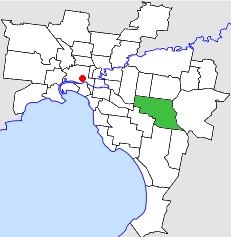
The City of
Waverley was subdivided into four wards on 31 May 1971, each electing three councillors:
217:
831:
826:
658:
484:
252:
842:
785:
769:
753:
738:
663:
638:
325:
303:
183:
159:
147:
795:
780:
764:
721:
711:
673:
643:
627:
516:
459:
295:
290:
188:
852:
847:
821:
816:
790:
727:
695:
612:
591:
299:
237:
178:
142:
29:
868:
806:
759:
700:
689:
668:
648:
607:
163:
743:
653:
632:
602:
245:
120:
920:
171:
152:
748:
241:
Oakleigh. On 14 April 1961, the Shire of
Mulgrave became the City of Waverley.
38:
546:
902:
889:
463:
587:
221:
213:
100:
44:
259:. It presently serves as the council seat for the City of Monash.
555:
454:
Australian Bureau of
Statistics, Victoria Office (1994).
251:
Council meetings were held at
Waverley Town Hall, on
212:about 20 kilometres (12 mi) east-southeast of
106:
93:
83:
75:
67:
59:
51:
23:
927:Former local government areas of Victoria (state)
128:
487:: Arnall & Jackson. 1992. pp. 521–522.
567:
8:
18:Local government area in Victoria, Australia
436:* Estimate in the 1958 Victorian Year Book.
574:
560:
552:
37:
20:
515:. Commonwealth of Australia. p. 9.
350:
446:
232:Waverley was first incorporated as the
475:
473:
176:
157:
140:
130:
7:
79:60.86 km (23.5 sq mi)
942:1994 disestablishments in Australia
236:in January 1857, which became the
14:
932:1857 establishments in Australia
119:
504:Australian Bureau of Statistics
63:2,060.5/km (5,336.6/sq mi)
1:
481:Victorian Municipal Directory
685:Doncaster & Templestowe
547:Victorian Places - Waverley
298:(shared with the Cities of
958:
598:
491:State Library of Victoria
194:
131:
127:
118:
36:
493:, La Trobe Reading Room.
136:around City of Waverley:
216:, the state capital of
584:local government areas
234:Oakleigh Road District
210:local government area
899: /
456:Victorian Year Book
55:125,400 (1992)
903:37.883°S 145.167°E
882:
881:
506:(1 August 1995).
437:
433:
432:
343:
238:Shire of Oakleigh
202:
201:
198:
197:
949:
914:
913:
911:
910:
909:
908:-37.883; 145.167
904:
900:
897:
896:
895:
892:
576:
569:
562:
553:
534:
533:
531:
529:
514:
500:
494:
488:
477:
468:
467:
451:
435:
351:
341:
206:City of Waverley
168:City of Waverley
129:
123:
41:
32:
26:
25:City of Waverley
21:
957:
956:
952:
951:
950:
948:
947:
946:
917:
916:
907:
905:
901:
898:
893:
890:
888:
886:
885:
883:
878:
838:South Melbourne
594:
580:
543:
538:
537:
527:
525:
523:
512:
502:
501:
497:
479:
478:
471:
453:
452:
448:
443:
349:
342:* Council seat.
287:
265:
253:Springvale Road
230:
162:
60: • Density
47:
28:
27:
24:
19:
12:
11:
5:
955:
953:
945:
944:
939:
937:City of Monash
934:
929:
919:
918:
880:
879:
877:
876:
871:
866:
861:
855:
850:
845:
840:
835:
829:
824:
819:
814:
809:
804:
802:Port Melbourne
799:
793:
788:
783:
778:
772:
767:
762:
757:
751:
746:
741:
736:
730:
725:
719:
714:
709:
703:
698:
693:
687:
682:
679:Diamond Valley
676:
671:
666:
661:
656:
651:
646:
641:
636:
630:
625:
620:
615:
610:
605:
599:
596:
595:
581:
579:
578:
571:
564:
556:
550:
549:
542:
541:External links
539:
536:
535:
521:
495:
469:
458:. p. 50.
445:
444:
442:
439:
431:
430:
427:
423:
422:
419:
415:
414:
411:
407:
406:
403:
399:
398:
395:
391:
390:
387:
383:
382:
379:
375:
374:
371:
367:
366:
363:
359:
358:
355:
348:
345:
339:
338:
333:
328:
323:
321:Mount Waverley
318:
315:
307:
293:
286:
283:
282:
281:
278:
275:
272:
264:
261:
246:City of Monash
229:
226:
200:
199:
196:
195:
192:
191:
186:
181:
175:
174:
169:
166:
156:
155:
150:
145:
139:
138:
125:
124:
116:
115:
110:
104:
103:
97:
91:
90:
85:
81:
80:
77:
73:
72:
69:
65:
64:
61:
57:
56:
53:
49:
48:
42:
34:
33:
17:
13:
10:
9:
6:
4:
3:
2:
954:
943:
940:
938:
935:
933:
930:
928:
925:
924:
922:
915:
912:
875:
872:
870:
867:
865:
862:
859:
856:
854:
851:
849:
846:
844:
841:
839:
836:
833:
830:
828:
825:
823:
820:
818:
815:
813:
810:
808:
805:
803:
800:
797:
794:
792:
789:
787:
784:
782:
779:
776:
773:
771:
768:
766:
763:
761:
758:
755:
752:
750:
747:
745:
742:
740:
737:
734:
731:
729:
726:
723:
720:
718:
715:
713:
710:
707:
704:
702:
699:
697:
694:
691:
688:
686:
683:
680:
677:
675:
672:
670:
667:
665:
662:
660:
657:
655:
652:
650:
647:
645:
642:
640:
637:
634:
631:
629:
626:
624:
621:
619:
616:
614:
611:
609:
606:
604:
601:
600:
597:
593:
589:
585:
577:
572:
570:
565:
563:
558:
557:
554:
548:
545:
544:
540:
524:
522:0-642-23117-6
518:
511:
510:
505:
499:
496:
492:
486:
482:
476:
474:
470:
465:
461:
457:
450:
447:
440:
438:
428:
425:
424:
420:
417:
416:
412:
409:
408:
404:
401:
400:
396:
393:
392:
388:
385:
384:
380:
377:
376:
372:
369:
368:
364:
361:
360:
356:
353:
352:
346:
344:
337:
336:Wheelers Hill
334:
332:
329:
327:
324:
322:
319:
316:
313:
312:
311:Glen Waverley
308:
305:
301:
297:
294:
292:
289:
288:
284:
279:
276:
273:
270:
269:
268:
262:
260:
258:
257:Glen Waverley
254:
249:
247:
242:
239:
235:
227:
225:
223:
219:
215:
211:
207:
193:
190:
187:
185:
182:
180:
177:
173:
170:
167:
165:
161:
158:
154:
151:
149:
146:
144:
141:
137:
135:
126:
122:
117:
114:
111:
109:
105:
102:
98:
96:
92:
89:
88:Glen Waverley
86:
82:
78:
74:
70:
66:
62:
58:
54:
50:
46:
40:
35:
31:
22:
16:
884:
874:Williamstown
863:
623:Broadmeadows
526:. Retrieved
508:
498:
489:Accessed at
480:
455:
449:
434:
340:
331:Notting Hill
309:
266:
250:
243:
231:
205:
203:
132:
84:Council seat
43:Location in
15:
906: /
858:Upper Yarra
827:Sandringham
733:Healesville
659:Collingwood
528:16 December
357:Population
317:Jordanville
274:Centre Ward
68:Established
921:Categories
843:Springvale
832:Sherbrooke
786:Nunawading
775:Mornington
770:Mordialloc
739:Heidelberg
664:Cranbourne
639:Camberwell
441:References
347:Population
304:Camberwell
280:South Ward
184:Springvale
160:Camberwell
148:Nunawading
52:Population
781:Northcote
765:Moorabbin
754:Lillydale
717:Frankston
712:Footscray
674:Dandenong
644:Caulfield
628:Brunswick
588:Melbourne
485:Brunswick
464:0067-1223
277:East Ward
271:West Ward
222:Australia
214:Melbourne
189:Dandenong
101:Melbourne
45:Melbourne
894:145°10′E
869:Werribee
864:Waverley
853:Sunshine
848:St Kilda
822:Ringwood
817:Richmond
796:Pakenham
791:Oakleigh
728:Hawthorn
722:Hastings
706:Flinders
696:Essendon
618:Brighton
613:Box Hill
592:Victoria
429:118,265
421:122,935
413:122,471
405:117,144
373:39,300*
326:Mulgrave
300:Box Hill
218:Victoria
179:Oakleigh
143:Box Hill
99:Eastern
30:Victoria
891:37°53′S
812:Preston
807:Prahran
760:Malvern
701:Fitzroy
669:Croydon
649:Chelsea
608:Berwick
582:Former
397:97,033
389:69,832
381:44,971
365:20,293
296:Burwood
291:Ashwood
285:Suburbs
228:History
164:Malvern
744:Keilor
690:Eltham
654:Coburg
603:Altona
519:
462:
208:was a
113:Bourke
108:County
95:Region
633:Bulla
513:(PDF)
354:Year
263:Wards
530:2007
517:ISBN
460:ISSN
426:1991
418:1986
410:1981
402:1976
394:1971
386:1966
378:1961
370:1958
362:1954
302:and
204:The
172:Knox
153:Knox
134:LGAs
76:Area
71:1857
860:(S)
834:(S)
798:(S)
777:(S)
756:(S)
749:Kew
735:(S)
724:(S)
708:(S)
692:(S)
681:(S)
635:(S)
586:in
923::
590:,
483:.
472:^
255:,
248:.
220:,
575:e
568:t
561:v
532:.
466:.
314:*
306:)
Text is available under the Creative Commons Attribution-ShareAlike License. Additional terms may apply.