42:
932:
668:
293:
According to the 2010 census, the township has a total area of 50.18 square miles (130.0 km), of which 49.09 square miles (127.1 km) (or 97.83%) is land and 1.09 square miles (2.8 km) (or 2.17%) is water. The streams of Almond Ditch, Ams Run, Blue Woods Creek, Boone Creek, Center
294:
Creek, Clay Creek, Cool Creek, Elliot Creek, Lily Vestal Drain, Henley Creek, Highway Run, Hot Lick Creek, Kirkendall Creek, Lion Creek, Little Cool Creek, Long Branch, Mitchener Ditch, Spring Mill Run, Well Run, Will Creek, and Witt Creek run through this township.
1002:
973:
55:
591:
41:
992:
760:
745:
321:
750:
735:
315:
476:
730:
333:
327:
740:
755:
720:
419:
966:
879:
584:
859:
823:
351:
345:
339:
538:
282:
410:
232:
959:
577:
259:, United States. As of the 2010 census, its population was 83,293 and it contained 32,375 housing units. Since the annexation of
447:
415:
569:
477:"Population, Housing Units, Area, and Density: 2010 - County -- County Subdivision and Place -- 2010 Census Summary File 1"
997:
480:
451:
109:
931:
433:
939:
601:
382:
377:
372:
363:
The township contains six cemeteries: Calvary, Carmel, Farley, Pleasant Grove, Poplar Ridge, and White Chapel.
252:
220:
145:
114:
87:
405:
770:
902:
813:
502:
392:
387:
225:
543:
909:
864:
783:
652:
623:
849:
798:
260:
874:
838:
788:
657:
702:
679:
517:
278:
943:
692:
687:
647:
854:
833:
828:
778:
697:
642:
303:
264:
869:
818:
808:
712:
248:
32:
519:
History of
Hamilton County, Indiana: Her People, Industries And Institutions, Volume 1
986:
843:
616:
97:
70:
57:
893:‡This populated place also has portions in an adjacent county or counties
559:
256:
102:
667:
533:
634:
448:"Census Bureau profile: Clay Township, Hamilton County, Indiana"
573:
564:
666:
503:"Home Place annexation begins today • Current Publishing"
947:
434:
United States Census Bureau cartographic boundary files
214:
46032, 46033, 46074, 46077, 46082, 46260, 46280, 46290
888:
797:
769:
711:
678:
633:
231:
219:
209:
201:
193:
188:
180:
172:
164:
156:
151:
141:
136:
128:
120:
108:
96:
86:
23:
267:is now completely coterminous with the township.
1003:Indianapolis-Anderson-Columbus geography stubs
176:1.09 sq mi (2.8 km) 2.17%
967:
585:
8:
671:Map of Indiana highlighting Hamilton County
974:
960:
592:
578:
570:
20:
406:"Clay Township, Hamilton County, Indiana"
471:
469:
420:United States Department of the Interior
439:
230:
208:
187:
179:
150:
135:
85:
50:
38:
565:United Township Association of Indiana
534:"National Register Information System"
479:. United States Census. Archived from
993:Townships in Hamilton County, Indiana
275:Clay Township was organized in 1833.
218:
200:
192:
171:
168:49.09 sq mi (127.1 km)
163:
160:50.18 sq mi (130.0 km)
155:
140:
127:
119:
107:
95:
7:
928:
926:
539:National Register of Historic Places
283:National Register of Historic Places
522:. B.F. Bowen & Co. p. 153.
411:Geographic Names Information System
946:. You can help Knowledge (XXG) by
600:Municipalities and communities of
334:Washington Township, Marion County
18:Township in Indiana, United States
14:
930:
40:
416:United States Geological Survey
1:
205:2,014.1/sq mi (777.6/km)
560:Indiana Township Association
352:Union Township, Boone County
346:Eagle Township, Boone County
340:Pike Township, Marion County
452:United States Census Bureau
46:Location in Hamilton County
1019:
925:
898:
664:
614:
51:
39:
30:
940:Hamilton County, Indiana
603:Hamilton County, Indiana
516:Haines, John F. (1915).
184:843 ft (257 m)
942:location article is a
672:
670:
544:National Park Service
71:39.96333°N 86.14833°W
998:Townships in Indiana
911:United States portal
751:Westfield Washington
483:on February 12, 2020
322:Noblesville Township
202: • Density
316:Washington Township
261:Home Place, Indiana
76:39.96333; -86.14833
67: /
673:
310:Adjacent townships
281:was listed on the
194: • Total
173: • Water
157: • Total
129:Township organized
955:
954:
920:
919:
328:Delaware Township
279:Micah Newby House
242:
241:
165: • Land
142: • Type
1010:
976:
969:
962:
934:
927:
912:
905:
669:
626:
619:
609:
604:
594:
587:
580:
571:
548:
547:
530:
524:
523:
513:
507:
506:
499:
493:
492:
490:
488:
473:
464:
463:
461:
459:
444:
430:
428:
426:
298:Cities and towns
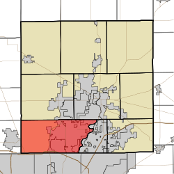
146:Indiana township
82:
81:
79:
78:
77:
72:
68:
65:
64:
63:
60:
44:
21:
1018:
1017:
1013:
1012:
1011:
1009:
1008:
1007:
983:
982:
981:
980:
923:
921:
916:
910:
903:
894:
884:
800:
793:
765:
707:
674:
662:
629:
624:
617:
610:
607:
602:
598:
556:
551:
546:. July 9, 2010.
532:
531:
527:
515:
514:
510:
501:
500:
496:
486:
484:
475:
474:
467:
457:
455:
446:
445:
441:
424:
422:
404:
401:
369:
361:
312:
300:
291:
273:
253:Hamilton County
247:is one of nine
215:
75:
73:
69:
66:
61:
58:
56:
54:
53:
47:
35:
26:
19:
12:
11:
5:
1016:
1014:
1006:
1005:
1000:
995:
985:
984:
979:
978:
971:
964:
956:
953:
952:
935:
918:
917:
915:
914:
907:
904:Indiana portal
899:
896:
895:
892:
890:
886:
885:
883:
882:
877:
872:
867:
862:
857:
852:
847:
841:
836:
831:
826:
821:
816:
811:
805:
803:
795:
794:
792:
791:
786:
781:
775:
773:
767:
766:
764:
763:
758:
753:
748:
743:
738:
733:
728:
723:
717:
715:
709:
708:
706:
705:
700:
695:
690:
684:
682:
676:
675:
665:
663:
661:
660:
655:
650:
645:
639:
637:
631:
630:
615:
612:
611:
599:
597:
596:
589:
582:
574:
568:
567:
562:
555:
554:External links
552:
550:
549:
525:
508:
494:
465:
438:
437:
436:
431:
400:
397:
396:
395:
393:State Road 431
390:
388:State Road 234
385:
383:U.S. Route 421
380:
375:
373:Interstate 465
368:
367:Major highways
365:
360:
357:
356:
355:
349:
343:
337:
331:
325:
319:
311:
308:
307:
306:
299:
296:
290:
287:
272:
269:
240:
239:
236:
229:
228:
223:
217:
216:
213:
211:
207:
206:
203:
199:
198:
195:
191:
190:
186:
185:
182:
178:
177:
174:
170:
169:
166:
162:
161:
158:
154:
153:
149:
148:
143:
139:
138:
134:
133:
130:
126:
125:
122:
118:
117:
112:
106:
105:
100:
94:
93:
90:
84:
83:
49:
48:
45:
37:
36:
31:
28:
27:
24:
17:
13:
10:
9:
6:
4:
3:
2:
1015:
1004:
1001:
999:
996:
994:
991:
990:
988:
977:
972:
970:
965:
963:
958:
957:
951:
949:
945:
941:
936:
933:
929:
924:
913:
908:
906:
901:
900:
897:
891:
887:
881:
878:
876:
873:
871:
868:
866:
863:
861:
858:
856:
853:
851:
848:
845:
842:
840:
837:
835:
832:
830:
827:
825:
822:
820:
817:
815:
814:Bakers Corner
812:
810:
807:
806:
804:
802:
796:
790:
787:
785:
782:
780:
777:
776:
774:
772:
768:
762:
759:
757:
754:
752:
749:
747:
744:
742:
739:
737:
734:
732:
729:
727:
724:
722:
719:
718:
716:
714:
710:
704:
701:
699:
696:
694:
691:
689:
686:
685:
683:
681:
677:
659:
656:
654:
651:
649:
646:
644:
641:
640:
638:
636:
632:
628:
627:
620:
613:
608:United States
605:
595:
590:
588:
583:
581:
576:
575:
572:
566:
563:
561:
558:
557:
553:
545:
541:
540:
535:
529:
526:
521:
520:
512:
509:
505:. March 2018.
504:
498:
495:
482:
478:
472:
470:
466:
453:
449:
443:
440:
435:
432:
425:September 24,
421:
417:
413:
412:
407:
403:
402:
398:
394:
391:
389:
386:
384:
381:
379:
378:U.S. Route 31
376:
374:
371:
370:
366:
364:
358:
353:
350:
347:
344:
341:
338:
335:
332:
329:
326:
323:
320:
317:
314:
313:
309:
305:
302:
301:
297:
295:
288:
286:
284:
280:
276:
270:
268:
266:
262:
258:
254:
250:
246:
245:Clay Township
237:
234:
227:
224:
222:
212:
204:
196:
183:
175:
167:
159:
147:
144:
131:
123:
116:
113:
111:
104:
101:
99:
92:United States
91:
89:
80:
52:Coordinates:
43:
34:
29:
25:Clay Township
22:
16:
948:expanding it
937:
922:
880:Walnut Grove
725:
622:
537:
528:
518:
511:
497:
485:. Retrieved
481:the original
456:. Retrieved
442:
423:. Retrieved
409:
362:
292:
277:
274:
244:
243:
221:Area code(s)
15:
865:New Britton
860:Millersburg
824:Clarksville
801:communities
784:Hortonville
761:White River
746:Noblesville
653:Noblesville
625:Noblesville
618:County seat
354:(northwest)
342:(southwest)
324:(northeast)
74: /
987:Categories
850:Home Place
736:Fall Creek
454:. May 2023
399:References
359:Cemeteries
235:feature ID
189:Population
137:Government
62:86°08′54″W
59:39°57′48″N
889:Footnotes
875:Strawtown
839:Eagletown
789:Riverwood
713:Townships
658:Westfield
458:March 18,
289:Geography
285:in 1986.
249:townships
210:ZIP codes
181:Elevation
731:Delaware
703:Sheridan
226:317, 463
115:Hamilton
33:Township
741:Jackson
693:Atlanta
688:Arcadia
648:Fishers
487:May 10,
336:(south)
318:(north)
271:History
257:Indiana
238:0453209
121:Settled
103:Indiana
88:Country
855:Lamong
834:Durbin
829:Deming
779:Boxley
698:Cicero
643:Carmel
635:Cities
348:(west)
330:(east)
304:Carmel
265:Carmel
197:99,093
110:County
938:This
870:Omega
819:Clare
809:Aroma
799:Other
756:Wayne
721:Adams
680:Towns
98:State
944:stub
844:Ekin
771:CDPs
726:Clay
489:2013
460:2024
427:2009
233:GNIS
152:Area
132:1833
124:1802
251:in
989::
621::
606:,
542:.
536:.
468:^
450:.
418:,
414:.
408:.
263:;
255:,
975:e
968:t
961:v
950:.
846:‡
593:e
586:t
579:v
491:.
462:.
429:.
Text is available under the Creative Commons Attribution-ShareAlike License. Additional terms may apply.