57:
64:
1130:
489:
244:
A biological survey was conducted in the area in 1982 and researchers found 189 plant species, 53 species of bird, 19 reptile species and 9 species of mammal. Several of the birds are endangered including the
56:
1110:
781:
272:, and it is part of the larger area of Rumburriya semi-moiety land known as Mangurinji. The area is significant to the Wambaya as ancestral beings known as Mangaya that feature in the
1115:
1072:
482:
154:
428:"Connells Lagoon Conservation Reserve, Brunette Alexandria Rd, Tennant Creek (sic), NT, Australia - listing on the now-defunct Register of the National Estate (Place ID 18992)"
1077:
791:
736:
475:
670:
384:
101:
771:
690:
1125:
884:
695:
710:
1120:
498:
305:
176:
1067:
615:
756:
660:
665:
329:
241:. On the higher areas graveley red-earth is found. The lagoon from which the reserve takes its name is found just outside the boundary fence.
849:
548:
1093:
The above list consists of places managed by the Parks and
Wildlife Commission of the Northern Territory either alone or with other parties
680:
650:
625:
1021:
715:
705:
594:
751:
761:
675:
599:
462:
165:
620:
203:
87:
1000:
889:
640:
589:
538:
879:
746:
700:
294:
196:
543:
812:
796:
720:
630:
395:
38:
766:
950:
924:
776:
655:
517:
391:
362:
635:
225:
The landscape is predominantly flat with watercourses found in the northern areas where small stands of trees are found.
1082:
995:
980:
955:
854:
786:
685:
432:
427:
94:
563:
741:
207:
975:
970:
558:
553:
990:
965:
864:
828:
573:
568:
1062:
1016:
960:
945:
874:
522:
512:
333:
1031:
940:
909:
904:
894:
358:
250:
833:
1046:
1026:
1041:
919:
914:
859:
211:
437:
42:
1036:
985:
899:
290:. Cattle and fire have been excluded from the area since 1984 when the area was gazetted and fenced.
869:
258:
265:
254:
29:
467:
246:
215:
282:
arrived in the area in the 1880s and the area was used as a stock reserve along the Barkly
238:
269:
219:
192:
1104:
287:
283:
279:
226:
1131:
Northern
Territory places listed on the defunct Register of the National Estate
330:"Terrestrial Protected Areas by Reserve Type in the Northern Territory (2012)"
286:
which was heavily trafficked up until the 1960s when road transport replaced
116:
103:
273:
234:
230:
202:
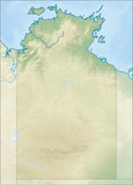
It is situated approximately 260 kilometres (162 mi) north east of
293:
In 2002, the conservation reserve was listed on the now-defunct
471:
233:
plains with cracking clays underlain by flat beds of Middle
63:
1073:
Parks and
Wildlife Commission of the Northern Territory
155:
Parks and
Wildlife Commission of the Northern Territory
229:
is also found in the wettest areas. The area contains
1078:
Protected areas managed by the
Australian government
1063:
Indigenous
Protected Areas of the Northern Territory
1055:
1009:
933:
842:
821:
805:
729:
608:
582:
531:
505:
172:
160:
148:
140:
132:
93:
81:
23:
18:
Protected area in the
Northern Territory, Australia
1111:Conservation reserves in the Northern Territory
206:and 350 kilometres (217 mi) south east of
1116:Important Bird Areas of the Northern Territory
483:
8:
490:
476:
468:
218:and was established primarily to conserve
20:
499:Protected areas of the Northern Territory
306:Protected areas of the Northern Territory
214:. The area is found in the middle of the
177:Protected areas of the Northern Territory
1068:National parks of the Northern Territory
324:
322:
320:
316:
359:"Connells Lagoon Conservation Reserve"
276:created several features in the area.
144:258.90 km (100.0 sq mi)
549:Douglas River / Daly River Esplanade
422:
420:
418:
416:
353:
351:
7:
185:Connells Lagoon Conservation Reserve
166:Connells Lagoon Conservation Reserve
70:Connells Lagoon Conservation Reserve
25:Connells Lagoon Conservation Reserve
1126:Protected areas established in 1994
1022:George Brown Darwin Botanic Gardens
14:
1121:1994 establishments in Australia
62:
55:
1001:Yeperenye/Emily and Jessie Gaps
792:Tennant Creek Telegraph Station
737:Alice Springs Telegraph Station
696:Napwerte/Ewaninga Rock Carvings
295:Register of the National Estate
197:Northern Territory of Australia
885:Iytwelepenty / Davenport Range
752:Barrow Creek Telegraph Station
1:
621:Black Jungle/Lambells Lagoon
392:Northern Territory Government
363:Northern Territory Government
1083:Protected areas of Australia
772:Heavitree Gap Police Station
671:Karlu Karlu / Devils Marbles
595:Newry Station Gouldian Finch
433:Australian Heritage Database
210:on the eastern boundary of
1147:
1032:Manton Dam Recreation Area
1091:
1017:Alice Springs Desert Park
334:Department of Environment
50:
36:
691:Mac Clark (Acacia peuce)
539:Adelaide River Foreshore
251:red-chested button-quail
1047:Windows on the Wetlands
1042:Territory Wildlife Park
1027:Leanyer Recreation Park
850:Barranyi (North Island)
247:flock bronzewing pigeon
956:Giwining / Flora River
583:Conservation Covenants
544:Daly River (Mt Nancar)
394:. 2015. Archived from
212:Brunette Downs Station
117:18.89056°S 136.54806°E
711:Tnorala (Gosse Bluff)
609:Conservation Reserves
438:Australian Government
268:of the lands are the
43:strict nature reserve
1037:Owen Springs Reserve
797:Victoria River Depot
757:Central Mount Stuart
150:Managing authorities
122:-18.89056; 136.54806
83:Nearest town or city
976:Leaning Tree Lagoon
971:Katherine Low Level
730:Historical Reserves
600:Longreach Waterhole
440:. 24 September 2002
259:pictorella mannikin
113: /
890:Judbarra / Gregory
782:John Flynn's Grave
661:Henbury Meteorites
532:Conservation Areas
266:traditional owners
255:Australian bustard
220:Mitchell grassland
30:Northern Territory
1098:
1097:
951:Cutta Cutta Caves
880:Garig Gunak Barlu
829:Garig Gunak Barlu
666:Illamurta Springs
182:
181:
1138:
996:Umbrawarra Gorge
806:Hunting Reserves
681:Knuckey Lagoons
616:Anna's Reservoir
506:Coastal Reserves
492:
485:
478:
469:
463:Official webpage
450:
449:
447:
445:
424:
411:
410:
408:
406:
401:on 26 April 2013
400:
389:
381:
375:
374:
372:
370:
355:
346:
345:
343:
341:
326:
216:Barkly Tableland
168:
151:
128:
127:
125:
124:
123:
118:
114:
111:
110:
109:
106:
84:
66:
65:
59:
32:
26:
21:
1146:
1145:
1141:
1140:
1139:
1137:
1136:
1135:
1101:
1100:
1099:
1094:
1087:
1051:
1005:
946:Butterfly Gorge
929:
925:West MacDonnell
838:
817:
801:
762:Chambers Pillar
725:
651:Corroboree Rock
646:Connells Lagoon
626:Blackmore River
604:
578:
564:Oolloo Crossing
527:
501:
496:
459:
454:
453:
443:
441:
426:
425:
414:
404:
402:
398:
387:
383:
382:
378:
368:
366:
357:
356:
349:
339:
337:
328:
327:
318:
313:
303:
164:
149:
121:
119:
115:
112:
107:
104:
102:
100:
99:
82:
77:
76:
75:
74:
73:
72:
71:
67:
46:
28:
27:
24:
19:
12:
11:
5:
1144:
1142:
1134:
1133:
1128:
1123:
1118:
1113:
1103:
1102:
1096:
1095:
1092:
1089:
1088:
1086:
1085:
1080:
1075:
1070:
1065:
1059:
1057:
1056:Related topics
1053:
1052:
1050:
1049:
1044:
1039:
1034:
1029:
1024:
1019:
1013:
1011:
1007:
1006:
1004:
1003:
998:
993:
991:Trephina Gorge
988:
983:
978:
973:
968:
966:Howard Springs
963:
958:
953:
948:
943:
937:
935:
931:
930:
928:
927:
922:
917:
912:
907:
902:
897:
892:
887:
882:
877:
872:
867:
862:
857:
855:Charles Darwin
852:
846:
844:
843:National Parks
840:
839:
837:
836:
831:
825:
823:
819:
818:
816:
815:
813:Howard Springs
809:
807:
803:
802:
800:
799:
794:
789:
784:
779:
774:
769:
767:Gregory's Tree
764:
759:
754:
749:
744:
739:
733:
731:
727:
726:
724:
723:
718:
716:Vernon Islands
713:
708:
706:Rainbow Valley
703:
698:
693:
688:
683:
678:
673:
668:
663:
658:
653:
648:
643:
638:
636:Channel Island
633:
628:
623:
618:
612:
610:
606:
605:
603:
602:
597:
592:
586:
584:
580:
579:
577:
576:
571:
566:
561:
559:Melacca Swamp
556:
551:
546:
541:
535:
533:
529:
528:
526:
525:
520:
515:
509:
507:
503:
502:
497:
495:
494:
487:
480:
472:
466:
465:
458:
457:External links
455:
452:
451:
412:
376:
347:
315:
314:
312:
309:
302:
299:
270:Wambaya people
193:protected area
187:also known as
180:
179:
174:
170:
169:
162:
158:
157:
152:
146:
145:
142:
138:
137:
134:
130:
129:
97:
91:
90:
85:
79:
78:
69:
68:
61:
60:
54:
53:
52:
51:
48:
47:
37:
34:
33:
17:
13:
10:
9:
6:
4:
3:
2:
1143:
1132:
1129:
1127:
1124:
1122:
1119:
1117:
1114:
1112:
1109:
1108:
1106:
1090:
1084:
1081:
1079:
1076:
1074:
1071:
1069:
1066:
1064:
1061:
1060:
1058:
1054:
1048:
1045:
1043:
1040:
1038:
1035:
1033:
1030:
1028:
1025:
1023:
1020:
1018:
1015:
1014:
1012:
1008:
1002:
999:
997:
994:
992:
989:
987:
984:
982:
981:N'Dhala Gorge
979:
977:
974:
972:
969:
967:
964:
962:
961:Holmes Jungle
959:
957:
954:
952:
949:
947:
944:
942:
941:Berry Springs
939:
938:
936:
932:
926:
923:
921:
918:
916:
913:
911:
908:
906:
903:
901:
898:
896:
893:
891:
888:
886:
883:
881:
878:
876:
873:
871:
868:
866:
863:
861:
858:
856:
853:
851:
848:
847:
845:
841:
835:
832:
830:
827:
826:
824:
820:
814:
811:
810:
808:
804:
798:
795:
793:
790:
788:
785:
783:
780:
778:
775:
773:
770:
768:
765:
763:
760:
758:
755:
753:
750:
748:
745:
743:
740:
738:
735:
734:
732:
728:
722:
719:
717:
714:
712:
709:
707:
704:
702:
699:
697:
694:
692:
689:
687:
684:
682:
679:
677:
676:Kintore Caves
674:
672:
669:
667:
664:
662:
659:
657:
654:
652:
649:
647:
644:
642:
639:
637:
634:
632:
629:
627:
624:
622:
619:
617:
614:
613:
611:
607:
601:
598:
596:
593:
591:
588:
587:
585:
581:
575:
572:
570:
567:
565:
562:
560:
557:
555:
554:Harrison Dam
552:
550:
547:
545:
542:
540:
537:
536:
534:
530:
524:
521:
519:
518:Channel Point
516:
514:
511:
510:
508:
504:
500:
493:
488:
486:
481:
479:
474:
473:
470:
464:
461:
460:
456:
439:
435:
434:
429:
423:
421:
419:
417:
413:
397:
393:
386:
380:
377:
364:
360:
354:
352:
348:
335:
331:
325:
323:
321:
317:
310:
308:
307:
300:
298:
296:
291:
289:
285:
281:
277:
275:
271:
267:
262:
260:
256:
252:
248:
242:
240:
236:
232:
228:
223:
222:communities.
221:
217:
213:
209:
205:
204:Tennant Creek
200:
198:
194:
190:
186:
178:
175:
171:
167:
163:
159:
156:
153:
147:
143:
139:
135:
131:
126:
98:
96:
92:
89:
88:Tennant Creek
86:
80:
58:
49:
44:
40:
39:IUCN category
35:
31:
22:
16:
1010:Other places
934:Nature Parks
865:Dulcie Range
834:Limmen Bight
822:Marine Parks
747:Attack Creek
645:
574:Stray Creek
442:. Retrieved
431:
403:. Retrieved
396:the original
385:"Fact Sheet"
379:
367:. Retrieved
338:. Retrieved
304:
292:
280:Pastoralists
278:
263:
243:
224:
201:
188:
184:
183:
15:
875:Finke Gorge
641:Caranbirini
288:overlanding
284:stock route
133:Established
120: /
108:136°32′53″E
95:Coordinates
1105:Categories
910:Mary River
905:Litchfield
895:Keep River
777:John Flynn
701:Native Gap
590:Lake Woods
569:Tree Point
311:References
237:Camooweal
231:black soil
105:18°53′26″S
787:Ryan Well
721:Woodgreen
631:Bullwaddy
523:Shoal Bay
513:Casuarina
274:dreamtime
189:Dalgajini
986:Ruby Gap
920:Watarrka
915:Nitmiluk
860:Djukbinj
742:Arltunga
656:Fogg Dam
444:17 March
405:10 April
369:10 April
340:10 April
301:See also
257:and the
239:Dolomite
235:Cambrian
227:Bluebush
173:See also
686:Kuyunba
208:Elliott
195:in the
161:Website
900:Limmen
365:. 2015
336:. 2012
191:is a
870:Elsey
399:(PDF)
388:(PDF)
446:2019
407:2015
371:2015
342:2015
264:The
141:Area
136:1994
41:Ia (
297:.
1107::
436:.
430:.
415:^
390:.
361:.
350:^
332:.
319:^
261:.
253:,
249:,
199:.
45:)
491:e
484:t
477:v
448:.
409:.
373:.
344:.
Text is available under the Creative Commons Attribution-ShareAlike License. Additional terms may apply.