31:
104:
by the route now known as
Concord Avenue. ((Today's sharp turn after crossing Pleasant Street in Belmont Center was a revision to the original turnpike, as its original path directly up the hill ahead proved too difficult for transportation. The earlier route still exists as Centre Ave.) The turnpike
121:
legislature. In 1805-06 most of the turnpike was constructed in very nearly a straight line from
Cambridge to Concord Center, despite the needless difficulties this entailed with steep hills along the selected path. (After construction, the route was somewhat modified to improve its practicality.)
261:
170:
148:. Its poor profits were probably due to the uncompromising "straight line" route, which both impeded traffic by needless steep hills and bypassed the important town of
241:
226:
130:
93:
122:
Much of the road opened for business in
February 1807, though the eastern segment within Cambridge was not completed until circa 1812.
81:
251:
178:
141:. The road's width varied from 50 feet (15 m) over much of its route to as much as 100 feet (30 m) at today's Broadway.
256:
246:
200:
Act of incorporation of the
Cambridge & Concord Turnpike, passed March 7, 1803 also, the bye laws of the same
149:
49:
105:
continued through
Lincoln in a direct line to Concord Center. Today one section forms part of Route 2 (from
134:
101:
53:
30:
17:
57:
80:). From there it proceeded along today's Broadway to Mechanics Square, where it intersected with the
117:
The
Cambridge and Concord Turnpike Corporation was established on March 7-8, 1803, by act of the
69:
214:
The
Turnpikes of New England and Evolution of the Same Through England, Virginia, and Maryland
85:
89:
209:, Lexington Historical Society, Lexington, Massachusetts, 1905. Vol. III, pages 110-116.
145:
97:
77:
235:
118:
73:
92:
by 90 feet (27 m) as required by law, and from there proceeded northwest past
144:
The turnpike was not an economic success, and in May 1829 it was converted to a
106:
45:
129:
were erected on the turnpike: one about 0.5 miles (0.80 km) west of
126:
109:
to Bypass Road); the other continues into
Concord as Cambridge Turnpike.
138:
171:"The Streets of Cambridge - Some Accounts of Their Origin And History"
29:
137:. No gates were erected within Cambridge, as a result of a
202:, printed by Samuel Etheridge, Charlestown , 1803.
216:, Boston: Marshall Jones Company, 1919. Page 122.
207:Proceedings of the Lexington Historical Society
60:; the remainder forms other major local roads.
56:. Portions have been incorporated into today's
205:A. Bradford Smith, "The Concord Turnpike", in
84:(now Hampshire Street), then continued to the
68:The turnpike began at the western end of the
8:
198:Cambridge and Concord Turnpike Corporation,
262:Pre-freeway turnpikes in the United States
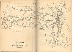
35:1919 map of the turnpikes in Massachusetts
18:Concord Avenue (Cambridge, Massachusetts)
227:19th-century turnpikes in Massachusetts
161:
7:
242:Streets in Cambridge, Massachusetts
25:
175:The Cambridge Historical Society
42:Cambridge and Concord Turnpike
1:
278:
252:History of Massachusetts
27:Highway in Massachusetts
257:Roads in Massachusetts
247:Concord, Massachusetts
100:, and then onwards to
54:Concord, Massachusetts
37:
212:Frederic James Wood,
58:Massachusetts Route 2
33:
133:, and the other in
82:Middlesex Turnpike
70:West Boston Bridge
38:
169:Hastings, Lewis.
64:Route description
16:(Redirected from
269:
191:
190:
188:
186:
177:. Archived from
166:
86:Cambridge Common
21:
277:
276:
272:
271:
270:
268:
267:
266:
232:
231:
223:
195:
194:
184:
182:
181:on 11 June 2016
168:
167:
163:
158:
115:
90:Harvard College
66:
36:
28:
23:
22:
15:
12:
11:
5:
275:
273:
265:
264:
259:
254:
249:
244:
234:
233:
230:
229:
222:
219:
218:
217:
210:
203:
193:
192:
160:
159:
157:
154:
146:public highway
114:
111:
98:Belmont Center
78:Kendall Square
65:
62:
34:
26:
24:
14:
13:
10:
9:
6:
4:
3:
2:
274:
263:
260:
258:
255:
253:
250:
248:
245:
243:
240:
239:
237:
228:
225:
224:
220:
215:
211:
208:
204:
201:
197:
196:
180:
176:
172:
165:
162:
155:
153:
151:
147:
142:
140:
136:
132:
128:
123:
120:
119:Massachusetts
112:
110:
108:
103:
99:
95:
91:
87:
83:
79:
75:
74:Cambridgeport
71:
63:
61:
59:
55:
51:
47:
44:was an early
43:
32:
19:
213:
206:
199:
185:14 September
183:. Retrieved
179:the original
174:
164:
143:
124:
116:
67:
41:
39:
88:, skirting
236:Categories
156:References
131:Fresh Pond
94:Fresh Pond
150:Lexington
127:tollgates
107:Route 128
50:Cambridge
221:See also
48:between
46:turnpike
139:lawsuit
135:Lincoln
113:History
102:Lincoln
76:(now
187:2013
125:Two
52:and
40:The
96:to
72:in
238::
173:.
152:.
189:.
20:)
Text is available under the Creative Commons Attribution-ShareAlike License. Additional terms may apply.