40:
52:
544:. The stream then bends northwest into a canyon, receiving West Fork Cow Creek on the left and Middle Creek from the right. It then continues northwards, bending steadily eastwards and doubling back on its former course. The river emerges from the mountains near
531:
at the confluence of South Fork Cow Creek and East Fork Cow Creek. The south fork, which is much larger, is sometimes considered the main stem. In its first few miles the creek flows west through an agricultural valley and through
368:
771:
766:
566:
675:
635:
600:
287:
206:
128:
666:
626:
591:
561:
734:
707:
671:
631:
596:
761:
39:
661:
621:
586:
528:
516:
512:
354:
273:
269:
192:
114:
110:
548:, and bends sharply south around a ridge, joining the South Umpqua about 2 miles (3 km) west of
533:
549:
350:
508:
500:
484:
338:
56:
Map of the Umpqua River watershed including Cow Creek (the C-shaped watercourse near the bottom)
17:
503:. It drains an area of over 400 square miles (1,000 km) on the western foothills of the
541:
696:
545:
478:
51:
755:
504:
70:
537:
697:"USGS Gage #14310000 on Cow Creek near Riddle, Oregon –– Water-Data Report 2009"
333:
383:
370:
302:
289:
221:
208:
143:
130:
496:
80:
540:
for several miles and receives Windy Creek from the right at
728:
259:
About 3 miles (4.8 km) east-southeast of Devils Flat
515:, a tiny portion in the southeast extends into northern
511:. Although the vast majority of the basin is within
476:
471:
457:
447:
437:
429:
417:
409:
399:
360:
344:
332:
318:
279:
263:
255:
237:
198:
185:
177:
159:
120:
103:
95:
86:
76:
66:
61:
32:
8:
567:Cow Creek Band of Umpqua Tribe of Indians
463:38,400 cu ft/s (1,090 m/s)
676:United States Department of the Interior
636:United States Department of the Interior
601:United States Department of the Interior
495:is a medium-sized river in southwestern
578:
656:
654:
652:
29:
453:7.4 cu ft/s (0.21 m/s)
443:856 cu ft/s (24.2 m/s)
7:
667:Geographic Names Information System
627:Geographic Names Information System
592:Geographic Names Information System
421:456 sq mi (1,180 km)
413:44 mi (71 km), East-west
25:
704:National Water Information System
562:List of longest streams of Oregon
772:Rivers of Douglas County, Oregon
767:Rivers of Jackson County, Oregon
730:USGS Topo Maps for United States
50:
38:
735:United States Geological Survey
708:United States Geological Survey
672:United States Geological Survey
632:United States Geological Survey
597:United States Geological Survey
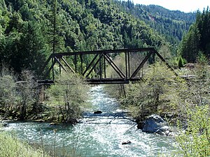
44:West Fork Bridge over Cow Creek
362: • coordinates
281: • coordinates
200: • coordinates
122: • coordinates
27:River in Oregon, United States
18:Cow Creek (South Umpqua River)
1:
87:Physical characteristics
401: • elevation
320: • elevation
243:4,500 ft (1,400 m)
239: • elevation
165:4,000 ft (1,200 m)
161: • elevation
536:. Cow Creek runs alongside
346: • location
265: • location
187: • location
109:A mile north of Round Top,
105: • location
788:
459: • maximum
449: • minimum
439: • average
324:2,402 ft (732 m)
467:
425:
328:
251:
247:
173:
169:
91:
49:
37:
527:The stream rises in the
405:636 ft (194 m)
733:(Map). Cartography by
587:"South Fork Cow Creek"
529:Umpqua National Forest
384:42.94694°N 123.33778°W
303:42.80167°N 122.99056°W
270:Umpqua National Forest
222:42.76722°N 122.93139°W
193:Umpqua National Forest
144:42.72611°N 122.99556°W
115:Umpqua National Forest
622:"East Fork Cow Creek"
499:, a tributary of the
534:Galesville Reservoir
389:42.94694; -123.33778
308:42.80167; -122.99056
227:42.76722; -122.93139
149:42.72611; -122.99556
99:South Fork Cow Creek
472:Basin features
380: /
299: /
218: /
181:East Fork Cow Creek
140: /
509:Oregon Coast Range
501:South Umpqua River
485:South Umpqua River
339:South Umpqua River
191:Richter Mountain,
490:
489:
256:Source confluence
16:(Redirected from
779:
762:Rivers of Oregon
746:
745:
743:
742:
725:
719:
718:
716:
715:
701:
693:
687:
686:
684:
683:
658:
647:
646:
644:
643:
618:
612:
611:
609:
608:
583:
542:Glendale, Oregon
481:
460:
450:
440:
395:
394:
392:
391:
390:
385:
381:
378:
377:
376:
373:
321:
314:
313:
311:
310:
309:
304:
300:
297:
296:
295:
292:
282:
266:
240:
233:
232:
230:
229:
228:
223:
219:
216:
215:
214:
211:
201:
188:
162:
155:
154:
152:
151:
150:
145:
141:
138:
137:
136:
133:
123:
106:
54:
42:
30:
21:
787:
786:
782:
781:
780:
778:
777:
776:
752:
751:
750:
749:
740:
738:
727:
726:
722:
713:
711:
699:
695:
694:
690:
681:
679:
660:
659:
650:
641:
639:
620:
619:
615:
606:
604:
585:
584:
580:
575:
558:
525:
507:and within the
477:
458:
448:
438:
402:
388:
386:
382:
379:
374:
371:
369:
367:
366:
363:
347:
319:
307:
305:
301:
298:
293:
290:
288:
286:
285:
280:
264:
238:
226:
224:
220:
217:
212:
209:
207:
205:
204:
199:
186:
160:
148:
146:
142:
139:
134:
131:
129:
127:
126:
121:
104:
57:
45:
28:
23:
22:
15:
12:
11:
5:
785:
783:
775:
774:
769:
764:
754:
753:
748:
747:
720:
688:
648:
613:
577:
576:
574:
571:
570:
569:
564:
557:
554:
524:
521:
517:Jackson County
513:Douglas County
488:
487:
482:
474:
473:
469:
468:
465:
464:
461:
455:
454:
451:
445:
444:
441:
435:
434:
431:
427:
426:
423:
422:
419:
415:
414:
411:
407:
406:
403:
400:
397:
396:
364:
361:
358:
357:
355:Douglas County
348:
345:
342:
341:
336:
330:
329:
326:
325:
322:
316:
315:
283:
277:
276:
274:Douglas County
267:
261:
260:
257:
253:
252:
249:
248:
245:
244:
241:
235:
234:
202:
196:
195:
189:
183:
182:
179:
175:
174:
171:
170:
167:
166:
163:
157:
156:
124:
118:
117:
111:Jackson County
107:
101:
100:
97:
93:
92:
89:
88:
84:
83:
78:
74:
73:
68:
64:
63:
59:
58:
55:
47:
46:
43:
35:
34:
26:
24:
14:
13:
10:
9:
6:
4:
3:
2:
784:
773:
770:
768:
765:
763:
760:
759:
757:
737:. ACME Mapper
736:
732:
731:
724:
721:
709:
705:
698:
692:
689:
677:
673:
669:
668:
663:
657:
655:
653:
649:
637:
633:
629:
628:
623:
617:
614:
602:
598:
594:
593:
588:
582:
579:
572:
568:
565:
563:
560:
559:
555:
553:
551:
547:
543:
539:
535:
530:
522:
520:
518:
514:
510:
506:
505:Cascade Range
502:
498:
494:
486:
483:
480:
475:
470:
466:
462:
456:
452:
446:
442:
436:
432:
428:
424:
420:
416:
412:
408:
404:
398:
393:
365:
359:
356:
352:
349:
343:
340:
337:
335:
331:
327:
323:
317:
312:
284:
278:
275:
271:
268:
262:
258:
254:
250:
246:
242:
236:
231:
203:
197:
194:
190:
184:
180:
176:
172:
168:
164:
158:
153:
125:
119:
116:
112:
108:
102:
98:
94:
90:
85:
82:
79:
75:
72:
71:United States
69:
65:
60:
53:
48:
41:
36:
31:
19:
739:. Retrieved
729:
723:
712:. Retrieved
703:
691:
680:. Retrieved
678:. 1980-11-28
665:
640:. Retrieved
638:. 1980-11-28
625:
616:
605:. Retrieved
603:. 1986-05-22
590:
581:
538:Interstate 5
526:
492:
491:
479:River system
662:"Cow Creek"
550:Canyonville
387: /
375:123°20′16″W
351:Canyonville
306: /
294:122°59′26″W
225: /
213:122°55′53″W
147: /
135:122°59′44″W
756:Categories
741:2010-08-23
714:2010-08-23
682:2010-08-23
642:2010-08-23
607:2010-08-23
573:References
418:Basin size
372:42°56′49″N
291:42°48′06″N
210:42°46′02″N
178:2nd source
132:42°43′34″N
493:Cow Creek
430:Discharge
33:Cow Creek
556:See also
62:Location
67:Country
710:. 2009
546:Riddle
523:Course
497:Oregon
433:
410:Length
96:Source
81:Oregon
700:(PDF)
334:Mouth
77:State
758::
706:.
702:.
674:,
670:.
664:.
651:^
634:,
630:.
624:.
599:,
595:.
589:.
552:.
519:.
353:,
272:,
113:,
744:.
717:.
685:.
645:.
610:.
20:)
Text is available under the Creative Commons Attribution-ShareAlike License. Additional terms may apply.