156:
120:
163:
127:
35:
155:
119:
220:
276:. The summit of Crag Hill is about 0.62 miles (1 km) away from the top of Great Coum, the latter being the highest point on the ridge at 2,254 feet (687 m).
314:(YDTT). This is a long-distance walking route that takes in the ten highest peaks in the Yorkshire Dales with a combined ascent of 22,000 feet (6,700 m).
75:
442:
437:
415:
365:
340:
381:
214:
68:
284:
447:
411:
361:
336:
292:
288:
249:
233:
228:
199:
140:
261:
176:
431:
304:
296:
260:. It lies on the boundary of the Yorkshire Dales national park, but its summit is in
44:
279:
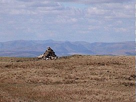
All three hills may be included in a single circular walk from High Moss near
269:
40:
90:
77:
280:
273:
253:
17:
34:
300:
265:
257:
207:
203:
180:
58:
268:. It is part of a ridge including the neighbouring fells of
406:
Lawrence, Paul; Maple, Les; Sparshatt, John, eds. (2009).
252:
in northern
England, not to be confused with the higher
291:
road. The views are extensive, with panoramas of the
227:
213:
195:
106:
67:
57:
52:
27:
310:The hill is listed as one of the waypoints in the
410:(8 ed.). Milnthorpe: Cicerone. p. 234.
185:Show map of the former South Lakeland district
360:. 1:25,000. Explorer. Ordnance Survey. 2016.
358:Yorkshire Dales - Southern & Western Area
335:. 1:50,000. Explorer. Ordnance Survey. 2015.
8:
24:
323:
7:
333:Wensleydale & Upper Wharfedale
14:
162:
126:
161:
154:
125:
118:
33:
443:Mountains and hills of Cumbria
248:is on the western edge of the
1:
408:The UK trailwalker's handbook
438:Peaks of the Yorkshire Dales
256:elsewhere in the county of
145:Show map of Yorkshire Dales
464:
63:682 m (2,238 ft)
15:
111:
32:
16:Not to be confused with
312:Yorkshire Dales Top Ten
386:yorkshiredales.org.uk
91:54.24446°N 2.47413°W
87: /
41:triangulation point
96:54.24446; -2.47413
53:Highest point
417:978-1-85284-579-7
243:
242:
47:in the background
455:
422:
421:
403:
397:
396:
394:
392:
378:
372:
371:
353:
347:
346:
328:
223:
186:
165:
164:
158:
146:
139:Location in the
129:
128:
122:
102:
101:
99:
98:
97:
92:
88:
85:
84:
83:
80:
37:
25:
463:
462:
458:
457:
456:
454:
453:
452:
428:
427:
426:
425:
418:
405:
404:
400:
390:
388:
380:
379:
375:
368:
355:
354:
350:
343:
330:
329:
325:
320:
293:Yorkshire Dales
250:Yorkshire Dales
219:
200:Yorkshire Dales
191:
190:
189:
188:
187:
184:
183:
173:
172:
171:
170:
166:
149:
148:
147:
144:
143:
141:Yorkshire Dales
137:
136:
135:
134:
130:
95:
93:
89:
86:
81:
78:
76:
74:
73:
48:
21:
12:
11:
5:
461:
459:
451:
450:
445:
440:
430:
429:
424:
423:
416:
398:
373:
366:
356:"OL2" (Map).
348:
341:
322:
321:
319:
316:
262:South Lakeland
241:
240:
231:
225:
224:
217:
211:
210:
197:
193:
192:
177:South Lakeland
174:
168:
167:
160:
159:
153:
152:
151:
150:
138:
132:
131:
124:
123:
117:
116:
115:
114:
113:
112:
109:
108:
104:
103:
71:
65:
64:
61:
55:
54:
50:
49:
38:
30:
29:
13:
10:
9:
6:
4:
3:
2:
460:
449:
448:Dent, Cumbria
446:
444:
441:
439:
436:
435:
433:
419:
413:
409:
402:
399:
387:
383:
377:
374:
369:
367:9780319263310
363:
359:
352:
349:
344:
342:9780319263419
338:
334:
331:"98" (Map).
327:
324:
317:
315:
313:
308:
306:
305:Lake District
302:
298:
297:Howgill Fells
294:
290:
286:
282:
277:
275:
271:
267:
263:
259:
255:
251:
247:
238:
235:
232:
230:
226:
222:
218:
216:
212:
209:
205:
201:
198:
194:
182:
178:
157:
142:
121:
110:
105:
100:
72:
70:
66:
62:
60:
56:
51:
46:
42:
36:
31:
26:
23:
19:
407:
401:
389:. Retrieved
385:
376:
357:
351:
332:
326:
311:
309:
278:
245:
244:
236:
175:Location in
22:
391:28 November
382:"Gragareth"
94: /
69:Coordinates
45:Mickle Fell
39:The summit
432:Categories
318:References
270:Great Coum
264:district,
237:Landranger
79:54°14′40″N
281:Whernside
274:Gragareth
254:Crag Hill
246:Crag Hill
169:Crag Hill
133:Crag Hill
107:Geography
82:2°28′27″W
59:Elevation
28:Crag Hill
18:Crag Hill
307:beyond.
303:and the
301:Pennines
285:Ingleton
229:Topo map
221:SD692833
196:Location
283:on the
266:Cumbria
258:Cumbria
215:OS grid
208:England
204:Cumbria
181:Cumbria
414:
364:
339:
299:, the
43:with
412:ISBN
393:2017
362:ISBN
337:ISBN
289:Dent
272:and
287:to
434::
384:.
295:,
239:98
234:OS
206:,
179:,
420:.
395:.
370:.
345:.
202:/
20:.
Text is available under the Creative Commons Attribution-ShareAlike License. Additional terms may apply.