51:
87:
829:
468:
456:
518:
874:
480:
31:
840:
503:
653:
850:
94:
58:
128:
327:. It is 2.5 miles (4.0 km) long, 0.6 miles (0.97 km) wide, 140 feet (43 m) deep, and has an area of 2.5 square kilometres (0.97 sq mi). The lake's primary inflow is Buttermere Dubs, itself the outflow of
405:) "'crumbaco'-'crooked'". This may refer to the winding course of the River Cocker, which flows out of the lake, or refer to the bending nature of the lake itself. The word "'water' is the main Lakeland term for 'lake'".
708:
384:
86:
701:
612:
50:
694:
425:, and many smaller towns, villages, and hamlets in the surrounding area for drinking and all other uses. This use ceased in October 2022 with the commissioning of the
455:
467:
915:
479:
517:
944:
436:
Crummock Water gained attention in 1988 when the body of Sheena Owlett was found in the lake. It later transpired she had been murdered in
934:
843:
616:
159:
717:
502:
292:
681:
949:
908:
572:
352:
364:
671:
588:
413:
Water from the lake was treated at
Cornhow water treatment works, near Loweswater, and was distributed to the towns of
383:
described it 'no pairing of hill and lake in
Lakeland have a closer partnership than these'. The lake is owned by the
71:
901:
853:
489:
336:
686:
332:
213:
36:
778:
393:, the highest waterfall in the Lake District, feeds the lake and has a drop of 170 feet (52 m).
939:
728:
324:
201:
30:
873:
568:
546:
509:
414:
380:
303:
885:
542:
426:
402:
773:
768:
763:
738:
658:
441:
225:
928:
320:
191:
141:
833:
753:
748:
676:
652:
360:
788:
758:
390:
340:
813:
808:
783:
733:
648:
493:
422:
348:
328:
174:
161:
803:
798:
793:
485:
430:
376:
344:
127:
107:
638:
367:, and its western shore forms part of the western boundary of the parish.
437:
418:
881:
613:"Times & Star - Public misled over fluoride in west Cumbrian water"
356:
202:
145:
111:
401:"The meaning of 'Crummock' seems to be 'Crooked one', from British" (
214:
567:. Nottingham: English Place-Name Society. pp. lx, 423 p.89.
316:
690:
379:
runs the full length of the lake on its western side; as
589:"DEFRA - North Cumbria Sporadic Cryptosporidiosis Study"
889:
718:
Lakes and principal tarns in the
English Lake District
291:
287:
279:
271:
263:
255:
247:
239:
235:
224:
212:
200:
190:
151:
137:
23:
152:
909:
702:
8:
461:Crummock Water with Grasmoor in the distance
916:
902:
709:
695:
687:
20:
565:A dictionary of Lake District place-names
523:Crummock Water from the south-eastern end
558:
556:
473:Looking down Crummock towards Buttermere
116:Show map of the former Allerdale Borough
534:
508:The western end of Crummock Water from
451:
682:The Cumbria Directory - Crummock Water
93:
57:
7:
870:
868:
849:
677:An Illustrated Guide -Crummock Water
351:. It is in the unitary authority of
259:2.57 km (0.99 sq mi)
888:. You can help Knowledge (XXG) by
14:
496:and Crummock Water from Haystacks
872:
848:
839:
838:
827:
651:
516:
501:
478:
466:
454:
126:
92:
85:
56:
49:
29:
278:
270:
262:
254:
246:
238:
639:"Home - West Cumbria Pipeline"
429:pipeline to bring supply from
1:
945:Buttermere, Cumbria (village)
355:and the ceremonial county of
136:
76:Show map of the Lake District
275:6.26 mi (10.07 km)
72:Lake District National Park
966:
935:Lakes of the Lake District
867:
304:not a well-defined measure
251:0.6 mi (0.97 km)
822:
724:
331:, and its outflow is the
301:
243:2.5 mi (4.0 km)
125:
43:
28:
16:Lake in Cumbria, England
950:Cumbria geography stubs
283:96 m (315 ft)
267:140 ft (43 m)
884:location article is a
563:Whaley, Diana (2006).
779:Haweswater Reservoir
343:before entering the
35:Crummock Water from
619:on 24 February 2015
171: /
729:Bassenthwaite Lake
335:, which meets the
325:North West England
897:
896:
862:
861:
510:Rannerdale Knotts
415:Silloth-on-Solway
381:Alfred Wainwright
310:
309:
280:Surface elevation
957:
918:
911:
904:
876:
869:
852:
851:
842:
841:
834:Lakes portal
832:
831:
830:
711:
704:
697:
688:
661:
656:
655:
643:
642:
635:
629:
628:
626:
624:
615:. Archived from
609:
603:
602:
600:
598:
593:
585:
579:
578:
560:
551:
550:
543:"Crummock Water"
539:
520:
505:
482:
470:
458:
427:United Utilities
403:Brythonic Celtic
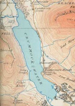
302:Shore length is
216:
215:Primary outflows
204:
186:
185:
183:
182:
181:
176:
175:54.550°N 3.300°W
172:
169:
168:
167:
164:
154:
130:
117:
96:
95:
89:
77:
70:Location in the
60:
59:
53:
33:
21:
965:
964:
960:
959:
958:
956:
955:
954:
925:
924:
923:
922:
865:
863:
858:
828:
826:
818:
769:Esthwaite Water
764:Ennerdale Water
720:
715:
668:
657:
650:
647:
646:
637:
636:
632:
622:
620:
611:
610:
606:
596:
594:
591:
587:
586:
582:
575:
562:
561:
554:
541:
540:
536:
531:
524:
521:
512:
506:
497:
483:
474:
471:
462:
459:
450:
411:
399:
373:
359:. It is in the
228: countries
208:Buttermere Dubs
203:Primary inflows
179:
177:
173:
170:
165:
162:
160:
158:
157:
133:
121:
120:
119:
118:
115:
114:
104:
103:
102:
101:
97:
80:
79:
78:
75:
74:
68:
67:
66:
65:
61:
39:
17:
12:
11:
5:
963:
961:
953:
952:
947:
942:
937:
927:
926:
921:
920:
913:
906:
898:
895:
894:
877:
860:
859:
857:
856:
846:
836:
823:
820:
819:
817:
816:
811:
806:
801:
796:
791:
786:
781:
776:
771:
766:
761:
756:
751:
746:
744:Crummock Water
741:
739:Coniston Water
736:
731:
725:
722:
721:
716:
714:
713:
706:
699:
691:
685:
684:
679:
674:
672:Crummock Water
667:
666:External links
664:
663:
662:
659:Cumbria portal
645:
644:
630:
604:
580:
573:
552:
533:
532:
530:
527:
526:
525:
522:
515:
513:
507:
500:
498:
484:
477:
475:
472:
465:
463:
460:
453:
449:
446:
442:West Yorkshire
410:
407:
398:
395:
385:National Trust
372:
369:
313:Crummock Water
308:
307:
299:
298:
295:
289:
288:
285:
284:
281:
277:
276:
273:
269:
268:
265:
261:
260:
257:
253:
252:
249:
245:
244:
241:
237:
236:
233:
232:
231:United Kingdom
229:
222:
221:
218:
210:
209:
206:
198:
197:
194:
188:
187:
180:54.550; -3.300
155:
149:
148:
139:
135:
134:
131:
123:
122:
105:
100:Crummock Water
99:
98:
91:
90:
84:
83:
82:
81:
69:
64:Crummock Water
63:
62:
55:
54:
48:
47:
46:
45:
44:
41:
40:
34:
26:
25:
24:Crummock Water
15:
13:
10:
9:
6:
4:
3:
2:
962:
951:
948:
946:
943:
941:
938:
936:
933:
932:
930:
919:
914:
912:
907:
905:
900:
899:
893:
891:
887:
883:
878:
875:
871:
866:
855:
847:
845:
837:
835:
825:
824:
821:
815:
812:
810:
807:
805:
802:
800:
797:
795:
792:
790:
787:
785:
782:
780:
777:
775:
772:
770:
767:
765:
762:
760:
757:
755:
752:
750:
749:Derwent Water
747:
745:
742:
740:
737:
735:
732:
730:
727:
726:
723:
719:
712:
707:
705:
700:
698:
693:
692:
689:
683:
680:
678:
675:
673:
670:
669:
665:
660:
654:
649:
640:
634:
631:
618:
614:
608:
605:
590:
584:
581:
576:
570:
566:
559:
557:
553:
548:
544:
538:
535:
528:
519:
514:
511:
504:
499:
495:
491:
487:
481:
476:
469:
464:
457:
452:
447:
445:
443:
439:
434:
432:
428:
424:
420:
416:
408:
406:
404:
396:
394:
392:
388:
386:
382:
378:
370:
368:
366:
362:
358:
354:
350:
346:
342:
338:
337:River Derwent
334:
330:
326:
322:
321:Lake District
318:
314:
305:
300:
296:
294:
290:
286:
282:
274:
266:
258:
250:
242:
234:
230:
227:
223:
219:
217:
211:
207:
205:
199:
195:
193:
189:
184:
156:
150:
147:
143:
142:Lake District
140:
129:
124:
113:
109:
88:
73:
52:
42:
38:
32:
27:
22:
19:
890:expanding it
879:
864:
754:Devoke Water
743:
633:
621:. Retrieved
617:the original
607:
595:. Retrieved
583:
564:
537:
435:
412:
400:
389:
375:The hill of
374:
333:River Cocker
312:
311:
272:Shore length
256:Surface area
220:River Cocker
106:Location in
18:
789:Rydal Water
759:Elter Water
623:24 February
597:24 February
391:Scale Force
341:Cockermouth
240:Max. length
178: /
153:Coordinates
940:Cumberland
929:Categories
814:Windermere
809:Wast Water
784:Loweswater
734:Buttermere
574:0904889726
547:Waterscape
529:References
494:Buttermere
423:Workington
365:Buttermere
353:Cumberland
349:Workington
329:Buttermere
264:Max. depth
248:Max. width
132:map (1925)
804:Ullswater
799:Thirlmere
794:Tarn Hows
486:High Crag
431:Thirlmere
397:Etymology
377:Mellbreak
371:Geography
345:Irish Sea
108:Allerdale
844:Category
774:Grasmere
438:Wetherby
419:Maryport
138:Location
37:Red Pike
882:Cumbria
854:Commons
448:Gallery
409:History
357:Cumbria
319:in the
293:Islands
163:54°33′N
146:Cumbria
112:Cumbria
571:
490:Pillar
361:parish
196:Ribbon
166:3°18′W
880:This
592:(PDF)
315:is a
226:Basin
886:stub
625:2015
599:2015
569:ISBN
317:lake
192:Type
387:.
363:of
347:at
339:at
323:in
931::
555:^
545:.
492:,
488:,
444:.
440:,
433:.
421:,
417:,
144:,
110:,
917:e
910:t
903:v
892:.
710:e
703:t
696:v
641:.
627:.
601:.
577:.
549:.
306:.
297:6
Text is available under the Creative Commons Attribution-ShareAlike License. Additional terms may apply.