60:
72:
761:
46:
156:
431:
In the township the population was spread out, with 24.5% under the age of 18, 10.1% from 18 to 24, 27.7% from 25 to 44, 23.4% from 45 to 64, and 14.2% who were 65 years of age or older. The median age was 37 years. For every 100 females there were 107.8 males. For every 100 females age 18 and over,
427:
living together, 4.8% had a female householder with no husband present, and 23.8% were non-families. 20.7% of all households were made up of individuals, and 8.2% had someone living alone who was 65 years of age or older. The average household size was 2.67 and the average family size was 3.05.
395:
of 2000, there were 1,280 people, 478 households, and 364 families residing in the township. The population density was 34.9 inhabitants per square mile (13.5/km). There were 607 housing units at an average density of 16.5/sq mi (6.4/km). The racial makeup of the township was 98.75%
59:
1118:
614:
435:
The median income for a household in the township was $ 35,703, and the median income for a family was $ 38,750. Males had a median income of $ 30,865 versus $ 21,618 for females. The
1157:
884:
879:
819:
824:
814:
804:
71:
839:
834:
829:
909:
869:
854:
849:
789:
904:
844:
784:
919:
899:
864:
799:
794:
607:
670:
45:
942:
262:
600:
213:
914:
530:
451:
278:
889:
293:, the township has a total area of 36.7 square miles (95 km), of which 36.7 square miles (95 km) is land and 0.03% is water.
1162:
1034:
592:
470:
188:
104:
624:
499:
232:
109:
874:
401:
859:
779:
405:
274:
50:
953:
675:
1095:
1019:
963:
924:
894:
750:
575:
409:
290:
1054:
1049:
994:
947:
745:
958:
715:
705:
357:
342:
327:
240:
725:
710:
695:
665:
646:
82:
1044:
1039:
1029:
989:
934:
771:
740:
720:
680:
423:
There were 478 households, out of which 33.3% had children under the age of 18 living with them, 66.3% were
228:
36:
1024:
1009:
1004:
735:
730:
700:
685:
657:
413:
1014:
535:
1102:
999:
690:
417:
198:
1072:
979:
397:
968:
549:
439:
for the township was $ 18,592. About 6.0% of families and 8.8% of the population were below the
436:
1151:
440:
236:
97:
639:
1064:
92:
1133:
1120:
179:
443:, including 11.2% of those under age 18 and 9.7% of those age 65 or over.
1086:‡This populated place also has portions in an adjacent county or counties
424:
392:
64:
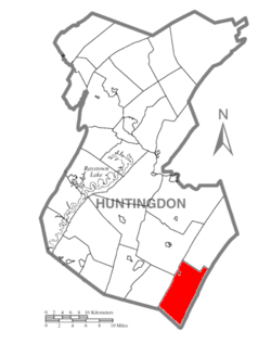
Map of
Huntingdon County, Pennsylvania Highlighting Dublin Township
205:
184:
525:
596:
759:
571:
494:
492:
490:
488:
1081:
1063:
978:
933:
770:
656:
212:
195:
178:
170:
162:
149:
144:
136:
128:
120:
115:
103:
91:
81:
23:
239:, United States. The population was 1,182 at the
608:
8:
1158:Townships in Huntingdon County, Pennsylvania
500:"City and Town Population Totals: 2020-2022"
615:
601:
593:
420:of any race were 0.70% of the population.
300:
263:Southern Huntingdon County School District
20:
462:
211:
177:
143:
114:
80:
56:
42:
18:Township in Pennsylvania, United States
526:"National Register Information System"
320:
76:Map of Huntingdon County, Pennsylvania
194:
169:
161:
148:
135:
132:36.81 sq mi (95.35 km)
127:
124:36.82 sq mi (95.36 km)
119:
102:
90:
68:
7:
531:National Register of Historic Places
452:Irish Place Names in Other Countries
412:, and 0.70% from two or more races.
279:National Register of Historic Places
140:0.00 sq mi (0.01 km)
623:Municipalities and communities of
550:"Census of Population and Housing"
310:
14:
155:
154:
70:
58:
44:
626:Huntingdon County, Pennsylvania
1:
473:. United States Census Bureau
275:Shade Gap Feed and Flour Mill
51:Shade Gap Feed and Flour Mill
576:United States Census Bureau
471:"2016 U.S. Gazetteer Files"
291:United States Census Bureau
174:34.69/sq mi (13.39/km)
163: • Estimate
1179:
1163:Townships in Pennsylvania
1091:
757:
637:
384:
371:
356:
341:
326:
319:
314:
309:
306:
258:Local phone exchange: 259
69:
57:
43:
34:
432:there were 106.0 males.
764:
1134:40.10000°N 77.86639°W
763:
572:"U.S. Census website"
536:National Park Service
385:U.S. Decennial Census
302:Historical population
197: • Summer (
1104:United States portal
1035:Pennsylvania Furnace
171: • Density
1139:40.10000; -77.86639
1130: /
1097:Pennsylvania portal
303:
247:General information
765:
506:. US Census Bureau
301:
277:was listed on the
150: • Total
137: • Water
121: • Total
27:Huntingdon County,
1113:
1112:
437:per capita income
389:
388:
289:According to the
261:School District:
233:Huntingdon County
222:
221:
129: • Land
1170:
1145:
1144:
1142:
1141:
1140:
1135:
1131:
1128:
1127:
1126:
1123:
1105:
1098:
762:
649:
642:
632:
627:
617:
610:
603:
594:
587:
586:
584:
582:
568:
562:
561:
559:
557:
546:
540:
539:
522:
516:
515:
513:
511:
496:
483:
482:
480:
478:
467:
402:African American
322:
317:
312:
304:
202:
158:
157:
74:
62:
48:
25:Dublin Township,
21:
1178:
1177:
1173:
1172:
1171:
1169:
1168:
1167:
1148:
1147:
1138:
1136:
1132:
1129:
1124:
1121:
1119:
1117:
1116:
1114:
1109:
1103:
1096:
1087:
1077:
1059:
981:
974:
929:
766:
760:
755:
652:
647:
640:
633:
630:
625:
621:
591:
590:
580:
578:
570:
569:
565:
555:
553:
548:
547:
543:
538:. July 9, 2010.
524:
523:
519:
509:
507:
498:
497:
486:
476:
474:
469:
468:
464:
459:
449:
425:married couples
406:Native American
315:
299:
287:
271:
252:ZIP Code: 17255
249:
225:Dublin Township
196:
77:
65:
53:
39:
30:
28:
26:
19:
12:
11:
5:
1176:
1174:
1166:
1165:
1160:
1150:
1149:
1111:
1110:
1108:
1107:
1100:
1092:
1089:
1088:
1085:
1083:
1079:
1078:
1076:
1075:
1069:
1067:
1061:
1060:
1058:
1057:
1052:
1047:
1042:
1037:
1032:
1027:
1022:
1017:
1012:
1007:
1002:
997:
992:
986:
984:
980:Unincorporated
976:
975:
973:
972:
966:
961:
956:
954:McConnellstown
951:
945:
939:
937:
931:
930:
928:
927:
922:
917:
912:
907:
902:
897:
892:
887:
882:
877:
872:
867:
862:
857:
852:
847:
842:
837:
832:
827:
822:
817:
812:
807:
802:
797:
792:
787:
782:
776:
774:
768:
767:
758:
756:
754:
753:
748:
743:
738:
733:
728:
723:
718:
713:
708:
703:
698:
693:
688:
683:
678:
676:Broad Top City
673:
668:
662:
660:
654:
653:
638:
635:
634:
622:
620:
619:
612:
605:
597:
589:
588:
563:
541:
517:
484:
461:
460:
458:
455:
448:
445:
387:
386:
382:
381:
378:
376:
373:
369:
368:
365:
363:
360:
354:
353:
350:
348:
345:
339:
338:
335:
333:
330:
324:
323:
318:
313:
308:
298:
295:
286:
283:
270:
267:
266:
265:
259:
256:
255:Area Code: 814
253:
248:
245:
220:
219:
216:
210:
209:
203:
193:
192:
182:
176:
175:
172:
168:
167:
164:
160:
159:
151:
147:
146:
142:
141:
138:
134:
133:
130:
126:
125:
122:
118:
117:
113:
112:
107:
101:
100:
95:
89:
88:
85:
79:
78:
75:
67:
66:
63:
55:
54:
49:
41:
40:
35:
32:
31:
24:
17:
13:
10:
9:
6:
4:
3:
2:
1175:
1164:
1161:
1159:
1156:
1155:
1153:
1146:
1143:
1106:
1101:
1099:
1094:
1093:
1090:
1084:
1080:
1074:
1071:
1070:
1068:
1066:
1062:
1056:
1053:
1051:
1048:
1046:
1043:
1041:
1038:
1036:
1033:
1031:
1028:
1026:
1023:
1021:
1020:McAlevys Fort
1018:
1016:
1013:
1011:
1008:
1006:
1003:
1001:
998:
996:
993:
991:
988:
987:
985:
983:
977:
970:
967:
965:
964:Warriors Mark
962:
960:
957:
955:
952:
949:
946:
944:
941:
940:
938:
936:
932:
926:
923:
921:
918:
916:
915:Warriors Mark
913:
911:
908:
906:
903:
901:
898:
896:
893:
891:
888:
886:
883:
881:
878:
876:
873:
871:
868:
866:
863:
861:
858:
856:
853:
851:
848:
846:
843:
841:
838:
836:
833:
831:
828:
826:
823:
821:
818:
816:
813:
811:
808:
806:
803:
801:
798:
796:
793:
791:
788:
786:
783:
781:
778:
777:
775:
773:
769:
752:
751:Three Springs
749:
747:
744:
742:
739:
737:
734:
732:
729:
727:
724:
722:
719:
717:
714:
712:
709:
707:
704:
702:
699:
697:
694:
692:
689:
687:
684:
682:
679:
677:
674:
672:
669:
667:
664:
663:
661:
659:
655:
651:
650:
643:
636:
631:United States
628:
618:
613:
611:
606:
604:
599:
598:
595:
577:
573:
567:
564:
551:
545:
542:
537:
533:
532:
527:
521:
518:
505:
501:
495:
493:
491:
489:
485:
472:
466:
463:
456:
454:
453:
446:
444:
442:
438:
433:
429:
426:
421:
419:
415:
411:
408:, 0.08% from
407:
403:
399:
394:
383:
379:
377:
374:
370:
366:
364:
361:
359:
355:
351:
349:
346:
344:
340:
336:
334:
331:
329:
325:
305:
296:
294:
292:
284:
282:
280:
276:
268:
264:
260:
257:
254:
251:
250:
246:
244:
242:
238:
234:
230:
226:
217:
215:
207:
204:
200:
190:
189:Eastern (EST)
186:
183:
181:
173:
165:
152:
139:
131:
123:
111:
108:
106:
99:
96:
94:
87:United States
86:
84:
73:
61:
52:
47:
38:
33:
22:
16:
1115:
1055:Water Street
1050:Spruce Creek
995:Blairs Mills
948:Burnt Cabins
890:Spruce Creek
809:
746:Shirleysburg
645:
579:. Retrieved
566:
554:. Retrieved
552:. Census.gov
544:
529:
520:
508:. Retrieved
503:
475:. Retrieved
465:
450:
441:poverty line
434:
430:
422:
390:
297:Demographics
288:
272:
237:Pennsylvania
224:
223:
218:42-061-20120
98:Pennsylvania
29:Pennsylvania
15:
1137: /
982:communities
959:Robertsdale
885:Springfield
716:Mount Union
706:Marklesburg
641:County seat
581:January 31,
510:January 31,
410:other races
372:2022 (est.)
241:2020 census
1152:Categories
1125:77°51′59″W
1122:40°06′00″N
1065:Ghost town
880:Smithfield
726:Petersburg
711:Mill Creek
696:Huntingdon
671:Birmingham
666:Alexandria
648:Huntingdon
504:Census.gov
477:August 14,
457:References
391:As of the
145:Population
110:Huntingdon
1082:Footnotes
1045:Saulsburg
1040:Puttstown
1030:Nossville
990:Ardenheim
943:Allenport
820:Henderson
772:Townships
741:Shade Gap
721:Orbisonia
681:Cassville
285:Geography
281:in 1990.
214:FIPS code
180:Time zone
1025:Neelyton
1010:Entriken
1005:Donation
825:Hopewell
815:Franklin
805:Cromwell
736:Saltillo
731:Rockhill
701:Mapleton
686:Coalmont
658:Boroughs
447:See also
414:Hispanic
404:, 0.16%
400:, 0.31%
229:township
37:Township
1015:Hesston
875:Shirley
840:Lincoln
835:Juniata
830:Jackson
556:June 4,
269:History
83:Country
1000:Calvin
910:Walker
870:Porter
860:Oneida
855:Morris
850:Miller
810:Dublin
790:Carbon
780:Barree
691:Dudley
418:Latino
393:census
307:Census
153:1,182
105:County
1073:Aitch
905:Union
845:Logan
785:Brady
398:White
375:1,182
367:−8.4%
362:1,182
347:1,290
332:1,280
227:is a
208:(EDT)
206:UTC-4
185:UTC-5
166:1,182
93:State
969:Wood
935:CDPs
925:Wood
920:West
900:Todd
895:Tell
865:Penn
800:Clay
795:Cass
583:2008
558:2016
512:2024
479:2017
380:0.0%
358:2020
352:0.8%
343:2010
328:2000
316:Note
311:Pop.
273:The
116:Area
416:or
231:in
199:DST
1154::
644::
629:,
574:.
534:.
528:.
502:.
487:^
321:%±
243:.
235:,
971:‡
950:‡
616:e
609:t
602:v
585:.
560:.
514:.
481:.
337:—
201:)
191:)
187:(
Text is available under the Creative Commons Attribution-ShareAlike License. Additional terms may apply.