49:
102:
122:
2216:
2228:
1369:
2240:
1386:
1361:
637:
621:
605:
589:
573:
196:
1344:
1237:
1248:
1263:
788:
407:
The entire parish forms the local service district of the parish of
Dumfries, established in 1966 to assess for fire protection. Community services were added to the assessment in 1967 and first aid and ambulance services in 1978.
397:
on the northwest by a line paralleling the southeastern line of the parish from east of Moon Pond to the southwestern corner of a grant to John Benn, which straddles
Allandale Road, then along the Benn grant to the Saint John
378:
on the Saint John River, about 300 metres upriver of
Rosborough Settlement Road, then along the prolongation of the grant line to the southern line of a grant to Arthur Henry on the western side of Duck Brook, west of
2258:
2311:
394:, then northerly along the railway grant and the prolongation of its eastern line to Shogomoc Lake, then running north-northwesterly along grant lines to a point about 825 metres east of Moon Pond;
972:"6 Wm. IV c. 45 An Act to amend and explain an Act, intituled An Act to alter the names of certain parts of three Parishes in the County of York, and to erect two separate Parishes therein.".
1440:
1098:
387:
2200:
1033:
Acts of the
General Assembly of Her Majesty's Province of New Brunswick, Passed in the Month of November, 1854, and in the Months of February, March, and April, 1855
2306:
1306:
62:
1433:
331:
In 1836 the Saint John River islands in front of
Dumfries were formally added to the parish, correcting an oversight in the legislation erecting Dumfries.
1805:
274:
48:
2023:
914:"3 Wm. IV c. 38 An Act to alter the Names of certain Parts of Three Parishes in the County of York, and to erect Two separate Parishes therein.".
862:"Communities in each of the 12 Regional Service Commissions (RSC) / Les communautés dans chacune des 12 Commissions de services régionaux (CSR)"
2056:
1426:
278:
2051:
1375:
310:
2243:
114:
1299:
1051:"57 Vic. c. 34 An Act to erect part of the Parishes of Prince William and Dumfries, in the County of York, into a separate Parish.".
1001:"13 Vic. c. 51 An Act to consolidate all the Laws now in force for the division of the Province into Counties, Towns and Parishes.".
2195:
2190:
1795:
1669:
1326:
745:
255:
134:
39:
1604:
2036:
2031:
1353:
1333:
338:
16:
This article is about the geographic parish, former local service district, and rural census subdivision. For the community, see
2061:
2046:
2041:
1818:
1458:
471:
368:
325:
314:
2071:
1893:
1511:
318:
861:
1539:
1292:
1031:"18 Vic. c. 45 An Act to erect a part of the Parish of Dumfries, in the County of York, into a separate Town or Parish.".
1614:
1400:
1395:
345:
2013:
2008:
2003:
1998:
1993:
1988:
1983:
1978:
1973:
1968:
1963:
1958:
1950:
1762:
1747:
282:
242:
221:
1863:
1697:
1639:
1634:
1554:
1471:
259:
139:
1717:
1501:
1654:
1659:
1649:
1619:
1599:
1579:
1491:
1549:
1878:
1858:
1692:
1609:
1569:
1466:
1081:
The original printed version is cited separately to distinguish it from the edited version available online.
444:
439:
375:
17:
1053:
Acts of the
General Assembly of Her Majesty's Province of New Brunswick. Passed in the Month of April, 1894
2219:
1868:
1843:
1813:
1677:
1564:
351:
In 1973 the islands in the Saint John River were removed from the parish. The islands were flooded by the
294:
1848:
1787:
1742:
1732:
1644:
1476:
454:
391:
1772:
1702:
1584:
374:
on the southeast by the southeastern line of a lot within a six-lot grant to St. Clement's Church in
231:
1284:
2227:
1888:
1873:
1225:
1221:
1217:
1004:
Acts of the
General Assembly of Her Mjaesty's Province of New Brunswick, Passed in the Year 1850
975:
Acts of the
General Assembly of His Majesty's Province of New Brunswick, Passed in the Year 1836
946:
Acts of the
General Assembly of His Majesty's Province of New Brunswick, Passed in the Year 1834
917:
Acts of the
General Assembly of His Majesty's Province of New Brunswick, Passed in the Year 1833
943:"4 Wm. IV c. 28 An Act to alter the Division Line between the Counties of York and Carleton.".
1833:
1823:
1757:
1712:
508:
503:
498:
380:
1132:
1752:
1559:
1167:
1727:
1264:"Census Profile, 2016 Census Dumfries, Parish [Census subdivision], New Brunswick"
1853:
1767:
523:
Parks, historic sites, and other noteworthy places at least partly within the parish.
2300:
2231:
1883:
1777:
1574:
1450:
1021:
Book was poorly proofread, resulting in title typo and reuse of page numbers 145–152.
352:
263:
127:
2085:
1838:
1828:
1707:
1544:
1002:
973:
944:
915:
1722:
1486:
1418:
1076:
1056:
1036:
1008:
979:
950:
921:
839:
1737:
1594:
1529:
1524:
1519:
1481:
2274:
2260:
890:
817:
324:
In 1834 the county line was altered to follow grant lines when it neared the
77:
64:
1687:
1682:
1629:
840:"New Brunswick Regulation 84-168 under the Municipalities Act (O.C. 84-582)"
212:
1589:
1534:
1192:
1152:
Remainder of parish on mapbooks 368, 387, 388, 406, and 407 at same site.
298:
1238:
2006 Statistics Canada Community Profile: Dumfries Parish, New Brunswick
1624:
1496:
94:
892:
A Monograph of the Place-Nomenclature of the Province of New Brunswick
1249:
2011 Statistics Canada Census Profile: Dumfries Parish, New Brunswick
267:
107:
328:, transferring several small areas between Dumfries and Woodstock.
238:
217:
334:
In 1850 Big and Little Coac Islands were removed from Dumfries.
293:
The parish may have been named in honour of Capt. Adam Allen, a
1422:
1288:
344:
In 1895 the rear of Dumfries was included in the newly erected
1011:: Government of New Brunswick. 1850. pp. 142–152, 145–149
383:, then westerly to the southwestern corner of the Henry grant;
536:
1115:
Remainder of parish on maps 125, 135, and 136 at same site.
1168:"Search the Canadian Geographical Names Database (CGNDB)"
1105:. Department of Natural Resources and Energy Development
1059:: Government of New Brunswick. 1894. pp. 157–160.
1039:: Government of New Brunswick. 1855. pp. 174–175.
2312:
Local service districts of York County, New Brunswick
924:: Government of New Brunswick. 1833. pp. 181–182
337:
In 1855 the western part of Dumfries was erected as
2181:
2070:
2022:
1949:
1902:
1804:
1786:
1668:
1510:
1457:
1079:: Government of New Brunswick. 1973. pp. 1–70.
953:: Government of New Brunswick. 1834. pp. 71–72
466:Bodies of water at least partly within the parish.
228:
211:
203:
187:
179:
171:
166:
158:
153:
145:
133:
113:
93:
30:
1315:Places adjacent to Dumfries Parish, New Brunswick
1193:"Explore New Brunswick's Protected Natural Areas"
388:New Brunswick and Canada Railway and Land Company
281:of the parish of Dumfries, which was a member of
1073:Revised Statutes of New Brunswick 1973 Volume IV
982:: Government of New Brunswick. 1836. p. 118
301:, who settled at the mouth of the Pokiok River.
416:Communities at least partly within the parish.
1434:
1300:
1258:
1256:
8:
1061:Available as a free ebook from Google Books.
1041:Available as a free ebook from Google Books.
812:
810:
783:
781:
53:Location within York County, New Brunswick.
1441:
1427:
1419:
1307:
1293:
1285:
1127:
1125:
1123:
1121:
513:more than ten other officially named lakes
420:indicate a name no longer in official use
27:
1093:
1091:
1089:
1087:
386:on the southwest by a large grant to the
1162:
1160:
1158:
1071:"Chapter T-3 Territorial Division Act".
671:
550:
277:, for governance purposes it formed the
777:
757:
210:
165:
162:298.51 km (115.26 sq mi)
152:
144:
92:
57:
45:
2307:Parishes of York County, New Brunswick
895:. Royal Society of Canada. p. 231
818:"Chapter T-3 Territorial Division Act"
764:Not including brooks, ponds or coves.
227:
202:
186:
178:
170:
157:
132:
112:
7:
1322:
1103:Provincial Archives of New Brunswick
527:Pokiok Stream Protected Natural Area
2239:
309:Dumfries was erected in 1833 from
14:
1140:Transportation and Infrastructure
746:List of parishes in New Brunswick
283:Capital Region Service Commission
2238:
2226:
2215:
2214:
1384:
1367:
1359:
1342:
636:
635:
620:
619:
604:
603:
588:
587:
572:
571:
195:
194:
120:
100:
47:
2090:Buctouche Micmac Band Extension
25:Parish in New Brunswick, Canada
2286:Dumfries Parish, New Brunswick
499:Little Magaguadavic Throughway
1:
2082:Big Hole Tract 8 (South Half)
2079:Big Hole Tract 8 (North Half)
1385:
1343:
1142:. Government of New Brunswick
842:. Government of New Brunswick
820:. Government of New Brunswick
2182:Non-administrative divisions
2123:Metepenagiag Urban Reserve 8
2120:Metepenagiag Urban Reserve 3
1951:Regional service commissions
1368:
1360:
363:Dumfries Parish is bounded:
889:Ganong, William F. (1896).
869:Government of New Brunswick
2328:
15:
2244:WikiProject:New Brunswick
2209:
1320:
188: • Change
58:
46:
37:
708:Both English and French
504:Little Magaguadavic Lake
367:on the northeast by the
2201:Local service districts
18:Dumfries, New Brunswick
2220:Category:New Brunswick
1869:Miramichi River Valley
279:local service district
275:2023 governance reform
204: • Dwellings
2275:45.96500°N 67.15000°W
1788:Regional municipality
1376:Prince William Parish
311:Prince William Parish
230: • Summer (
183:1.4/km (4/sq mi)
1703:Fredericton Junction
1172:Government of Canada
668:Mother tongue (2016)
519:Other notable places
487:Little Pokiok Stream
180: • Density
2280:45.96500; -67.15000
2270: /
2126:Metepenagiag Uta'nk
1655:Vallée-des-Rivières
1550:Grand Bay–Westfield
1266:. Statistics Canada
1216:Statistics Canada:
313:. and that part of
74: /
1889:Sunbury-York South
1874:Nackawic-Millville
1327:Southampton Parish
299:Dumfries, Scotland
172: • Total
2253:
2252:
1979:Greater Miramichi
1959:Acadian Peninsula
1921:Greater Miramichi
1909:Acadian Peninsula
1834:Eastern Charlotte
1824:Campobello Island
1806:Rural communities
1758:Southern Victoria
1713:Fundy-St. Martins
1413:
1412:
1408:
1407:
1354:Canterbury Parish
1334:Queensbury Parish
795:. 26 October 2022
793:Statistics Canada
736:
735:
729:
728:
655:
654:
509:Magaguadavic Lake
381:Magaguadavic Lake
339:Canterbury Parish
256:geographic parish
249:
248:
191:
159: • Land
2319:
2294:
2293:
2291:
2290:
2289:
2287:
2282:
2281:
2276:
2271:
2268:
2267:
2266:
2263:
2242:
2241:
2230:
2218:
2217:
2108:Indian Island 28
2037:Anglophone South
2032:Anglophone North
2024:School districts
1819:Butternut Valley
1753:Nouvelle-Arcadie
1560:Grand-Bouctouche
1449:Subdivisions of
1443:
1436:
1429:
1420:
1388:
1387:
1371:
1370:
1363:
1362:
1346:
1345:
1323:
1309:
1302:
1295:
1286:
1276:
1275:
1273:
1271:
1260:
1251:
1246:
1240:
1235:
1229:
1214:
1208:
1207:
1205:
1203:
1189:
1183:
1182:
1180:
1178:
1164:
1153:
1151:
1149:
1147:
1137:
1129:
1116:
1114:
1112:
1110:
1095:
1082:
1080:
1068:
1062:
1060:
1048:
1042:
1040:
1028:
1022:
1020:
1018:
1016:
998:
992:
991:
989:
987:
969:
963:
962:
960:
958:
940:
934:
933:
931:
929:
911:
905:
904:
902:
900:
886:
880:
879:
878:
876:
866:
858:
852:
851:
849:
847:
836:
830:
829:
827:
825:
814:
805:
804:
802:
800:
789:"Census Profile"
785:
765:
762:
719:Other languages
672:
639:
638:
623:
622:
607:
606:
591:
590:
575:
574:
551:
547:Population trend
537:
472:Saint John River
369:Saint John River
326:Saint John River
315:Woodstock Parish
235:
198:
197:
189:
126:
124:
123:
106:
104:
103:
89:
88:
86:
85:
84:
79:
78:45.965°N 67.15°W
75:
72:
71:
70:
67:
51:
28:
2327:
2326:
2322:
2321:
2320:
2318:
2317:
2316:
2297:
2296:
2285:
2283:
2279:
2277:
2273:
2272:
2269:
2264:
2261:
2259:
2257:
2256:
2254:
2249:
2205:
2177:
2168:The Brothers 18
2129:Moose Meadows 4
2072:Indian reserves
2066:
2047:Anglophone West
2042:Anglophone East
2018:
1945:
1903:Rural districts
1898:
1894:Upper Miramichi
1800:
1782:
1728:Lakeland Ridges
1664:
1605:Rivière-du-Nord
1506:
1453:
1447:
1416:
1414:
1409:
1372:
1365:Dumfries Parish
1316:
1313:
1282:
1280:
1279:
1269:
1267:
1262:
1261:
1254:
1247:
1243:
1236:
1232:
1215:
1211:
1201:
1199:
1191:
1190:
1186:
1176:
1174:
1166:
1165:
1156:
1145:
1143:
1135:
1131:
1130:
1119:
1108:
1106:
1097:
1096:
1085:
1070:
1069:
1065:
1050:
1049:
1045:
1030:
1029:
1025:
1014:
1012:
1000:
999:
995:
985:
983:
971:
970:
966:
956:
954:
942:
941:
937:
927:
925:
913:
912:
908:
898:
896:
888:
887:
883:
874:
872:
864:
860:
859:
855:
845:
843:
838:
837:
833:
823:
821:
816:
815:
808:
798:
796:
787:
786:
779:
774:
769:
768:
763:
759:
754:
742:
737:
665:
657:
544:
534:
521:
516:
464:
462:Bodies of water
459:
414:
405:
361:
319:Carleton County
307:
291:
229:
121:
119:
101:
99:
82:
80:
76:
73:
68:
65:
63:
61:
60:
54:
42:
33:
26:
21:
12:
11:
5:
2325:
2323:
2315:
2314:
2309:
2299:
2298:
2251:
2250:
2248:
2247:
2235:
2223:
2210:
2207:
2206:
2204:
2203:
2198:
2196:Civil parishes
2193:
2188:
2185:
2183:
2179:
2178:
2176:
2175:
2172:
2169:
2166:
2163:
2160:
2157:
2154:
2151:
2148:
2145:
2142:
2139:
2136:
2133:
2130:
2127:
2124:
2121:
2118:
2115:
2112:
2111:Indian Point 1
2109:
2106:
2103:
2100:
2097:
2094:
2091:
2088:
2083:
2080:
2076:
2074:
2068:
2067:
2065:
2064:
2059:
2054:
2049:
2044:
2039:
2034:
2028:
2026:
2020:
2019:
2017:
2016:
2014:Western Valley
2011:
2006:
2001:
1996:
1991:
1986:
1981:
1976:
1971:
1966:
1964:Capital Region
1961:
1955:
1953:
1947:
1946:
1944:
1943:
1942:Western Valley
1940:
1937:
1934:
1931:
1928:
1925:
1922:
1919:
1916:
1913:
1912:Capital Region
1910:
1906:
1904:
1900:
1899:
1897:
1896:
1891:
1886:
1881:
1876:
1871:
1866:
1861:
1856:
1854:Haut-Madawaska
1851:
1846:
1841:
1836:
1831:
1826:
1821:
1816:
1810:
1808:
1802:
1801:
1799:
1798:
1792:
1790:
1784:
1783:
1781:
1780:
1775:
1770:
1768:Tobique Valley
1765:
1760:
1755:
1750:
1745:
1740:
1735:
1730:
1725:
1720:
1715:
1710:
1705:
1700:
1695:
1690:
1685:
1680:
1674:
1672:
1666:
1665:
1663:
1662:
1657:
1652:
1647:
1642:
1637:
1632:
1627:
1622:
1617:
1612:
1607:
1602:
1597:
1592:
1587:
1585:Île-de-Lamèque
1582:
1577:
1572:
1567:
1562:
1557:
1552:
1547:
1542:
1540:Carleton North
1537:
1532:
1527:
1522:
1516:
1514:
1508:
1507:
1505:
1504:
1499:
1494:
1489:
1484:
1479:
1474:
1469:
1463:
1461:
1455:
1454:
1448:
1446:
1445:
1438:
1431:
1423:
1411:
1410:
1406:
1405:
1403:
1398:
1392:
1391:
1389:
1382:
1379:
1378:
1373:
1358:
1356:
1350:
1349:
1347:
1340:
1337:
1336:
1331:
1329:
1321:
1318:
1317:
1314:
1312:
1311:
1304:
1297:
1289:
1278:
1277:
1252:
1241:
1230:
1209:
1184:
1154:
1117:
1083:
1063:
1043:
1023:
993:
964:
935:
906:
881:
853:
831:
806:
776:
775:
773:
770:
767:
766:
756:
755:
753:
750:
749:
748:
741:
738:
734:
733:
727:
726:
723:
720:
716:
715:
712:
709:
705:
704:
701:
698:
694:
693:
690:
687:
683:
682:
679:
676:
664:
661:
659:
653:
652:
649:
646:
642:
641:
633:
630:
626:
625:
617:
614:
610:
609:
601:
598:
594:
593:
585:
582:
578:
577:
569:
566:
562:
561:
558:
555:
543:
540:
535:
533:
530:
529:
528:
520:
517:
515:
514:
511:
506:
501:
496:
495:
494:
490:Pokiok Stream
488:
485:
484:
483:
480:
477:
468:
463:
460:
458:
457:
452:
447:
442:
437:
434:
429:
426:
422:
413:
410:
404:
401:
400:
399:
395:
384:
372:
360:
357:
306:
303:
290:
289:Origin of name
287:
247:
246:
236:
226:
225:
215:
209:
208:
205:
201:
200:
192:
185:
184:
181:
177:
176:
173:
169:
168:
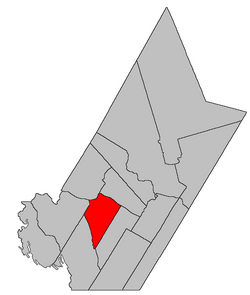
164:
163:
160:
156:
155:
151:
150:
147:
143:
142:
137:
131:
130:
117:
111:
110:
97:
91:
90:
83:45.965; -67.15
56:
55:
52:
44:
43:
38:
35:
34:
31:
24:
13:
10:
9:
6:
4:
3:
2:
2324:
2313:
2310:
2308:
2305:
2304:
2302:
2295:
2292:
2246:
2245:
2236:
2234:
2233:
2232:Portal:Canada
2229:
2224:
2222:
2221:
2212:
2211:
2208:
2202:
2199:
2197:
2194:
2192:
2189:
2187:
2186:
2184:
2180:
2173:
2170:
2167:
2164:
2162:St. Mary's 24
2161:
2158:
2156:Soegao No. 35
2155:
2153:Richibucto 15
2152:
2149:
2146:
2143:
2141:Pokemouche 13
2140:
2137:
2134:
2131:
2128:
2125:
2122:
2119:
2116:
2113:
2110:
2107:
2104:
2102:Esgenoôpetitj
2101:
2098:
2095:
2092:
2089:
2087:
2084:
2081:
2078:
2077:
2075:
2073:
2069:
2063:
2060:
2058:
2055:
2053:
2050:
2048:
2045:
2043:
2040:
2038:
2035:
2033:
2030:
2029:
2027:
2025:
2021:
2015:
2012:
2010:
2007:
2005:
2002:
2000:
1997:
1995:
1992:
1990:
1987:
1985:
1982:
1980:
1977:
1975:
1972:
1970:
1967:
1965:
1962:
1960:
1957:
1956:
1954:
1952:
1948:
1941:
1938:
1935:
1932:
1929:
1926:
1923:
1920:
1917:
1914:
1911:
1908:
1907:
1905:
1901:
1895:
1892:
1890:
1887:
1885:
1884:Strait Shores
1882:
1880:
1877:
1875:
1872:
1870:
1867:
1865:
1862:
1860:
1857:
1855:
1852:
1850:
1847:
1845:
1842:
1840:
1837:
1835:
1832:
1830:
1827:
1825:
1822:
1820:
1817:
1815:
1812:
1811:
1809:
1807:
1803:
1797:
1794:
1793:
1791:
1789:
1785:
1779:
1778:Valley Waters
1776:
1774:
1771:
1769:
1766:
1764:
1761:
1759:
1756:
1754:
1751:
1749:
1746:
1744:
1741:
1739:
1736:
1734:
1731:
1729:
1726:
1724:
1721:
1719:
1716:
1714:
1711:
1709:
1706:
1704:
1701:
1699:
1696:
1694:
1691:
1689:
1686:
1684:
1681:
1679:
1676:
1675:
1673:
1671:
1667:
1661:
1658:
1656:
1653:
1651:
1648:
1646:
1643:
1641:
1638:
1636:
1633:
1631:
1628:
1626:
1623:
1621:
1618:
1616:
1615:Saint-Quentin
1613:
1611:
1608:
1606:
1603:
1601:
1598:
1596:
1593:
1591:
1588:
1586:
1583:
1581:
1578:
1576:
1575:Hautes-Terres
1573:
1571:
1568:
1566:
1563:
1561:
1558:
1556:
1553:
1551:
1548:
1546:
1543:
1541:
1538:
1536:
1533:
1531:
1528:
1526:
1523:
1521:
1518:
1517:
1515:
1513:
1509:
1503:
1500:
1498:
1495:
1493:
1490:
1488:
1485:
1483:
1480:
1478:
1475:
1473:
1470:
1468:
1465:
1464:
1462:
1460:
1456:
1452:
1451:New Brunswick
1444:
1439:
1437:
1432:
1430:
1425:
1424:
1421:
1417:
1404:
1402:
1401:McAdam Parish
1399:
1397:
1396:McAdam Parish
1394:
1393:
1390:
1383:
1381:
1380:
1377:
1374:
1366:
1357:
1355:
1352:
1351:
1348:
1341:
1339:
1338:
1335:
1332:
1330:
1328:
1325:
1324:
1319:
1310:
1305:
1303:
1298:
1296:
1291:
1290:
1287:
1283:
1265:
1259:
1257:
1253:
1250:
1245:
1242:
1239:
1234:
1231:
1227:
1223:
1219:
1213:
1210:
1198:
1194:
1188:
1185:
1173:
1169:
1163:
1161:
1159:
1155:
1141:
1134:
1128:
1126:
1124:
1122:
1118:
1104:
1100:
1094:
1092:
1090:
1088:
1084:
1078:
1074:
1067:
1064:
1058:
1054:
1047:
1044:
1038:
1034:
1027:
1024:
1010:
1006:
1005:
997:
994:
981:
977:
976:
968:
965:
952:
948:
947:
939:
936:
923:
919:
918:
910:
907:
894:
893:
885:
882:
870:
863:
857:
854:
841:
835:
832:
819:
813:
811:
807:
794:
790:
784:
782:
778:
771:
761:
758:
751:
747:
744:
743:
739:
732:
724:
721:
718:
717:
713:
710:
707:
706:
702:
699:
696:
695:
691:
688:
686:English only
685:
684:
680:
677:
674:
673:
670:
669:
662:
660:
658:
650:
647:
644:
643:
634:
631:
628:
627:
618:
615:
612:
611:
602:
599:
596:
595:
586:
583:
580:
579:
570:
567:
564:
563:
559:
556:
553:
552:
549:
548:
541:
539:
538:
531:
526:
525:
524:
518:
512:
510:
507:
505:
502:
500:
497:
493:Big Deadwater
492:
491:
489:
486:
481:
479:Nackawic Bend
478:
475:
474:
473:
470:
469:
467:
461:
456:
453:
451:
448:
446:
443:
441:
438:
436:Davidson Lake
435:
433:
430:
427:
424:
423:
421:
419:
411:
409:
402:
396:
393:
390:northeast of
389:
385:
382:
377:
373:
370:
366:
365:
364:
358:
356:
354:
353:Mactaquac Dam
349:
347:
346:McAdam Parish
342:
340:
335:
332:
329:
327:
322:
320:
317:south of the
316:
312:
304:
302:
300:
296:
288:
286:
284:
280:
276:
273:Prior to the
271:
269:
265:
264:New Brunswick
261:
257:
253:
244:
240:
237:
233:
223:
219:
216:
214:
206:
193:
182:
174:
161:
148:
141:
138:
136:
129:
128:New Brunswick
118:
116:
109:
98:
96:
87:
59:Coordinates:
50:
41:
36:
29:
23:
19:
2255:
2237:
2225:
2213:
2174:Woodstock 23
2165:Tabusintac 9
2159:St Basile 10
2132:Oinpegitjoig
2117:Kingsclear 6
2114:Indian Ranch
2105:Fort Folly 1
2096:Eel Ground 2
2086:Buctouche 16
1839:Fundy Shores
1829:Central York
1763:Three Rivers
1748:New Maryland
1708:Fundy Albert
1415:
1364:
1281:
1268:. Retrieved
1244:
1233:
1212:
1200:. Retrieved
1196:
1187:
1175:. Retrieved
1171:
1144:. Retrieved
1139:
1107:. Retrieved
1102:
1072:
1066:
1052:
1046:
1032:
1026:
1013:. Retrieved
1003:
996:
984:. Retrieved
974:
967:
955:. Retrieved
945:
938:
926:. Retrieved
916:
909:
897:. Retrieved
891:
884:
873:, retrieved
868:
856:
844:. Retrieved
834:
822:. Retrieved
797:. Retrieved
792:
760:
730:
697:French only
667:
666:
656:
546:
545:
532:Demographics
522:
482:Pokiok Reach
465:
449:
431:
417:
415:
406:
362:
350:
343:
336:
333:
330:
323:
308:
292:
272:
251:
250:
22:
2278: /
2138:Pabineau 11
2135:Oromocto 26
2099:Eel River 3
1999:Restigouche
1933:Restigouche
1864:Maple Hills
1723:Grand Manan
1698:Five Rivers
1640:St. Stephen
1635:St. Andrews
1555:Grand Falls
1487:Fredericton
1472:Campbellton
1077:Fredericton
1057:Fredericton
1037:Fredericton
1009:Fredericton
980:Fredericton
951:Fredericton
922:Fredericton
871:, July 2017
824:13 November
678:Population
560:Change (%)
557:Population
412:Communities
260:York County
81: /
2301:Categories
2284: (
2265:67°09′00″W
2262:45°57′54″N
2171:Tobique 20
2147:Red Bank 7
2144:Red Bank 4
2057:Nord-Ouest
1738:Memramcook
1718:Grand Lake
1595:Quispamsis
1530:Cap-Acadie
1525:Belle-Baie
1520:Beaurivage
1502:Saint John
1482:Edmundston
875:2 February
799:29 October
772:References
542:Population
476:Coac Reach
403:Governance
359:Boundaries
167:Population
69:67°09′00″W
66:45°57′54″N
2150:Renous 12
2009:Southwest
2004:Southeast
1994:Northwest
1939:Southwest
1936:Southeast
1930:Northwest
1688:Bois-Joli
1683:Belledune
1660:Woodstock
1650:Tantramar
1630:Shippagan
1620:Salisbury
1600:Riverview
1580:Heron Bay
1545:Champdoré
1492:Miramichi
1270:7 October
1099:"No. 124"
675:Language
425:Allandale
285:(RSC11).
213:Time zone
190:2016-2021
2191:Counties
2093:Devon 30
2052:Nord-Est
1879:Nashwaak
1859:Kedgwick
1796:Tracadie
1693:Doaktown
1670:Villages
1610:Rothesay
1590:Oromocto
1570:Hartland
1535:Caraquet
1467:Bathurst
1015:27 March
986:27 March
957:27 March
928:27 March
899:17 March
740:See also
681:Pct (%)
663:Language
445:Hawkshaw
440:Dumfries
376:Dumfries
297:born in
295:Loyalist
252:Dumfries
115:Province
32:Dumfries
1969:Chaleur
1915:Chaleur
1844:Hanwell
1814:Alnwick
1678:Arcadia
1625:Shediac
1565:Hampton
1497:Moncton
1146:25 June
1109:25 June
846:25 July
554:Census
418:italics
305:History
146:Erected
95:Country
1849:Harvey
1743:Neguac
1733:McAdam
1645:Sussex
1477:Dieppe
1459:Cities
1228:census
1202:3 July
1177:3 July
731:
692:94.4%
455:Pokiok
450:Murray
432:Carson
428:Barony
398:River.
392:McAdam
321:line.
268:Canada
135:County
125:
108:Canada
105:
40:Parish
1989:Kings
1974:Fundy
1927:Kings
1918:Fundy
1773:Tracy
1512:Towns
1197:GeoNB
1136:(PDF)
1133:"367"
865:(PDF)
752:Notes
725:1.4%
703:4.2%
645:1991
640:4.3%
629:1996
624:5.3%
613:2001
608:6.1%
597:2006
592:1.1%
581:2011
576:4.6%
565:2016
254:is a
239:UTC-3
218:UTC-4
199:18.0%
1984:Kent
1924:Kent
1272:2019
1226:2006
1222:2001
1218:1996
1204:2021
1179:2021
1148:2021
1111:2021
1017:2021
988:2021
959:2021
930:2021
901:2021
877:2021
848:2020
826:2020
801:2022
689:335
651:N/A
648:398
632:415
616:393
600:369
584:373
568:356
154:Area
149:1833
140:York
2062:Sud
714:0%
700:15
258:in
243:ADT
232:DST
222:AST
207:304
175:420
2303::
1255:^
1224:,
1220:,
1195:.
1170:.
1157:^
1138:.
1120:^
1101:.
1086:^
1075:.
1055:.
1035:.
1007:.
978:.
949:.
920:.
867:,
809:^
791:.
780:^
722:5
711:0
355:.
348:.
341:.
270:.
266:,
262:,
2288:)
1442:e
1435:t
1428:v
1308:e
1301:t
1294:v
1274:.
1206:.
1181:.
1150:.
1113:.
1019:.
990:.
961:.
932:.
903:.
850:.
828:.
803:.
371:;
245:)
241:(
234:)
224:)
220:(
20:.
Text is available under the Creative Commons Attribution-ShareAlike License. Additional terms may apply.