59:
43:
128:
66:
342:
category was as follows: 393 cultivators (i.e. people who owned or leased their own land); 293 agricultural labourers (i.e. people who worked someone else's land in return for payment); 6 workers in livestock, forestry, fishing, hunting, plantations, orchards, etc.; 0 in mining and quarrying; 1 household industry worker; 6 workers employed in other
328:
recorded
Dakhinwara as having a total population of 2,610 people (1,290 male and 1,320 female), in 464 households and 454 physical houses. The area of the village was listed as 380.00 hectares. Members of the 0-6 age group numbered 573, or 22% of the total; this group was 52% male (297) and 48%
341:
of the village was 37% (555 men and 203 women, counting only people age 7 and up). 736 people were classified as main workers (663 men and 73 women), while 0 people were classified as marginal workers; the remaining 1,874 residents were non-workers. The breakdown of main workers by employment
281:
recorded
Dakhinwara (as "Dakhin Wara") as comprising 16 hamlets, with a total population of 1,309 people (664 male and 645 female), in 270 households and 265 physical houses. The area of the village was given as 966
309:
recorded
Dakhinwara as comprising 19 hamlets, with a total population of 914 people (448 male and 466 female), in 298 households and 277 physical houses. The area of the village was given as 966 acres.
676:
545:
501:
266:. As of 2011, it has a population of 3,840 people, in 613 households. It has two primary schools and one maternity and child welfare centre and it hosts a weekly
681:
90:
686:
607:
58:
712:
691:
440:
Census 1991 Series-25 Uttar
Pradesh Part-XII B Village & Townwise Primary Census Abstract District Census Handbook District Raebareli
152:
42:
140:
600:
640:
394:
350:; 10 employed in trade and commerce; 0 employed in transport, storage, and communications; and 27 in other services.
164:
564:
Census 1981 Uttar
Pradesh: District Census Handbook Part XIII-A: Village & Town Directory, District Rae Bareli
593:
395:"Census of India 2011: Uttar Pradesh District Census Handbook - Sultanpur, Part A (Village and Town Directory)"
562:
518:
438:
474:
317:
recorded
Dakhinwara as having a population of 2,002 people, in 409 households, and having an area of 390.94
302:. The village had a district board-run primary school with 111 students in attendance as of 1 January 1951.
299:
325:
314:
306:
278:
238:
347:
251:
539:
495:
291:
286:. 67 residents were literate, 64 male and 3 female. The village was listed as belonging to the
157:
635:
334:
645:
616:
330:
271:
255:
169:
476:
Census of India, 1951: District Census
Handbook Uttar Pradesh (49 - Rae Bareli District)
218:
706:
343:
338:
259:
145:
660:
655:
520:
Census 1961: District Census
Handbook, Uttar Pradesh (44 - Sultanpur District)
105:
92:
333:
numbered 961, or 37% of the village's total population, while no members of
234:
229:
318:
287:
630:
367:
585:
295:
263:
133:
650:
283:
267:
222:
589:
321:. The main staple foods were listed as wheat and rice.
669:
623:
228:
214:
209:
201:
193:
188:
180:
175:
163:
151:
139:
121:
23:
372:Do a radial search using these coordinates here
677:Rajiv Gandhi Institute of Petroleum Technology
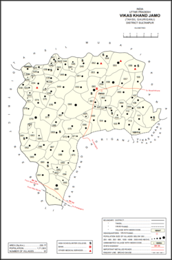
47:Map showing Dakhinwara (#034) in Jamo CD block
601:
557:
555:
513:
511:
469:
467:
465:
463:
461:
433:
431:
429:
427:
425:
423:
421:
419:
389:
387:
385:
383:
381:
270:but not a periodic market. It belongs to the
8:
346:, processing, service, and repair roles; 0
682:Indian Institute of Information Technology
608:
594:
586:
544:: CS1 maint: location missing publisher (
500:: CS1 maint: location missing publisher (
20:
687:Footwear Design and Development Institute
359:
227:
208:
187:
174:
120:
85:
51:
39:
537:
493:
482:. Allahabad. 1955. pp. 130–1, 199
213:
200:
192:
184:3.804 km (1.469 sq mi)
179:
162:
150:
138:
7:
692:Indira Gandhi Rashtriya Uran Akademi
526:. Lucknow. 1965. pp. xvi–xvii
446:. 1992. pp. xxiv–xxviii, 82–3
65:
14:
126:
78:Location in Uttar Pradesh, India
64:
57:
41:
18:Village in Uttar Pradesh, India
1:
713:Villages in Amethi district
205:1,000/km (2,600/sq mi)
729:
329:female (276). Members of
86:
52:
40:
33:
106:26.384175°N 81.579738°E
570:. 1982. pp. 44–5
215: • Official
348:construction workers
202: • Density
111:26.384175; 81.579738
337:were recorded. The
102: /
194: • Total
181: • Total
700:
699:
404:. pp. 147–63
402:Census 2011 India
368:"Geonames Search"
245:
244:
158:Faizabad division
720:
610:
603:
596:
587:
580:
579:
577:
575:
569:
559:
550:
549:
543:
535:
533:
531:
525:
515:
506:
505:
499:
491:
489:
487:
481:
471:
456:
455:
453:
451:
445:
435:
414:
413:
411:
409:
399:
391:
376:
375:
364:
335:scheduled tribes
331:scheduled castes
250:is a village in
132:
130:
129:
117:
116:
114:
113:
112:
107:
103:
100:
99:
98:
95:
68:
67:
61:
45:
21:
728:
727:
723:
722:
721:
719:
718:
717:
703:
702:
701:
696:
665:
619:
617:Amethi district
614:
584:
583:
573:
571:
567:
561:
560:
553:
536:
529:
527:
523:
517:
516:
509:
492:
485:
483:
479:
473:
472:
459:
449:
447:
443:
437:
436:
417:
407:
405:
397:
393:
392:
379:
366:
365:
361:
356:
272:nyaya panchayat
256:Amethi district
127:
125:
110:
108:
104:
101:
96:
93:
91:
89:
88:
82:
81:
80:
79:
76:
75:
74:
73:
69:
48:
36:
29:
26:
19:
12:
11:
5:
726:
724:
716:
715:
705:
704:
698:
697:
695:
694:
689:
684:
679:
673:
671:
667:
666:
664:
663:
658:
653:
648:
643:
638:
633:
627:
625:
621:
620:
615:
613:
612:
605:
598:
590:
582:
581:
551:
507:
457:
415:
377:
358:
357:
355:
352:
243:
242:
232:
226:
225:
216:
212:
211:
207:
206:
203:
199:
198:
195:
191:
190:
186:
185:
182:
178:
177:
173:
172:
167:
161:
160:
155:
149:
148:
143:
137:
136:
123:
119:
118:
84:
83:
77:
71:
70:
63:
62:
56:
55:
54:
53:
50:
49:
46:
38:
37:
34:
31:
30:
27:
24:
17:
13:
10:
9:
6:
4:
3:
2:
725:
714:
711:
710:
708:
693:
690:
688:
685:
683:
680:
678:
675:
674:
672:
668:
662:
659:
657:
654:
652:
649:
647:
644:
642:
639:
637:
634:
632:
629:
628:
626:
622:
618:
611:
606:
604:
599:
597:
592:
591:
588:
566:
565:
558:
556:
552:
547:
541:
522:
521:
514:
512:
508:
503:
497:
478:
477:
470:
468:
466:
464:
462:
458:
442:
441:
434:
432:
430:
428:
426:
424:
422:
420:
416:
403:
396:
390:
388:
386:
384:
382:
378:
373:
369:
363:
360:
353:
351:
349:
345:
344:manufacturing
340:
339:literacy rate
336:
332:
327:
322:
320:
316:
311:
308:
303:
301:
297:
293:
289:
285:
280:
275:
273:
269:
265:
261:
260:Uttar Pradesh
257:
253:
249:
240:
236:
233:
231:
224:
220:
217:
204:
196:
183:
171:
168:
166:
159:
156:
154:
147:
146:Uttar Pradesh
144:
142:
135:
124:
115:
87:Coordinates:
60:
44:
32:
22:
16:
656:Musafirkhana
572:. Retrieved
563:
528:. Retrieved
519:
484:. Retrieved
475:
448:. Retrieved
439:
406:. Retrieved
401:
371:
362:
323:
312:
304:
276:
247:
246:
15:
574:17 December
530:17 December
486:17 December
450:17 December
408:17 December
326:1991 census
315:1981 census
307:1961 census
279:1951 census
109: /
670:Institutes
641:Jagdishpur
354:References
300:Jagdishpur
292:Gaura Jamo
248:Dakhinwara
189:Population
97:81°34′47″E
94:26°23′03″N
72:Dakhinwara
28:Dakhinwāra
25:Dakhinwara
636:Gauriganj
540:cite book
496:cite book
274:of Jamo.
254:block of
230:Time zone
210:Languages
707:Category
646:Ranigunj
319:hectares
294:and the
235:UTC+5:30
165:District
153:Division
288:pargana
122:Country
35:Village
631:Amethi
170:Amethi
131:
661:Salon
624:Towns
568:(PDF)
524:(PDF)
480:(PDF)
444:(PDF)
398:(PDF)
296:thana
284:acres
264:India
219:Hindi
197:3,840
141:State
134:India
651:Jais
576:2021
546:link
532:2021
502:link
488:2021
452:2021
410:2021
324:The
313:The
305:The
277:The
268:haat
252:Jamo
223:Urdu
176:Area
298:of
290:of
239:IST
709::
554:^
542:}}
538:{{
510:^
498:}}
494:{{
460:^
418:^
400:.
380:^
370:.
262:,
258:,
221:,
609:e
602:t
595:v
578:.
548:)
534:.
504:)
490:.
454:.
412:.
374:.
241:)
237:(
Text is available under the Creative Commons Attribution-ShareAlike License. Additional terms may apply.