55:
40:
67:
691:
381:
In the township the population was spread out, with 24.1% under the age of 18, 7.5% from 18 to 24, 28.0% from 25 to 44, 23.9% from 45 to 64, and 16.6% who were 65 years of age or older. The median age was 40 years. For every 100 females there were 97.9 males. For every 100 females age 18 and over,
377:
living together, 4.9% had a female householder with no husband present, and 20.2% were non-families. 16.0% of all households were made up of individuals, and 7.4% had someone living alone who was 65 years of age or older. The average household size was 2.80 and the average family size was 3.12.
349:
of 2000, there were 465 people, 163 households, and 130 families residing in the township. The population density was 32.0 inhabitants per square mile (12.4/km). There were 177 housing units at an average density of 12.2/sq mi (4.7/km). The racial makeup of the township was 99.14%
54:
1062:
39:
385:
The median income for a household in the township was $ 33,542, and the median income for a family was $ 41,750. Males had a median income of $ 30,357 versus $ 20,893 for females. The
802:
619:
842:
817:
337:, the township has a total area of 14.8 square miles (38 km), of which 14.5 square miles (38 km) is land and 0.3 square miles (0.78 km) (1.96%) is water.
1101:
917:
912:
892:
66:
927:
897:
857:
787:
837:
827:
902:
807:
797:
852:
832:
812:
822:
937:
887:
872:
877:
847:
612:
1000:
907:
1005:
605:
867:
932:
922:
882:
862:
410:
597:
507:
438:
960:
355:
45:
769:
729:
1039:
759:
629:
581:
557:
334:
318:
100:
990:
955:
754:
744:
276:
261:
246:
970:
749:
724:
719:
203:
1026:
980:
947:
779:
764:
734:
675:
373:
There were 163 households, out of which 30.7% had children under the age of 18 living with them, 71.8% were
314:
30:
1010:
714:
701:
363:
985:
670:
195:
325:, United States. The population was 456 at the 2020 census, a decline from the figure of 502 in 2010.
1046:
995:
739:
680:
651:
367:
184:
709:
662:
359:
351:
389:
for the township was $ 16,413. About 6.9% of families and 9.0% of the population were below the
484:
527:
458:
386:
174:
539:
470:
1095:
212:
208:
390:
322:
90:
644:
85:
1077:
1064:
165:
393:, including 9.2% of those under age 18 and none of those age 65 or over.
374:
346:
191:
170:
601:
689:
577:
553:
432:
430:
428:
1019:
969:
946:
778:
700:
661:
202:
181:
164:
156:
148:
140:
135:
127:
119:
111:
106:
96:
84:
76:
21:
59:Location of Deer Creek Township in Mercer County
613:
8:
508:"City and Town Population Totals: 2020-2021"
439:"City and Town Population Totals: 2020-2023"
620:
606:
598:
370:of any race were 0.22% of the population.
219:
18:
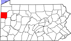
71:Location of Mercer County in Pennsylvania
1102:Townships in Mercer County, Pennsylvania
402:
201:
163:
134:
105:
75:
51:
36:
16:Township in Pennsylvania, United States
535:
525:
466:
456:
239:
180:
155:
147:
139:
126:
123:14.55 sq mi (37.67 km)
118:
115:14.85 sq mi (38.46 km)
110:
95:
83:
63:
7:
362:, and 0.22% from two or more races.
131:0.30 sq mi (0.79 km)
628:Municipalities and communities of
485:"Census of Population and Housing"
229:
14:
65:
53:
38:
1:
413:. United States Census Bureau
46:Maurice K. Goddard State Park
631:Mercer County, Pennsylvania
582:United States Census Bureau
558:United States Census Bureau
411:"2016 U.S. Gazetteer Files"
335:United States Census Bureau
160:33.21/sq mi (12.82/km)
149: • Estimate
1118:
1035:
687:
642:
303:
290:
275:
260:
245:
238:
233:
228:
225:
64:
52:
37:
28:
382:there were 97.2 males.
694:
1078:41.46667°N 80.11639°W
693:
578:"U.S. Census website"
554:"U.S. Census website"
304:U.S. Decennial Census
221:Historical population
183: • Summer (
1048:United States portal
157: • Density
1083:41.46667; -80.11639
1074: /
1041:Pennsylvania portal
506:Bureau, US Census.
437:Bureau, US Census.
311:Deer Creek Township
222:
23:Deer Creek Township
1020:Former settlements
695:
538:has generic name (
514:. US Census Bureau
469:has generic name (
445:. US Census Bureau
220:
141: • Total
128: • Water
112: • Total
1057:
1056:
803:East Lackawannock
387:per capita income
345:According to the
333:According to the
308:
307:
218:
217:
120: • Land
1109:
1089:
1088:
1086:
1085:
1084:
1079:
1075:
1072:
1071:
1070:
1067:
1049:
1042:
961:Reynolds Heights
908:South Pymatuning
692:
654:
647:
637:
632:
622:
615:
608:
599:
592:
591:
589:
588:
574:
568:
567:
565:
564:
550:
544:
543:
537:
533:
531:
523:
521:
519:
503:
497:
496:
494:
492:
481:
475:
474:
468:
464:
462:
454:
452:
450:
434:
423:
422:
420:
418:
407:
356:African American
241:
236:
231:
223:
188:
69:
57:
42:
19:
1117:
1116:
1112:
1111:
1110:
1108:
1107:
1106:
1092:
1091:
1082:
1080:
1076:
1073:
1068:
1065:
1063:
1061:
1060:
1058:
1053:
1047:
1040:
1031:
1015:
972:
965:
942:
774:
696:
690:
685:
657:
652:
645:
638:
635:
630:
626:
596:
595:
586:
584:
576:
575:
571:
562:
560:
552:
551:
547:
534:
524:
517:
515:
505:
504:
500:
490:
488:
483:
482:
478:
465:
455:
448:
446:
436:
435:
426:
416:
414:
409:
408:
404:
399:
375:married couples
343:
331:
234:
182:
72:
60:
48:
33:
24:
17:
12:
11:
5:
1115:
1113:
1105:
1104:
1094:
1093:
1055:
1054:
1052:
1051:
1044:
1036:
1033:
1032:
1030:
1029:
1023:
1021:
1017:
1016:
1014:
1013:
1008:
1003:
998:
993:
988:
983:
977:
975:
971:Unincorporated
967:
966:
964:
963:
958:
952:
950:
944:
943:
941:
940:
935:
930:
925:
920:
915:
910:
905:
900:
895:
890:
885:
880:
875:
870:
865:
860:
855:
850:
845:
840:
835:
830:
825:
820:
815:
810:
805:
800:
795:
790:
784:
782:
776:
775:
773:
772:
770:West Middlesex
767:
762:
757:
752:
747:
742:
737:
732:
730:Jackson Center
727:
722:
717:
712:
706:
704:
698:
697:
688:
686:
684:
683:
678:
673:
667:
665:
659:
658:
643:
640:
639:
627:
625:
624:
617:
610:
602:
594:
593:
569:
545:
498:
476:
424:
401:
400:
398:
395:
342:
339:
330:
327:
306:
305:
301:
300:
297:
295:
292:
288:
287:
284:
282:
279:
273:
272:
269:
267:
264:
258:
257:
254:
252:
249:
243:
242:
237:
232:
227:
216:
215:
206:
200:
199:
189:
179:
178:
168:
162:
161:
158:
154:
153:
150:
146:
145:
142:
138:
137:
133:
132:
129:
125:
124:
121:
117:
116:
113:
109:
108:
104:
103:
98:
94:
93:
88:
82:
81:
78:
74:
73:
70:
62:
61:
58:
50:
49:
43:
35:
34:
29:
26:
25:
22:
15:
13:
10:
9:
6:
4:
3:
2:
1114:
1103:
1100:
1099:
1097:
1090:
1087:
1050:
1045:
1043:
1038:
1037:
1034:
1028:
1025:
1024:
1022:
1018:
1012:
1009:
1007:
1004:
1002:
999:
997:
994:
992:
989:
987:
984:
982:
979:
978:
976:
974:
968:
962:
959:
957:
954:
953:
951:
949:
945:
939:
936:
934:
931:
929:
926:
924:
921:
919:
916:
914:
911:
909:
906:
904:
901:
899:
896:
894:
891:
889:
886:
884:
881:
879:
876:
874:
871:
869:
866:
864:
861:
859:
856:
854:
851:
849:
846:
844:
841:
839:
836:
834:
831:
829:
826:
824:
821:
819:
816:
814:
811:
809:
806:
804:
801:
799:
796:
794:
791:
789:
786:
785:
783:
781:
777:
771:
768:
766:
763:
761:
760:Sheakleyville
758:
756:
753:
751:
748:
746:
743:
741:
738:
736:
733:
731:
728:
726:
723:
721:
718:
716:
713:
711:
708:
707:
705:
703:
699:
682:
679:
677:
674:
672:
669:
668:
666:
664:
660:
656:
655:
648:
641:
636:United States
633:
623:
618:
616:
611:
609:
604:
603:
600:
583:
579:
573:
570:
559:
555:
549:
546:
541:
529:
513:
509:
502:
499:
486:
480:
477:
472:
460:
444:
440:
433:
431:
429:
425:
412:
406:
403:
396:
394:
392:
388:
383:
379:
376:
371:
369:
365:
361:
357:
353:
348:
340:
338:
336:
328:
326:
324:
320:
319:Mercer County
316:
312:
302:
298:
296:
293:
289:
285:
283:
280:
278:
274:
270:
268:
265:
263:
259:
255:
253:
250:
248:
244:
224:
214:
210:
207:
205:
197:
193:
190:
186:
176:
172:
169:
167:
159:
151:
143:
130:
122:
114:
102:
99:
92:
89:
87:
80:United States
79:
68:
56:
47:
44:Waterfall at
41:
32:
27:
20:
1059:
991:Clarks Mills
956:Lake Latonka
843:Lackawannock
818:French Creek
792:
650:
585:. Retrieved
572:
561:. Retrieved
548:
536:|last1=
516:. Retrieved
511:
501:
489:. Retrieved
487:. Census.gov
479:
467:|last1=
447:. Retrieved
442:
415:. Retrieved
405:
391:poverty line
384:
380:
372:
344:
341:Demographics
332:
323:Pennsylvania
310:
309:
91:Pennsylvania
1081: /
973:communities
918:Sugar Grove
913:Springfield
893:Sandy Creek
868:Otter Creek
755:Sharpsville
745:New Lebanon
646:County seat
291:2023 (est.)
1069:80°06′59″W
1066:41°28′00″N
1001:Indian Run
933:Wolf Creek
928:Wilmington
923:West Salem
898:Sandy Lake
883:Pymatuning
863:New Vernon
858:Mill Creek
793:Deer Creek
788:Coolspring
750:Sandy Lake
725:Grove City
720:Greenville
587:2008-01-31
563:2017-03-05
512:Census.gov
443:Census.gov
397:References
204:Area codes
136:Population
1027:Wheatland
1006:Maysville
981:Amsterdam
838:Jefferson
828:Hempfield
780:Townships
765:Stoneboro
735:Jamestown
676:Hermitage
329:Geography
166:Time zone
1096:Category
1011:Transfer
903:Shenango
808:Fairview
798:Delaware
715:Fredonia
702:Boroughs
528:cite web
459:cite web
364:Hispanic
358:, 0.22%
354:, 0.43%
315:township
31:Township
986:Carlton
853:Liberty
833:Jackson
813:Findley
671:Farrell
518:26 June
491:June 4,
449:July 1,
417:Aug 14,
77:Country
996:Hadley
823:Greene
740:Mercer
681:Sharon
663:Cities
653:Mercer
368:Latino
347:census
226:Census
101:Mercer
97:County
938:Worth
888:Salem
873:Perry
710:Clark
360:Asian
352:White
313:is a
299:−2.9%
286:−9.2%
192:UTC-5
171:UTC-4
86:State
948:CDPs
878:Pine
848:Lake
540:help
520:2022
493:2016
471:help
451:2024
419:2017
277:2020
271:8.0%
262:2010
247:2000
235:Note
230:Pop.
107:Area
366:or
317:in
294:443
281:456
266:502
251:465
213:814
209:724
196:EDT
185:DST
175:EST
152:443
144:454
1098::
649::
634:,
580:.
556:.
532::
530:}}
526:{{
510:.
463::
461:}}
457:{{
441:.
427:^
321:,
240:%±
211:,
621:e
614:t
607:v
590:.
566:.
542:)
522:.
495:.
473:)
453:.
421:.
256:—
198:)
194:(
187:)
177:)
173:(
Text is available under the Creative Commons Attribution-ShareAlike License. Additional terms may apply.