42:
54:
976:
826:
843:
818:
369:
801:
379:
359:
450:
The township's age distribution consisted of 23.3% under the age of 18, 8.5% from 18 to 24, 20.9% from 25 to 44, 29.2% from 45 to 64, and 18.0% who were 65 years of age or older. The median age was 43.4 years. For every 100 females, there were 105.4 males. For every 100 females age 18 and over, there
446:
There were 2,097 households, out of which 29.00% had children under the age of 18 living with them, 37.05% were married couples living together, 12.54% had a female householder with no spouse present, and 44.44% were non-families. 39.40% of all households were made up of individuals, and 20.60% had
410:
there were 4,729 people, 2,097 households, and 1,165 families residing in the township. The population density was 127.85 inhabitants per square mile (49.36/km). There were 2,352 housing units at an average density of 63.58 per square mile (24.55/km). The racial makeup of the township was 93.40%
285:
According to the 2021 census gazetteer files, Denning
Township has a total area of 36.99 square miles (95.80 km), of which 35.85 square miles (92.85 km) (or 96.91%) is land and 1.14 square miles (2.95 km) (or 3.09%) is water.
454:
The median income for a household in the township was $ 31,048, and the median income for a family was $ 43,542. Males had a median income of $ 38,676 versus $ 19,444 for females. The
67:
889:
41:
53:
1279:
760:
1095:
832:
1110:
1105:
1070:
810:
785:
1085:
1115:
1065:
1060:
790:
780:
733:
1100:
1090:
1075:
611:
597:
564:
247:
882:
588:
932:
875:
753:
447:
someone living alone who was 65 years of age or older. The average household size was 2.37 and the average family size was 3.12.
229:
208:
593:
1284:
867:
428:
416:
746:
659:
420:
121:
1185:
432:
899:
738:
521:
506:
491:
407:
266:
126:
960:
306:
99:
583:
1249:
1160:
1125:
1032:
616:
1215:
1170:
1005:
436:
324:
295:
1226:
945:
1180:
319:
1256:
1210:
1133:
1022:
440:
218:
1205:
1200:
1143:
1042:
1016:
424:
412:
334:
458:
for the township was $ 20,283. About 22.7% of families and 24.7% of the population were below the
1220:
1195:
1165:
1027:
1011:
987:
372:
329:
704:
633:
1190:
995:
965:
678:
455:
382:
728:
1175:
1037:
955:
950:
940:
921:
301:
1000:
690:
277:. As of the 2020 census, its population was 4,729 and it contained 2,352 housing units.
1155:
1052:
262:
32:
1273:
362:
274:
459:
914:
348:
The township contains these four cemeteries: Denning, Follis, Hanes and Rose.
109:
82:
69:
199:
462:, including 30.2% of those under age 18 and 26.1% of those age 65 or over.
368:
1240:‡This populated place also has portions in an adjacent county or counties
270:
114:
378:
340:(This list is based on USGS data and may include former settlements.)
975:
225:
204:
871:
742:
358:
769:
Places adjacent to
Denning Township, Franklin County, Illinois
974:
612:
United States Census Bureau 2007 TIGER/Line
Shapefiles
1235:
1142:
1124:
1051:
986:
931:
554:
Zeigler-Royalton
Community Unit School District 188
246:
236:
215:
198:
190:
182:
177:
169:
161:
153:
145:
140:
132:
120:
108:
98:
23:
165:1.14 sq mi (3.0 km) 3.09%
883:
754:
584:"Denning Township, Franklin County, Illinois"
8:
979:Map of Illinois highlighting Franklin County
548:Frankfort Community Unit School District 168
890:
876:
868:
761:
747:
739:
464:
443:of any race were 1.29% of the population.
20:
598:United States Department of the Interior
622:
551:Herrin Community Unit School District 4
245:
235:
197:
176:
168:
139:
131:
97:
62:
38:
1280:Townships in Franklin County, Illinois
686:
676:
484:
58:Franklin County's location in Illinois
565:Illinois' 12th congressional district
214:
189:
181:
160:
152:
144:
119:
107:
50:
7:
776:
628:
626:
435:, and 5.10% from two or more races.
157:35.85 sq mi (92.9 km)
149:36.99 sq mi (95.8 km)
589:Geographic Names Information System
18:Township in Illinois, United States
898:Municipalities and communities of
705:"Census of Population and Housing"
474:
14:
841:
824:
816:
799:
377:
367:
357:
52:
40:
594:United States Geological Survey
1:
842:
800:
825:
817:
617:United States National Atlas
46:Location in Franklin County
1301:
241:62812, 62865, 62874, 62896
1245:
972:
912:
901:Franklin County, Illinois
774:
535:
520:
505:
490:
483:
478:
473:
470:
63:
51:
39:
30:
572:State Senate District 59
569:State House District 117
173:387 ft (118 m)
734:Illinois State Archives
290:Cities, towns, villages
980:
194:130/sq mi (49/km)
1285:Townships in Illinois
978:
634:"Explore Census Data"
536:U.S. Decennial Census
466:Historical population
217: • Summer (
83:37.90806°N 88.98417°W
1258:United States portal
314:Unincorporated towns
191: • Density
658:Bureau, US Census.
559:Political districts
467:
88:37.90806; -88.98417
79: /
981:
833:Frankfort Township
689:has generic name (
465:
373:Illinois Route 149
183: • Total
162: • Water
146: • Total
1267:
1266:
865:
864:
860:
859:
811:Six Mile Township
786:Browning Township
660:"Gazetteer Files"
540:
539:
456:per capita income
451:were 85.8 males.
383:Illinois Route 37
261:is one of twelve
256:
255:
154: • Land
1292:
1259:
1252:
977:
924:
917:
907:
902:
892:
885:
878:
869:
845:
844:
828:
827:
822:Denning Township
820:
819:
803:
802:
777:
763:
756:
749:
740:
717:
716:
714:
712:
701:
695:
694:
688:
684:
682:
674:
672:
670:
655:
649:
648:
646:
644:
630:
608:
606:
604:
543:School districts
486:
481:
476:
468:
429:Pacific Islander
417:African American
381:
371:
361:
259:Denning Township
222:
136:November 4, 1884
94:
93:
91:
90:
89:
84:
80:
77:
76:
75:
72:
56:
44:
25:Denning Township
21:
1300:
1299:
1295:
1294:
1293:
1291:
1290:
1289:
1270:
1269:
1268:
1263:
1257:
1251:Illinois portal
1250:
1241:
1231:
1147:
1145:
1138:
1120:
1047:
982:
970:
927:
922:
915:
908:
905:
900:
896:
866:
861:
854:
829:
791:Benton Township
781:Tyrone Township
770:
767:
725:
720:
710:
708:
703:
702:
698:
685:
675:
668:
666:
657:
656:
652:
642:
640:
638:data.census.gov
632:
631:
624:
602:
600:
582:
579:
561:
545:
479:
421:Native American
404:
391:
354:
346:
316:
292:
283:
267:Franklin County
242:
216:
87:
85:
81:
78:
73:
70:
68:
66:
65:
59:
47:
35:
26:
19:
12:
11:
5:
1298:
1296:
1288:
1287:
1282:
1272:
1271:
1265:
1264:
1262:
1261:
1254:
1246:
1243:
1242:
1239:
1237:
1233:
1232:
1230:
1229:
1224:
1218:
1213:
1208:
1203:
1198:
1193:
1188:
1183:
1178:
1173:
1168:
1163:
1158:
1152:
1150:
1146:unincorporated
1140:
1139:
1137:
1136:
1130:
1128:
1122:
1121:
1119:
1118:
1113:
1108:
1103:
1098:
1093:
1088:
1083:
1078:
1073:
1068:
1063:
1057:
1055:
1049:
1048:
1046:
1045:
1040:
1035:
1030:
1025:
1020:
1014:
1009:
1003:
998:
992:
990:
984:
983:
973:
971:
969:
968:
963:
961:West Frankfort
958:
953:
948:
943:
937:
935:
929:
928:
913:
910:
909:
897:
895:
894:
887:
880:
872:
863:
862:
858:
857:
855:
852:
849:
848:
846:
839:
836:
835:
830:
815:
813:
807:
806:
804:
797:
794:
793:
788:
783:
775:
772:
771:
768:
766:
765:
758:
751:
743:
737:
736:
731:
724:
723:External links
721:
719:
718:
696:
650:
621:
620:
619:
614:
609:
578:
575:
574:
573:
570:
567:
560:
557:
556:
555:
552:
549:
544:
541:
538:
537:
533:
532:
529:
527:
524:
518:
517:
514:
512:
509:
503:
502:
499:
497:
494:
488:
487:
482:
477:
472:
403:
400:
399:
398:
395:
390:
387:
386:
385:
375:
365:
353:
352:Major highways
350:
345:
342:
338:
337:
332:
327:
322:
315:
312:
311:
310:
307:West Frankfort
304:
299:
291:
288:
282:
279:
254:
253:
250:
244:
243:
240:
238:
234:
233:
223:
213:
212:
202:
196:
195:
192:
188:
187:
184:
180:
179:
175:
174:
171:
167:
166:
163:
159:
158:
155:
151:
150:
147:
143:
142:
138:
137:
134:
130:
129:
124:
118:
117:
112:
106:
105:
102:
96:
95:
61:
60:
57:
49:
48:
45:
37:
36:
31:
28:
27:
24:
17:
13:
10:
9:
6:
4:
3:
2:
1297:
1286:
1283:
1281:
1278:
1277:
1275:
1260:
1255:
1253:
1248:
1247:
1244:
1238:
1234:
1228:
1225:
1222:
1219:
1217:
1214:
1212:
1209:
1207:
1204:
1202:
1199:
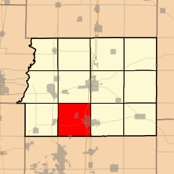
1197:
1194:
1192:
1189:
1187:
1184:
1182:
1179:
1177:
1174:
1172:
1169:
1167:
1164:
1162:
1161:Akin Junction
1159:
1157:
1154:
1153:
1151:
1149:
1141:
1135:
1132:
1131:
1129:
1127:
1123:
1117:
1114:
1112:
1109:
1107:
1104:
1102:
1099:
1097:
1094:
1092:
1089:
1087:
1084:
1082:
1079:
1077:
1074:
1072:
1069:
1067:
1064:
1062:
1059:
1058:
1056:
1054:
1050:
1044:
1041:
1039:
1036:
1034:
1033:Thompsonville
1031:
1029:
1026:
1024:
1021:
1018:
1015:
1013:
1010:
1007:
1004:
1002:
999:
997:
994:
993:
991:
989:
985:
967:
964:
962:
959:
957:
954:
952:
949:
947:
944:
942:
939:
938:
936:
934:
930:
926:
925:
918:
911:
906:United States
903:
893:
888:
886:
881:
879:
874:
873:
870:
856:
853:
851:
850:
847:
840:
838:
837:
834:
831:
823:
814:
812:
809:
808:
805:
798:
796:
795:
792:
789:
787:
784:
782:
779:
778:
773:
764:
759:
757:
752:
750:
745:
744:
741:
735:
732:
730:
729:City-Data.com
727:
726:
722:
706:
700:
697:
692:
680:
665:
661:
654:
651:
639:
635:
629:
627:
623:
618:
615:
613:
610:
599:
595:
591:
590:
585:
581:
580:
576:
571:
568:
566:
563:
562:
558:
553:
550:
547:
546:
542:
534:
530:
528:
525:
523:
519:
515:
513:
510:
508:
504:
500:
498:
495:
493:
489:
469:
463:
461:
457:
452:
448:
444:
442:
438:
434:
431:, 0.42% from
430:
426:
422:
418:
414:
409:
401:
396:
393:
392:
388:
384:
380:
376:
374:
370:
366:
364:
363:Interstate 57
360:
356:
355:
351:
349:
343:
341:
336:
333:
331:
328:
326:
323:
321:
318:
317:
313:
308:
305:
303:
300:
297:
294:
293:
289:
287:
280:
278:
276:
272:
268:
264:
260:
251:
249:
239:
231:
227:
224:
220:
210:
206:
203:
201:
193:
185:
172:
164:
156:
148:
135:
128:
125:
123:
116:
113:
111:
104:United States
103:
101:
92:
64:Coordinates:
55:
43:
34:
29:
22:
16:
1216:Valier Patch
1171:Deering City
1080:
1006:Freeman Spur
920:
821:
709:. Retrieved
707:. Census.gov
699:
667:. Retrieved
663:
653:
641:. Retrieved
637:
601:. Retrieved
587:
460:poverty line
453:
449:
445:
405:
402:Demographics
347:
339:
298:(north half)
296:Freeman Spur
284:
258:
257:
252:17-055-19421
15:
1227:Whittington
1148:communities
946:Christopher
916:County seat
687:|last=
669:January 22,
643:January 22,
603:January 16,
433:other races
408:2020 census
397:Cambon Lake
394:Beaver Lake
309:(west half)
133:Established
86: /
1274:Categories
1211:Steel City
1134:Mulkeytown
1023:North City
664:Census.gov
577:References
406:As of the
344:Cemeteries
325:Lake Creek
178:Population
74:88°59′03″W
71:37°54′29″N
1236:Footnotes
1206:Rend City
1201:Plumfield
1096:Frankfort
1053:Townships
1043:West City
1017:Macedonia
335:Plumfield
281:Geography
263:townships
248:FIPS code
237:ZIP codes
200:Time zone
170:Elevation
1221:West End
1196:Pershing
1166:Cleburne
1111:Six Mile
1106:Northern
1071:Browning
1028:Royalton
1012:Hanaford
988:Villages
679:cite web
437:Hispanic
427:, 0.00%
423:, 0.30%
419:, 0.36%
415:, 0.42%
330:Pershing
271:Illinois
127:Franklin
115:Illinois
33:Township
1191:Parrish
1086:Eastern
1081:Denning
996:Buckner
966:Zeigler
711:June 4,
100:Country
1181:Kegley
1176:Frisco
1116:Tyrone
1066:Benton
1061:Barren
1038:Valier
956:Sesser
951:Orient
941:Benton
933:Cities
923:Benton
471:Census
441:Latino
320:Cambon
302:Orient
122:County
1186:Meyer
1144:Other
1101:Goode
1091:Ewing
1001:Ewing
531:−9.1%
526:4,729
511:5,202
496:5,075
425:Asian
413:White
389:Lakes
226:UTC-5
205:UTC-6
186:4,729
110:State
1156:Akin
1076:Cave
713:2016
691:help
671:2023
645:2023
605:2010
522:2020
516:2.5%
507:2010
492:2000
480:Note
475:Pop.
141:Area
1126:CDP
439:or
275:USA
265:in
230:CDT
219:DST
209:CST
1276::
919::
904:,
683::
681:}}
677:{{
662:.
636:.
625:^
596:,
592:.
586:.
485:%±
273:,
269:,
1223:‡
1019:‡
1008:‡
891:e
884:t
877:v
762:e
755:t
748:v
715:.
693:)
673:.
647:.
607:.
501:—
232:)
228:(
221:)
211:)
207:(
Text is available under the Creative Commons Attribution-ShareAlike License. Additional terms may apply.