2009:
84:
56:
72:
2528:
1478:
1827:
1834:
2701:
100:
2387:
1841:
2408:
2379:
484:
2362:
1855:
553:
Dhankuta is a mid-hill district of eastern hill region of Nepal. It is situated between 26°53' to 27°19' north latitude and 87°8' to 88°33' east longitude. Total area of the district is 888.7 square kilometres (343.1 sq mi) and it is located at 243 metres (9,600 in) to 629 metres
521:
From 1885 to 1962 Nepal remained divided into 32 districts and there were six districts in eastern-hill region: East No. 1, East No. 2, East No. 3, East No. 4, Ilam and
Dhankuta. Dhankuta was center of these districts. That time also dhankuta was a large (by area) district. Current
570:
rivers, and cooler temperate forests on some of the high ridges that mark the watershed between the two catchments. The altitude ranges from around 300m to 2500m. The majority of the population are involved in agriculture and crops include maize, rice and
587:, and in recent years, tea. A well-preserved forest (Rani Ban – Queen's Forest) spreads along a ridge line on the northwest side of the village, with well-developed mature stands of rhododendron and sallo (pine) trees.
3163:
445:
2589:
437:
755:, Dhankuta District had a population of 150,599. It has a literacy rate of 73.9% and a sex ratio of 1040 females per 1000 males. 27,351 (19.41%) lived in municipalities.
2582:
2327:
2264:
2463:
2575:
538:
and
Dhankuta districts were Incorporated under one district. The total area of the former Dhankuta district was 3,448 square miles (8,930 km).
55:
3114:
1944:
1700:
1471:
3158:
2271:
2250:
2218:
2186:
2161:
1951:
2512:
1880:. Itahari is 69 km (43 mi) at distance from Dhankuta. The NH-08 also connects Dhankuta to northern hill and mountainous area.
2320:
2048:
83:
2105:
542:
2556:
1696:
2502:
2456:
238:
228:
2092:
2507:
1392:
153:
465:. The district covers an area of 891 km (344 sq mi) and has a population (2011) of 163,412. The hill town of
2313:
71:
2517:
1798:
1760:
454:
205:
188:
3153:
2449:
2100:, . Forest & Landscape Development and Environment Series 2-2005 and CFC-TIS Document Series No.110., 2005,
2808:
2803:
2622:
2371:
334:
166:
3052:
3042:
3032:
2944:
2876:
2838:
2662:
2546:
2349:
523:
496:
2924:
2551:
2483:
1833:
1809:
1772:
1738:
1053:
1009:
2094:
The Map of
Potential Vegetation of Nepal – a forestry/agroecological/biodiversity classification system
2026:
1826:
2939:
2652:
1955:
1909:
930:
478:
3100:
3080:
2954:
2667:
2242:
2210:
2178:
1790:
1311:
183:
1565:
2979:
2823:
2813:
2798:
2778:
2740:
2682:
2677:
2657:
2602:
2598:
2397:
2393:
1571:
593:
567:
535:
531:
527:
390:
112:
46:
2153:
3085:
3012:
2891:
2833:
2745:
2735:
2687:
2417:
2101:
1939:
1937:
1904:
1601:
1515:
1207:
1199:
1149:
1129:
1049:
1041:
994:
964:
752:
648:
3095:
3070:
3065:
3037:
3022:
2997:
2989:
2969:
2934:
2916:
2906:
2901:
2881:
2871:
2856:
2848:
2818:
2793:
2788:
2783:
2770:
2755:
2750:
2717:
2672:
2642:
2422:
1861:
1782:
1662:
1419:
1195:
1183:
1119:
1089:
607:
500:
210:
2527:
541:
In 1962, Nepal divided into 75 districts and 16 districts of eastern Nepal grouped to form
3075:
3060:
2959:
2896:
2886:
2861:
2828:
2760:
2647:
2426:
1576:
1560:
1530:
1505:
1477:
1203:
1191:
1175:
1139:
1109:
1069:
432:
395:
3017:
3007:
3002:
2974:
2964:
2949:
2929:
2866:
2730:
2637:
2614:
2537:
2305:
1921:
1606:
1211:
1187:
1179:
1159:
1099:
1079:
458:
399:
117:
3147:
3090:
3027:
2725:
2632:
1873:
1045:
979:
934:
922:
902:
858:
808:
2706:
2567:
2111:
1983:
1752:
1678:
1667:
1591:
1525:
1338:
914:
906:
894:
838:
818:
788:
314:
309:
288:
195:
562:
The vegetation zones in the district range from sub-tropical Sal forest along the
1872:
Dhankuta, the headquarter (center) of
Dhankuta District is connected with NH-08 (
17:
1627:
1621:
1611:
1555:
1535:
576:
563:
515:
128:
2135:
2696:
2493:
2070:
1510:
1500:
1406:
918:
890:
848:
778:
633:
382:
378:
299:
3129:
3116:
2071:"Official website of District Administration department of Dhankuta district"
1894:
1786:
1646:
1639:
1632:
1586:
1550:
1545:
1284:
1222:
Dhankuta is divided into 3 urban municipalities and 4 rural municipalities.
511:
373:
178:
483:
1214:. In 2011, 43.47% of the population spoke Nepali as their first language.
1899:
1794:
1756:
1748:
1673:
1520:
1488:
1365:
1257:
492:
466:
200:
173:
146:
487:
This cropped map of
Eastern Nepal (1942) showing large Dhankuta district
1877:
1683:
1656:
1651:
1616:
1540:
886:
768:
683:
580:
403:
304:
510:
and
Dhankuta-chainpur district was one of them. All land from east of
1596:
1325:
938:
898:
798:
584:
572:
2441:
1298:
324:
2294:
1433:
2606:
1581:
1495:
1476:
926:
910:
828:
507:
482:
462:
105:
2288:
1984:"Official website of District coordination committee of Dhankuta"
1889:
1352:
61:
2571:
2445:
2309:
1271:
1945:"National Population and Housing Census 2011(National Report)"
1876:), which connects Dhankuta with NH-01 (East-west Highway) at
1470:
Formerly
Dhankuta was divided into 2 municipalities and many
1457:
1379:
678:
415:
3164:
Districts of Nepal established during Rana regime or before
469:
serves as the district headquarters of
Dhankuta District.
2010:"प्रशासकीय पुनर्गठन समिति (बुच कमिशन) को प्रतिवेदन, २००९"
1174:
As their first language, 45.44% of the population spoke
1954:. Government of Nepal. November 2012. Archived from
3051:
2988:
2915:
2847:
2769:
2716:
2613:
2535:
2491:
2154:"Provincial/District/Local reports: Koshi Province"
410:
389:
372:
364:
356:
348:
340:
333:
322:
294:
287:
279:
271:
263:
258:
250:
245:
234:
224:
219:
152:
142:
134:
123:
111:
93:
34:
2237:
2235:
885:Ethnicity/caste: 19.93% of the population were
575:. Important cash crops include citrus fruits,
554:(24,800 in) of elevation above sea level.
2583:
2457:
2321:
8:
761:Ethnicity/caste of Dhankuta district (2021)
669:
2205:
2203:
545:and Dhankuta became the headquarter of it.
341: • Income per capita (US dollars)
2590:
2576:
2568:
2464:
2450:
2442:
2328:
2314:
2306:
668:
31:
499:) before unification of those parts into
2289:District Development Committee, Dhankuta
2173:
2171:
1705:
1224:
589:
1933:
409:
388:
371:
332:
286:
257:
244:
218:
164:
141:
122:
92:
68:
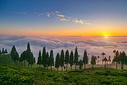
60:A scene of sunset from a tea garden at
52:
1978:
1976:
1062:Languages of Dhankuta district (2021)
506:After 1816 there were 10 districts in
1481:Map of the VDC/s in Dhankuta District
363:
355:
347:
339:
321:
293:
278:
270:
262:
249:
233:
223:
151:
133:
110:
80:
7:
2343:
2336:Places adjacent to Dhankuta District
949:Religion in Dhankuta District (2021)
518:was one district Dhankuta-chainpur.
2179:"Table 1: Caste/Ethnicity and sex"
25:
612:below 300 meters (1,000 ft)
254:892 km (344 sq mi)
29:District in Koshi Province, Nepal
2699:
2526:
2406:
2385:
2377:
2360:
2243:"Table 5: Mother tongue and sex"
2136:"Nepal: Provinces and Districts"
2049:"1. Eastern Development Region:"
1853:
1839:
1832:
1825:
867: Other Hill Janjati (5.47%)
98:
82:
70:
54:
2265:"Social characteristics tables"
1695:Dhankuta District has a single
1326:www.mahalaxmimundhankuta.gov.np
1763:(excluding ward no. 4 & 5)
1472:Village development committees
873: Other Khas Dalit (3.56%)
88:Divisions of Dhankuta District
1:
2407:
2361:
2386:
2378:
2272:Central Bureau of Statistics
2251:Central Bureau of Statistics
2219:Central Bureau of Statistics
2187:Central Bureau of Statistics
2162:Central Bureau of Statistics
2027:"Eastern Development Region"
1952:Central Bureau of Statistics
1670:(now Pakhribas Municipality)
1659:(now Pakhribas Municipality)
1635:(now Pakhribas Municipality)
1624:(now Pakhribas Municipality)
1568:(now Pakhribas Municipality)
365: • Life Expectancy
3159:Districts of Koshi Province
2211:"Table 5: Religion and sex"
1799:Khalsa Chhintang Sahidbhumi
1761:Khalsa Chhintang Sahidbhumi
206:Khalsa Chhintang Sahidbhumi
3180:
1797:and ward no. 4 & 5 of
1697:Parliamentary constituency
1353:www.sangurigadhimun.gov.np
543:Eastern Development Region
476:
295: • Ethnic groups
135:Reestablished (rearranged)
2694:
2524:
2479:
2341:
2029:. myholidaynepal.com. n.d
1701:Provincial constituencies
1031:
1023:
1018:
1008:
1003:
993:
988:
978:
973:
963:
958:
953:
948:
744:
696:—
436:
349: • Poverty rate
81:
69:
53:
44:
1759:(excluding ward no. 2),
1397:खाल्सा छिन्ताङ सहीदभूमि
655:6,400 to 9,800 ft.
640:3,300 to 6,600 ft.
625:1,000 to 3,300 ft.
1299:www.pakhribasmun.gov.np
491:Dhankuta was a part of
335:Human Development Index
280: • Households
275:180/km (470/sq mi)
2051:. khullakitab.com. n.d
1482:
1458:www.ddcdhankuta.gov.np
1434:www.choubisemun.gov.np
1407:www.choubisemun.gov.np
1380:www.choubisemun.gov.np
1272:www.dhankutamun.gov.np
1040:Religion: 49.56% were
488:
229:Coordination committee
3130:26.98139°N 87.34333°E
2484:Dhankuta Municipality
2140:www.citypopulation.de
1480:
670:Historical population
653:2,000 to 3,000 meters
638:1,000 to 2,000 meters
549:Geography and Climate
486:
357: • Literacy
2494:Rural municipalities
2295:"Districts of Nepal"
1910:Chintang Devi temple
1168: Others (5.14%)
879: Others (1.92%)
479:Unification of Nepal
323: • Female
272: • Density
76:Location of Dhankuta
3126: /
1806:Indra Mani Parajuli
1712:Incorporated areas
1024:Other or not stated
751:At the time of the
671:
623:300 to 1,000 meters
3135:26.98139; 87.34333
2398:Panchthar District
2117:on 3 December 2013
1988:ddcdhankuta.gov.np
1793:and ward No. 2 of
1735:Rajendra Kumar Rai
1483:
1240:Population (2011)
489:
264: • Total
251: • Total
3154:Dhankuta District
3109:
3108:
2565:
2564:
2473:Dhankuta District
2439:
2438:
2434:
2433:
2247:Census Nepal 2021
2215:Census Nepal 2021
2183:Census Nepal 2021
2158:Census Nepal 2021
1905:Namaste Waterfall
1815:
1814:
1463:
1462:
1036:
1035:
753:2021 Nepal census
749:
748:
662:
661:
429:Dhankuta District
426:
425:
235: • Body
225: • Type
36:Dhankuta District
18:Dhankuta district
16:(Redirected from
3171:
3141:
3140:
3138:
3137:
3136:
3131:
3127:
3124:
3123:
3122:
3119:
2709:
2704:
2703:
2702:
2592:
2585:
2578:
2569:
2530:
2513:Chhathar Jorpati
2466:
2459:
2452:
2443:
2410:
2409:
2389:
2388:
2381:
2380:
2364:
2363:
2344:
2330:
2323:
2316:
2307:
2302:
2276:
2275:
2269:
2261:
2255:
2254:
2239:
2230:
2229:
2227:
2225:
2207:
2198:
2197:
2195:
2193:
2175:
2166:
2165:
2150:
2144:
2143:
2132:
2126:
2125:
2124:
2122:
2116:
2110:, archived from
2099:
2089:
2083:
2082:
2080:
2078:
2067:
2061:
2060:
2058:
2056:
2045:
2039:
2038:
2036:
2034:
2023:
2017:
2016:
2014:
2006:
2000:
1999:
1997:
1995:
1980:
1971:
1970:
1968:
1966:
1961:on 18 April 2013
1960:
1949:
1941:
1863:
1857:
1856:
1850:
1843:
1842:
1836:
1829:
1783:Chhathar Jorpati
1706:
1466:Former divisions
1420:Chhathar Jorpati
1225:
1167:
1157:
1147:
1137:
1127:
1117:
1107:
1097:
1087:
1077:
1067:
946:
945:
878:
872:
866:
856:
846:
836:
826:
816:
806:
796:
786:
776:
766:
685:
680:
672:
598:Elevation Range
590:
501:Kingdom of Nepal
452:
451:
450:
448:
440:
422:
419:
417:
391:Main Language(s)
211:Chhathar Jorpati
104:
102:
101:
86:
74:
58:
32:
21:
3179:
3178:
3174:
3173:
3172:
3170:
3169:
3168:
3144:
3143:
3134:
3132:
3128:
3125:
3120:
3117:
3115:
3113:
3112:
3110:
3105:
3047:
2984:
2911:
2843:
2765:
2712:
2705:
2700:
2698:
2692:
2609:
2596:
2566:
2561:
2531:
2522:
2487:
2475:
2470:
2440:
2435:
2390:
2337:
2334:
2293:
2285:
2280:
2279:
2267:
2263:
2262:
2258:
2241:
2240:
2233:
2223:
2221:
2209:
2208:
2201:
2191:
2189:
2177:
2176:
2169:
2152:
2151:
2147:
2134:
2133:
2129:
2120:
2118:
2114:
2108:
2097:
2091:
2090:
2086:
2076:
2074:
2069:
2068:
2064:
2054:
2052:
2047:
2046:
2042:
2032:
2030:
2025:
2024:
2020:
2012:
2008:
2007:
2003:
1993:
1991:
1982:
1981:
1974:
1964:
1962:
1958:
1947:
1943:
1942:
1935:
1930:
1918:
1886:
1870:
1869:
1868:
1865:
1864:
1860:
1858:
1854:
1851:
1848:
1846:
1844:
1840:
1837:
1830:
1820:
1693:
1688:
1577:Jitpur Arkhaule
1506:Arkhaule Jitpur
1468:
1220:
1172:
1171:
1170:
1169:
1165:
1163:
1155:
1153:
1145:
1143:
1135:
1133:
1125:
1123:
1115:
1113:
1105:
1103:
1095:
1093:
1085:
1083:
1075:
1073:
1065:
1038:
1037:
1029:
1016:
1001:
986:
971:
883:
882:
881:
880:
876:
874:
870:
868:
864:
862:
854:
852:
844:
842:
834:
832:
824:
822:
814:
812:
804:
802:
794:
792:
784:
782:
774:
772:
764:
667:
654:
639:
624:
620:Upper Tropical
560:
551:
481:
475:
446:
444:
443:
442:
414:
317:
312:
307:
302:
215:
163:
162:
99:
97:
89:
77:
65:
49:
40:
37:
30:
23:
22:
15:
12:
11:
5:
3177:
3175:
3167:
3166:
3161:
3156:
3146:
3145:
3107:
3106:
3104:
3103:
3098:
3093:
3088:
3083:
3078:
3073:
3068:
3063:
3057:
3055:
3049:
3048:
3046:
3045:
3040:
3035:
3030:
3025:
3020:
3015:
3010:
3005:
3000:
2994:
2992:
2986:
2985:
2983:
2982:
2977:
2972:
2967:
2962:
2957:
2952:
2947:
2942:
2937:
2932:
2927:
2921:
2919:
2913:
2912:
2910:
2909:
2904:
2899:
2894:
2889:
2884:
2879:
2874:
2869:
2864:
2859:
2853:
2851:
2845:
2844:
2842:
2841:
2836:
2831:
2826:
2821:
2816:
2811:
2806:
2804:Kavrepalanchok
2801:
2796:
2791:
2786:
2781:
2775:
2773:
2767:
2766:
2764:
2763:
2758:
2753:
2748:
2743:
2738:
2733:
2728:
2722:
2720:
2714:
2713:
2711:
2710:
2695:
2693:
2691:
2690:
2685:
2680:
2675:
2670:
2665:
2660:
2655:
2650:
2645:
2640:
2635:
2630:
2625:
2619:
2617:
2611:
2610:
2597:
2595:
2594:
2587:
2580:
2572:
2563:
2562:
2560:
2559:
2554:
2549:
2543:
2541:
2538:Municipalities
2533:
2532:
2525:
2523:
2521:
2520:
2515:
2510:
2505:
2499:
2497:
2489:
2488:
2481:Headquarters:
2480:
2477:
2476:
2471:
2469:
2468:
2461:
2454:
2446:
2437:
2436:
2432:
2431:
2429:
2420:
2414:
2413:
2411:
2404:
2401:
2400:
2391:
2376:
2374:
2368:
2367:
2365:
2358:
2355:
2354:
2352:
2347:
2342:
2339:
2338:
2335:
2333:
2332:
2325:
2318:
2310:
2304:
2303:
2291:
2284:
2283:External links
2281:
2278:
2277:
2256:
2231:
2199:
2167:
2145:
2127:
2106:
2084:
2062:
2040:
2018:
2001:
1972:
1932:
1931:
1929:
1926:
1925:
1924:
1922:Zones of Nepal
1917:
1914:
1913:
1912:
1907:
1902:
1897:
1892:
1885:
1882:
1866:
1859:
1852:
1845:
1838:
1831:
1824:
1823:
1822:
1821:
1819:
1818:Transportation
1816:
1813:
1812:
1807:
1804:
1801:
1780:
1776:
1775:
1770:
1767:
1764:
1746:
1742:
1741:
1736:
1733:
1730:
1729:whole district
1727:
1723:
1722:
1719:
1716:
1715:Type of cons.
1713:
1710:
1709:Name of cons.
1692:
1691:Constituencies
1689:
1687:
1686:
1681:
1676:
1671:
1665:
1660:
1654:
1649:
1644:
1636:
1630:
1625:
1619:
1614:
1609:
1607:Marek Katahare
1604:
1599:
1594:
1589:
1584:
1579:
1574:
1569:
1563:
1558:
1553:
1548:
1543:
1538:
1533:
1528:
1523:
1518:
1513:
1508:
1503:
1498:
1493:
1484:
1467:
1464:
1461:
1460:
1455:
1452:
1449:
1446:
1443:
1440:
1437:
1436:
1431:
1428:
1425:
1422:
1417:
1414:
1410:
1409:
1404:
1401:
1398:
1395:
1390:
1387:
1383:
1382:
1377:
1374:
1371:
1368:
1363:
1360:
1356:
1355:
1350:
1347:
1344:
1341:
1336:
1333:
1329:
1328:
1323:
1320:
1317:
1314:
1309:
1306:
1302:
1301:
1296:
1293:
1290:
1287:
1282:
1279:
1275:
1274:
1269:
1266:
1263:
1260:
1255:
1252:
1248:
1247:
1244:
1241:
1238:
1235:
1232:
1229:
1219:
1216:
1164:
1154:
1144:
1134:
1124:
1114:
1104:
1094:
1084:
1074:
1064:
1060:
1059:
1058:
1034:
1033:
1030:
1027:
1025:
1021:
1020:
1017:
1014:
1012:
1006:
1005:
1002:
999:
997:
991:
990:
987:
984:
982:
976:
975:
972:
969:
967:
961:
960:
957:
955:
951:
950:
944:
943:
875:
869:
863:
853:
843:
833:
823:
813:
803:
793:
783:
773:
763:
759:
758:
757:
747:
746:
742:
741:
738:
735:
731:
730:
727:
724:
720:
719:
716:
713:
709:
708:
705:
702:
698:
697:
694:
691:
687:
686:
681:
676:
666:
663:
660:
659:
656:
651:
645:
644:
641:
636:
630:
629:
626:
621:
617:
616:
613:
610:
603:
602:
599:
596:
559:
556:
550:
547:
512:Dudhkosi river
474:
471:
459:Koshi Province
424:
423:
412:
408:
407:
393:
387:
386:
376:
370:
369:
366:
362:
361:
358:
354:
353:
350:
346:
345:
342:
338:
337:
331:
330:
327:
320:
319:
296:
292:
291:
285:
284:
281:
277:
276:
273:
269:
268:
265:
261:
260:
256:
255:
252:
248:
247:
243:
242:
236:
232:
231:
226:
222:
221:
217:
216:
214:
213:
208:
203:
198:
193:
186:
181:
176:
171:
160:
159:
158:
156:
150:
149:
144:
140:
139:
136:
132:
131:
125:
121:
120:
118:Koshi Province
115:
109:
108:
95:
91:
90:
87:
79:
78:
75:
67:
66:
59:
51:
50:
45:
42:
41:
38:
35:
28:
24:
14:
13:
10:
9:
6:
4:
3:
2:
3176:
3165:
3162:
3160:
3157:
3155:
3152:
3151:
3149:
3142:
3139:
3102:
3099:
3097:
3094:
3092:
3089:
3087:
3084:
3082:
3079:
3077:
3074:
3072:
3069:
3067:
3064:
3062:
3059:
3058:
3056:
3054:
3053:Sudurpashchim
3050:
3044:
3043:Western Rukum
3041:
3039:
3036:
3034:
3031:
3029:
3026:
3024:
3021:
3019:
3016:
3014:
3011:
3009:
3006:
3004:
3001:
2999:
2996:
2995:
2993:
2991:
2987:
2981:
2978:
2976:
2973:
2971:
2968:
2966:
2963:
2961:
2958:
2956:
2953:
2951:
2948:
2946:
2945:Eastern Rukum
2943:
2941:
2938:
2936:
2933:
2931:
2928:
2926:
2923:
2922:
2920:
2918:
2914:
2908:
2905:
2903:
2900:
2898:
2895:
2893:
2890:
2888:
2885:
2883:
2880:
2878:
2875:
2873:
2870:
2868:
2865:
2863:
2860:
2858:
2855:
2854:
2852:
2850:
2846:
2840:
2839:Sindhupalchok
2837:
2835:
2832:
2830:
2827:
2825:
2822:
2820:
2817:
2815:
2812:
2810:
2807:
2805:
2802:
2800:
2797:
2795:
2792:
2790:
2787:
2785:
2782:
2780:
2777:
2776:
2774:
2772:
2768:
2762:
2759:
2757:
2754:
2752:
2749:
2747:
2744:
2742:
2739:
2737:
2734:
2732:
2729:
2727:
2724:
2723:
2721:
2719:
2715:
2708:
2697:
2689:
2686:
2684:
2681:
2679:
2676:
2674:
2671:
2669:
2666:
2664:
2663:Sankhuwasabha
2661:
2659:
2656:
2654:
2651:
2649:
2646:
2644:
2641:
2639:
2636:
2634:
2631:
2629:
2626:
2624:
2621:
2620:
2618:
2616:
2612:
2608:
2604:
2600:
2593:
2588:
2586:
2581:
2579:
2574:
2573:
2570:
2558:
2555:
2553:
2550:
2548:
2545:
2544:
2542:
2540:
2539:
2534:
2529:
2519:
2516:
2514:
2511:
2509:
2506:
2504:
2501:
2500:
2498:
2496:
2495:
2490:
2486:
2485:
2478:
2474:
2467:
2462:
2460:
2455:
2453:
2448:
2447:
2444:
2430:
2428:
2424:
2421:
2419:
2416:
2415:
2412:
2405:
2403:
2402:
2399:
2395:
2392:
2384:
2375:
2373:
2370:
2369:
2366:
2359:
2357:
2356:
2353:
2351:
2350:Sankhuwasabha
2348:
2346:
2345:
2340:
2331:
2326:
2324:
2319:
2317:
2312:
2311:
2308:
2300:
2296:
2292:
2290:
2287:
2286:
2282:
2273:
2266:
2260:
2257:
2252:
2248:
2244:
2238:
2236:
2232:
2220:
2216:
2212:
2206:
2204:
2200:
2188:
2184:
2180:
2174:
2172:
2168:
2163:
2159:
2155:
2149:
2146:
2141:
2137:
2131:
2128:
2113:
2109:
2107:87-7903-210-9
2103:
2096:
2095:
2088:
2085:
2072:
2066:
2063:
2050:
2044:
2041:
2028:
2022:
2019:
2011:
2005:
2002:
1989:
1985:
1979:
1977:
1973:
1957:
1953:
1946:
1940:
1938:
1934:
1927:
1923:
1920:
1919:
1915:
1911:
1908:
1906:
1903:
1901:
1898:
1896:
1893:
1891:
1888:
1887:
1884:Tourist areas
1883:
1881:
1879:
1875:
1874:Koshi Highway
1862:
1835:
1828:
1817:
1811:
1808:
1805:
1802:
1800:
1796:
1792:
1788:
1784:
1781:
1779:Dhankuta 1(B)
1778:
1777:
1774:
1771:
1768:
1765:
1762:
1758:
1754:
1750:
1747:
1745:Dhankuta 1(A)
1744:
1743:
1740:
1737:
1734:
1732:parliamentary
1731:
1728:
1725:
1724:
1720:
1717:
1714:
1711:
1708:
1707:
1704:
1702:
1698:
1690:
1685:
1682:
1680:
1677:
1675:
1672:
1669:
1666:
1664:
1661:
1658:
1655:
1653:
1650:
1648:
1645:
1643:
1641:
1637:
1634:
1631:
1629:
1626:
1623:
1620:
1618:
1615:
1613:
1610:
1608:
1605:
1603:
1600:
1598:
1595:
1593:
1590:
1588:
1585:
1583:
1580:
1578:
1575:
1573:
1570:
1567:
1564:
1562:
1559:
1557:
1554:
1552:
1549:
1547:
1544:
1542:
1539:
1537:
1534:
1532:
1529:
1527:
1524:
1522:
1519:
1517:
1514:
1512:
1509:
1507:
1504:
1502:
1499:
1497:
1494:
1492:
1490:
1486:
1485:
1479:
1475:
1473:
1465:
1459:
1456:
1453:
1450:
1447:
1444:
1441:
1439:
1438:
1435:
1432:
1429:
1426:
1423:
1421:
1418:
1415:
1412:
1411:
1408:
1405:
1402:
1399:
1396:
1394:
1391:
1388:
1385:
1384:
1381:
1378:
1375:
1372:
1369:
1367:
1364:
1361:
1358:
1357:
1354:
1351:
1348:
1345:
1342:
1340:
1337:
1334:
1331:
1330:
1327:
1324:
1321:
1318:
1315:
1313:
1310:
1307:
1304:
1303:
1300:
1297:
1294:
1291:
1288:
1286:
1283:
1280:
1277:
1276:
1273:
1270:
1267:
1264:
1261:
1259:
1256:
1253:
1250:
1249:
1245:
1242:
1239:
1236:
1233:
1230:
1227:
1226:
1223:
1217:
1215:
1213:
1209:
1205:
1201:
1197:
1193:
1189:
1185:
1181:
1177:
1161:
1151:
1141:
1131:
1121:
1111:
1101:
1091:
1081:
1071:
1063:
1057:
1055:
1051:
1047:
1043:
1026:
1022:
1013:
1011:
1007:
998:
996:
992:
983:
981:
980:Kirat Mundhum
977:
968:
966:
962:
956:
952:
947:
942:
940:
936:
932:
928:
924:
920:
916:
912:
908:
904:
900:
896:
892:
888:
860:
850:
840:
830:
820:
810:
800:
790:
780:
770:
762:
756:
754:
743:
739:
736:
733:
732:
728:
725:
722:
721:
717:
714:
711:
710:
706:
703:
700:
699:
695:
692:
689:
688:
682:
677:
674:
673:
664:
657:
652:
650:
647:
646:
642:
637:
635:
632:
631:
627:
622:
619:
618:
614:
611:
609:
605:
604:
600:
597:
595:
592:
591:
588:
586:
582:
578:
574:
569:
565:
557:
555:
548:
546:
544:
539:
537:
533:
529:
525:
524:Sankhuwasabha
519:
517:
513:
509:
504:
502:
498:
494:
485:
480:
472:
470:
468:
464:
460:
456:
449:
439:
438:धनकुटा जिल्ला
434:
430:
421:
413:
405:
401:
397:
394:
392:
384:
380:
377:
375:
367:
359:
351:
343:
336:
328:
326:
316:
311:
306:
301:
297:
290:
282:
274:
266:
253:
240:
237:
230:
227:
212:
209:
207:
204:
202:
199:
197:
194:
192:
191:
187:
185:
182:
180:
177:
175:
172:
170:
169:
165:
157:
155:
148:
145:
137:
130:
126:
119:
116:
114:
107:
96:
85:
73:
63:
57:
48:
43:
39:धनकुटा जिल्ला
33:
27:
19:
3111:
2925:Arghakhanchi
2707:Nepal portal
2627:
2536:
2503:Sangurigadhi
2492:
2482:
2472:
2382:
2298:
2259:
2246:
2222:. Retrieved
2214:
2190:. Retrieved
2182:
2157:
2148:
2139:
2130:
2119:, retrieved
2112:the original
2093:
2087:
2075:. Retrieved
2065:
2053:. Retrieved
2043:
2031:. Retrieved
2021:
2004:
1992:. Retrieved
1987:
1963:. Retrieved
1956:the original
1871:
1867:Kosi Highway
1753:Sangurigadhi
1694:
1642:Municipality
1638:
1592:Kuruletenupa
1566:Ghorlikharka
1491:Municipality
1487:
1469:
1424:छथर जोरपाटी
1339:Sangurigadhi
1221:
1173:
1061:
1039:
1010:Christianity
884:
839:Kami (caste)
760:
750:
665:Demographics
594:Climate Zone
561:
552:
540:
520:
505:
490:
455:14 districts
453:) is one of
428:
427:
289:Demographics
196:Sangurigadhi
189:
167:
154:Municipality
26:
3133: /
2955:Kapilavastu
2653:Okhaldhunga
2508:Shahidbhumi
2121:22 November
2055:14 February
2033:14 February
1628:Murtidhunga
1612:Maunabudhuk
1572:Hattikharka
1556:Danda Bazar
1536:Budi Morang
1393:Shahidbhumi
1316:महालक्ष्मी
1196:Athpahariya
1120:Athpahariya
919:Athpahariya
849:Athpahariya
658: 3.2%
634:Subtropical
615: 3.7%
577:cauliflower
516:Mechi river
497:pallo kirat
461:of eastern
416:ddcdhankuta
129:Rana regime
124:Established
3148:Categories
3121:87°20′36″E
3118:26°58′53″N
3101:Kanchanpur
3081:Dadeldhura
2683:Tehrathum
2668:Solukhumbu
1965:1 November
1928:References
1803:provincial
1766:provincial
1726:Dhankuta 1
1602:Mahabharat
1511:Basantatar
1501:Ankhisalla
1343:सागुरीगढी
1289:पाख्रीबास
1210:and 1.39%
1188:Magar Dhut
1100:Magar Dhut
1052:and 2.47%
937:and 1.08%
601:% of Area
558:Vegetation
477:See also:
259:Population
241:, Dhankuta
220:Government
64:, Dhankuta
2980:Rupandehi
2824:Ramechhap
2814:Makwanpur
2799:Kathmandu
2779:Bhaktapur
2741:Mahottari
2678:Taplejung
2658:Panchthar
2603:Districts
2599:Provinces
2557:Mahalaxmi
2547:Pakhribas
2394:Tehrathum
2077:5 October
1994:4 October
1895:Pakhribas
1791:Mahalaxmi
1787:Pakhribas
1769:Niran Rai
1663:Raja Rani
1647:Parewadin
1640:Pakhribas
1633:Pakhribas
1587:Khuwaphok
1561:Dandagaun
1551:Chungmang
1546:Chhintang
1531:Budhabare
1445:Dhankuta
1442:District
1312:Mahalaxmi
1285:Pakhribas
1218:Divisions
1208:Chhintang
1178:, 12.98%
1150:Chhintang
1054:Christian
1048:, 13.11%
1044:, 34.74%
897:, 10.35%
893:, 13.85%
889:, 19.70%
649:Temperate
536:Panchthar
532:Taplejung
528:Tehrathum
379:UTC+05:45
374:Time zone
318:37%Others
184:Mahalaxmi
179:Pakhribas
143:Admin HQ.
3086:Darchula
3013:Jajarkot
2892:Nawalpur
2834:Sindhuli
2809:Lalitpur
2746:Rautahat
2736:Dhanusha
2688:Udayapur
2628:Dhankuta
2552:Dhankuta
2518:Chaubise
2418:Udayapur
2383:Dhankuta
2299:Statoids
2224:16 March
2192:16 March
1916:See also
1900:Bhedetar
1795:Dhankuta
1757:Dhankuta
1749:Chaubise
1674:Tankhuwa
1521:Bhirgaun
1516:Belahara
1489:Dhankuta
1451:163,412
1366:Chaubise
1258:Dhankuta
1246:Website
1206:, 1.61%
1202:, 2.54%
1198:, 3.09%
1194:, 3.40%
1190:, 5.28%
1186:, 9.28%
1182:, 9.85%
1082:(12.98%)
1072:(45.44%)
1050:Buddhist
995:Buddhism
965:Hinduism
954:Religion
933:, 1.39%
929:, 1.42%
925:, 2.14%
921:, 2.88%
917:, 3.56%
913:, 3.65%
909:, 4.09%
905:, 4.48%
901:, 6.56%
801:(10.35%)
791:(13.85%)
781:(19.70%)
771:(19.93%)
745:Sources:
608:Tropical
493:Limbuwan
467:Dhankuta
201:Chaubise
174:Dhankuta
147:Dhankuta
113:Province
47:District
3096:Kailali
3071:Bajhang
3066:Baitadi
3038:Surkhet
3023:Kalikot
2998:Dailekh
2990:Karnali
2970:Pyuthan
2935:Bardiya
2917:Lumbini
2907:Tanahun
2902:Syangja
2882:Mustang
2872:Lamjung
2857:Baglung
2849:Gandaki
2819:Nuwakot
2794:Dolakha
2789:Dhading
2784:Chitwan
2771:Bagmati
2756:Sarlahi
2751:Saptari
2718:Madhesh
2673:Sunsari
2643:Khotang
2623:Bhojpur
2423:Sunsari
2372:Bhojpur
1878:Itahari
1849:10miles
1718:MP/MLA
1684:Vedatar
1657:Phalate
1652:Phaksib
1617:Mudebas
1541:Chanuwa
1448:धनकुटा
1430:102.83
1427:18,322
1400:18,760
1373:19,283
1370:चौविसे
1346:21,536
1319:24,800
1295:144.29
1265:36,619
1262:धनकुटा
1237:Nepali
1184:Bantawa
1162:(1.39%)
1152:(1.61%)
1142:(2.54%)
1132:(3.09%)
1122:(3.40%)
1112:(5.28%)
1102:(9.28%)
1092:(9.85%)
1090:Bantawa
1028:
1015:
1000:
985:
970:
959:Percent
887:Chhetri
861:(2.88%)
851:(3.56%)
841:(3.65%)
831:(4.09%)
821:(4.48%)
811:(6.56%)
769:Chhetri
737:150,599
726:163,412
715:166,479
704:146,386
693:129,781
684:±% p.a.
581:cabbage
514:to the
473:History
411:Website
406:, Magar
404:Bantawa
305:Chhetri
267:163,412
127:during
94:Country
3076:Bajura
3061:Achham
3033:Salyan
2960:Parasi
2897:Parbat
2887:Myagdi
2877:Manang
2862:Gorkha
2829:Rasuwa
2761:Siraha
2648:Morang
2427:Morang
2425:&
2396:&
2104:
1721:Party
1699:and 2
1597:Leguwa
1416:Rural
1403:99.55
1389:Rural
1376:147.6
1362:Rural
1349:147.6
1335:Rural
1308:Urban
1292:22078
1281:Urban
1254:Urban
1212:Newari
1204:Yakkha
1192:Tamang
1176:Nepali
1166:
1160:Newari
1158:
1156:
1148:
1146:
1140:Yakkha
1138:
1136:
1128:
1126:
1118:
1116:
1110:Tamang
1108:
1106:
1098:
1096:
1088:
1086:
1078:
1076:
1070:Nepali
1068:
1066:
1046:Kirati
1004:13.11%
989:34.74%
974:49.56%
939:Bhujel
935:Gurung
923:Yakkha
903:Tamang
877:
871:
865:
859:Yakkha
857:
855:
847:
845:
837:
835:
827:
825:
817:
815:
809:Tamang
807:
805:
797:
795:
787:
785:
777:
775:
767:
765:
740:−0.81%
729:−0.19%
718:+1.29%
707:+1.21%
643:46.6%
628:44.7%
606:Lower
585:ginger
573:millet
447:Listen
433:Nepali
396:Nepali
344:$ 1257
283:37,616
103:
3018:Jumla
3008:Humla
3003:Dolpa
2975:Rolpa
2965:Palpa
2950:Gulmi
2930:Banke
2867:Kaski
2731:Parsa
2638:Jhapa
2615:Koshi
2607:Nepal
2268:(PDF)
2115:(PDF)
2098:(PDF)
2073:. n.d
2013:(PDF)
1990:. n.d
1959:(PDF)
1948:(PDF)
1679:Telia
1668:Sanne
1582:Khoku
1526:Bodhe
1496:Ahale
1243:Area
1234:Name
1231:Type
1180:Limbu
1080:Limbu
1042:Hindu
1032:0.12%
1019:2.47%
931:Sarki
927:Damai
911:Bahun
907:Newar
899:Magar
895:Limbu
829:Bahun
819:Newar
799:Magar
789:Limbu
734:2021
723:2011
712:2001
701:1991
690:1981
564:Tamor
508:Nepal
463:Nepal
400:Limbu
352:15.9%
315:Magar
310:Limbu
190:Rural
168:Urban
106:Nepal
3091:Doti
3028:Mugu
2940:Dang
2726:Bara
2633:Ilam
2601:and
2226:2024
2194:2024
2123:2013
2102:ISBN
2079:2018
2057:2018
2035:2018
1996:2018
1967:2012
1890:Hile
1847:15km
1622:Muga
1454:892
1322:129
1268:111
1228:No.
915:Kami
679:Pop.
675:Year
568:Arun
566:and
418:.gov
246:Area
161:List
138:1962
62:Hile
2605:of
1810:NCP
1773:NCP
1739:NCP
1200:Rai
1130:Rai
891:Rai
779:Rai
457:of
441:) (
420:.np
383:NPT
360:74%
329:53%
313:10%
308:13%
303:20%
300:Rai
298:20%
239:DCC
3150::
2297:.
2270:.
2249:.
2245:.
2234:^
2217:.
2213:.
2202:^
2185:.
2181:.
2170:^
2160:.
2156:.
2138:.
1986:.
1975:^
1950:.
1936:^
1789:,
1785:,
1755:,
1751:,
1703::
1474:.
1413:7
1386:6
1359:5
1332:4
1305:3
1278:2
1251:1
1056:.
941:.
583:,
579:,
534:,
530:,
526:,
503:.
435::
402:,
398:,
368:69
2591:e
2584:t
2577:v
2465:e
2458:t
2451:v
2329:e
2322:t
2315:v
2301:.
2274:.
2253:.
2228:.
2196:.
2164:.
2142:.
2081:.
2059:.
2037:.
2015:.
1998:.
1969:.
495:(
431:(
385:)
381:(
325:♀
20:)
Text is available under the Creative Commons Attribution-ShareAlike License. Additional terms may apply.