821:. A bench about 45 metres (148 ft) high on the west side of White Island, 1 nautical mile (1.9 km; 1.2 mi) from the north end. The bench comprises the northwest-most moraine-covered volcanic outcrops on the island, upon which occur tuffaceous conglomerate block and shell fragments of the Scallop Hill Formation. Named by US-ACAN (1999) after Ian G. Speden, New Zealand Geological Survey, DSIR, who, accompanied by A.C. Beck, collected fossiliferous deposits here, December 22, 1958.
65:
192:
46:
631:. A conspicuous rock bluff, 1 nautical mile (1.9 km; 1.2 mi) south of Marshall Cirque on the west side of White Island, Ross Archipelago. The bluff rises abruptly from Murdo Ice Shelf to over 400 meters. Named by US-ACAN (1999) after Ray R. Dibble, Department of Geology, Victoria University of Wellington, who investigated volcanic eruptions and the seismicity of nearby Mount Erebus in five seasons, 1980-81 through 1984-85.
859:. The northernmost cape of White Island. Named by the NZGSAE (1958-59) for the Rev. Arnold P. Spencer-Smith, chaplain with the Ross Sea Party of the Imperial Trans-Antarctic Expedition (1914-17), who died on March 9, 1916, on the return journey after laying the depots to Mount Hope for Shackleton's party. He had suffered from scurvy and had been carried for 40 days on a sledge by his companions prior to his death.
745:. An ice-filled cirque, 1 nautical mile (1.9 km; 1.2 mi) wide, located 1 nautical mile (1.9 km; 1.2 mi) southwest of Kienle Cirque on the west side of White Island. Named by US-ACAN (1999) after Dianne L. Marshall, Geophysical Institute, University of Alaska, Fairbanks, who investigated the volcanic activity and seismicity of nearby Mount Erebus in 1981-82 and 1982-83.
593:. A rock bluff rising to about 500 metres (1,600 ft) high between Dibble Bluff and Mount Nesos. Named by US-ACAN (2005) after Michael A. Castellini, Institute of Marine Sciences, University of Alaska, Fairbanks, AK, who studied the Weddell seal in McMurdo Sound sea ice areas, 1977-2004, including winter season research at White Island with Randall W. Davis (Davis Bluff), 1981.
783:. An ice-filled cirque, 2 nautical miles (3.7 km; 2.3 mi) wide, the largest cirque on the west side of White Island. Named by US-ACAN (1999) after Juergen Kienle, Geophysical Institute, University of Alaska, Fairbanks, a team leader for the investigation of volcanic activity and seismicity at nearby Mount Erebus in six seasons, 1980-81 through 1985-86.
72:
1296:
1136:
517:(US-ACAN; 2005) after Randall W. Davis, Department of Marine Biology, Texas A'&'M University, Galveston, TX, who studied the Weddell seal in McMurdo Sound sea ice areas, 1977-2003, including winter season research at White Island with Michael A. Castellini (Castellini Bluff. q.v.), 1981.
669:. A hill 2 nautical miles (3.7 km; 2.3 mi) southwest of Mount Heine. Named by the NZGSAE (1958-59) for V. Hayward, a Canadian member of the Imperial Trans-Antarctic Expedition (1914-17), who lost his life in a blizzard on May 8, 1916 when the sea ice in McMurdo Sound went out.
707:. A hill, 760 metres (2,490 ft) high, in the north part of White Island. Named by the NZGSAE (1958-59) for A.J. Heine, leader of their party who visited White Island. Heine, who climbed this hill, spent four summers and one winter in Antarctica, mostly in the McMurdo Sound area.
1300:
1140:
555:. A hill, 760 metres (2,490 ft) high, standing almost precisely in the center of White Island. Nipha is a Greek word for snow. So named by the NZGSAE (1958-59) because the hill is surrounded by ice and snow.
437:. A hill 2 nautical miles (3.7 km; 2.3 mi) west-northwest of Isolation Point in the south-central part of White Island. Named by the NZGSAE (1958-59) for G.B. Henderson, a member of that expedition.
280:
270:
475:. A small volcanic peak projecting through the ice sheet covering the southeast extremity of White Island. So named because of its remote position by the NZGSAE, 1958-59.
399:(NZGSAE; 1958-59) from the Greek word nesos (nisos), meaning island, and referring to the fact that although isolated by the ice sheet the hill is a part of White Island.
396:
113:
513:. A rock bluff rising to 400 metres (1,300 ft) high, 2 nautical miles (3.7 km; 2.3 mi) northeast of Isolation Point. Named by United States
395:. The remnants of a volcanic core, over 400 metres (1,300 ft) high, projecting through the ice near the southwest end of White Island. Named by the
204:
357:
Features include, from south to north, Mount Nesos, Mount
Henderson, Isolation Point, Mount Nipha, Mount Hayward, Mount Heine, and Cape Spencer-Smith.
1319:
1286:
1249:
1228:
1207:
1186:
1165:
1144:
1329:
1324:
717:
603:
514:
258:
793:
1277:
1240:
1219:
1198:
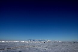
1177:
1156:
755:
565:
485:
1272:
1235:
1214:
1193:
1172:
1151:
276:
64:
319:
831:
679:
641:
527:
447:
409:
367:
1304:
1282:
1245:
1224:
1203:
1182:
1161:
254:
346:
28:
341:
336:
920:
925:
170:
191:
275:
Some 142 km of shelf ice adjoining the north-west coast of the island has been designated an
331:
242:
157:
45:
1256:
299:
250:
1313:
303:
32:
1118:
284:
887:
895:
Management Plan for
Antarctic Specially Protected Area No. 137: Measure 9, Annex
296:
249:. It is 15 nautical miles (28 km; 17 mi) long, protruding through the
915:
246:
101:
846:
833:
808:
795:
770:
757:
732:
719:
694:
681:
656:
643:
618:
605:
580:
567:
542:
529:
500:
487:
462:
449:
424:
411:
382:
369:
261:(1901–04) and so named by them because of the mantle of snow that covers it.
220:
206:
129:
115:
17:
51:
190:
283:) because it supports an isolated, small breeding population of
306:. The last known eruption occurred 0.17 million years ago.
271:
North-west White Island
Antarctic Specially Protected Area
1126:(2 ed.), United States Board on Geographic Names
181:
176:
163:
153:
107:
97:
92:
397:New Zealand Geological Survey Antarctic Expedition
1016:
1064:
944:
1076:
1088:
1028:
8:
992:
38:
44:
37:
1287:United States Department of the Interior
1250:United States Department of the Interior
1229:United States Department of the Interior
1208:United States Department of the Interior
1187:United States Department of the Interior
1166:United States Department of the Interior
888:"North-west White Island, McMurdo Sound"
1261:, USGS: United States Geological Survey
1145:United States Board on Geographic Names
1100:
1052:
1040:
1004:
980:
968:
956:
874:
867:
515:Advisory Committee on Antarctic Names
259:British National Antarctic Expedition
7:
897:. Antarctic Treaty Secretariat. 2008
71:
1278:Geographic Names Information System
1241:Geographic Names Information System
1220:Geographic Names Information System
1199:Geographic Names Information System
1178:Geographic Names Information System
1157:Geographic Names Information System
1303:from websites or documents of the
1143:from websites or documents of the
277:Antarctic Specially Protected Area
25:
1120:Geographic Names of the Antarctic
1299: This article incorporates
1294:
1139: This article incorporates
1134:
70:
63:
1320:White Island (Ross Archipelago)
1305:United States Geological Survey
1283:United States Geological Survey
1246:United States Geological Survey
1225:United States Geological Survey
1204:United States Geological Survey
1183:United States Geological Survey
1162:United States Geological Survey
1117:Alberts, Fred G., ed. (1995),
1:
295:White Island consists of two
1330:Polygenetic shield volcanoes
1325:Pleistocene shield volcanoes
347:GPX (secondary coordinates)
257:. It was discovered by the
29:White Island (Enderby Land)
1346:
733:78.0833333°S 167.2666667°E
619:78.1166667°S 167.2166667°E
268:
26:
342:GPX (primary coordinates)
317:Map all coordinates using
168:
58:
43:
921:Global Volcanism Program
809:78.028715°S 167.418146°E
738:-78.0833333; 167.2666667
624:-78.1166667; 167.2166667
325:Download coordinates as:
27:Not to be confused with
926:Smithsonian Institution
171:Antarctic Treaty System
169:Administered under the
1301:public domain material
1141:public domain material
814:-78.028715; 167.418146
241:) is an island in the
195:
84:Location in Antarctica
1017:Castellini Bluff USGS
771:78.0666667°S 167.35°E
581:78.15°S 167.1666667°E
501:78.15°S 167.5833333°E
337:GPX (all coordinates)
194:
1065:Marshall Cirque USGS
945:Mount Discovery USGS
253:immediately east of
843: /
805: /
776:-78.0666667; 167.35
767: /
729: /
691: /
653: /
615: /
586:-78.15; 167.1666667
577: /
539: /
506:-78.15; 167.5833333
497: /
459: /
421: /
379: /
216: /
125: /
40:
1152:"Castellini Bluff"
1077:Kienle Cirque USGS
847:78.000°S 167.450°E
825:Cape Spencer-Smith
695:78.083°S 167.450°E
657:78.117°S 167.350°E
543:78.150°S 167.400°E
463:78.183°S 167.500°E
425:78.183°S 167.333°E
383:78.200°S 167.100°E
221:78.133°S 167.400°E
196:
130:78.133°S 167.400°E
50:White Island from
1236:"Marshall Cirque"
1089:Speden Bench USGS
1029:Dibble Bluff USGS
189:
188:
16:(Redirected from
1337:
1298:
1297:
1289:
1268:
1267:
1266:
1252:
1231:
1210:
1189:
1168:
1138:
1137:
1133:
1132:
1131:
1125:
1104:
1098:
1092:
1086:
1080:
1074:
1068:
1062:
1056:
1050:
1044:
1038:
1032:
1026:
1020:
1014:
1008:
1002:
996:
993:Davis Bluff USGS
990:
984:
978:
972:
966:
960:
954:
948:
942:
936:
935:
933:
932:
912:
906:
905:
903:
902:
892:
884:
878:
872:
858:
857:
855:
854:
853:
852:-78.000; 167.450
848:
844:
841:
840:
839:
836:
820:
819:
817:
816:
815:
810:
806:
803:
802:
801:
798:
782:
781:
779:
778:
777:
772:
768:
765:
764:
763:
760:
744:
743:
741:
740:
739:
734:
730:
727:
726:
725:
722:
706:
705:
703:
702:
701:
700:-78.083; 167.450
696:
692:
689:
688:
687:
684:
668:
667:
665:
664:
663:
662:-78.117; 167.350
658:
654:
651:
650:
649:
646:
630:
629:
627:
626:
625:
620:
616:
613:
612:
611:
608:
592:
591:
589:
588:
587:
582:
578:
575:
574:
573:
570:
559:Castellini Bluff
554:
553:
551:
550:
549:
548:-78.150; 167.400
544:
540:
537:
536:
535:
532:
512:
511:
509:
508:
507:
502:
498:
495:
494:
493:
490:
474:
473:
471:
470:
469:
468:-78.183; 167.500
464:
460:
457:
456:
455:
452:
436:
435:
433:
432:
431:
430:-78.183; 167.333
426:
422:
419:
418:
417:
414:
394:
393:
391:
390:
389:
388:-78.200; 167.100
384:
380:
377:
376:
375:
372:
300:shield volcanoes
243:Ross Archipelago
240:
239:
237:
236:
235:
233:
228:
227:
226:-78.133; 167.400
222:
217:
214:
213:
212:
209:
158:Ross Archipelago
149:
148:
146:
145:
144:
142:
137:
136:
135:-78.133; 167.400
131:
126:
123:
122:
121:
118:
74:
73:
67:
48:
41:
21:
1345:
1344:
1340:
1339:
1338:
1336:
1335:
1334:
1310:
1309:
1295:
1292:
1271:
1264:
1262:
1258:Mount Discovery
1255:
1234:
1215:"Kienle Cirque"
1213:
1192:
1171:
1150:
1135:
1129:
1127:
1123:
1116:
1112:
1107:
1099:
1095:
1087:
1083:
1075:
1071:
1063:
1059:
1051:
1047:
1039:
1035:
1027:
1023:
1015:
1011:
1003:
999:
991:
987:
979:
975:
967:
963:
955:
951:
943:
939:
930:
928:
914:
913:
909:
900:
898:
890:
886:
885:
881:
873:
869:
865:
851:
849:
845:
842:
837:
834:
832:
830:
829:
827:
813:
811:
807:
804:
799:
796:
794:
792:
791:
789:
775:
773:
769:
766:
761:
758:
756:
754:
753:
751:
737:
735:
731:
728:
723:
720:
718:
716:
715:
713:
711:Marshall Cirque
699:
697:
693:
690:
685:
682:
680:
678:
677:
675:
661:
659:
655:
652:
647:
644:
642:
640:
639:
637:
623:
621:
617:
614:
609:
606:
604:
602:
601:
599:
585:
583:
579:
576:
571:
568:
566:
564:
563:
561:
547:
545:
541:
538:
533:
530:
528:
526:
525:
523:
505:
503:
499:
496:
491:
488:
486:
484:
483:
481:
467:
465:
461:
458:
453:
450:
448:
446:
445:
443:
441:Isolation Point
429:
427:
423:
420:
415:
412:
410:
408:
407:
405:
403:Mount Henderson
387:
385:
381:
378:
373:
370:
368:
366:
365:
363:
355:
354:
353:
352:
351:
312:
293:
273:
267:
231:
229:
225:
223:
219:
218:
215:
210:
207:
205:
203:
202:
140:
138:
134:
132:
128:
127:
124:
119:
116:
114:
112:
111:
88:
87:
86:
85:
82:
81:
80:
79:
75:
54:
36:
23:
22:
15:
12:
11:
5:
1343:
1341:
1333:
1332:
1327:
1322:
1312:
1311:
1291:
1290:
1273:"Speden Bench"
1269:
1253:
1232:
1211:
1194:"Dibble Bluff"
1190:
1169:
1148:
1113:
1111:
1108:
1106:
1105:
1093:
1081:
1069:
1057:
1055:, p. 324.
1045:
1043:, p. 321.
1033:
1021:
1009:
1007:, p. 527.
997:
985:
983:, p. 365.
973:
971:, p. 327.
961:
959:, p. 521.
949:
937:
916:"White Island"
907:
879:
877:, p. 809.
866:
864:
861:
826:
823:
788:
785:
750:
747:
712:
709:
674:
671:
636:
633:
598:
595:
560:
557:
522:
519:
480:
477:
442:
439:
404:
401:
362:
359:
350:
349:
344:
339:
334:
328:
322:
315:
314:
313:
311:
308:
304:volcanic cones
292:
289:
269:Main article:
266:
265:Protected Area
263:
251:Ross Ice Shelf
187:
186:
183:
179:
178:
174:
173:
166:
165:
164:Administration
161:
160:
155:
151:
150:
109:
105:
104:
99:
95:
94:
90:
89:
83:
77:
76:
69:
68:
62:
61:
60:
59:
56:
55:
49:
24:
14:
13:
10:
9:
6:
4:
3:
2:
1342:
1331:
1328:
1326:
1323:
1321:
1318:
1317:
1315:
1308:
1306:
1302:
1288:
1284:
1280:
1279:
1274:
1270:
1260:
1259:
1254:
1251:
1247:
1243:
1242:
1237:
1233:
1230:
1226:
1222:
1221:
1216:
1212:
1209:
1205:
1201:
1200:
1195:
1191:
1188:
1184:
1180:
1179:
1174:
1173:"Davis Bluff"
1170:
1167:
1163:
1159:
1158:
1153:
1149:
1146:
1142:
1122:
1121:
1115:
1114:
1109:
1102:
1097:
1094:
1090:
1085:
1082:
1078:
1073:
1070:
1066:
1061:
1058:
1054:
1049:
1046:
1042:
1037:
1034:
1030:
1025:
1022:
1018:
1013:
1010:
1006:
1001:
998:
994:
989:
986:
982:
977:
974:
970:
965:
962:
958:
953:
950:
946:
941:
938:
927:
923:
922:
917:
911:
908:
896:
889:
883:
880:
876:
871:
868:
862:
860:
856:
824:
822:
818:
786:
784:
780:
749:Kienle Cirque
748:
746:
742:
710:
708:
704:
672:
670:
666:
635:Mount Hayward
634:
632:
628:
596:
594:
590:
558:
556:
552:
520:
518:
516:
510:
478:
476:
472:
440:
438:
434:
402:
400:
398:
392:
360:
358:
348:
345:
343:
340:
338:
335:
333:
330:
329:
327:
326:
321:
320:OpenStreetMap
318:
309:
307:
305:
301:
298:
290:
288:
286:
285:Weddell seals
282:
278:
272:
264:
262:
260:
256:
252:
248:
244:
238:
200:
193:
184:
180:
175:
172:
167:
162:
159:
156:
152:
147:
110:
106:
103:
100:
96:
91:
66:
57:
53:
47:
42:
34:
33:White Islands
30:
19:
1293:
1276:
1263:, retrieved
1257:
1239:
1218:
1197:
1176:
1155:
1128:, retrieved
1119:
1101:Alberts 1995
1096:
1084:
1072:
1060:
1053:Alberts 1995
1048:
1041:Alberts 1995
1036:
1024:
1012:
1005:Alberts 1995
1000:
988:
981:Alberts 1995
976:
969:Alberts 1995
964:
957:Alberts 1995
952:
940:
929:. Retrieved
919:
910:
899:. Retrieved
894:
882:
875:Alberts 1995
870:
828:
790:
787:Speden Bench
752:
714:
676:
638:
600:
597:Dibble Bluff
562:
524:
482:
444:
406:
364:
356:
324:
323:
316:
302:overlain by
294:
274:
255:Black Island
232:White Island
199:White Island
198:
197:
177:Demographics
141:White Island
78:White Island
39:White Island
18:Dibble Bluff
850: /
812: /
800:167°25′05″E
774: /
762:167°21′00″E
736: /
724:167°16′00″E
698: /
673:Mount Heine
660: /
622: /
610:167°13′00″E
584: /
572:167°10′00″E
546: /
521:Mount Nipha
504: /
492:167°35′00″E
479:Davis Bluff
466: /
428: /
386: /
361:Mount Nesos
297:Pleistocene
224: /
185:Uninhabited
154:Archipelago
133: /
108:Coordinates
1314:Categories
1265:2024-02-23
1130:2024-01-30
931:2020-03-17
901:2013-09-21
863:References
797:78°01′43″S
759:78°04′00″S
721:78°05′00″S
607:78°07′00″S
569:78°09′00″S
489:78°09′00″S
247:Antarctica
230: (
182:Population
139: (
102:Antarctica
93:Geography
838:167°27′E
686:167°27′E
648:167°21′E
534:167°24′E
454:167°30′E
416:167°20′E
374:167°06′E
310:Features
281:ASPA 137
211:167°24′E
120:167°24′E
98:Location
52:Ross Sea
1110:Sources
835:78°00′S
683:78°05′S
645:78°07′S
531:78°09′S
451:78°11′S
413:78°11′S
371:78°12′S
291:Geology
208:78°08′S
117:78°8′S
1124:(PDF)
891:(PDF)
332:KML
245:of
31:or
1316::
1307:.
1285:,
1281:,
1275:,
1248:,
1244:,
1238:,
1227:,
1223:,
1217:,
1206:,
1202:,
1196:,
1185:,
1181:,
1175:,
1164:,
1160:,
1154:,
924:.
918:.
893:.
287:.
1147:.
1103:.
1091:.
1079:.
1067:.
1031:.
1019:.
995:.
947:.
934:.
904:.
279:(
234:)
201:(
143:)
35:.
20:)
Text is available under the Creative Commons Attribution-ShareAlike License. Additional terms may apply.