486:
70:
54:
77:
256:
The park's boundaries follow the
Dniester River for 100 km as it flows from northwest to southeast in western Ukraine. For much of this length, the park is only about 5 – 10 km wide, centered on the river. There are over 50 significant caves in the park, cut in the
294:
The park is sectioned into four zones: a reserved zone, a regulated recreation zone, a stationary recreation zone and a business zone. There are a number of tourist trails and much of the territory is near developed areas for services.
485:
281:
Dfb), with large seasonal temperature differentials and a warm summer (at least four months averaging over 10 °C (50 °F), but no month averaging over 22 °C (72 °F). The park is in the southern edge of the
265:– is in the park. As with most National Nature Parks in Ukraine, the main park includes many smaller nature reserves, local park sites, historical monuments and natural attractions open to public visits.
450:
410:
185:
69:
730:
956:
475:
379:
234:. The canyon is known for its varied geological formations, including two of the longest caves in the world. It is in the administrative district of
118:
922:
755:
419:
403:
951:
577:
906:
870:
805:
880:
670:
825:
815:
655:
607:
780:
775:
715:
710:
566:
396:
946:
875:
850:
810:
665:
640:
494:
690:
465:
820:
685:
630:
278:
371:
896:
891:
785:
650:
635:
597:
556:
865:
680:
660:
612:
283:
39:
830:
911:
835:
705:
645:
427:
760:
735:
261:
rock. These include the Ozerna (105 km) and
Optymistychna (230 km) caves. The largest waterfall in Ukraine –
901:
860:
855:
845:
840:
790:
770:
745:
445:
226:. It protects a relatively undeveloped portion of the Ukrainian forest-steppe landscape, about 75 km east of the
750:
725:
720:
700:
695:
522:
516:
470:
440:
795:
765:
601:
561:
941:
622:
304:
274:
800:
886:
527:
507:
460:
587:
572:
547:
552:
542:
532:
512:
376:
740:
53:
592:
537:
502:
227:
582:
388:
346:
207:
27:
162:
383:
251:
239:
215:
96:
235:
223:
935:
43:
455:
435:
262:
166:
106:
258:
133:
120:
324:
195:
219:
154:
347:"Decree of the President of Ukraine establishing NNP Dniester Canyon"
273:
The official climate designation for the
Dniester Canyon area is '
231:
158:
392:
76:
230:
in western
Ukraine, and about 400 km southwest of
621:
493:
426:
212:Національний природний парк «Дністровський каньйон»
191:
186:
Ministry of
Ecology and Natural Resources (Ukraine)
181:
173:
149:
112:
102:
92:
32:Національний природний парк «Дністровський каньйон»
21:
377:Map of Dniester Canyon NNP at ProtectedPlanet.net
420:National Conservation Areas of Nature in Ukraine
372:Map of Dniester Canyon NNP at OpenStreetMap.com
404:
8:
411:
397:
389:
18:
923:Categories of protected areas of Ukraine
349:(in Ukrainian). Verhovna Rada of Ukraine
196:http://dnistercanyon.pp.ua/index.php/en/
316:
325:"Dniester Canyon National Nature Park"
7:
204:Dniester Canyon National Nature Park
91:
58:Dniester Canyon National Nature Park
22:Dniester Canyon National Nature Park
957:Protected areas established in 2010
14:
222:, along the middle course of the
484:
75:
68:
52:
172:
101:
952:2010 establishments in Ukraine
284:Central European mixed forests
1:
279:Köppen climate classification
973:
249:
947:National parks of Ukraine
920:
731:Ivory Coast of Sviatoslav
482:
305:National Parks of Ukraine
277:– warm summer sub-type' (
275:Humid continental climate
211:
63:
51:
37:
31:
26:
218:, the largest canyon in
16:National park in Ukraine
741:Karmeliukove Podillia
623:National nature parks
608:Yalta Mountain-Forest
578:Michael's Virgin Land
269:Climate and ecoregion
567:Striltsivskyi Steppe
228:Carpathian Mountains
756:Kremenets Mountains
182:Governing body
130: /
562:Stanytsia-Luhanska
428:Biosphere reserves
382:2022-05-07 at the
929:
928:
907:Zacharovanyi Krai
871:Tsumanska Pushcha
831:Pushcha Radzivila
806:Northern Podillia
201:
200:
103:Nearest city
964:
942:IUCN Category II
881:Upper Pobuzhzhia
671:Desna-Stara Huta
598:Ukrainian Steppe
557:Provallia Steppe
488:
413:
406:
399:
390:
359:
358:
356:
354:
343:
337:
336:
334:
332:
321:
213:
145:
144:
142:
141:
140:
135:
134:48.65°N 25.735°E
131:
128:
127:
126:
123:
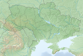
84:Location of Park
79:
78:
72:
56:
33:
19:
972:
971:
967:
966:
965:
963:
962:
961:
932:
931:
930:
925:
916:
826:Prypiat-Stokhid
816:Podilian Tovtry
676:Dniester Canyon
656:Charming Harbor
617:
613:Yelanets Steppe
495:Nature reserves
489:
480:
466:East Carpathian
422:
417:
384:Wayback Machine
368:
363:
362:
352:
350:
345:
344:
340:
330:
328:
323:
322:
318:
313:
301:
292:
271:
254:
252:Dniester Canyon
248:
240:Ternopil Oblast
216:Dniester Canyon
138:
136:
132:
129:
124:
121:
119:
117:
116:
97:Ternopil Oblast
88:
87:
86:
85:
82:
81:
80:
59:
47:
17:
12:
11:
5:
970:
968:
960:
959:
954:
949:
944:
934:
933:
927:
926:
921:
918:
917:
915:
914:
909:
904:
899:
894:
889:
884:
878:
873:
868:
863:
858:
853:
848:
843:
838:
833:
828:
823:
818:
813:
808:
803:
798:
793:
788:
783:
781:Lower Polissia
778:
776:Lower Dniester
773:
768:
763:
761:Kreminna Woods
758:
753:
748:
743:
738:
736:Kamianska Sich
733:
728:
723:
718:
716:Homilsha Woods
713:
711:Holy Mountains
708:
703:
698:
693:
688:
683:
678:
673:
668:
663:
658:
653:
648:
643:
638:
633:
627:
625:
619:
618:
616:
615:
610:
605:
595:
590:
585:
580:
575:
570:
564:
559:
550:
545:
540:
535:
530:
525:
520:
510:
505:
499:
497:
491:
490:
483:
481:
479:
478:
473:
468:
463:
458:
453:
448:
443:
438:
432:
430:
424:
423:
418:
416:
415:
408:
401:
393:
387:
386:
374:
367:
366:External links
364:
361:
360:
338:
315:
314:
312:
309:
308:
307:
300:
297:
291:
288:
270:
267:
250:Main article:
247:
244:
236:Chortkiv Raion
224:Dniester River
199:
198:
193:
189:
188:
183:
179:
178:
175:
171:
170:
151:
147:
146:
114:
110:
109:
104:
100:
99:
94:
90:
89:
83:
74:
73:
67:
66:
65:
64:
61:
60:
57:
49:
48:
38:
35:
34:
24:
23:
15:
13:
10:
9:
6:
4:
3:
2:
969:
958:
955:
953:
950:
948:
945:
943:
940:
939:
937:
924:
919:
913:
910:
908:
905:
903:
900:
898:
895:
893:
890:
888:
885:
882:
879:
877:
876:Tuzly Lagoons
874:
872:
869:
867:
864:
862:
859:
857:
854:
852:
851:Skole Beskids
849:
847:
844:
842:
841:Royal Beskids
839:
837:
834:
832:
829:
827:
824:
822:
819:
817:
814:
812:
811:Oleshky Sands
809:
807:
804:
802:
799:
797:
794:
792:
789:
787:
784:
782:
779:
777:
774:
772:
771:Lower Dnieper
769:
767:
764:
762:
759:
757:
754:
752:
749:
747:
746:Kholodnyi Yar
744:
742:
739:
737:
734:
732:
729:
727:
724:
722:
721:Hutsulshchyna
719:
717:
714:
712:
709:
707:
704:
702:
699:
697:
694:
692:
689:
687:
684:
682:
679:
677:
674:
672:
669:
667:
666:Derman-Ostroh
664:
662:
659:
657:
654:
652:
649:
647:
644:
642:
641:Boikivshchyna
639:
637:
634:
632:
629:
628:
626:
624:
620:
614:
611:
609:
606:
603:
599:
596:
594:
591:
589:
586:
584:
581:
579:
576:
574:
571:
568:
565:
563:
560:
558:
554:
551:
549:
546:
544:
541:
539:
536:
534:
531:
529:
526:
524:
521:
518:
514:
511:
509:
506:
504:
501:
500:
498:
496:
492:
487:
477:
476:West Polissia
474:
472:
469:
467:
464:
462:
459:
457:
454:
452:
449:
447:
444:
442:
439:
437:
434:
433:
431:
429:
425:
421:
414:
409:
407:
402:
400:
395:
394:
391:
385:
381:
378:
375:
373:
370:
369:
365:
348:
342:
339:
326:
320:
317:
310:
306:
303:
302:
298:
296:
289:
287:
285:
280:
276:
268:
266:
264:
260:
253:
245:
243:
241:
237:
233:
229:
225:
221:
217:
209:
205:
197:
194:
190:
187:
184:
180:
176:
168:
164:
160:
156:
152:
148:
143:
139:48.65; 25.735
115:
111:
108:
105:
98:
95:
71:
62:
55:
50:
45:
44:national park
41:
40:IUCN category
36:
29:
25:
20:
691:Grand Meadow
675:
523:Dnieper-Oril
517:Swan Islands
503:Cape Martian
436:Askania-Nova
351:. Retrieved
341:
331:February 27,
329:. Retrieved
319:
293:
272:
255:
203:
202:
821:Pryazovskyi
686:Dzharylhach
631:Azov-Syvash
602:Chalk Flora
471:Roztochchia
327:. Park Site
286:ecoregion.
263:Dzhurynskyi
174:Established
161:; 108
137: /
113:Coordinates
107:Zalishchyky
936:Categories
897:Vyzhnytsia
892:Verkhovyna
883:(proposed)
786:Lower Sula
651:Carpathian
636:Bile Ozero
446:Carpathian
311:References
290:Public use
259:Travertine
246:Topography
214:) follows
167:sq mi
165:; 42
153:10,829.18
125:25°44′06″E
122:48°39′00″N
866:Syniohora
681:Dvorichna
661:Cheremosh
528:Drevlians
508:Cheremske
451:Chernobyl
441:Black Sea
353:March 12,
208:Ukrainian
28:Ukrainian
912:Zalissia
836:Pyriatyn
766:Kuialnyk
706:Holosiiv
646:Bug Gard
588:Polissia
573:Medobory
548:Kazantyp
380:Archived
299:See also
157:(26,759
155:hectares
93:Location
902:Yavoriv
861:Synevyr
856:Sloboda
791:Meotyda
553:Luhansk
543:Karadag
533:Gorgany
220:Ukraine
192:Website
846:Shatsk
751:Khotyn
726:Ichnia
701:Hetman
696:Halych
513:Crimea
456:Danube
801:Nobel
796:Mezyn
593:Rivne
538:Kaniv
461:Desna
159:acres
583:Opuk
355:2019
333:2019
232:Kyiv
177:2010
150:Area
42:II (
887:Uzh
238:in
938::
242:.
210::
163:km
30::
604:)
600:(
569:)
555:(
519:)
515:(
412:e
405:t
398:v
357:.
335:.
206:(
169:)
46:)
Text is available under the Creative Commons Attribution-ShareAlike License. Additional terms may apply.