64:
1245:
86:
52:
163:
851:
417:
183:
93:
815:
In the town, the population was spread out, with 22.5% under the age of 18, 7.5% from 18 to 24, 26.0% from 25 to 44, 28.6% from 45 to 64, and 16.3% who were 65 years of age or older. The median age was 44.7 years. For every 100 females, there were 99.6 males. For every 100 females age 18 and over,
811:
living together, 12.1% had a female householder with no husband present, and 45.2% were non-families. 39.7% of all households were made up of individuals, and 13.9% had someone living alone who was 65 years of age or older. The average household size was 2.15 and the average family size was 2.92.
775:
of 2010, there were 936 people, 431 households, and 236 families residing in the town. The population density was 1,337.1 inhabitants per square mile (516.3/km). There were 501 housing units at an average density of 715.7 per square mile (276.3/km). The racial makeup of the town was 90.38%
533:
to the north. Built-up areas outside the town limits include extensive residential, commercial, and minor-industrial areas upstream in the valley floor, on Summit Ridge to the south-southwest, and on high ground to the west, at the intersections of
Colorado Highways 145 and 184.
63:
469:
819:
The median income for a household in the town was $ 30,417, and the median income for a family was $ 32,188. Males had a median income of $ 27,404 versus $ 19,286 for females. The
1183:
461:
489:
465:
1412:
1067:
475:
424:
Dolores (Spanish for "sorrows" and named for the river on which it is located) is located at the mouth of the
Dolores Valley and the upper reaches of
1176:
352:
123:
983:
895:
493:
1169:
362:
864:
506:
393:
225:
85:
42:
1352:
1161:
789:
781:
1023:
975:
433:
195:
51:
1105:
979:
920:
793:
1019:
1417:
1193:
397:
200:
70:
748:
733:
718:
703:
688:
673:
658:
643:
628:
613:
598:
583:
568:
519:
405:
1064:
340:
155:
20:
1007:
1382:
1332:
1322:
1279:
1156:
807:
There were 431 households, out of which 25.3% had children under the age of 18 living with them, 38.5% were
1358:
1086:
797:
481:
453:
429:
207:
1074:
Colorado
Historical Society Office of Archaeology and Historic Preservation. Retrieved August 10, 2011.
1389:
801:
763:
309:
1342:
1302:
785:
777:
530:
320:
299:
916:
1317:
1312:
823:
for the town was $ 14,912. About 16.6% of families and 17.3% of the population were below the
820:
1327:
1292:
1269:
1234:
1215:
437:
425:
1287:
1071:
856:
949:, Department of Personnel & Administration, Colorado State Archives. December 1, 2004
942:
500:
316:
295:
1406:
526:
345:
168:
107:
891:
824:
441:
1208:
416:
1032:
846:
175:
1008:
U.S. Geological Survey
Geographic Names Information System: Dolores, Colorado
138:
125:
444:
founded by New Mexico Lumber
Company, that is now covered by the reservoir.
290:
470:
National
Register of Historic Places listings in Montezuma County, Colorado
827:, including 24.1% of those under age 18 and 11.6% of those age 65 or over.
522:, the town had a total area of 425 acres (1.721 km), all of it land.
1373:‡This populated place also has portions in an adjacent county or counties
1027:
946:
808:
401:
328:
188:
836:
529:
near the point where the river turns from flowing southward out of the
376:
1244:
1149:
1126:
772:
464:, and the on-site Domniguez and Escalante Pueblos are listed on the
1065:
Colorado State
Register of Historic Properties - Montezuma County.
415:
1256:
1226:
1036:
1165:
509:, also known as Benny's Hogan and the Rio Grande Southern Hotel
1243:
839:
network. It is on the
Durango-Grand Junction Outrider line.
1101:
525:
The town is confined to a narrow valley bottom along the
484:
settlement of 11 pueblos occupied between AD 1075 - 1150.
436:, it replaced the earlier town, Big Bend, now covered by
1088:
National
Register of Historic Places in Montezuma County
452:
The following are
Dolores area historic sites of the
404:, United States. The town population was 885 at the
1368:
1341:
1301:
1278:
1255:
1225:
371:
361:
351:
339:
327:
306:
289:
281:
273:
268:
260:
252:
244:
236:
231:
221:
216:
206:
194:
174:
154:
33:
976:"Decennial Census P.L. 94-171 Redistricting Data"
462:Canyons of the Ancients Visitor Center and Museum
16:Town in Montezuma County, Colorado, United States
1091:American Dreams, Inc. Retrieved October 7, 2011.
428:, approximately 40 miles (64 km) from the
490:Colorado State Register of Historic Properties
466:Colorado State Register of Historic Properties
1248:Map of Colorado highlighting Montezuma County
1177:
970:
968:
966:
964:
8:
804:of any race were 10.90% of the population.
1184:
1170:
1162:
1060:
1058:
1056:
541:
30:
476:Canyons of the Ancients National Monument
28:Statutory Town in Colorado, United States
886:
884:
882:
880:
876:
503:, also known as the Lebanon Schoolhouse
370:
350:
326:
288:
267:
259:
230:
215:
153:
118:
105:Location of the Town of Dolores in the
78:
60:
48:
1082:
1080:
1003:
1001:
561:
420:Railroad Avenue, Dolores' main street.
360:
338:
305:
280:
272:
256:0.000 sq mi (0.000 km)
251:
248:0.664 sq mi (1.721 km)
243:
240:0.664 sq mi (1.721 km)
235:
220:
205:
193:
173:
7:
984:United States Department of Commerce
917:"2014 U.S. Gazetteer Files: Places"
896:Colorado Department of Local Affairs
796:, and 3.74% from two or more races.
494:National Register of Historic Places
1413:Towns in Montezuma County, Colorado
1359:Ute Mountain Ute Indian Reservation
943:"Colorado Municipal Incorporations"
68:Location of the Town of Dolores in
1192:Municipalities and communities of
865:List of municipalities in Colorado
551:
488:Other historic sites added to the
440:. McPhee Reservoir is named for a
432:. Established as a station on the
14:
892:"Active Colorado Municipalities"
849:
181:
161:
91:
84:
62:
50:
1353:Southern Ute Indian Reservation
1157:CDOT map of the Town of Dolores
92:
835:Dolores is part of Colorado's
1:
1024:United States Postal Service
434:Rio Grande Southern Railroad
264:6,946 ft (2,117 m)
1106:United States Census Bureau
980:United States Census Bureau
921:United States Census Bureau
1434:
1195:Montezuma County, Colorado
71:Montezuma County, Colorado
18:
1378:
1241:
1206:
762:
747:
732:
717:
702:
687:
672:
657:
642:
627:
612:
597:
582:
567:
560:
555:
550:
547:
520:2020 United States Census
406:2020 United States Census
285:1,332/sq mi (514/km)
119:
79:
61:
49:
40:
21:Dolores County, Colorado
19:Not to be confused with
1070:April 24, 2012, at the
816:there were 99.7 males.
56:Aerial photo of Dolores
1249:
421:
139:37.47333°N 108.50389°W
1247:
1102:"U.S. Census website"
764:U.S. Decennial Census
543:Historical population
454:Ancient Pueblo People
430:Four Corners Monument
419:
308: • Summer (
1391:United States portal
282: • Density
144:37.47333; -108.50389
1041:on November 4, 2010
544:
135: /
1250:
1127:"Bustang Schedule"
542:
531:San Juan Mountains
422:
274: • Total
253: • Water
237: • Total
1418:Towns in Colorado
1400:
1399:
1020:"ZIP Code Lookup"
986:. August 12, 2021
947:State of Colorado
821:per capita income
769:
768:
480:O'Brien Site, an
387:
386:
245: • Land
222: • Type
35:Dolores, Colorado
1425:
1392:
1385:
1246:
1218:
1211:
1201:
1196:
1186:
1179:
1172:
1163:
1153:
1152:
1150:Official website
1135:
1134:
1123:
1117:
1116:
1114:
1112:
1098:
1092:
1084:
1075:
1062:
1051:
1050:
1048:
1046:
1040:
1026:. Archived from
1016:
1010:
1005:
996:
995:
993:
991:
972:
959:
958:
956:
954:
939:
933:
932:
930:
928:
913:
907:
906:
904:
902:
888:
859:
854:
853:
852:
790:Pacific Islander
563:
558:
553:
545:
438:McPhee Reservoir
426:McPhee Reservoir
398:Montezuma County
383:
380:
378:
313:
201:Montezuma County
187:
185:
184:
167:
165:
164:
150:
149:
147:
146:
145:
140:
136:
133:
132:
131:
128:
111:
95:
94:
88:
74:
66:
54:
31:
1433:
1432:
1428:
1427:
1426:
1424:
1423:
1422:
1403:
1402:
1401:
1396:
1390:
1384:Colorado portal
1383:
1374:
1364:
1344:
1337:
1304:
1297:
1274:
1251:
1239:
1221:
1216:
1209:
1202:
1199:
1194:
1190:
1148:
1147:
1144:
1139:
1138:
1125:
1124:
1120:
1110:
1108:
1100:
1099:
1095:
1085:
1078:
1072:Wayback Machine
1063:
1054:
1044:
1042:
1030:
1018:
1017:
1013:
1006:
999:
989:
987:
974:
973:
962:
952:
950:
941:
940:
936:
926:
924:
915:
914:
910:
900:
898:
890:
889:
878:
873:
857:Colorado portal
855:
850:
848:
845:
833:
809:married couples
782:Native American
556:
540:
516:
450:
414:
375:
363:GNIS feature ID
335:
307:
182:
180:
162:
160:
143:
141:
137:
134:
129:
126:
124:
122:
121:
115:
114:
113:
112:
106:
103:
102:
101:
100:
96:
75:
69:
57:
45:
36:
29:
24:
17:
12:
11:
5:
1431:
1429:
1421:
1420:
1415:
1405:
1404:
1398:
1397:
1395:
1394:
1387:
1379:
1376:
1375:
1372:
1370:
1366:
1365:
1363:
1362:
1356:
1349:
1347:
1339:
1338:
1336:
1335:
1330:
1325:
1320:
1315:
1309:
1307:
1303:Unincorporated
1299:
1298:
1296:
1295:
1290:
1284:
1282:
1276:
1275:
1273:
1272:
1267:
1261:
1259:
1253:
1252:
1242:
1240:
1238:
1237:
1231:
1229:
1223:
1222:
1207:
1204:
1203:
1191:
1189:
1188:
1181:
1174:
1166:
1160:
1159:
1154:
1143:
1142:External links
1140:
1137:
1136:
1118:
1093:
1076:
1052:
1011:
997:
960:
934:
923:. July 1, 2014
908:
875:
874:
872:
869:
868:
867:
861:
860:
844:
841:
832:
831:Transportation
829:
767:
766:
760:
759:
756:
754:
751:
745:
744:
741:
739:
736:
730:
729:
726:
724:
721:
715:
714:
711:
709:
706:
700:
699:
696:
694:
691:
685:
684:
681:
679:
676:
670:
669:
666:
664:
661:
655:
654:
651:
649:
646:
640:
639:
636:
634:
631:
625:
624:
621:
619:
616:
610:
609:
606:
604:
601:
595:
594:
591:
589:
586:
580:
579:
576:
574:
571:
565:
564:
559:
554:
549:
539:
536:
515:
512:
511:
510:
507:Southern Hotel
504:
501:Lebanon School
486:
485:
482:Ancient Pueblo
478:
473:
449:
446:
413:
410:
394:Statutory Town
385:
384:
373:
369:
368:
365:
359:
358:
355:
349:
348:
343:
337:
336:
333:
331:
325:
324:
314:
304:
303:
293:
287:
286:
283:
279:
278:
275:
271:
270:
266:
265:
262:
258:
257:
254:
250:
249:
246:
242:
241:
238:
234:
233:
229:
228:
226:Statutory Town
223:
219:
218:
214:
213:
210:
204:
203:
198:
192:
191:
178:
172:
171:
158:
152:
151:
117:
116:
104:
98:
97:
90:
89:
83:
82:
81:
80:
77:
76:
67:
59:
58:
55:
47:
46:
43:Statutory Town
41:
38:
37:
34:
27:
15:
13:
10:
9:
6:
4:
3:
2:
1430:
1419:
1416:
1414:
1411:
1410:
1408:
1393:
1388:
1386:
1381:
1380:
1377:
1371:
1367:
1360:
1357:
1354:
1351:
1350:
1348:
1346:
1340:
1334:
1333:Yellow Jacket
1331:
1329:
1326:
1324:
1323:Pleasant View
1321:
1319:
1316:
1314:
1311:
1310:
1308:
1306:
1300:
1294:
1291:
1289:
1286:
1285:
1283:
1281:
1277:
1271:
1268:
1266:
1263:
1262:
1260:
1258:
1254:
1236:
1233:
1232:
1230:
1228:
1224:
1220:
1219:
1212:
1205:
1200:United States
1197:
1187:
1182:
1180:
1175:
1173:
1168:
1167:
1164:
1158:
1155:
1151:
1146:
1145:
1141:
1132:
1128:
1122:
1119:
1107:
1103:
1097:
1094:
1090:
1089:
1083:
1081:
1077:
1073:
1069:
1066:
1061:
1059:
1057:
1053:
1038:
1034:
1029:
1025:
1021:
1015:
1012:
1009:
1004:
1002:
998:
985:
981:
977:
971:
969:
967:
965:
961:
948:
944:
938:
935:
922:
918:
912:
909:
897:
893:
887:
885:
883:
881:
877:
870:
866:
863:
862:
858:
847:
842:
840:
838:
830:
828:
826:
822:
817:
813:
810:
805:
803:
799:
795:
792:, 3.42% from
791:
787:
783:
779:
774:
765:
761:
757:
755:
752:
750:
746:
742:
740:
737:
735:
731:
727:
725:
722:
720:
716:
712:
710:
707:
705:
701:
697:
695:
692:
690:
686:
682:
680:
677:
675:
671:
667:
665:
662:
660:
656:
652:
650:
647:
645:
641:
637:
635:
632:
630:
626:
622:
620:
617:
615:
611:
607:
605:
602:
600:
596:
592:
590:
587:
585:
581:
577:
575:
572:
570:
566:
546:
537:
535:
532:
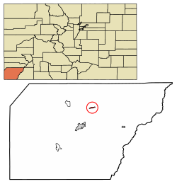
528:
527:Dolores River
523:
521:
513:
508:
505:
502:
499:
498:
497:
495:
491:
483:
479:
477:
474:
471:
467:
463:
459:
458:
457:
455:
447:
445:
443:
439:
435:
431:
427:
418:
411:
409:
407:
403:
399:
395:
391:
382:
377:townofdolores
374:
366:
364:
356:
354:
347:
344:
342:
332:
330:
322:
318:
315:
311:
301:
297:
294:
292:
284:
276:
263:
255:
247:
239:
227:
224:
212:July 19, 1900
211:
209:
202:
199:
197:
190:
179:
177:
170:
169:United States
159:
157:
148:
120:Coordinates:
109:
108:United States
87:
72:
65:
53:
44:
39:
32:
26:
22:
1345:reservations
1264:
1214:
1130:
1121:
1109:. Retrieved
1096:
1087:
1045:September 8,
1043:. Retrieved
1028:the original
1014:
990:September 7,
988:. Retrieved
953:September 2,
951:. Retrieved
937:
925:. Retrieved
911:
899:. Retrieved
834:
825:poverty line
818:
814:
806:
770:
538:Demographics
524:
517:
487:
451:
442:company town
423:
389:
388:
208:Incorporated
25:
1305:communities
1210:County seat
1131:RideBustang
1111:January 31,
901:October 16,
794:other races
412:Description
396:located in
142: /
130:108°30′14″W
1407:Categories
1033:JavaScript
927:January 5,
871:References
771:As of the
269:Population
217:Government
127:37°28′24″N
1369:Footnotes
514:Geography
496:include:
379:.colorado
353:FIPS code
341:Area code
317:UTC−06:00
296:UTC−07:00
291:Time zone
261:Elevation
1068:Archived
843:See also
798:Hispanic
788:, 0.21%
784:, 0.11%
780:, 2.14%
468:and the
402:Colorado
357:08-20770
329:ZIP code
189:Colorado
1318:Lebanon
1313:Arriola
1265:Dolores
1133:. CDOT.
837:Bustang
518:At the
448:History
390:Dolores
372:Website
367:2412439
156:Country
99:Dolores
1343:Indian
1328:Stoner
1293:Towaoc
1270:Mancos
1235:Cortez
1217:Cortez
802:Latino
773:census
593:196.3%
548:Census
196:County
186:
166:
1288:Lewis
1257:Towns
786:Asian
778:White
758:−5.4%
728:−1.0%
698:−2.2%
668:10.4%
653:−9.3%
638:44.3%
623:19.8%
608:45.3%
392:is a
334:81323
176:State
1227:City
1113:2008
1047:2007
1037:HTML
992:2021
955:2007
929:2015
903:2021
749:2020
743:9.2%
734:2010
719:2000
713:8.0%
704:1990
689:1980
683:1.9%
674:1970
659:1960
644:1950
629:1940
614:1930
599:1920
584:1910
569:1900
557:Note
552:Pop.
492:and
460:The
381:.gov
232:Area
1280:CDP
800:or
753:885
738:936
723:857
708:866
693:802
678:820
663:805
648:729
633:804
618:557
603:465
588:320
573:108
346:970
321:MDT
310:DST
300:MST
277:885
1409::
1213::
1198:,
1129:.
1104:.
1079:^
1055:^
1022:.
1000:^
982:,
978:.
963:^
945:.
919:.
894:.
879:^
562:%±
456::
408:.
400:,
1361:‡
1355:‡
1185:e
1178:t
1171:v
1115:.
1049:.
1039:)
1035:/
1031:(
994:.
957:.
931:.
905:.
578:—
472:.
323:)
319:(
312:)
302:)
298:(
110:.
73:.
23:.
Text is available under the Creative Commons Attribution-ShareAlike License. Additional terms may apply.