601:
616:
631:
313:(Waterschap) was founded for the Dommel. It had authority in all the municipalities where the Dommel flowed. One of its first priorities was to prevent flooding, especially between 's-Hertogenbosch and Boxtel. If possible, it wanted to canalize the same stretch, and to improve its navigability, but for the latter a lock would be required. C. 1865, the water board diverted the Dommel through the western city moat of 's-Hertogenbosch and made a sluice in the left dyke of the Dieze.
552:
327:
409:
29:
585:
the fortification works. The second are the post millennial works to restore the fortifications, and to make the Dommel an ecological connection zone. This meant that on the Dommel the fortifications, and in particular the city wall were made visible again. In the Dommel itself a more natural river-side was created to aid wild-life.
584:
Here the Dommel in 's-Hertogenbosch is understood as the new bed that is currently called 'Dommel'. Its appearance has been influenced by two major events. The first was that the city lost its status as a fortification in the 1880s. It prompted works that canalized the city moat, obliterating many of
576:
The Dommel reaches the southern tip of the city center on its eastern side. The connection from the Dommel to the city moat was made by digging about 100 m to the west from that point. The 1864 Dommel then turns north to run along the west side of the city center. At the point where the Dommel turns
516:
is a highly contextual subject. In the context of current commercial navigation the size of the ships that the Dommel can handle is much too small to make shipping economically viable. Before the introduction of the steam engine however, river ships were much smaller, and navigation was economically
467:
to Vught is primarily rural. The most original part and natural state of the Dommel can be found between
Eindhoven and Boxtel. Here, the Dommel still has many of its original winds and meanders, though many have also been lost. The stretch forms a cultural-historical and valuable landscape area that
508:
diverts from the Dommel. It was dug by hand in 1933–1936 in order to prevent flooding in Boxtel. It cut off a bend of the Dommel of about 4 km that flowed through Boxtel. The Boxtel 'arm' then received only little water till the waterschap reverted the situation in 2013. Now the Dommel bed is again
572:
which was north of the
Oliemolen bastion in 's-Hertogenbosch. It connected the western city moat to the Dieze. In turn this city moat was connected to the Dommel at about the same time. The result was that henceforward the Dommel not only flowed to the Dieze under the name 'Binnendieze', but also
424:
before it reaches the south west tip of the
Eindhoven municipality. After flowing below a handful of bridges of the motorways A67 and A2, most of the water of the Dommel is taken by the Afwateringskanaal. This canal was dug to prevent flooding in Eindhoven and ends in the Wilhelmina Canal. In the
349:
Just west of Peer, the Dommel flows through the small nature reserve
Mullemer Bemden, where it is joined by the Kleinbeek. To the east there was a small diversion of the water towards the Watermill of Peer. Part of this mill is still standing on the Molhem road. The Mullemer Bemden is part of the
589:
Bolwerk a rediscovered older part, which had fallen over in the moat, has been resurrected. The
Wilhelminabrug connects to the station and is heavily decorated with often neglected post war sculptures. The swing bridge near the confluence with the Dieze is a fine piece of industrial engineering.
563:
While residents of
Eindhoven generally know that their city is on the Dommel, the citizens of 's-Hertogenbosch are convinced that their city is situated on the Dieze. Up till the 1860s, this was a matter of using a different name for the same river. However, in 1864 a sluice was made in the left
588:
There are some highlights of the Dommel in 's-Hertogenbosch. The St-Jan's
Bolwerk is a reconstructed part of the city wall which functions as a tiny city park. The clever aspect is that on the inside it functions as a sewer overflow. The late medieval city walls have been excavated. At St-Jan's
495:
area, which is a natural monument. It (used to) consist of regularly flooded low-lying meadows used to grow hay, and higher situated "bolakkers" (high fields), where cereals were cultivated. The aim of the natural monument is to restore part of this situation.
509:
the primary course of the Dommel in Boxtel, and the
Afwateringskanaal Boxtel is only used at high water. An unexpected effect of the Afwateringskanaal is that it allows canoes to make a round trip in Boxtel, the so-called 'Rondje Boxtel'.
436:, and the new extension of this museum which juts out into the Dommel. The river then continues on the east side of Eindhoven city center. Here it almost touches the Eindhovensch Kanaal. The Dommel next flows along the terrain of the
600:
381:
The stretch of the Dommel from the canal near
Neerpelt till Valkenswaard is especially valuable. The Dommel first flows through the nature reserve Hageven, and then passes the Dutch border, south of
297:
The Dommel often looks like a brook nowadays, but it has many geographical features that only larger rivers have. These are the width of the rivers' valley, and large meanders from the
350:
preserve 'Valley of the Dommel and
Bollisserbeek' which stretches till west of Kleine Brogel. At the end of the preserve is the building of the Kleine Molen (small mill).
521:, but apart from the fact that a mill in Boxtel blocked its course, there were too many bends in the river too make navigation till Sint-Oedenrode economically feasible.
301:. In the past, there was talk about the Romans navigating the Dommel. Later, the near forests were cut down, and so the river became more shallow and started to meander.
615:
573:
flowed to the Dieze in a new bed as 'Dommel'. With more water flowing through the new bed, than through the older Binnendieze bed, confusion became inevitable.
696:
821:
842:
630:
581:
starts. This was constructed from 1906 to 1910. If the water level on Dommel and Aa is high, this canal is actually the main discharge of both.
543:. In Roman times Halder was probably the most important settlement on the Dommel. A small museum is dedicated to the Roman history of the area.
385:. From the Dutch-Belgian border the Dommel then drops only 25 meters more. The Dommel then flows along the nature reserve Malpie, which is a
432:
In the center of Eindhoven, the shores and bridges of the Dommel are rather utilitarian. An exception is the new pedestrian bridge near the
862:
491:, and is now known as the Moerkuilen. The many ponds in the area have been formed by excavating peat. Just west of the Moerkuilen is the
857:
437:
837:
867:
120:
425:
south of Eindhoven, the Dommel flows mainly through parks. First the Genneper Parken, and then the Dommelplantsoen, where the
877:
847:
362:
284:. To the east is that of the Aa. Further to the south a number of rivers flow into the Meuse much further upstream.
852:
700:
400:. This also the end of the popular canoe trips, that start just north of the Bocholt-Herentals canal in Belgium.
335:
505:
455:. Here is it led through culverts that dive below the Canal. The Dommel then appears again on the other side.
342:. Other brooks on this plateau flow directly to the Meuse, or flow to the Schelde via the Zwarte Beek and the
532:
while en route to Boxtel. The skipper was from Sint-Michielsgestel, and was killed together with his son.
524:
Up till about 1870, there was still some navigation on the Dommel. In 1859, a ship loaded with stone and
353:
From Kleine Brogel the Dommel first passes the Wedelse Mill, which is a monument. It then passes east of
882:
754:
429:
joins the Dommel. Next comes the Anne Frank plantsoen, and then the Dommel reaches the city center.
280:, which also belongs to that of the Meuse. To the south the basin of the Dommel borders that of the
622:
607:
556:
540:
529:
517:
viable between Boxtel and 's-Hertogenbosch. The Dommel was even wide enough to allow shipping till
484:
298:
261:
221:
872:
802:
784:
736:
200:. It is 120 km long, of which 85 km are in the Netherlands. The Dommel takes in water from the
201:
578:
452:
382:
551:
512:
Boxtel is traditionally said to be the point till which the Dommel is navigable. However,
469:
213:
656:
472:. This is a National Landscape situated between Eindhoven, Tilburg and 's-Hertogenbosch.
657:"Aardkundig excursiepunt 29 De Dommel: een kleine rivier in het brabantse dekzandgebied"
641:
518:
480:
464:
448:
433:
273:
253:
249:
346:. The source of the Dommel is 77 metres above sea level. On its course it drops 75 m.
831:
637:
492:
339:
277:
217:
396:
This stretch of the Dommel ends at the Venberg Watermill (Venbergse Molen) south of
536:
513:
397:
237:
209:
673:
390:
326:
310:
193:
91:
51:
276:
of the Dommel belongs to that of the Meuse. To the west of is the basin of the
476:
426:
225:
205:
28:
357:, where the Bemvoortse molen is. The Dommel passed very close to the west of
135:
122:
421:
334:
The source of the Dommel is in the Kempens Plateau, part of which forms the
245:
176:
408:
417:
358:
354:
241:
233:
569:
366:
281:
189:
80:
47:
525:
444:
370:
257:
228:
stream to form the river Dieze, which subsequently flows towards the
504:
About two kilometers before reaching the center of Boxtel town, the
565:
550:
407:
386:
343:
325:
229:
197:
172:
168:
106:
488:
232:. The main cities and towns along the Dommel's course are Peer,
483:. It is actually a very old meander of the Dommel. Since the
416:
After the Venberg Watermill, the Dommel flows north between
447:
the Dommel is joined by the Kleine Dommel. Just south of
719:
717:
675:
Aardrijkskundig woordenboek der Nederlanden, Volume 3
479:is a heath area with a mere few kilometres east of
420:and Valkenswaard. It then flows between Waalre and
164:
159:
151:
112:
100:
90:
74:
66:
57:
43:
38:
21:
667:(6), Nederlandse Geologische Vereniging: 161–166
377:From the Bocholt-Herentals canal to Valkenswaard
338:. The exact source is south of Wauberg, near
8:
771:
803:"Waterschap van de rivier de Dommel c.a."
688:
596:
18:
723:
7:
322:North of the Bocholt-Herentals canal
672:Van der Aa, Abraham Jacob (1841),
438:Eindhoven University of Technology
14:
539:joins the Dommel near the hamlet
629:
614:
599:
535:West of Sint-Michielsgestel the
27:
843:International rivers of Europe
114: • coordinates
1:
678:, Jacobus Noorduyn, Gorinchem
546:
499:
58:Physical characteristics
16:River in Belgium, Netherlands
759:Provinciale Noordbrabantsche
863:Rivers of Limburg (Belgium)
806:Nederlandsche staatscourant
737:"'s Hertopgenbosch 26 Sept"
487:, it has grown closed with
102: • location
76: • location
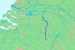
33:Location map of the Dommel.
899:
500:Boxtel to 's-Hertogenbosch
365:. It passes this canal by
858:Rivers of the Netherlands
822:Dommel Corridor Eindhoven
785:"Amsterdam, 24 Februarij"
336:Hoge Kempen National Park
86:
62:
26:
838:Tributaries of the Meuse
506:Afwateringskanaal Boxtel
196:, left tributary of the
155:120 km (75 mi)
868:Rivers of North Brabant
655:Kiden, Patrick (2009),
568:dyke just north of the
412:Near the Van Abbemuseum
363:Bocholt–Herentals Canal
361:, and then reaches the
697:"Waterschap De Dommel"
560:
413:
331:
264:and 's-Hertogenbosch.
220:streams and merges at
661:Grondboor & Hamer
554:
451:the Dommel meets the
411:
330:The Dommel in Belgium
329:
743:. 30 September 1863.
741:Algemeen Handelsblad
528:sank on the Aa near
188:is a small river in
136:51.69500°N 5.30083°E
848:Subterranean rivers
791:. 25 February 1859.
623:Sint-Michielsgestel
547:In 's-Hertogenbosch
530:Sint-Michielsgestel
485:Last Glacial Period
299:Last Glacial Period
262:Sint-Michielsgestel
160:Basin features
132: /
636:The Dommel at the
561:
559:before restoration
459:From Son to Boxtel
414:
332:
853:Rivers of Belgium
463:The stretch from
182:
181:
141:51.69500; 5.30083
890:
878:'s-Hertogenbosch
810:
809:
799:
793:
792:
781:
775:
769:
763:
762:
751:
745:
744:
733:
727:
721:
712:
711:
709:
708:
699:. Archived from
693:
679:
668:
633:
618:
608:'s-Hertogenbosch
603:
579:Drongelens Canal
557:'s-Hertogenbosch
453:Wilhelmina Canal
222:'s-Hertogenbosch
147:
146:
144:
143:
142:
137:
133:
130:
129:
128:
125:
77:
31:
19:
898:
897:
893:
892:
891:
889:
888:
887:
828:
827:
818:
813:
808:. 20 July 1864.
801:
800:
796:
783:
782:
778:
772:Van der Aa 1841
770:
766:
761:. 25 July 1865.
753:
752:
748:
735:
734:
730:
722:
715:
706:
704:
695:
694:
690:
686:
671:
654:
651:
644:
634:
625:
619:
610:
604:
595:
577:northward, the
549:
502:
470:Het Groene Woud
468:is part of the
461:
406:
379:
324:
319:
307:
295:
290:
270:
140:
138:
134:
131:
126:
123:
121:
119:
118:
115:
103:
75:
34:
17:
12:
11:
5:
896:
894:
886:
885:
880:
875:
870:
865:
860:
855:
850:
845:
840:
830:
829:
826:
825:
817:
816:External links
814:
812:
811:
794:
776:
774:, p. 420.
764:
746:
728:
726:, p. 163.
713:
687:
685:
682:
681:
680:
669:
650:
647:
646:
645:
642:Sint-Oedenrode
635:
628:
626:
621:The Dommel in
620:
613:
611:
606:The Dommel in
605:
598:
594:
591:
548:
545:
519:Sint-Oedenrode
501:
498:
481:Sint-Oedenrode
465:Son en Breugel
460:
457:
434:Van Abbemuseum
405:
402:
378:
375:
323:
320:
318:
315:
306:
303:
294:
291:
289:
286:
274:drainage basin
269:
268:Drainage basin
266:
254:Sint-Oedenrode
250:Son en Breugel
180:
179:
166:
162:
161:
157:
156:
153:
149:
148:
116:
113:
110:
109:
104:
101:
98:
97:
94:
88:
87:
84:
83:
78:
72:
71:
68:
64:
63:
60:
59:
55:
54:
45:
41:
40:
36:
35:
32:
24:
23:
15:
13:
10:
9:
6:
4:
3:
2:
895:
884:
881:
879:
876:
874:
871:
869:
866:
864:
861:
859:
856:
854:
851:
849:
846:
844:
841:
839:
836:
835:
833:
824:- Photography
823:
820:
819:
815:
807:
804:
798:
795:
790:
786:
780:
777:
773:
768:
765:
760:
756:
750:
747:
742:
738:
732:
729:
725:
720:
718:
714:
703:on 2019-03-20
702:
698:
692:
689:
683:
677:
676:
670:
666:
662:
658:
653:
652:
648:
643:
639:
638:Dommelbeemden
632:
627:
624:
617:
612:
609:
602:
597:
592:
590:
586:
582:
580:
574:
571:
567:
558:
553:
544:
542:
538:
533:
531:
527:
522:
520:
515:
510:
507:
497:
494:
493:Dommelbeemden
490:
486:
482:
478:
473:
471:
466:
458:
456:
454:
450:
446:
443:Just west of
441:
439:
435:
430:
428:
423:
419:
410:
403:
401:
399:
394:
392:
388:
384:
376:
374:
372:
368:
364:
360:
356:
351:
347:
345:
341:
340:Peer, Belgium
337:
328:
321:
316:
314:
312:
304:
302:
300:
292:
287:
285:
283:
279:
275:
267:
265:
263:
259:
255:
251:
247:
243:
239:
235:
231:
227:
223:
219:
218:Kleine Dommel
215:
211:
207:
203:
199:
195:
191:
187:
178:
174:
170:
167:
163:
158:
154:
150:
145:
117:
111:
108:
105:
99:
95:
93:
89:
85:
82:
79:
73:
69:
65:
61:
56:
53:
49:
46:
42:
37:
30:
25:
20:
883:Valkenswaard
805:
797:
788:
779:
767:
758:
755:"Waterstaat"
749:
740:
731:
705:. Retrieved
701:the original
691:
674:
664:
660:
587:
583:
575:
562:
537:Esschestroom
534:
523:
514:navigability
511:
503:
474:
462:
442:
431:
415:
404:To Eindhoven
398:Valkenswaard
395:
380:
352:
348:
333:
308:
296:
293:Former glory
271:
238:Valkenswaard
185:
183:
311:Water board
305:Water board
194:Netherlands
165:Progression
139: /
52:Netherlands
832:Categories
724:Kiden 2009
707:2018-01-24
649:References
477:Moerkuilen
427:Tongelreep
389:with many
309:In 1863 a
206:Tongelreep
124:51°41′42″N
873:Eindhoven
422:Veldhoven
246:Eindhoven
224:with the
177:North Sea
44:Countries
418:Dommelen
367:culverts
359:Neerpelt
355:Overpelt
242:Dommelen
234:Neerpelt
192:and the
127:5°18′3″E
39:Location
593:Gallery
570:ravelin
371:sluices
288:History
282:Schelde
202:Keersop
190:Belgium
81:Campine
48:Belgium
789:De Tijd
541:Halder
526:Gravel
445:Nuenen
383:Schaft
317:Course
258:Boxtel
214:Gender
186:Dommel
152:Length
96:
70:
67:Source
22:Dommel
684:Notes
566:Dieze
391:meres
387:Heath
344:Demer
278:Donge
230:Meuse
198:Dieze
173:Meuse
169:Dieze
107:Dieze
92:Mouth
489:peat
475:The
369:and
272:The
216:and
184:The
640:in
555:In
449:Son
210:Run
834::
787:.
757:.
739:.
716:^
665:63
663:,
659:,
440:.
393:.
373:.
260:,
256:,
252:,
248:,
244:,
240:,
236:,
226:Aa
212:,
208:,
204:,
175:→
171:→
50:,
710:.
Text is available under the Creative Commons Attribution-ShareAlike License. Additional terms may apply.