53:
806:
480:
In the town, the population was spread out, with 26.7% under the age of 18, 8.6% from 18 to 24, 25.2% from 25 to 44, 24.5% from 45 to 64, and 15.0% who were 65 years of age or older. The median age was 36 years. For every 100 females, there were 97.6 males. For every 100 females age 18 and over,
476:
living together, 11.5% had a female householder with no husband present, and 27.7% were non-families. 25.4% of all households were made up of individuals, and 16.9% had someone living alone who was 65 years of age or older. The average household size was 2.51 and the average family size was 3.01.
452:
of 2000, there were 326 people, 130 households, and 93 families residing in the town. The population density was 499.1 inhabitants per square mile (192.7/km). There were 143 housing units at an average density of 218.9 per square mile (84.5/km). The racial makeup of the town was 97.85%
52:
484:
The median income for a household in the town was $ 22,813, and the median income for a family was $ 28,500. Males had a median income of $ 29,250 versus $ 20,500 for females. The
739:
1074:
858:
732:
638:
250:
689:
66:
725:
873:
835:
260:
883:
878:
933:
918:
913:
863:
302:
938:
908:
888:
868:
709:
201:
943:
903:
953:
948:
928:
923:
898:
893:
525:
717:
590:
122:
749:
668:
594:
466:
462:
458:
454:
358:
276:
127:
1069:
564:
1021:
425:
410:
395:
354:
has its northern terminus in
Donaldson and leads 17 miles (27 km) to Arkadelphia by a more southerly route.
288:
501:
238:
98:
549:
1039:
963:
472:
There were 130 households, out of which 31.5% had children under the age of 18 living with them, 56.9% were
642:
1011:
1026:
981:
347:
1046:
1001:
976:
830:
505:
211:
639:"Annual Estimates of the Resident Population for Incorporated Places: April 1, 2010 to July 1, 2014"
1006:
991:
500:
Public education for early childhood, elementary and secondary school students is available by the
351:
971:
795:
696:
616:
488:
for the town was $ 13,307. About 15.0% of families and 17.1% of the population were below the
1016:
790:
771:
485:
339:
338:
runs through the northern side of the community, leading northeast 11 miles (18 km) to
840:
565:"Geographic Identifiers: 2010 Demographic Profile Data (G001): Donaldson town, Arkansas"
850:
331:
1063:
335:
284:
243:
103:
489:
764:
343:
550:
U.S. Geological Survey
Geographic Names Information System: Donaldson, Arkansas
110:
317:
304:
81:
68:
17:
192:
492:, including 25.3% of those under age 18 and 10.7% of those age 65 or over.
361:, Donaldson has a total area of 0.66 square miles (1.7 km), all land.
473:
280:
226:
115:
805:
449:
690:"2020 CENSUS - SCHOOL DISTRICT REFERENCE MAP: Hot Spring County, AR"
461:, and 1.53% from two or more races. 0.61% of the population were
218:
197:
817:
782:
43:
721:
804:
664:
299:
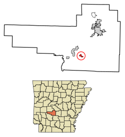
Donaldson is located in southern Hot Spring County at
334:, which passes 2 miles (3 km) west of the town.
57:
Location of
Donaldson in Hot Spring County, Arkansas.
990:
962:
849:
816:
781:
259:
249:
237:
225:
208:
191:
183:
175:
170:
162:
154:
146:
138:
133:
121:
109:
97:
34:
809:Map of Arkansas highlighting Hot Spring County
330:(34.237169, -92.921177), in the valley of the
733:
559:
557:
8:
740:
726:
718:
591:"US Gazetteer files: 2010, 2000, and 1990"
368:
31:
346:, and southwest 14 miles (23 km) to
517:
248:
224:
190:
169:
161:
132:
96:
61:
49:
545:
543:
388:
258:
236:
207:
182:
174:
153:
145:
137:
120:
108:
7:
1075:Towns in Hot Spring County, Arkansas
158:0.00 sq mi (0.00 km)
150:0.59 sq mi (1.53 km)
142:0.59 sq mi (1.53 km)
748:Municipalities and communities of
617:"Census of Population and Housing"
378:
25:
504:, which leads to graduation from
287:. The population was 301 at the
51:
29:Town in Arkansas, United States
1:
528:. United States Census Bureau
187:465.31/sq mi (179.74/km)
751:Hot Spring County, Arkansas
669:United States Census Bureau
595:United States Census Bureau
526:"2020 U.S. Gazetteer Files"
359:United States Census Bureau
1091:
1035:
802:
762:
439:
424:
409:
394:
387:
382:
377:
374:
62:
50:
41:
502:Ouachita School District
481:there were 100.8 males.
166:230 ft (70 m)
810:
808:
665:"U.S. Census website"
440:U.S. Decennial Census
370:Historical population
318:34.23722°N 92.92111°W
210: • Summer (
82:34.23500°N 92.91944°W
1048:United States portal
992:Other unincorporated
571:. U.S. Census Bureau
506:Ouachita High School
184: • Density
597:. February 12, 2011
569:American Factfinder
371:
352:Arkansas Highway 51
323:34.23722; -92.92111
314: /
87:34.23500; -92.91944
78: /
36:Donaldson, Arkansas
811:
697:U.S. Census Bureau
369:
176: • Total
155: • Water
139: • Total
1070:Towns in Arkansas
1057:
1056:
486:per capita income
446:
445:
357:According to the
277:Hot Spring County
270:
269:
147: • Land
16:(Redirected from
1082:
1049:
1042:
807:
774:
767:
757:
752:
742:
735:
728:
719:
712:
707:
705:
703:
694:
686:
680:
679:
677:
675:
661:
655:
654:
652:
650:
641:. Archived from
635:
629:
628:
626:
624:
613:
607:
606:
604:
602:
587:
581:
580:
578:
576:
561:
552:
547:
538:
537:
535:
533:
522:
390:
385:
380:
372:
329:
328:
326:
325:
324:
319:
315:
312:
311:
310:
307:
215:
93:
92:
90:
89:
88:
83:
79:
76:
75:
74:
71:
55:
32:
21:
1090:
1089:
1085:
1084:
1083:
1081:
1080:
1079:
1060:
1059:
1058:
1053:
1047:
1041:Arkansas portal
1040:
1031:
1022:Shorewood Hills
993:
986:
958:
845:
812:
800:
777:
772:
765:
758:
755:
750:
746:
716:
715:
701:
699:
692:
688:
687:
683:
673:
671:
663:
662:
658:
648:
646:
645:on May 22, 2015
637:
636:
632:
622:
620:
615:
614:
610:
600:
598:
589:
588:
584:
574:
572:
563:
562:
555:
548:
541:
531:
529:
524:
523:
519:
514:
498:
474:married couples
459:Native American
441:
383:
367:
322:
320:
316:
313:
308:
305:
303:
301:
300:
297:
233:
209:
86:
84:
80:
77:
72:
69:
67:
65:
64:
58:
46:
37:
30:
23:
22:
15:
12:
11:
5:
1088:
1086:
1078:
1077:
1072:
1062:
1061:
1055:
1054:
1052:
1051:
1044:
1036:
1033:
1032:
1030:
1029:
1024:
1019:
1014:
1009:
1004:
998:
996:
988:
987:
985:
984:
979:
974:
968:
966:
960:
959:
957:
956:
951:
946:
941:
936:
931:
926:
921:
916:
911:
906:
901:
896:
891:
886:
881:
876:
871:
866:
861:
855:
853:
847:
846:
844:
843:
838:
833:
828:
822:
820:
814:
813:
803:
801:
799:
798:
793:
787:
785:
779:
778:
763:
760:
759:
747:
745:
744:
737:
730:
722:
714:
713:
681:
656:
630:
608:
582:
553:
539:
516:
515:
513:
510:
497:
494:
444:
443:
437:
436:
433:
431:
428:
422:
421:
418:
416:
413:
407:
406:
403:
401:
398:
392:
391:
386:
381:
376:
366:
363:
332:Ouachita River
296:
293:
268:
267:
264:
257:
256:
253:
247:
246:
241:
235:
234:
231:
229:
223:
222:
216:
206:
205:
195:
189:
188:
185:
181:
180:
177:
173:
172:
168:
167:
164:
160:
159:
156:
152:
151:
148:
144:
143:
140:
136:
135:
131:
130:
125:
119:
118:
113:
107:
106:
101:
95:
94:
60:
59:
56:
48:
47:
42:
39:
38:
35:
28:
24:
14:
13:
10:
9:
6:
4:
3:
2:
1087:
1076:
1073:
1071:
1068:
1067:
1065:
1050:
1045:
1043:
1038:
1037:
1034:
1028:
1025:
1023:
1020:
1018:
1015:
1013:
1010:
1008:
1005:
1003:
1000:
999:
997:
995:
989:
983:
980:
978:
975:
973:
970:
969:
967:
965:
961:
955:
952:
950:
947:
945:
942:
940:
937:
935:
932:
930:
927:
925:
922:
920:
917:
915:
912:
910:
907:
905:
902:
900:
897:
895:
892:
890:
887:
885:
882:
880:
877:
875:
874:Brown Springs
872:
870:
867:
865:
862:
860:
857:
856:
854:
852:
848:
842:
839:
837:
834:
832:
829:
827:
824:
823:
821:
819:
815:
797:
794:
792:
789:
788:
786:
784:
780:
776:
775:
768:
761:
756:United States
753:
743:
738:
736:
731:
729:
724:
723:
720:
711:
702:September 17,
698:
691:
685:
682:
670:
666:
660:
657:
644:
640:
634:
631:
618:
612:
609:
596:
592:
586:
583:
570:
566:
560:
558:
554:
551:
546:
544:
540:
527:
521:
518:
511:
509:
507:
503:
495:
493:
491:
487:
482:
478:
475:
470:
469:of any race.
468:
464:
460:
456:
451:
442:2014 Estimate
438:
434:
432:
429:
427:
423:
419:
417:
414:
412:
408:
404:
402:
399:
397:
393:
373:
364:
362:
360:
355:
353:
349:
345:
341:
337:
336:U.S. Route 67
333:
327:
294:
292:
290:
286:
285:United States
282:
278:
275:is a town in
274:
265:
262:
254:
252:
245:
242:
240:
230:
228:
220:
217:
213:
203:
202:Central (CST)
199:
196:
194:
186:
178:
165:
157:
149:
141:
129:
126:
124:
117:
114:
112:
105:
104:United States
102:
100:
91:
63:Coordinates:
54:
45:
40:
33:
27:
19:
18:Donaldson, AR
1012:Morning Star
825:
770:
700:. Retrieved
684:
672:. Retrieved
659:
647:. Retrieved
643:the original
633:
621:. Retrieved
619:. Census.gov
611:
599:. Retrieved
585:
573:. Retrieved
568:
530:. Retrieved
520:
499:
490:poverty line
483:
479:
471:
447:
365:Demographics
356:
298:
272:
271:
26:
1027:Social Hill
994:communities
982:Magnet Cove
977:Jones Mills
884:Clear Creek
879:Butterfield
766:County seat
674:January 31,
532:October 29,
348:Arkadelphia
344:county seat
321: /
289:2010 census
85: /
1064:Categories
1002:Bonnerdale
934:Montgomery
831:Friendship
512:References
448:As of the
309:92°55′16″W
306:34°14′14″N
263:feature ID
171:Population
128:Hot Spring
73:92°55′10″W
70:34°14′06″N
1007:Glen Rose
919:Lone Hill
914:Henderson
864:Big Creek
851:Townships
826:Donaldson
601:April 23,
575:April 21,
496:Education
295:Geography
273:Donaldson
251:FIPS code
239:Area code
193:Time zone
163:Elevation
972:Bismarck
939:Ouachita
909:Harrison
889:De Roche
869:Bismarck
796:Rockport
710:2010 map
463:Hispanic
457:, 0.61%
281:Arkansas
255:05-19450
227:ZIP code
116:Arkansas
1017:Saginaw
944:Prairie
904:Gifford
859:Antioch
791:Malvern
773:Malvern
649:June 4,
623:June 4,
340:Malvern
266:2406386
99:Country
954:Valley
949:Saline
929:Midway
924:Magnet
899:Fenter
836:Midway
783:Cities
467:Latino
450:census
375:Census
342:, the
123:County
894:Dover
841:Perla
818:Towns
693:(PDF)
455:White
435:−8.6%
420:−7.7%
232:71941
221:(CDT)
219:UTC-5
198:UTC-6
111:State
964:CDPs
704:2022
676:2008
651:2015
625:2015
603:2011
577:2017
534:2021
426:2020
411:2010
396:2000
384:Note
379:Pop.
261:GNIS
134:Area
44:Town
465:or
430:275
415:301
400:326
244:501
212:DST
179:275
1066::
769::
754:,
708:-
695:.
667:.
593:.
567:.
556:^
542:^
508:.
389:%±
350:.
291:.
283:,
279:,
741:e
734:t
727:v
706:.
678:.
653:.
627:.
605:.
579:.
536:.
405:—
214:)
204:)
200:(
20:)
Text is available under the Creative Commons Attribution-ShareAlike License. Additional terms may apply.