42:
628:
398:
In the CDP, the population was spread out, with 19.9% under the age of 18, 6.9% from 18 to 24, 19.4% from 25 to 44, 26.4% from 45 to 64, and 27.3% who were 65 years of age or older. The median age was 51 years. For every 100 females, there were 87.8 males. For every 100 females age 18 and over, there
394:
living together, 9.3% had a female householder with no husband present, and 30.9% were non-families. 24.7% of all households were made up of individuals, and 17.5% had someone living alone who was 65 years of age or older. The average household size was 2.23 and the average family size was 2.54.
41:
911:
402:
The median income for a household in the CDP was $ 27,292, and the median income for a family was $ 28,523. Males had a median income of $ 19,643 versus $ 22,083 for females. The
566:
367:
was 24.8 people per square mile (9.6/km). There were 153 housing units at an average density of 17.6/sq mi (6.8/km). The racial makeup of the CDP was 64.81%
916:
476:
559:
220:
784:
62:
304:, the Dry Creek CDP has a total area of 8.7 square miles (22.5 km), of which 0.004 square miles (0.01 km), or 0.07%, is water.
230:
426:
552:
687:
544:
372:
376:
195:
116:
528:
301:
480:
727:
576:
338:
290:
282:
278:
262:
254:
121:
47:
773:
94:
461:
450:
881:
794:
669:
250:
32:
390:
There were 97 households, out of which 20.6% had children under the age of 18 living with them, 54.6% were
380:
789:
692:
647:
888:
778:
384:
274:
205:
829:
799:
758:
737:
722:
617:
598:
368:
286:
246:
849:
804:
364:
281:. The CDP is bordered on the north and east by Dry Creek, an inlet to the lake; on the west by
814:
809:
752:
697:
653:
403:
406:
for the CDP was $ 14,186. About 14.7% of families and 22.5% of the population were below the
839:
768:
747:
742:
717:
682:
677:
857:
763:
707:
363:
of 2000, there were 216 people, 97 households, and 67 families residing in the CDP. The
732:
712:
658:
477:"Geographic Identifiers: 2010 Demographic Profile Data (G001): Dry Creek CDP, Oklahoma"
294:
905:
819:
285:; and on the southwest by Elk Creek. Highway 82 leads north 14 miles (23 km) to
410:, including 48.8% of those under the age of eighteen and 8.9% of those 65 or over.
407:
591:
502:
462:
U.S. Geological Survey
Geographic Names Information System: Dry Creek, Oklahoma
451:
U.S. Geological Survey
Geographic Names Information System: Dry Creek, Oklahoma
273:
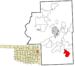
Dry Creek is located in southeastern
Cherokee County southeast of the head of
104:
77:
64:
186:
872:‡This populated place also has portions in an adjacent county or counties
391:
258:
109:
51:
360:
212:
191:
639:
609:
548:
289:, the Cherokee County seat, and south 22 miles (35 km) to
626:
524:
479:. U.S. Census Bureau, American Factfinder. Archived from
912:
Census-designated places in
Cherokee County, Oklahoma
867:
848:
828:
668:
638:
608:
229:
219:
202:
185:
177:
169:
164:
156:
148:
140:
132:
127:
115:
103:
93:
23:
18:Census-designated place in Oklahoma, United States
261:, United States. The population was 227 at the
560:
471:
469:
8:
627:
567:
553:
545:
387:of any race were 1.85% of the population.
311:
20:
418:
218:
184:
163:
155:
126:
92:
57:
38:
446:
444:
331:
228:
201:
176:
168:
147:
139:
131:
114:
102:
7:
917:Census-designated places in Oklahoma
379:, and 3.70% from two or more races.
144:8.69 sq mi (22.51 km)
136:8.70 sq mi (22.53 km)
152:0.01 sq mi (0.01 km)
575:Municipalities and communities of
503:"Census of Population and Housing"
321:
14:
427:"ArcGIS REST Services Directory"
40:
1:
429:. United States Census Bureau
529:United States Census Bureau
302:United States Census Bureau
181:26.81/sq mi (10.35/km)
933:
160:1,030 ft (310 m)
877:
624:
589:
578:Cherokee County, Oklahoma
352:
337:
330:
325:
320:
317:
283:Oklahoma State Highway 82
58:
39:
30:
247:unincorporated community
251:census-designated place
33:Census-designated place
632:
630:
525:"U.S. Census website"
353:U.S. Decennial Census
313:Historical population
204: • Summer (
78:35.75250°N 94.87306°W
890:United States portal
483:on February 12, 2015
275:Tenkiller Ferry Lake
178: • Density
631:Cherokee County map
314:
83:35.75250; -94.87306
74: /
25:Dry Creek, Oklahoma
850:Indian reservation
633:
365:population density
312:
170: • Total
149: • Water
133: • Total
899:
898:
404:per capita income
399:were 88.0 males.
357:
356:
300:According to the
240:
239:
141: • Land
50:and the state of
924:
891:
884:
629:
601:
594:
584:
579:
569:
562:
555:
546:
540:
539:
537:
535:
521:
515:
514:
512:
510:
499:
493:
492:
490:
488:
473:
464:
459:
453:
448:
439:
438:
436:
434:
423:
373:African American
333:
328:
323:
315:
209:
89:
88:
86:
85:
84:
79:
75:
72:
71:
70:
67:
46:Location within
44:
21:
932:
931:
927:
926:
925:
923:
922:
921:
902:
901:
900:
895:
889:
883:Oklahoma portal
882:
873:
863:
858:Cherokee Nation
844:
831:
824:
728:Johnson Prairie
664:
634:
622:
604:
599:
592:
585:
582:
577:
573:
543:
533:
531:
523:
522:
518:
508:
506:
501:
500:
496:
486:
484:
475:
474:
467:
460:
456:
449:
442:
432:
430:
425:
424:
420:
416:
392:married couples
377:Native American
326:
310:
271:
255:Cherokee County
203:
82:
80:
76:
73:
68:
65:
63:
61:
60:
54:
48:Cherokee County
35:
26:
19:
12:
11:
5:
930:
928:
920:
919:
914:
904:
903:
897:
896:
894:
893:
886:
878:
875:
874:
871:
869:
865:
864:
862:
861:
854:
852:
846:
845:
843:
842:
836:
834:
826:
825:
823:
822:
817:
812:
807:
802:
797:
792:
787:
782:
776:
774:Pumpkin Hollow
771:
766:
761:
756:
750:
745:
740:
735:
730:
725:
720:
715:
710:
705:
700:
695:
690:
685:
680:
674:
672:
666:
665:
663:
662:
656:
651:
644:
642:
636:
635:
625:
623:
621:
620:
614:
612:
606:
605:
590:
587:
586:
574:
572:
571:
564:
557:
549:
542:
541:
516:
494:
465:
454:
440:
417:
415:
412:
355:
354:
350:
349:
346:
344:
341:
335:
334:
329:
324:
319:
309:
306:
279:Illinois River
270:
267:
238:
237:
234:
227:
226:
223:
217:
216:
210:
200:
199:
189:
183:
182:
179:
175:
174:
171:
167:
166:
162:
161:
158:
154:
153:
150:
146:
145:
142:
138:
137:
134:
130:
129:
125:
124:
119:
113:
112:
107:
101:
100:
97:
91:
90:
56:
55:
45:
37:
36:
31:
28:
27:
24:
17:
13:
10:
9:
6:
4:
3:
2:
929:
918:
915:
913:
910:
909:
907:
892:
887:
885:
880:
879:
876:
870:
866:
859:
856:
855:
853:
851:
847:
841:
838:
837:
835:
833:
827:
821:
818:
816:
813:
811:
808:
806:
803:
801:
798:
796:
795:Steely Hollow
793:
791:
788:
786:
783:
780:
777:
775:
772:
770:
767:
765:
762:
760:
757:
754:
751:
749:
746:
744:
741:
739:
736:
734:
731:
729:
726:
724:
721:
719:
716:
714:
711:
709:
706:
704:
701:
699:
696:
694:
691:
689:
686:
684:
681:
679:
676:
675:
673:
671:
667:
660:
657:
655:
652:
649:
646:
645:
643:
641:
637:
619:
616:
615:
613:
611:
607:
603:
602:
595:
588:
583:United States
580:
570:
565:
563:
558:
556:
551:
550:
547:
530:
526:
520:
517:
504:
498:
495:
482:
478:
472:
470:
466:
463:
458:
455:
452:
447:
445:
441:
433:September 20,
428:
422:
419:
413:
411:
409:
405:
400:
396:
393:
388:
386:
382:
378:
374:
370:
366:
362:
351:
347:
345:
342:
340:
336:
316:
307:
305:
303:
298:
296:
292:
291:Interstate 40
288:
284:
280:
276:
268:
266:
264:
260:
256:
252:
248:
244:
235:
232:
224:
222:
214:
211:
207:
197:
196:Central (CST)
193:
190:
188:
180:
172:
159:
151:
143:
135:
123:
120:
118:
111:
108:
106:
99:United States
98:
96:
87:
59:Coordinates:
53:
49:
43:
34:
29:
22:
16:
702:
597:
532:. Retrieved
519:
507:. Retrieved
505:. Census.gov
497:
487:February 12,
485:. Retrieved
481:the original
457:
431:. Retrieved
421:
408:poverty line
401:
397:
389:
358:
308:Demographics
299:
272:
242:
241:
15:
790:Sparrowhawk
785:Shady Grove
693:Caney Ridge
648:Fort Gibson
593:County seat
534:January 31,
263:2010 census
81: /
906:Categories
779:Rocky Ford
414:References
359:As of the
233:feature ID
165:Population
69:94°52′23″W
66:35°45′09″N
868:Footnotes
832:community
800:Tenkiller
759:Park Hill
738:Lost City
723:Grandview
703:Dry Creek
618:Tahlequah
600:Tahlequah
375:, 30.56%
287:Tahlequah
269:Geography
253:(CDP) in
243:Dry Creek
221:FIPS code
187:Time zone
157:Elevation
805:Teresita
381:Hispanic
371:, 0.93%
259:Oklahoma
225:40-21755
122:Cherokee
110:Oklahoma
52:Oklahoma
815:Woodall
810:Welling
753:Norwood
698:Cookson
654:Hulbert
509:June 4,
277:on the
236:2408690
95:Country
840:Qualls
769:Pettit
748:Moodys
743:Lowrey
718:Gideon
683:Briggs
678:Barber
385:Latino
361:census
318:Census
245:is an
117:County
830:Other
764:Peggs
708:Eldon
688:Caney
640:Towns
369:White
215:(CST)
213:UTC-5
192:UTC-6
105:State
733:Keys
713:Etta
670:CDPs
659:Oaks
610:City
536:2008
511:2016
489:2015
435:2022
339:2020
327:Note
322:Pop.
295:Vian
249:and
231:GNIS
128:Area
820:Zeb
383:or
343:233
293:at
206:DST
173:233
908::
596::
581:,
527:.
468:^
443:^
332:%±
297:.
265:.
257:,
860:‡
781:‡
755:‡
661:‡
650:‡
568:e
561:t
554:v
538:.
513:.
491:.
437:.
348:—
208:)
198:)
194:(
Text is available under the Creative Commons Attribution-ShareAlike License. Additional terms may apply.