61:
73:
752:
49:
442:
In the township the population was spread out, with 26.6% under the age of 18, 4.5% from 18 to 24, 25.2% from 25 to 44, 26.3% from 45 to 64, and 17.4% who were 65 years of age or older. The median age was 40 years. For every 100 females there were 93.7 males. For every 100 females age 18 and over,
402:
of 2000, there were 1,701 people, 584 households, and 460 families residing in the township. The population density was 80.2 inhabitants per square mile (31.0/km). There were 599 housing units at an average density of 28.2 per square mile (10.9/km). The racial makeup of the township was 97.18%
438:
living together, 5.3% had a female householder with no husband present, and 21.1% were non-families. 17.3% of all households were made up of individuals, and 8.9% had someone living alone who was 65 years of age or older. The average household size was 2.77 and the average family size was 3.15.
60:
86:
446:
The median income for a household in the township was $ 41,250, and the median income for a family was $ 44,948. Males had a median income of $ 35,489 versus $ 21,731 for females. The
680:
390:, the township has a total area of 21.2 square miles (55 km), of which 21.2 square miles (55 km) is land and 0.04 square miles (0.10 km) (0.09%) is water.
903:
878:
17:
1130:
978:
973:
953:
72:
988:
958:
918:
853:
848:
898:
888:
963:
868:
858:
913:
893:
873:
883:
998:
948:
933:
938:
908:
673:
262:
1061:
968:
1066:
666:
928:
993:
983:
943:
923:
471:
142:
658:
568:
499:
1021:
408:
412:
830:
790:
1100:
820:
690:
642:
618:
420:
387:
371:
147:
48:
1051:
1016:
815:
805:
329:
314:
299:
1031:
810:
785:
780:
250:
118:
1087:
1041:
1008:
840:
825:
795:
736:
434:
There were 584 households, out of which 32.5% had children under the age of 18 living with them, 70.0% were
367:
39:
378:, United States. The population was 1,666 at the 2020 census, a decline from the figure of 1,682 in 2010.
1071:
775:
762:
424:
1046:
731:
242:
1107:
1056:
800:
741:
712:
428:
231:
770:
723:
416:
404:
450:
for the township was $ 16,589. About 9.2% of families and 15.0% of the population were below the
545:
588:
519:
447:
221:
600:
531:
1124:
255:
123:
451:
375:
135:
705:
130:
101:
88:
212:
454:, including 28.8% of those under age 18 and 10.6% of those age 65 or over.
435:
399:
238:
217:
662:
750:
638:
614:
65:
493:
491:
489:
1080:
1030:
1007:
839:
761:
722:
261:
249:
228:
211:
203:
195:
187:
182:
174:
166:
158:
153:
141:
129:
117:
28:
18:Lackawannock Township, Mercer County, Pennsylvania
674:
8:
569:"City and Town Population Totals: 2020-2021"
500:"City and Town Population Totals: 2020-2023"
681:
667:
659:
431:of any race were 0.94% of the population.
272:
25:
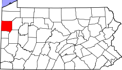
77:Location of Mercer County in Pennsylvania
1131:Townships in Mercer County, Pennsylvania
463:
260:
248:
210:
181:
152:
116:
81:
57:
45:
23:Township in Pennsylvania, United States
596:
586:
527:
517:
292:
227:
202:
194:
186:
173:
170:21.40 sq mi (55.44 km)
165:
162:21.42 sq mi (55.48 km)
157:
140:
128:
69:
7:
423:, and 1.00% from two or more races.
178:0.02 sq mi (0.04 km)
689:Municipalities and communities of
546:"Census of Population and Housing"
282:
14:
71:
59:
47:
1:
474:. United States Census Bureau
692:Mercer County, Pennsylvania
643:United States Census Bureau
619:United States Census Bureau
472:"2016 U.S. Gazetteer Files"
388:United States Census Bureau
207:76.99/sq mi (29.73/km)
196: • Estimate
32:Mercer County, Pennsylvania
30:East Lackawannock Township,
1147:
364:East Lackawannock Township
15:
1096:
748:
703:
356:
343:
328:
313:
298:
291:
286:
281:
278:
82:
70:
58:
46:
37:
16:Not to be confused with
443:there were 93.8 males.
755:
53:Barn on Vickerman Road
754:
639:"U.S. Census website"
615:"U.S. Census website"
357:U.S. Decennial Census
274:Historical population
230: • Summer (
102:41.20000°N 80.28306°W
1109:United States portal
204: • Density
1102:Pennsylvania portal
567:Bureau, US Census.
498:Bureau, US Census.
275:
107:41.20000; -80.28306
98: /
1081:Former settlements
756:
599:has generic name (
575:. US Census Bureau
530:has generic name (
506:. US Census Bureau
273:
188: • Total
175: • Water
159: • Total
1118:
1117:
864:East Lackawannock
448:per capita income
386:According to the
361:
360:
271:
270:
167: • Land
1138:
1110:
1103:
1022:Reynolds Heights
969:South Pymatuning
753:
715:
708:
698:
693:
683:
676:
669:
660:
653:
652:
650:
649:
635:
629:
628:
626:
625:
611:
605:
604:
598:
594:
592:
584:
582:
580:
564:
558:
557:
555:
553:
542:
536:
535:
529:
525:
523:
515:
513:
511:
495:
484:
483:
481:
479:
468:
409:African American
294:
289:
284:
276:
235:
113:
112:
110:
109:
108:
103:
99:
96:
95:
94:
91:
75:
63:
51:
26:
1146:
1145:
1141:
1140:
1139:
1137:
1136:
1135:
1121:
1120:
1119:
1114:
1108:
1101:
1092:
1076:
1033:
1026:
1003:
835:
757:
751:
746:
718:
713:
706:
699:
696:
691:
687:
657:
656:
647:
645:
637:
636:
632:
623:
621:
613:
612:
608:
595:
585:
578:
576:
566:
565:
561:
551:
549:
544:
543:
539:
526:
516:
509:
507:
497:
496:
487:
477:
475:
470:
469:
465:
460:
436:married couples
413:Native American
396:
384:
287:
229:
106:
104:
100:
97:
92:
89:
87:
85:
84:
78:
66:
54:
42:
33:
31:
24:
21:
12:
11:
5:
1144:
1142:
1134:
1133:
1123:
1122:
1116:
1115:
1113:
1112:
1105:
1097:
1094:
1093:
1091:
1090:
1084:
1082:
1078:
1077:
1075:
1074:
1069:
1064:
1059:
1054:
1049:
1044:
1038:
1036:
1032:Unincorporated
1028:
1027:
1025:
1024:
1019:
1013:
1011:
1005:
1004:
1002:
1001:
996:
991:
986:
981:
976:
971:
966:
961:
956:
951:
946:
941:
936:
931:
926:
921:
916:
911:
906:
901:
896:
891:
886:
881:
876:
871:
866:
861:
856:
851:
845:
843:
837:
836:
834:
833:
831:West Middlesex
828:
823:
818:
813:
808:
803:
798:
793:
791:Jackson Center
788:
783:
778:
773:
767:
765:
759:
758:
749:
747:
745:
744:
739:
734:
728:
726:
720:
719:
704:
701:
700:
688:
686:
685:
678:
671:
663:
655:
654:
630:
606:
559:
537:
485:
462:
461:
459:
456:
395:
392:
383:
380:
359:
358:
354:
353:
350:
348:
345:
341:
340:
337:
335:
332:
326:
325:
322:
320:
317:
311:
310:
307:
305:
302:
296:
295:
290:
285:
280:
269:
268:
265:
259:
258:
253:
247:
246:
236:
226:
225:
215:
209:
208:
205:
201:
200:
197:
193:
192:
189:
185:
184:
180:
179:
176:
172:
171:
168:
164:
163:
160:
156:
155:
151:
150:
145:
139:
138:
133:
127:
126:
121:
115:
114:
80:
79:
76:
68:
67:
64:
56:
55:
52:
44:
43:
38:
35:
34:
29:
22:
13:
10:
9:
6:
4:
3:
2:
1143:
1132:
1129:
1128:
1126:
1111:
1106:
1104:
1099:
1098:
1095:
1089:
1086:
1085:
1083:
1079:
1073:
1070:
1068:
1065:
1063:
1060:
1058:
1055:
1053:
1050:
1048:
1045:
1043:
1040:
1039:
1037:
1035:
1029:
1023:
1020:
1018:
1015:
1014:
1012:
1010:
1006:
1000:
997:
995:
992:
990:
987:
985:
982:
980:
977:
975:
972:
970:
967:
965:
962:
960:
957:
955:
952:
950:
947:
945:
942:
940:
937:
935:
932:
930:
927:
925:
922:
920:
917:
915:
912:
910:
907:
905:
902:
900:
897:
895:
892:
890:
887:
885:
882:
880:
877:
875:
872:
870:
867:
865:
862:
860:
857:
855:
852:
850:
847:
846:
844:
842:
838:
832:
829:
827:
824:
822:
821:Sheakleyville
819:
817:
814:
812:
809:
807:
804:
802:
799:
797:
794:
792:
789:
787:
784:
782:
779:
777:
774:
772:
769:
768:
766:
764:
760:
743:
740:
738:
735:
733:
730:
729:
727:
725:
721:
717:
716:
709:
702:
697:United States
694:
684:
679:
677:
672:
670:
665:
664:
661:
644:
640:
634:
631:
620:
616:
610:
607:
602:
590:
574:
570:
563:
560:
547:
541:
538:
533:
521:
505:
501:
494:
492:
490:
486:
473:
467:
464:
457:
455:
453:
449:
444:
440:
437:
432:
430:
426:
422:
419:, 0.29% from
418:
414:
410:
406:
401:
393:
391:
389:
381:
379:
377:
373:
372:Mercer County
369:
365:
355:
351:
349:
346:
342:
338:
336:
333:
331:
327:
323:
321:
318:
316:
312:
308:
306:
303:
301:
297:
277:
266:
264:
257:
254:
252:
244:
240:
237:
233:
223:
219:
216:
214:
206:
198:
190:
177:
169:
161:
149:
146:
144:
137:
134:
132:
125:
124:United States
122:
120:
111:
83:Coordinates:
74:
62:
50:
41:
36:
27:
19:
1052:Clarks Mills
1017:Lake Latonka
904:Lackawannock
879:French Creek
863:
711:
646:. Retrieved
633:
622:. Retrieved
609:
597:|last1=
577:. Retrieved
572:
562:
550:. Retrieved
548:. Census.gov
540:
528:|last1=
508:. Retrieved
503:
476:. Retrieved
466:
452:poverty line
445:
441:
433:
397:
394:Demographics
385:
376:Pennsylvania
363:
362:
267:42-085-21336
136:Pennsylvania
1034:communities
979:Sugar Grove
974:Springfield
954:Sandy Creek
929:Otter Creek
816:Sharpsville
806:New Lebanon
707:County seat
421:other races
344:2023 (est.)
105: /
1062:Indian Run
994:Wolf Creek
989:Wilmington
984:West Salem
959:Sandy Lake
944:Pymatuning
924:New Vernon
919:Mill Creek
854:Deer Creek
849:Coolspring
811:Sandy Lake
786:Grove City
781:Greenville
648:2008-01-31
624:2017-03-05
573:Census.gov
504:Census.gov
458:References
398:As of the
183:Population
93:80°16′59″W
1088:Wheatland
1067:Maysville
1042:Amsterdam
899:Jefferson
889:Hempfield
841:Townships
826:Stoneboro
796:Jamestown
737:Hermitage
382:Geography
263:FIPS code
251:Area code
213:Time zone
90:41°12′0″N
1125:Category
1072:Transfer
964:Shenango
869:Fairview
859:Delaware
776:Fredonia
763:Boroughs
589:cite web
520:cite web
425:Hispanic
415:, 0.29%
411:, 0.06%
407:, 1.18%
368:township
40:Township
1047:Carlton
914:Liberty
894:Jackson
874:Findley
732:Farrell
579:26 June
552:June 4,
510:July 1,
478:Aug 14,
119:Country
1057:Hadley
884:Greene
801:Mercer
742:Sharon
724:Cities
714:Mercer
429:Latino
400:census
279:Census
148:Mercer
143:County
999:Worth
949:Salem
934:Perry
771:Clark
417:Asian
405:White
366:is a
352:−1.1%
347:1,651
339:−0.7%
334:1,670
324:−1.1%
319:1,682
304:1,701
239:UTC-5
218:UTC-4
199:1,651
191:1,670
131:State
1009:CDPs
939:Pine
909:Lake
601:help
581:2022
554:2016
532:help
512:2024
480:2017
330:2020
315:2010
300:2000
288:Note
283:Pop.
154:Area
427:or
370:in
256:724
243:EDT
232:DST
222:EST
1127::
710::
695:,
641:.
617:.
593::
591:}}
587:{{
571:.
524::
522:}}
518:{{
502:.
488:^
374:,
293:%±
682:e
675:t
668:v
651:.
627:.
603:)
583:.
556:.
534:)
514:.
482:.
309:—
245:)
241:(
234:)
224:)
220:(
20:.
Text is available under the Creative Commons Attribution-ShareAlike License. Additional terms may apply.