73:
379:
113:
367:
391:
801:
53:
542:
120:
80:
38:
574:
344:
which developed in the middle ages on the higher grounds. The communal pasture is triangular. The village developed during the 19th and early 20th century during the exploration of the
348:
in the area. In 1840, it was home to 134 people. The earliest church was from 1858, but no longer exists. The Dutch
Reformed Church dates from 1913. It used to be a
785:
567:
842:
560:
292:
72:
861:
304:
584:
482:
148:
871:
112:
835:
378:
284:
546:
366:
828:
673:
390:
180:
734:
678:
704:
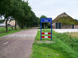
472:
263:
552:
866:
709:
273:
17:
602:
729:
478:
349:
812:
618:
417:
52:
37:
855:
739:
749:
683:
643:
588:
323:
319:
205:
185:
97:
800:
759:
754:
668:
163:
150:
769:
688:
663:
340:
254:
541:
774:
744:
724:
719:
714:
633:
808:
628:
327:
195:
93:
764:
638:
280:
259:
658:
653:
442:
648:
345:
556:
512:
355:
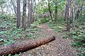
Een has become a recreational area with forests and heaths.
816:
697:
611:
595:
303:
291:
270:
253:
245:
237:
232:
224:
216:
211:
201:
191:
179:
28:
836:
786:List of cities, towns and villages in Drenthe
568:
8:
843:
829:
575:
561:
553:
466:
464:
25:
507:
505:
503:
501:
406:
362:
290:
252:
231:
223:
210:
178:
143:
64:
46:
34:
412:
410:
302:
269:
244:
236:
215:
200:
190:
7:
797:
795:
418:"Kerncijfers wijken en buurten 2021"
352:, but has developed into a cluster.
220:0.81 km (0.31 sq mi)
815:. You can help Knowledge (XXG) by
14:
799:
540:
389:
377:
365:
118:
111:
78:
71:
51:
36:
449:(in Dutch). Het Waterschapshuis
447:Actueel Hoogtebestand Nederland
477:(in Dutch). Zwolle: Waanders.
1:
23:Place in Drenthe, Netherlands
422:Central Bureau of Statistics
862:Populated places in Drenthe
119:
79:
888:
794:
15:
783:
443:"Postcodetool for 9342PA"
249:670/km (1,700/sq mi)
144:
65:
47:
35:
583:Populated places in the
471:Ronald Stenvert (2001).
92:Location in province of
872:Drenthe geography stubs
135:Show map of Netherlands
811:location article is a
272: • Summer (
228:7 m (23 ft)
549:at Wikimedia Commons
322:. It is part of the
318:is a village in the
246: • Density
164:53.07556°N 6.39389°E
18:EEN (disambiguation)
16:For other uses, see
160: /
102:Show map of Drenthe
238: • Total
217: • Total
824:
823:
792:
791:
547:Een (Noordenveld)
545:Media related to
350:linear settlement
313:
312:
169:53.07556; 6.39389
132:Een (Netherlands)
879:
845:
838:
831:
803:
796:
577:
570:
563:
554:
544:
529:
528:
526:
524:
509:
496:
495:
493:
491:
468:
459:
458:
456:
454:
439:
433:
432:
430:
428:
414:
393:
381:
369:
326:municipality in
277:
175:
174:
172:
171:
170:
165:
161:
158:
157:
156:
153:
136:
122:
121:
115:
103:
82:
81:
75:
55:
40:
26:
887:
886:
882:
881:
880:
878:
877:
876:
852:
851:
850:
849:
793:
788:
779:
693:
607:
591:
581:
537:
532:
522:
520:
511:
510:
499:
489:
487:
485:
470:
469:
462:
452:
450:
441:
440:
436:
426:
424:
416:
415:
408:
404:
397:
396:Forest near Een
394:
385:
382:
373:
370:
361:
336:
299:
271:
168:
166:
162:
159:
154:
151:
149:
147:
146:
140:
139:
138:
137:
134:
133:
130:
129:
128:
127:
123:
106:
105:
104:
101:
100:
90:
89:
88:
87:
83:
61:
60:
59:
58:
43:
42:Main street Een
31:
24:
21:
12:
11:
5:
885:
883:
875:
874:
869:
864:
854:
853:
848:
847:
840:
833:
825:
822:
821:
804:
790:
789:
784:
781:
780:
778:
777:
772:
767:
762:
757:
752:
747:
742:
737:
735:Huis ter Heide
732:
727:
722:
717:
712:
707:
701:
699:
695:
694:
692:
691:
686:
681:
676:
671:
666:
661:
656:
651:
646:
641:
636:
631:
626:
621:
615:
613:
609:
608:
606:
605:
599:
597:
593:
592:
582:
580:
579:
572:
565:
557:
551:
550:
536:
535:External links
533:
531:
530:
497:
483:
460:
434:
405:
403:
400:
399:
398:
395:
388:
386:
384:Heath near Een
383:
376:
374:
371:
364:
360:
357:
335:
332:
311:
310:
307:
301:
300:
297:
295:
289:
288:
278:
268:
267:
257:
251:
250:
247:
243:
242:
239:
235:
234:
230:
229:
226:
222:
221:
218:
214:
213:
209:
208:
203:
199:
198:
193:
189:
188:
183:
177:
176:
142:
141:
131:
125:
124:
117:
116:
110:
109:
108:
107:
91:
85:
84:
77:
76:
70:
69:
68:
67:
66:
63:
62:
56:
50:
49:
48:
45:
44:
41:
33:
32:
29:
22:
13:
10:
9:
6:
4:
3:
2:
884:
873:
870:
868:
865:
863:
860:
859:
857:
846:
841:
839:
834:
832:
827:
826:
820:
818:
814:
810:
805:
802:
798:
787:
782:
776:
773:
771:
768:
766:
763:
761:
758:
756:
753:
751:
748:
746:
743:
741:
740:Leutingewolde
738:
736:
733:
731:
728:
726:
723:
721:
718:
716:
713:
711:
708:
706:
703:
702:
700:
696:
690:
687:
685:
682:
680:
677:
675:
672:
670:
667:
665:
662:
660:
657:
655:
652:
650:
647:
645:
642:
640:
637:
635:
632:
630:
627:
625:
622:
620:
617:
616:
614:
610:
604:
601:
600:
598:
594:
590:
586:
578:
573:
571:
566:
564:
559:
558:
555:
548:
543:
539:
538:
534:
518:
514:
508:
506:
504:
502:
498:
486:
484:90 400 9454 3
480:
476:
475:
467:
465:
461:
448:
444:
438:
435:
423:
419:
413:
411:
407:
401:
392:
387:
380:
375:
372:Houses in Een
368:
363:
358:
356:
353:
351:
347:
343:
342:
333:
331:
329:
325:
321:
317:
308:
306:
296:
294:
286:
282:
279:
275:
265:
261:
258:
256:
248:
240:
227:
219:
207:
204:
197:
194:
187:
184:
182:
173:
145:Coordinates:
114:
99:
95:
74:
54:
39:
27:
19:
817:expanding it
806:
623:
585:municipality
521:. Retrieved
517:Plaatsengids
516:
488:. Retrieved
473:
451:. Retrieved
446:
437:
425:. Retrieved
421:
354:
339:
337:
315:
314:
305:Dialing code
202:Municipality
867:Noordenveld
750:Norgervaart
684:Westervelde
674:Steenbergen
644:Nieuw-Roden
589:Noordenveld
324:Noordenveld
320:Netherlands
293:Postal code
206:Noordenveld
186:Netherlands
167: /
98:Netherlands
856:Categories
760:Peizerwold
755:Peizermade
679:Veenhuizen
669:Roderwolde
519:(in Dutch)
402:References
338:Een is an
233:Population
770:Sandebuur
689:Zuidvelde
664:Roderesch
255:Time zone
225:Elevation
155:6°23′38″E
152:53°4′32″N
775:Terheijl
745:Matsloot
730:De Horst
725:Foxwolde
720:Een-West
715:Boerlaan
705:Alteveer
634:Lieveren
612:Villages
192:Province
809:Drenthe
710:Amerika
698:Hamlets
629:Langelo
523:9 March
490:9 March
453:9 March
427:9 March
359:Gallery
334:History
328:Drenthe
196:Drenthe
181:Country
96:in the
94:Drenthe
765:De Pol
639:Nietap
619:Altena
481:
341:esdorp
807:This
659:Peize
654:Peest
603:Roden
596:Towns
513:"Een"
281:UTC+2
260:UTC+1
813:stub
649:Norg
525:2022
492:2022
479:ISBN
455:2022
429:2022
346:peat
309:0592
298:9342
285:CEST
212:Area
57:Flag
624:Een
587:of
474:Een
316:Een
274:DST
264:CET
241:540
126:Een
86:Een
30:Een
858::
515:.
500:^
463:^
445:.
420:.
409:^
330:.
844:e
837:t
830:v
819:.
576:e
569:t
562:v
527:.
494:.
457:.
431:.
287:)
283:(
276:)
266:)
262:(
20:.
Text is available under the Creative Commons Attribution-ShareAlike License. Additional terms may apply.