44:
51:
369:
Eleshnitsa river receives the majority of its water due to rain-snow feeding and reaches its maximum during April. The minimum amount of water in the river is reached in August. Eleshnitsa is the most turbid river in
Bulgaria.
517:Мичев (Michev), Николай (Nikolay); Михайлов (Mihaylov), Цветко (Tsvetko); Вапцаров (Vaptsarov), Иван (Ivan); Кираджиев (Kiradzhiev), Светлин (Svetlin) (1980).
308:
In its entirety, the river flows in a deep, weakly afforested valley. In its first 17 kilometers of riverbank, it flows parallel to the border with
549:
452:
43:
539:
202:
316:
village, then it turns north, and after
Chetirtsi village takes a sharp turn east, and after 2 kilometers flows into the
259:
123:
544:
395:
387:
347:
255:
339:
415:
278:
379:
251:
359:
239:
75:
363:
355:
327:
554:
351:
331:
478:"от Бакьово до Драгоната и обратно над река Елешница | Пейзажна Фотография от Павел Пронин"
309:
302:
97:
320:
at 437 meters above sea level. The river often floods during its peak water levels.
286:
477:
266:. Eleshnitsa is 59 km long, which makes her the 66th in length among the rivers in
317:
263:
184:
533:
335:
343:
323:
The river basin has a total area of 358 km which is 2,07% of Struma's basin.
169:
297:
The
Eleshnitsa springs at an altitude of 2,173 m above sea level from the
17:
399:
188:
217:
204:
138:
125:
411:
391:
383:
407:
267:
247:
525:] (in Bulgarian). София (Sofia): Наука и култура (Nauka i kultura).
435:
433:
431:
403:
313:
298:
282:
274:
109:
277:. It is the fourth largest tributary of the Struma, along with the
453:"И Елешница и Струма излязоха на места от коритата си - Кюстендил"
273:
It serves as a natural drain to the eastern and southern parts of
439:
500:Интересните риби в община Кюстендил (In Bulgarian Language)
305:(2,251 m), the highest summit of the mountain range.
301:
mountain range, 400 meters southwest of the peak
382:. Along its course there are seven villages —
194:
178:
168:
154:
115:
103:
92:
83:
63:
32:
502:. Macedonia: CCI 2014TC16I5CB006. pp. 1–3.
67:
312:. Thereafter, it takes a turn northeast until
8:
50:
427:
262:. It is a right tributary of the river
440:Geographic Dictionary of Bulgaria 1980
29:
7:
498:Publication, European Union (2014).
25:
523:Geographic Dictionary of Bulgaria
550:Landforms of Kyustendil Province
246:) is a river located in western
49:
42:
459:(in Bulgarian). 4 December 2010
196: • coordinates
117: • coordinates
1:
519:Географски речник на България
326:Fish species can be met like
84:Physical characteristics
378:The river flows entirely in
374:Settlements along Eleshnitsa
156: • elevation
180: • location
105: • location
571:
540:Tributaries of the Struma
243:
164:
88:
68:
37:
388:Kyustendil Municipality
348:Chondrostoma vardarense
256:Kyustendil Municipality
416:Nevestino Municipality
340:Alburnoides strumicae
254:. It passes through
380:Kyustendil Province
252:Kyustendil Province
218:42.2475°N 22.8892°E
214: /
139:42.1533°N 22.5133°E
135: /
545:Rivers of Bulgaria
360:Barbatula bureschi
442:, p. 198–199
364:Cobitis strumicae
356:Barbus Cyclolepis
344:Alburnus alburnus
336:Phoxinus phoxinus
328:Salmo macedonicus
275:Osogovska planina
233:
232:
96:400 meters SW of
16:(Redirected from
562:
526:
504:
503:
495:
489:
488:
486:
485:
474:
468:
467:
465:
464:
449:
443:
437:
352:Gobio bulgaricus
332:Squalius orpheus
245:
229:
228:
226:
225:
224:
223:42.2475; 22.8892
219:
215:
212:
211:
210:
207:
157:
150:
149:
147:
146:
145:
144:42.1533; 22.5133
140:
136:
133:
132:
131:
128:
118:
106:
79:
71:
70:
53:
52:
46:
30:
21:
570:
569:
565:
564:
563:
561:
560:
559:
530:
529:
516:
513:
508:
507:
497:
496:
492:
483:
481:
476:
475:
471:
462:
460:
451:
450:
446:
438:
429:
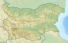
424:
376:
310:North Macedonia
295:
222:
220:
216:
213:
208:
205:
203:
201:
200:
197:
181:
155:
143:
141:
137:
134:
129:
126:
124:
122:
121:
116:
104:
73:
59:
58:
57:
56:
55:
54:
28:
23:
22:
18:Eleshnica river
15:
12:
11:
5:
568:
566:
558:
557:
552:
547:
542:
532:
531:
528:
527:
512:
509:
506:
505:
490:
469:
444:
426:
425:
423:
420:
375:
372:
294:
291:
287:Dragovishtitsa
231:
230:
198:
195:
192:
191:
182:
179:
176:
175:
172:
166:
165:
162:
161:
158:
152:
151:
119:
113:
112:
107:
101:
100:
94:
90:
89:
86:
85:
81:
80:
65:
61:
60:
48:
47:
41:
40:
39:
38:
35:
34:
26:
24:
14:
13:
10:
9:
6:
4:
3:
2:
567:
556:
553:
551:
548:
546:
543:
541:
538:
537:
535:
524:
520:
515:
514:
510:
501:
494:
491:
479:
473:
470:
458:
454:
448:
445:
441:
436:
434:
432:
428:
421:
419:
417:
413:
409:
405:
401:
397:
393:
389:
385:
381:
373:
371:
367:
365:
361:
357:
353:
349:
345:
341:
337:
333:
329:
324:
321:
319:
315:
311:
306:
304:
300:
292:
290:
288:
284:
280:
279:Strumeshnitsa
276:
271:
269:
265:
261:
257:
253:
249:
241:
237:
227:
199:
193:
190:
186:
183:
177:
173:
171:
167:
163:
159:
153:
148:
120:
114:
111:
108:
102:
99:
95:
91:
87:
82:
77:
66:
62:
45:
36:
31:
19:
522:
518:
499:
493:
482:. Retrieved
480:. 2018-06-28
472:
461:. Retrieved
457:dariknews.bg
456:
447:
377:
368:
325:
322:
307:
296:
272:
235:
234:
221: /
160:2173 meters
142: /
64:Native name
534:Categories
511:References
484:2021-03-30
463:2021-03-30
412:Chetiritsi
400:Stradalovo
236:Eleshnitsa
209:22°53′21″E
206:42°14′51″N
189:Aegean Sea
130:22°30′48″E
127:42°09′12″N
33:Eleshnitsa
422:Citations
392:Chekanets
384:Sazhdenik
293:Geography
260:Nevestino
240:Bulgarian
76:Bulgarian
408:Drumohar
268:Bulgaria
248:Bulgaria
244:Елешница
69:Елешница
555:Osogovo
404:Vaksevo
314:Vaksevo
299:Osogovo
283:Angitis
110:Osogovo
396:Rakovo
318:Struma
264:Struma
185:Struma
174:
93:Source
72:
521:[
250:, in
170:Mouth
27:River
410:and
390:and
303:Ruen
285:and
258:and
98:Ruen
414:in
386:in
536::
455:.
430:^
418:.
406:,
402:,
398:,
394:,
366:.
362:,
358:,
354:,
350:,
346:,
342:,
338:,
334:,
330:,
289:.
281:,
270:.
242::
187:→
487:.
466:.
238:(
78:)
74:(
20:)
Text is available under the Creative Commons Attribution-ShareAlike License. Additional terms may apply.