59:
84:
40:
91:
66:
349:
The final proposition was submitted to UNESCO in the summer of 2007, and the official designation was obtained on
November 21, 2007, after which the Board of Directors established the structure of the organization. The project was renamed the Fundy Biosphere Reserve, and later the Fundy Biosphere
331:
The committee suggested that the region be called the Fundy
Biosphere and secured UNESCO designation by meeting the requirements, which included evidence of unique ecosystems, landscapes, and heritage. The committee also sought to enhance the image of the area regionally, nationally, and
323:
The initiative to create the Fundy
Biosphere Region came from a group of volunteers in 1999. Initially, the project was called the Fundy Biosphere Reserve Initiative. A planning committee was formed to examine the requirements of UNESCO's
311:. Like much of this part of the North American coastline, the coastline is rocky. UNESCO has identified 8 species in the reserve that require conservation efforts, including the peregrine falcon and the
248:
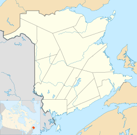
The Fundy
Biosphere Region extends over an area of over 442,250 hectares adjacent to the upper Bay of Fundy in New Brunswick. The region begins at Saint Martin's, passes through
124:
565:
58:
328:, to work with the Canadian Biosphere Reserves Association, and seek input from conservation groups, resources sectors, academic institutions, and scientists.
275:. It has a buffer zone of 26,124 hectares. Human activity in this zone is controlled to ensure the conservation of the core area. The buffer zone includes the
271:
The region is divided into three zones. The core area covers 20,600 hectares devoted to long-term conservation. This central region is represented by
276:
279:
of Little Salmon River, Dowdall Lake, McManus Hill, Point Wolfe River Gorge, Caledonia Gorge, and Wilson Brook, and provincial parks including the
295:. Most of the region is a transition area, covering 395,552 hectares. This is reserved for local activities that promote sustainable development.
83:
560:
555:
223:
272:
204:
organization whose mission is based on the conservation of biodiversity and the promotion of sustainable development within the
325:
193:, and was named and designated as a biosphere reserve by the United Nations Educational, Scientific and Cultural Organization (
402:
359:
253:
222:
The Fundy
Biosphere Region lies in south-eastern New Brunswick. It includes the watershed of the Bay of Fundy between
465:
345:
Identify citizen initiatives and the various stakeholders’ engagement in the sustainable development of the region.
261:
230:. The central area of the reserve corresponds with Fundy National Park. The reserve also includes the city of
540:
288:
249:
201:
339:
Identify the special landscapes in the region of the Bay of Fundy and their unique attributes;
292:
257:
447:
332:
internationally, and to encourage the development of a sustainable economy in the region.
265:
17:
284:
211:
44:
549:
182:
111:
39:
238:
205:
178:
530:
312:
303:
The reserve contains a variety of habitats, including mixed wood forests, tidal
280:
242:
227:
490:
308:
139:
126:
177:
is an area of rugged woodlands and coastline that lies along next the upper
504:
304:
231:
190:
403:"Anyone can discover a fossil on this beach—if you wait out the tides"
388:
194:
186:
535:
429:
335:
The planning committee's proposition was based on the following:
525:
214:
is a provincial park located within the Bay of Fundy, Canada.
200:
The Fundy
Biosphere Region is a community-based environmental
430:"Fundy Biosphere Region – UNESCO Fundy Biosphere Region"
452:
World
Network of Island and Coastal Biosphere Reserves
264:. The borders of the region follow the limits of the
342:
Identify the history and the culture of the region;
163:
155:
118:
107:
32:
491:"Fundy - Canadian Biosphere Regions Association"
234:, the only officially bilingual city in Canada.
27:UNESCO Biosphere Region in New Brunswick, Canada
90:
65:
8:
360:List of UNESCO Biosphere Reserves in Canada
29:
566:Geography of Albert County, New Brunswick
389:"Fundy - Man and the Biosphere Programme"
268:of the upper region of the Bay of Fundy.
424:
422:
420:
418:
416:
371:
383:
381:
379:
377:
375:
7:
466:"High and Low Tides in Bay of Fundy"
106:
159:442,250 hectares (1,092,800 acres)
25:
89:
82:
64:
57:
38:
326:Man and the Biosphere Programme
241:, which has one of the largest
162:
536:Hopewell Rocks Provincial Park
1:
526:http://www.fundy-biosphere.ca
561:Biosphere reserves of Canada
582:
556:Geography of New Brunswick
252:, including almost all of
189:. The area covers 442,250
470:earthobservatory.nasa.gov
73:Show map of New Brunswick
51:
37:
18:Fundy (biosphere reserve)
237:The reserve lies on the
289:National Wildlife Areas
277:protected natural areas
509:Fundy Biosphere Region
434:Fundy Biosphere Region
175:Fundy Biosphere Region
33:Fundy Biosphere Region
541:Google Sites: Sign-in
409:. September 16, 2024.
140:45.92000°N 65.18000°W
391:– via UNESCO.
299:Biology and ecology
273:Fundy National Park
206:Bay of Fundy Canada
145:45.92000; -65.18000
136: /
256:, and ends at the
98:Show map of Canada
171:
170:
16:(Redirected from
573:
513:
512:
501:
495:
494:
487:
481:
480:
478:
477:
462:
456:
455:
448:"Fundy (Canada)"
444:
438:
437:
426:
411:
410:
399:
393:
392:
385:
151:
150:
148:
147:
146:
141:
137:
134:
133:
132:
129:
99:
93:
92:
86:
74:
68:
67:
61:
42:
30:
21:
581:
580:
576:
575:
574:
572:
571:
570:
546:
545:
522:
517:
516:
503:
502:
498:
489:
488:
484:
475:
473:
464:
463:
459:
446:
445:
441:
428:
427:
414:
401:
400:
396:
387:
386:
373:
368:
356:
321:
301:
291:of Shepody and
258:Tantramar Marsh
220:
144:
142:
138:
135:
130:
127:
125:
123:
122:
103:
102:
101:
100:
97:
96:
95:
94:
77:
76:
75:
72:
71:
70:
69:
47:
28:
23:
22:
15:
12:
11:
5:
579:
577:
569:
568:
563:
558:
548:
547:
544:
543:
538:
533:
528:
521:
520:External links
518:
515:
514:
496:
482:
457:
439:
412:
394:
370:
369:
367:
364:
363:
362:
355:
352:
347:
346:
343:
340:
320:
317:
300:
297:
285:Hopewell Rocks
219:
216:
212:Hopewell Rocks
169:
168:
165:
161:
160:
157:
153:
152:
120:
116:
115:
109:
105:
104:
88:
87:
81:
80:
79:
78:
63:
62:
56:
55:
54:
53:
52:
49:
48:
45:Hopewell Rocks
43:
35:
34:
26:
24:
14:
13:
10:
9:
6:
4:
3:
2:
578:
567:
564:
562:
559:
557:
554:
553:
551:
542:
539:
537:
534:
532:
529:
527:
524:
523:
519:
510:
506:
500:
497:
492:
486:
483:
471:
467:
461:
458:
453:
449:
443:
440:
435:
431:
425:
423:
421:
419:
417:
413:
408:
404:
398:
395:
390:
384:
382:
380:
378:
376:
372:
365:
361:
358:
357:
353:
351:
344:
341:
338:
337:
336:
333:
329:
327:
318:
316:
314:
310:
306:
298:
296:
294:
290:
286:
282:
278:
274:
269:
267:
263:
259:
255:
254:Albert County
251:
246:
244:
240:
235:
233:
229:
225:
224:Saint Martins
217:
215:
213:
209:
207:
203:
198:
196:
192:
188:
184:
183:New Brunswick
180:
176:
166:
158:
154:
149:
121:
117:
113:
112:New Brunswick
110:
85:
60:
50:
46:
41:
36:
31:
19:
508:
499:
485:
474:. Retrieved
472:. 2006-06-14
469:
460:
451:
442:
433:
406:
397:
348:
334:
330:
322:
309:salt marshes
302:
270:
247:
243:tidal ranges
239:Bay of Fundy
236:
226:and borders
221:
210:
199:
179:Bay of Fundy
174:
172:
313:Canada lynx
281:Fundy Trail
260:, close to
228:Nova Scotia
197:) in 2007.
164:Established
143: /
119:Coordinates
550:Categories
505:"About Us"
476:2022-11-06
366:References
287:, and the
245:on earth.
202:non-profit
131:65°10′48″W
128:45°55′12″N
293:Tantramar
266:watershed
262:Sackville
218:Geography
354:See also
350:Region.
305:mudflats
283:and the
191:hectares
114:, Canada
108:Location
319:History
250:Moncton
232:Moncton
407:Travel
307:, and
195:UNESCO
187:Canada
531:index
173:The
167:2007
156:Area
181:in
552::
507:.
468:.
450:.
432:.
415:^
405:.
374:^
315:.
208:.
185:,
511:.
493:.
479:.
454:.
436:.
20:)
Text is available under the Creative Commons Attribution-ShareAlike License. Additional terms may apply.