65:
409:
145:
370:
629:
64:
337:
634:
655:
624:
422:
259:. MacArdle, a branch of the MacMahons of Oriel are noted here, as well as septs of Callan, O'Finn, O'Larkin, Hughes/Hayes, and O'Donegan.
310:
330:
440:
596:
323:
75:
408:
393:
515:
470:
606:
586:
243:. The O'Larkin sept is cited as chiefs alongside the O'Neills and MacCanns in the old territory of
133:
87:
80:
216:
196:
295:
125:
55:
347:
177:
165:
149:
129:
92:
251:). O Cosgro (ve) (O Cosgraigh) was the name of the chiefs of Feara Ruis (Fir Rois) near
591:
555:
383:
271:
252:
240:
208:
204:
117:
44:
649:
500:
388:
248:
200:
611:
545:
505:
228:
220:
212:
189:
144:
244:
601:
495:
490:
356:
181:
17:
560:
525:
460:
445:
185:
570:
530:
520:
485:
480:
465:
450:
435:
315:
276:
153:
565:
510:
430:
398:
378:
361:
540:
535:
475:
224:
550:
455:
164:
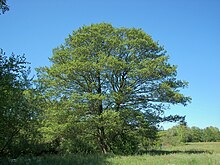
Farney takes its name from the ancient kingdom of
Fernmag ("plain of
239:
O'Ciaran or O'Kieran is given as a chief of
Fearnmuigh as a clan of
247:(Oriel), where they were chiefs of Farney and West Uí Breasail (in
256:
143:
319:
407:
296:
http://www.rootsweb.ancestry.com/~irlkik/ihm/baronie3.htm
69:
Map of Farney in 1846, with land colour-coded by owner.
579:
418:
369:
103:
98:
86:
74:
34:
267:Below is a list of settlements in Farney barony:
630:Category:Mountains and hills of County Monaghan
331:
8:
338:
324:
316:
31:
288:
107:272.48 km (105.21 sq mi)
97:
73:
61:
635:Category:Geography of County Monaghan
102:
85:
7:
625:List of townlands in County Monaghan
195:Farney is bordered to the north by
199:, County Monaghan; to the east by
25:
63:
1:
176:Farney is found in southeast
656:Baronies of County Monaghan
29:Barony in Monaghan, Ireland
672:
620:
405:
354:
62:
53:
311:McMahon, Lords of Farney
148:Farney is named for the
412:
161:
121:
597:Dún na Rí Forest Park
411:
223:; and to the west by
147:
607:Rossmore Forest Park
263:List of settlements
413:
215:; to the south by
162:
104: • Total
643:
642:
111:
110:
48:
16:(Redirected from
663:
587:Black Pig's Dyke
340:
333:
326:
317:
298:
293:
67:
39:
32:
21:
18:Farney, Monaghan
671:
670:
666:
665:
664:
662:
661:
660:
646:
645:
644:
639:
616:
575:
420:
414:
403:
365:
350:
348:County Monaghan
344:
307:
302:
301:
294:
290:
285:
265:
237:
180:, north of the
178:County Monaghan
174:
142:
130:County Monaghan
76:Sovereign state
70:
58:
49:
37:
30:
23:
22:
15:
12:
11:
5:
669:
667:
659:
658:
648:
647:
641:
640:
638:
637:
632:
627:
621:
618:
617:
615:
614:
609:
604:
599:
594:
592:Dartrey Forest
589:
583:
581:
577:
576:
574:
573:
568:
563:
558:
556:Threemilehouse
553:
548:
543:
538:
533:
528:
523:
518:
513:
508:
503:
498:
493:
488:
483:
478:
473:
468:
463:
458:
453:
448:
443:
438:
433:
427:
425:
416:
415:
406:
404:
402:
401:
396:
391:
386:
384:Carrickmacross
381:
375:
373:
367:
366:
355:
352:
351:
345:
343:
342:
335:
328:
320:
314:
313:
306:
305:External links
303:
300:
299:
287:
286:
284:
281:
280:
279:
274:
272:Carrickmacross
264:
261:
253:Carrickmacross
236:
233:
184:, west of the
173:
170:
141:
138:
109:
108:
105:
101:
100:
96:
95:
90:
84:
83:
78:
72:
71:
68:
60:
59:
54:
51:
50:
38:
35:
28:
24:
14:
13:
10:
9:
6:
4:
3:
2:
668:
657:
654:
653:
651:
636:
633:
631:
628:
626:
623:
622:
619:
613:
610:
608:
605:
603:
600:
598:
595:
593:
590:
588:
585:
584:
582:
578:
572:
569:
567:
564:
562:
559:
557:
554:
552:
549:
547:
544:
542:
539:
537:
534:
532:
529:
527:
524:
522:
519:
517:
514:
512:
509:
507:
504:
502:
501:Knockacullion
499:
497:
494:
492:
489:
487:
484:
482:
479:
477:
474:
472:
469:
467:
464:
462:
459:
457:
454:
452:
449:
447:
444:
442:
439:
437:
434:
432:
429:
428:
426:
424:
417:
410:
400:
397:
395:
392:
390:
389:Castleblayney
387:
385:
382:
380:
377:
376:
374:
372:
368:
364:
363:
358:
353:
349:
341:
336:
334:
329:
327:
322:
321:
318:
312:
309:
308:
304:
297:
292:
289:
282:
278:
275:
273:
270:
269:
268:
262:
260:
258:
254:
250:
249:County Armagh
246:
242:
234:
232:
230:
226:
222:
218:
214:
210:
206:
202:
201:Dundalk Upper
198:
193:
191:
188:and south of
187:
183:
179:
171:
169:
167:
159:
155:
151:
146:
139:
137:
135:
131:
127:
123:
119:
115:
106:
94:
91:
89:
82:
79:
77:
66:
57:
52:
46:
42:
33:
27:
19:
612:Slieve Beagh
546:Smithborough
506:Knockatallon
360:
291:
266:
238:
229:County Cavan
221:County Meath
213:County Louth
194:
190:Lough Muckno
175:
163:
157:
113:
112:
40:
26:
602:Lough Egish
496:Killymarron
491:Killycarnan
441:Castleshane
357:County town
241:Tír Eoghain
217:Lower Slane
182:River Lagan
561:Tirnaneill
526:Scotshouse
461:Derryarrit
446:Clontibret
346:Places in
283:References
186:River Fane
580:Landforms
571:Tyholland
531:Scotstown
521:Rockcorry
486:Inniskeen
481:Glaslough
466:Doohamlet
451:Corblonog
436:Ballinode
423:townlands
277:Inniskeen
245:Airgíalla
154:Old Irish
140:Etymology
122:Fearnaigh
41:Fearnaigh
650:Category
566:Tydavnet
511:Newbliss
431:Annyalla
419:Villages
399:Monaghan
379:Ballybay
362:Monaghan
197:Cremorne
172:Location
93:Monaghan
541:Skeatry
536:Sheskin
476:Emyvale
235:History
225:Clankee
134:Ireland
124:) is a
81:Ireland
551:Tassan
456:Corlat
394:Clones
166:alders
152:tree (
126:barony
114:Farney
88:County
56:Barony
36:Farney
371:Towns
257:Ardee
209:Ardee
205:Louth
150:alder
118:Irish
45:Irish
516:Oram
471:Drum
421:and
255:and
207:and
168:").
158:fern
99:Area
128:in
652::
359::
231:.
227:,
219:,
211:,
203:,
192:.
156::
136:.
132:,
120::
339:e
332:t
325:v
160:)
116:(
47:)
43:(
20:)
Text is available under the Creative Commons Attribution-ShareAlike License. Additional terms may apply.

